| Home | City Bus | Maps | Villages | Cities | Rail | Tourist Places | School | College | Pin Codes | Corona Cases Count |
| Distance Calculator Bus Services IFSC Codes Trace Mobile Number Weather Search Place Trace IP Available Cash ATM/Banks Locate Polling Booth Report an Error contact People |
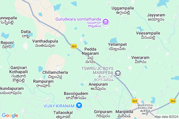
Ganya Thanda
Ganya Thanda Map
EDIT Map
Add Your House
 ..
..
Current Corona Virus Infected Patients Count in Warangal District
| City Name | District Name | Total Covid cases |
|---|---|---|
| Warangal Urban District | Warangal Urban | 23 |
| Mulugu District | Mulugu | 2 |
| Mahabubabad District | Mahabubabad | 1 |
Locality Name :
Ganya Thanda
( గణ్య తండా )
Mandal Name : Narsimhulapet
District : Warangal
State : Telangana
Region : Telangana
Language : Telugu and Urdu
Current Time 01:06 PM
Date: Tuesday , Apr 29,2025 (IST)
Time zone: IST (UTC+5:30)
Elevation / Altitude: 212 meters. Above Seal level
Telephone Code / Std Code: 08719
Assembly constituency : Dornakal assembly constituency
Assembly MLA : Jatoth Ram Chander Naik
Lok Sabha constituency : Mahabubabad parliamentary constituency
Parliament MP : Kavitha Malothu
Serpanch Name :
Pin Code : 506324
Post Office Name : Dantalapalli
Main Village Name : Peddanagaram
Commodities Prices : Mahabubabad Market / Mandi
Ganya Thanda Live Weather
Temperature: 39.5 °C
clear sky
Humidity: 23%
Wind : 3.2 mt/sec towards SW
StationName : "MahbÅ«bÄ\u0081bÄ\u0081d"
observed on 5 Mins Back
Temperature: 39.5 °C
clear sky
Humidity: 23%
Wind : 3.2 mt/sec towards SW
StationName : "MahbÅ«bÄ\u0081bÄ\u0081d"
observed on 5 Mins Back
Ganya Thanda Weather Forecast for Next 5 days
30-04-2025
27.6°C to 40.3°C
clear sky
27.6°C to 40.3°C
clear sky
01-05-2025
26.6°C to 40.8°C
clear sky, broken clouds, few clouds, scattered clouds
26.6°C to 40.8°C
clear sky, broken clouds, few clouds, scattered clouds
02-05-2025
27.3°C to 41.7°C
few clouds, clear sky, scattered clouds
27.3°C to 41.7°C
few clouds, clear sky, scattered clouds
03-05-2025
27.8°C to 41.8°C
scattered clouds, few clouds, clear sky, broken clouds
27.8°C to 41.8°C
scattered clouds, few clouds, clear sky, broken clouds
04-05-2025
27.6°C to 42.7°C
clear sky, broken clouds, scattered clouds, overcast clouds
27.6°C to 42.7°C
clear sky, broken clouds, scattered clouds, overcast clouds
National Highways Reachable To Ganya Thanda
Nationa High Way :NH365BB
Nationa High Way :NH365A;365BB
Nationa High Way :NH365BB
Nationa High Way :NH365A;365BB
Rivers Near Ganya Thanda
Bukleru River
Musi River
Bukleru River
Musi River
About Ganya Thanda
Correct below Info and add more info about Ganya ThandaGanya Thanda is a small Village/hamlet in Narsimhulapet Mandal in Warangal District of Telangana State, India. It comes under Peddanagaram Panchayath. It belongs to Telangana region . It is located 76 KM towards South from District head quarters Warangal. 9 KM from Narsimhulapet.
Ganya Thanda Pin code is 506324 and postal head office is Dantalapalli .
Ganya Thanda is surrounded by Narsimhulapet Mandal towards west , Nuthankal Mandal towards west , Nallikudur Mandal towards North , Thirumalayapalem Mandal towards South .
Khammam , Suryapet , Kodad , Yellandu are the near by Cities to Ganya Thanda.
This Place is in the border of the Warangal District and Nalgonda District. Nalgonda District Nuthankal is west towards this place .
Demographics of Ganya Thanda
Telugu is the Local Language here. Total population of Ganya Thanda is 5328 .Males are 2724 and Females are 2,604 living in 1133 Houses. Total area of Ganya Thanda is 2004 hectares.Politics in Ganya Thanda
TDP , TRS , INC are the major political parties in this area.Polling Stations /Booths near Ganya Thanda
1)Pakirathanda H/o Chilkodu2)Peddanagaram
3)Peddamupparam
4)Gollacherla
5)Parkajala Thanda H/o Neelkurthy
HOW TO REACH Ganya Thanda
By Road
Warangal is the Nearest Town to Ganya Thanda. Warangal is 77 km from Ganya Thanda. Road connectivity is there from Warangal to Ganya Thanda.By Rail
There is no railway station near to Ganya Thanda in less than 10 km. How ever there are railway Stations from Near By town Warangal. are the railway Stations near to Warangal. You can reach from Warangal to Ganya Thanda by road after .Colleges near Ganya Thanda
Sai Ram Juniour College
Address :
Gowthami Jr College, Narsimhulapet
Address : Narsimhulapet
Schools in Ganya Thanda
Vignan High School
Address : peddanagaram , narsimhulapet , warangal , Andhra Pradesh . PIN- 506324 , Post - Dantalapalli
Zphs Pedda Nagaram
Address : peddanagaram , narsimhulapet , warangal , Andhra Pradesh . PIN- 506324 , Post - Dantalapalli
Sri Vignan E M Ups Pngrm
Address : peddanagaram , narsimhulapet , warangal , Andhra Pradesh . PIN- 506324 , Post - Dantalapalli
Govt Health Centers near Ganya Thanda
1) SubCentre, Pedda Nagaram , 1-183 , PEDDANAGARAM , SARPANCH STREET2) SubCentre, Yellampeta , MAIN ROAD , Yellampeta , SUBSTATION (ELC)
3) SubCentre, Anepuram , B.C.COLONY , Anepuram , NEAR SCHOOL
Hospitals in Ganya Thanda,Narsimhulapet
Pravet Medicol Practitioner
Bodrai sentar; Venkampad; Telangana 506315; India
6.7 KM distance Detail
more ..
Petrol Bunks in Ganya Thanda,Narsimhulapet
LAXMI SHIVA FILLING STATION
MARIPEDA ON SH8; WARANGAL; Telangana 506315; India
6.7 KM distance Detail
more ..
Colleges in Ganya Thanda,Narsimhulapet
Govt Junior College Maripeda
506315; Maripeda - Mahabubabad Rd; Mahabubabad; Telangana 506101; India
9.4 KM distance Detail
Govt Degree College
Maripeda - Mahabubabad Rd; Maripeda; Telangana 506315; India
9.4 KM distance Detail
more ..
Schools in Ganya Thanda,Narsimhulapet
LAXMATHANDA ZPSS HIGH SHCOOL
LAXMATHANDA Road; 506315; Yellampeta; Telangana; India
4.0 KM distance Detail
Electronic Shops in Ganya Thanda,Narsimhulapet
Sharmista Comuniction Center.tilaring Center
Chillamcherla; Telangana 506315; India
5.5 KM distance Detail
Super Markets in Ganya Thanda,Narsimhulapet
Naga lakshmi Kiranam and General Stores
Dasharadhi street; Chinna gudur; Chinnagudur; Mahabubabad; Telangana 506104; India
10.8 KM distance Detail
Police Stations near Ganya Thanda,Narsimhulapet
Police Station
Narsimhulapet Mandal;; Narsimhulapet; Telangana 506324; India
10.2 KM distance Detail
Maripeda Bangla Police Station
Jaya Prakash Narayana Road; మరిపెడ బంగ్లో; తెలంగాణ 506315; India
10.6 KM distance Detail
About Ganya Thanda &
History
How to reach Ganya Thanda
Tourist Places Near By Ganya Thanda
Schools in Ganya Thanda
Colleges in Ganya Thanda
Temperature & weather of Ganya Thanda
places in Ganya Thanda
Ganya Thanda photos
More Information
How to reach Ganya Thanda
Tourist Places Near By Ganya Thanda
Schools in Ganya Thanda
Colleges in Ganya Thanda
Temperature & weather of Ganya Thanda
places in Ganya Thanda
Ganya Thanda photos
More Information
Village Talk
Post News or Events about this Village
Near Cities
Khammam 44 KM near
Suryapet 45 KM near
Kodad 55 KM near
Yellandu 62 KM near
Khammam 44 KM near
Suryapet 45 KM near
Kodad 55 KM near
Yellandu 62 KM near
Near By Taluks
Maripeda 6 KM near
Narsimhulapet 9 KM near
Nuthankal 18 KM near
Thirumalayapalem 20 KM near
Maripeda 6 KM near
Narsimhulapet 9 KM near
Nuthankal 18 KM near
Thirumalayapalem 20 KM near
Near By Air Ports
Vijayawada Airport 161 KM near
Rajiv Gandhi International Airport 168 KM near
Rajahmundry Airport 240 KM near
Nanded Airport 367 KM near
Vijayawada Airport 161 KM near
Rajiv Gandhi International Airport 168 KM near
Rajahmundry Airport 240 KM near
Nanded Airport 367 KM near
Near By Tourist Places
Khammam 44 KM near
Warangal 73 KM near
Nagarjunakonda 89 KM near
Medaram 120 KM near
Nagarjunsagar 124 KM near
Khammam 44 KM near
Warangal 73 KM near
Nagarjunakonda 89 KM near
Medaram 120 KM near
Nagarjunsagar 124 KM near
Near By Districts
Khammam 44 KM near
Warangal 73 KM near
Nalgonda 83 KM near
Karimnagar 148 KM near
Khammam 44 KM near
Warangal 73 KM near
Nalgonda 83 KM near
Karimnagar 148 KM near
Near By RailWay Station
Mahbubabad Rail Way Station 28 KM near
Kesamudram Rail Way Station 31 KM near
Mahbubabad Rail Way Station 28 KM near
Kesamudram Rail Way Station 31 KM near