| Home | City Bus | Maps | Villages | Cities | Rail | Tourist Places | School | College | Pin Codes | Corona Cases Count |
| Distance Calculator Bus Services IFSC Codes Trace Mobile Number Weather Search Place Trace IP Available Cash ATM/Banks Locate Polling Booth Report an Error contact People |
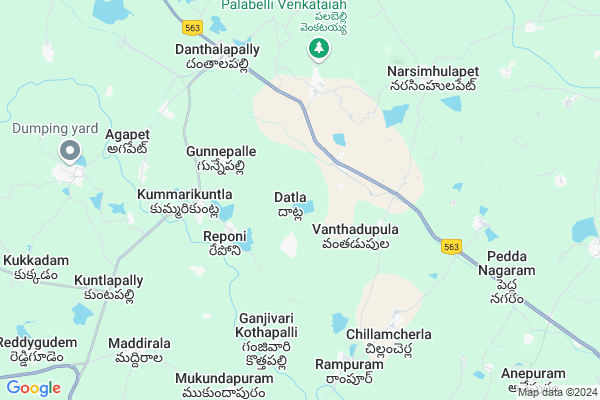
Datla
Datla Map
EDIT Map
Add Your House
 ..
..
Current Corona Virus Infected Patients Count in Warangal District
| City Name | District Name | Total Covid cases |
|---|---|---|
| Warangal Urban District | Warangal Urban | 23 |
| Mulugu District | Mulugu | 2 |
| Mahabubabad District | Mahabubabad | 1 |
Locality Name :
Datla
( దాట్ల )
Mandal Name : Narsimhulapet
District : Warangal
State : Telangana
Region : Telangana
Language : Telugu and Urdu
Current Time 10:59 AM
Date: Tuesday , Apr 29,2025 (IST)
Time zone: IST (UTC+5:30)
Elevation / Altitude: 212 meters. Above Seal level
Telephone Code / Std Code: 08719
Assembly constituency : Dornakal assembly constituency
Assembly MLA : Jatoth Ram Chander Naik
Lok Sabha constituency : Mahabubabad parliamentary constituency
Parliament MP : Kavitha Malothu
Serpanch Name :
Pin Code : 506324
Post Office Name : Dantalapalli
Commodities Prices : Kesamudram Market / Mandi
Datla Live Weather
Temperature: 30.4 °C
clear sky
Humidity: 55%
Wind : 4.63 mt/sec towards SE
StationName : "MahbÅ«bÄ\u0081bÄ\u0081d"
observed on 2 Hours Back
Temperature: 30.4 °C
clear sky
Humidity: 55%
Wind : 4.63 mt/sec towards SE
StationName : "MahbÅ«bÄ\u0081bÄ\u0081d"
observed on 2 Hours Back
Datla Weather Forecast for Next 5 days
30-04-2025
27.3°C to 40.0°C
clear sky, few clouds
27.3°C to 40.0°C
clear sky, few clouds
01-05-2025
26.4°C to 40.3°C
clear sky, overcast clouds, broken clouds, scattered clouds, few clouds
26.4°C to 40.3°C
clear sky, overcast clouds, broken clouds, scattered clouds, few clouds
02-05-2025
27.0°C to 41.7°C
few clouds, scattered clouds, clear sky
27.0°C to 41.7°C
few clouds, scattered clouds, clear sky
03-05-2025
27.6°C to 41.4°C
scattered clouds, broken clouds, clear sky, light rain, overcast clouds
27.6°C to 41.4°C
scattered clouds, broken clouds, clear sky, light rain, overcast clouds
04-05-2025
27.6°C to 42.4°C
few clouds, clear sky, light rain, broken clouds, overcast clouds
27.6°C to 42.4°C
few clouds, clear sky, light rain, broken clouds, overcast clouds
Edit below overview about Datla
Edit below overview about Datla
OverView of Datla
my motherland is datla.this village is fastest growing.this village is 20 k.m near by thorrur city. This is devoloping by many commersial. Lot of poltisions are devoloping this village....Edit below overview about Datla
National Highways Reachable To Datla
Nationa High Way :NH365BB
Nationa High Way :NH365A;365BB
Nationa High Way :NH365BB
Nationa High Way :NH365A;365BB
Rivers Near Datla
Bukleru River
Musi River
Bukleru River
Musi River
About Datla
Datla is a Village in Narsimhulapet Mandal in Warangal District of Telangana State, India. It belongs to Telangana region . It is located 70 KM towards South from District head quarters Warangal. 3 KM from Narsimhulapet.
Datla Pin code is 506324 and postal head office is Dantalapalli .
Beerishettigudem ( 2 KM ) , Vanthadupula ( 3 KM ) , Kummarikuntla ( 3 KM ) , Gunnepalle ( 4 KM ) , Ramanujapuram ( 6 KM ) are the nearby Villages to Datla. Datla is surrounded by Thorrur Mandal towards North , Maripeda Mandal towards East , Nuthankal Mandal towards South , Nallikudur Mandal towards North .
Suryapet , Khammam , Kodad , Yellandu are the near by Cities to Datla.
This Place is in the border of the Warangal District and Nalgonda District. Nalgonda District Nuthankal is South towards this place .
Datla 2011 Census Details
Datla Local Language is Telugu. Datla Village Total population is 5797 and number of houses are 1385. Female Population is 50.2%. Village literacy rate is 48.4% and the Female Literacy rate is 20.4%.
Population
| Census Parameter | Census Data |
| Total Population | 5797 |
| Total No of Houses | 1385 |
| Female Population % | 50.2 % ( 2910) |
| Total Literacy rate % | 48.4 % ( 2805) |
| Female Literacy rate | 20.4 % ( 1184) |
| Scheduled Tribes Population % | 15.8 % ( 914) |
| Scheduled Caste Population % | 36.8 % ( 2132) |
| Working Population % | 52.0 % |
| Child(0 -6) Population by 2011 | 683 |
| Girl Child(0 -6) Population % by 2011 | 46.7 % ( 319) |
Datla Census More Deatils.
Politics in Datla
TDP , TRS , INC are the major political parties in this area.Polling Stations /Booths near Datla
1)Danthalapally2)Datla
3)Datla
4)Beecharajupelly
5)Reponi
HOW TO REACH Datla
By Road
Warangal is the Nearest Town to Datla. Warangal is 79 km from Datla. Road connectivity is there from Warangal to Datla.By Rail
There is no railway station near to Datla in less than 10 km. How ever there are railway Stations from Near By town Warangal. are the railway Stations near to Warangal. You can reach from Warangal to Datla by road after .Colleges near Datla
Sai Ram Juniour College
Address :
Gowthami Jr College, Narsimhulapet
Address : Narsimhulapet
Schools in Datla
Zphs Datla
Address : datla , narsimhulapet , warangal , Andhra Pradesh . PIN- 506324 , Post - Dantalapalli
Adarsha U.p.s
Address : datla , narsimhulapet , warangal , Andhra Pradesh . PIN- 506324 , Post - Dantalapalli
Mpups
Address : datla , narsimhulapet , warangal , Andhra Pradesh . PIN- 506324 , Post - Dantalapalli
Govt Health Centers near Datla
1) SubCentre, Datla , , Datla , NEAR HIGH SCHOOL2) SubCentre, Vanthadpla , Vanthadpula , Vanthadpula , NEAR G.P
3) SubCentre, Gunnepally , , Gunnepally , NEAR (V) TEMPLE
Sub Villages in Datla
Hospitals in Datla,Narsimhulapet
Danthalapally P.H.C
main road; Danthalapally; Khammam - Warangal Hwy; Danthalapally; Telangana 506324; India
7.5 KM distance Detail
Govt. Hospital
danthala pally; sh 8; Khammam - Warangal Hwy; Danthalapally; Telangana 506324; India
7.5 KM distance Detail
more ..
Petrol Bunks in Datla,Narsimhulapet
ESSAR PETROLEUM
Suryapet - Warangal Road; Vemulapalle; Telangana 506324; India
7.1 KM distance Detail
more ..
Electronic Shops in Datla,Narsimhulapet
Sharmista Comuniction Center.tilaring Center
Chillamcherla; Telangana 506315; India
6.6 KM distance Detail
Sri Srinivasa Engineering Electrical
Danthalapally; Thorrur; Telangana 506324; India
7.2 KM distance Detail
Super Markets in Datla,Narsimhulapet
Venkateshwara Kiranam Madhu
4-126/1a; Khammam - Warangal Hwy; Danthalapally; Telangana 506324; India
7.1 KM distance Detail
Police Stations near Datla,Narsimhulapet
Danthalapally Police Station
main road; Khammam - Warangal Hwy; Danthalapally; Telangana 506324; India
7.7 KM distance Detail
About Datla &
History
How to reach Datla
Tourist Places Near By Datla
Schools in Datla
Colleges in Datla
Temperature & weather of Datla
places in Datla
Datla photos
More Information
How to reach Datla
Tourist Places Near By Datla
Schools in Datla
Colleges in Datla
Temperature & weather of Datla
places in Datla
Datla photos
More Information
Village Talk
Post News or Events about this Village
Near Cities
Suryapet 44 KM near
Khammam 53 KM near
Kodad 62 KM near
Yellandu 69 KM near
Suryapet 44 KM near
Khammam 53 KM near
Kodad 62 KM near
Yellandu 69 KM near
Near By Taluks
Narsimhulapet 3 KM near
Thorrur 15 KM near
Maripeda 15 KM near
Nuthankal 16 KM near
Narsimhulapet 3 KM near
Thorrur 15 KM near
Maripeda 15 KM near
Nuthankal 16 KM near
Near By Air Ports
Rajiv Gandhi International Airport 160 KM near
Vijayawada Airport 170 KM near
Rajahmundry Airport 249 KM near
Nanded Airport 359 KM near
Rajiv Gandhi International Airport 160 KM near
Vijayawada Airport 170 KM near
Rajahmundry Airport 249 KM near
Nanded Airport 359 KM near
Near By Tourist Places
Khammam 53 KM near
Warangal 67 KM near
Nagarjunakonda 94 KM near
Medaram 120 KM near
Nagarjunsagar 123 KM near
Khammam 53 KM near
Warangal 67 KM near
Nagarjunakonda 94 KM near
Medaram 120 KM near
Nagarjunsagar 123 KM near
Near By Districts
Khammam 53 KM near
Warangal 67 KM near
Nalgonda 79 KM near
Karimnagar 140 KM near
Khammam 53 KM near
Warangal 67 KM near
Nalgonda 79 KM near
Karimnagar 140 KM near
Near By RailWay Station
Kesamudram Rail Way Station 31 KM near
Mahbubabad Rail Way Station 32 KM near
Kesamudram Rail Way Station 31 KM near
Mahbubabad Rail Way Station 32 KM near