| Home | City Bus | Maps | Villages | Cities | Rail | Tourist Places | School | College | Pin Codes | Corona Cases Count |
| Distance Calculator Bus Services IFSC Codes Trace Mobile Number Weather Search Place Trace IP Available Cash ATM/Banks Locate Polling Booth Report an Error contact People |
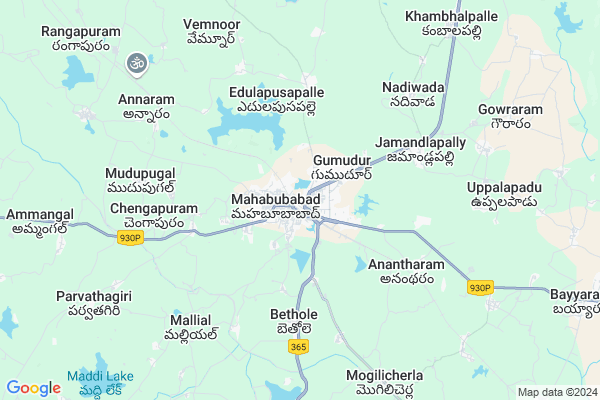
Mahabubabad
Mahabubabad Map
EDIT Map
Add Your House
 ..
..
Current Corona Virus Infected Patients Count in Warangal District
| City Name | District Name | Total Covid cases |
|---|---|---|
| Warangal Urban District | Warangal Urban | 23 |
| Mulugu District | Mulugu | 2 |
| Mahabubabad District | Mahabubabad | 1 |
Locality Name :
Mahabubabad
( మహబూబాబాద్ )
Mandal Name : Mahbubabad
District : Warangal
State : Telangana
Region : Telangana
Language : Telugu and Urdu
Current Time 07:27 AM
Date: Saturday , Apr 26,2025 (IST)
Time zone: IST (UTC+5:30)
Elevation / Altitude: 200 meters. Above Seal level
Telephone Code / Std Code: 08719
Assembly constituency : Mahabubabad assembly constituency
Assembly MLA : Dr. Murali Naik Bhukya
Lok Sabha constituency : Mahabubabad parliamentary constituency
Parliament MP : Kavitha Malothu
Serpanch Name :
Pin Code : 506101
Post Office Name : Mahabubabad
Commodities Prices : Mahabubabad Market / Mandi
Mahabubabad Live Weather
Temperature: 27.1 °C
scattered clouds
Humidity: 73%
Wind : 4.84 mt/sec towards SE
StationName : "MahbÅ«bÄ\u0081bÄ\u0081d"
observed on 1 Hours Back
Temperature: 27.1 °C
scattered clouds
Humidity: 73%
Wind : 4.84 mt/sec towards SE
StationName : "MahbÅ«bÄ\u0081bÄ\u0081d"
observed on 1 Hours Back
Mahabubabad Weather Forecast for Next 5 days
27-04-2025
27.9°C to 41.4°C
scattered clouds, few clouds, clear sky, light rain
27.9°C to 41.4°C
scattered clouds, few clouds, clear sky, light rain
28-04-2025
27.4°C to 38.5°C
broken clouds, overcast clouds, light rain
27.4°C to 38.5°C
broken clouds, overcast clouds, light rain
29-04-2025
26.2°C to 40.8°C
scattered clouds, clear sky, few clouds
26.2°C to 40.8°C
scattered clouds, clear sky, few clouds
30-04-2025
26.2°C to 41.7°C
clear sky, scattered clouds
26.2°C to 41.7°C
clear sky, scattered clouds
01-05-2025
26.3°C to 42.4°C
scattered clouds, few clouds, clear sky, light rain
26.3°C to 42.4°C
scattered clouds, few clouds, clear sky, light rain
Edit below overview about Mahabubabad
Edit below overview about Mahabubabad
OverView of Mahabubabad
Mahabubabad original name is Manukota which consist of two words Mranu and kota Mranu means (trees) in telugu and kota means (fort) manukota means fort of trees. Manukota is well-known place in Telangana region from Nizams rule.Gandiji visited Manukota when he was traveling to Warangal.Manukota is fully surrounded by forests ,ponds and streams like Munneru vagu which is tributary of Krishna river.people live here from pre-historic period and find lot archeological evidence of first humans in world history. Bayyaram is east side of Manukota which is full of iron ores. Manukota have lot of natural resources and that wealth is higher then Indian Richest man Ambani.Edit below overview about Mahabubabad
National Highways Reachable To Mahabubabad
Nationa High Way :NH365A
Nationa High Way :NH365BG
Nationa High Way :NH365A
Nationa High Way :NH365BG
Rivers Near Mahabubabad
Are Vagu
Sali Vagu
Are Vagu
Sali Vagu
About Mahabubabad
Mahabubabad is a Town in Mahbubabad Mandal in Warangal District of Telangana State, India. It belongs to Telangana region . It is located 72 KM towards East from District head quarters Warangal. It is a Mandal head quarter.
Mahabubabad Pin code is 506101 and postal head office is Mahabubabad .
Shanigapuram ( 4 KM ) , Anantharamu ( 5 KM ) , Jamandlapalli ( 5 KM ) , Edulapusapally ( 5 KM ) , Vemunur ( 6 KM ) are the nearby Villages to Mahabubabad. Mahabubabad is surrounded by Kuravi Mandal towards South , Kesamudram Mandal towards west , Bayyaram Mandal towards East , Garla Mandal towards East .
Yellandu , Khammam , Palwancha , Warangal are the nearby Cities to Mahabubabad.
This Place is in the border of the Warangal District and Khammam District. Khammam District Bayyaram is East towards this place .
Demographics of Mahabubabad
Telugu is the Local Language here. Total population of Mahabubabad (CT) is 42851 according to census 2011.Among them Males are 20716 and Females are 22135 living in 7710 Houses. children's below 6 years are 4170 . Among them literate people are 30623. All the numbers are according to 2011 census.Politics in Mahabubabad
TDP , TRS , JP , INC are the major political parties in this area.Polling Stations /Booths near Mahabubabad
1)Mahabubabad2)Mahabubabad
3)Mahabubabad
4)Mahabubabad
5)Mahabubabad
HOW TO REACH Mahabubabad
By Road
Warangal is the Nearest Town to Mahabubabad. Warangal is 60 km from Mahabubabad. Road connectivity is there from Warangal to Mahabubabad.By Rail
Mahbubabad Rail Way Station , Tadla Pusapalli Rail Way Station are the very nearby railway stations to Mahabubabad. Also you can consider railway Stations from Near By town Warangal. Warangal Rail Way Station , Kazipet Town Rail Way Station are the railway stations near to Warangal. You can reach from Warangal to Mahabubabad by road after .Govt Health Centers near Mahabubabad
1) Area Hospital, Mahabubabad , Mahabubabad , Mahabubabad , Mahabubabad2) SubCentre, Indira Nagar , 6-1-108/75/2 , Indiranagar , UPS
3) SubCentre, Ambedker Nagar , 2-1-47/45/1B , Ambedkar nagar , Hastinapuram
Hospitals in Mahabubabad,Mahbubabad
AKSHAYA HOSPITAL
M.R.O. OFFICE ROAD;OPP:MASJID;MAHABUBAD;TELENGANA; 506101; India
0.5 KM distance Detail
more ..
Petrol Bunks in Mahabubabad,Mahbubabad
Bhargavi Filling Station
Bhargavi Filling Station; ByPass Rd; Mahabubabad; Telangana 506101; India
1.3 KM distance Detail
more ..
Schools in Mahabubabad,Mahbubabad
Govt. High School Mahabubabad
Railway Station Rd; Mahabubabad; Telangana 506101; India
0.2 KM distance Detail
Vajra Digital Studio
Railway Station Rd; Mahabubabad; Telangana 506101; India
0.3 KM distance Detail
Electronic Shops in Mahabubabad,Mahbubabad
Sri Kiran Electronics
2-2-12/1; opp.fish market; RTC Cross Road; Mahabubabad; Telangana; India
0.3 KM distance Detail
Local Parks in Mahabubabad,Mahbubabad
Nandana Gardens
6-2-35 506102; Krishna Colony; Gopalapuram; Mahabubabad; Telangana 506101; India
1.0 KM distance Detail
Governement Offices near Mahabubabad,Mahbubabad
Mahabubabad Civil Court
506102; Marwadi Bazar Rd; Mahabubabad; Telangana 506101; India
0.4 KM distance Detail
About Mahabubabad &
History
How to reach Mahabubabad
Tourist Places Near By Mahabubabad
Schools in Mahabubabad
Colleges in Mahabubabad
Temperature & weather of Mahabubabad
places in Mahabubabad
Mahabubabad photos
More Information
How to reach Mahabubabad
Tourist Places Near By Mahabubabad
Schools in Mahabubabad
Colleges in Mahabubabad
Temperature & weather of Mahabubabad
places in Mahabubabad
Mahabubabad photos
More Information
Town Talk
Post News or Events about this Town
Near Cities
Yellandu 38 KM near
Khammam 47 KM near
Palwancha 58 KM near
Warangal 69 KM near
Yellandu 38 KM near
Khammam 47 KM near
Palwancha 58 KM near
Warangal 69 KM near
Near By Taluks
Mahbubabad 2 KM near
Kuravi 10 KM near
Kesamudram 15 KM near
Bayyaram 17 KM near
Mahbubabad 2 KM near
Kuravi 10 KM near
Kesamudram 15 KM near
Bayyaram 17 KM near
Near By Air Ports
Vijayawada Airport 163 KM near
Rajiv Gandhi International Airport 192 KM near
Rajahmundry Airport 224 KM near
Nanded Airport 373 KM near
Vijayawada Airport 163 KM near
Rajiv Gandhi International Airport 192 KM near
Rajahmundry Airport 224 KM near
Nanded Airport 373 KM near
Near By Tourist Places
Khammam 47 KM near
Warangal 67 KM near
Medaram 94 KM near
Bhadrachalam 106 KM near
Nagarjunakonda 110 KM near
Khammam 47 KM near
Warangal 67 KM near
Medaram 94 KM near
Bhadrachalam 106 KM near
Nagarjunakonda 110 KM near
Near By Districts
Khammam 47 KM near
Warangal 68 KM near
Nalgonda 111 KM near
Karimnagar 145 KM near
Khammam 47 KM near
Warangal 68 KM near
Nalgonda 111 KM near
Karimnagar 145 KM near
Near By RailWay Station
Mahbubabad Rail Way Station 0.6 KM near
Kesamudram Rail Way Station 16 KM near
Mahbubabad Rail Way Station 0.6 KM near
Kesamudram Rail Way Station 16 KM near