| Home | City Bus | Maps | Villages | Cities | Rail | Tourist Places | School | College | Pin Codes | Corona Cases Count |
| Distance Calculator Bus Services IFSC Codes Trace Mobile Number Weather Search Place Trace IP Available Cash ATM/Banks Locate Polling Booth Report an Error contact People |
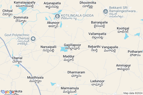
Gagillapur Map
EDIT Map
Add Your House
 ..
..
Current Corona Virus Infected Patients Count in Warangal District
| City Name | District Name | Total Covid cases |
|---|---|---|
| Warangal Urban District | Warangal Urban | 23 |
| Mulugu District | Mulugu | 2 |
| Mahabubabad District | Mahabubabad | 1 |
Locality Name :
Gagillapur
( గాగిల్లాపూర్ )
Mandal Name : Maddur
District : Warangal
State : Telangana
Region : Telangana
Language : Telugu and Urdu
Current Time 09:41 AM
Date: Friday , Apr 25,2025 (IST)
Time zone: IST (UTC+5:30)
Elevation / Altitude: 380 meters. Above Seal level
Telephone Code / Std Code: 08710
Assembly constituency : Jangaon assembly constituency
Assembly MLA : Palla Rajeshwar Reddy
Lok Sabha constituency : Bhongir parliamentary constituency
Parliament MP : Komati Reddy Venkat Reddy
Serpanch Name :
Pin Code : 506367
Post Office Name : Maddur (Warangal)
Commodities Prices : Cherial Market / Mandi
Gagillapur Live Weather
Temperature: 34.3 °C
scattered clouds
Humidity: 31%
Wind : 4.96 mt/sec towards S
StationName : "Jangaon"
observed on 15 Mins Back
Temperature: 34.3 °C
scattered clouds
Humidity: 31%
Wind : 4.96 mt/sec towards S
StationName : "Jangaon"
observed on 15 Mins Back
Gagillapur Weather Forecast for Next 5 days
26-04-2025
28.9°C to 40.1°C
scattered clouds, few clouds, broken clouds
28.9°C to 40.1°C
scattered clouds, few clouds, broken clouds
27-04-2025
27.9°C to 39.6°C
broken clouds, scattered clouds, few clouds, clear sky, light rain
27.9°C to 39.6°C
broken clouds, scattered clouds, few clouds, clear sky, light rain
28-04-2025
26.4°C to 35.8°C
broken clouds, overcast clouds, few clouds
26.4°C to 35.8°C
broken clouds, overcast clouds, few clouds
29-04-2025
26.2°C to 38.2°C
broken clouds, overcast clouds, few clouds, light rain, scattered clouds, clear sky
26.2°C to 38.2°C
broken clouds, overcast clouds, few clouds, light rain, scattered clouds, clear sky
30-04-2025
25.4°C to 38.4°C
clear sky, scattered clouds, light rain, few clouds
25.4°C to 38.4°C
clear sky, scattered clouds, light rain, few clouds
National Highways Reachable To Gagillapur
Nationa High Way :NH163
Nationa High Way :NH563
Nationa High Way :NH163
Nationa High Way :NH563
About Gagillapur
Correct below Info and add more info about GagillapurGagillapur is a Village in Maddur Mandal in Warangal District of Telangana State, India. It belongs to Telangana region . It is located 65 KM towards west from District head quarters Warangal. 3 KM from Maddur.
Gagillapur Pin code is 506367 and postal head office is Maddur (Warangal).
Rampoor ( 3 KM ) , Rebarthi ( 3 KM ) , Narasaipalle ( 3 KM ) , Vallampatla ( 4 KM ) , Akunoor ( 5 KM ) are the nearby Villages to Gagillapur. Gagillapur is surrounded by Cheriyal Mandal towards west , Narmetta Mandal towards East , Bachannapeta Mandal towards South , Nanganur Mandal towards North .
Jangaon , Siddipet , Bhongir , Karimnagar are the near by Cities to Gagillapur.
This Place is in the border of the Warangal District and Medak District. Medak District Nanganur is North towards this place .
Gagillapoor 2011 Census Details
Gagillapur Local Language is Telugu. Gagillapoor Village Total population is 2285 and number of houses are 517. Female Population is 50.9%. Village literacy rate is 53.1% and the Female Literacy rate is 22.1%.
Population
| Census Parameter | Census Data |
| Total Population | 2285 |
| Total No of Houses | 517 |
| Female Population % | 50.9 % ( 1163) |
| Total Literacy rate % | 53.1 % ( 1213) |
| Female Literacy rate | 22.1 % ( 504) |
| Scheduled Tribes Population % | 0.1 % ( 2) |
| Scheduled Caste Population % | 17.3 % ( 395) |
| Working Population % | 51.3 % |
| Child(0 -6) Population by 2011 | 231 |
| Girl Child(0 -6) Population % by 2011 | 53.2 % ( 123) |
Gagillapoor Census More Deatils.
Politics in Gagillapur
TDP , TRS , INC are the major political parties in this area.Polling Stations /Booths near Gagillapur
1)Errakunta Thanda H/o Pedda Padu2)Gagillapur
3)Madduru
4)Madduru
5)Machupahad
HOW TO REACH Gagillapur
By Road
Jangaon is the Nearest Town to Gagillapur. Jangaon is 40 km from Gagillapur. Road connectivity is there from Jangaon to Gagillapur.By Rail
There is no railway station near to Gagillapur in less than 10 km. How ever there are railway Stations from Near By town Jangaon. are the railway Stations near to Jangaon. You can reach from Jangaon to Gagillapur by road after .Colleges near Gagillapur
Govt Jr College, Maddur
Address : Maddur
Schools in Gagillapur
Mpps Naradasu Gudiselu
Address : gagillapur , maddur , warangal , Andhra Pradesh . PIN- 506367 , Post - Maddur (Warangal)
Mpps Gagillapur
Address : gagillapur , maddur , warangal , Andhra Pradesh . PIN- 506367 , Post - Maddur (Warangal)
Govt Health Centers near Gagillapur
1) SubCentre, Gagillapur , , SC Colony , SC Community Hall2) SubCentre, Maddur - I , , BC Colony , BC Colony
3) Primary Health Centre, Maddur , , Near mandal office , Near police stupum
Petrol Bunks in Gagillapur,Maddur
HP PETROL PUMP - ADHOC SRI RAJAMMA FS
Survey NO 241 Village Maddur Maddur Mandal; 506367; India
2.3 KM distance Detail
more ..
Schools in Gagillapur,Maddur
Viswabharati Residential Junior College
Gagillapuram; Telangana 506367; India
0.2 KM distance Detail
Electronic Shops in Gagillapur,Maddur
Jai Ganesh Electronics Sales & Service
# 23-88/2; Netaji Road; Cherial; Telangana 506223; India
9.8 KM distance Detail
Super Markets in Gagillapur,Maddur
Vijaya Laxmi General Store
Bachannapet - Narmetta Rd; Kesireddipalle; Telangana 506221; India
13.3 KM distance Detail
Governement Offices near Gagillapur,Maddur
MeeSeva Center
9-76; Shivakumar Online Service; Beside Bsnl Exchange Office; Maddur; Telangana 506367; India
1.6 KM distance Detail
About Gagillapur &
History
How to reach Gagillapur
Tourist Places Near By Gagillapur
Schools in Gagillapur
Colleges in Gagillapur
Temperature & weather of Gagillapur
places in Gagillapur
Gagillapur photos
More Information
How to reach Gagillapur
Tourist Places Near By Gagillapur
Schools in Gagillapur
Colleges in Gagillapur
Temperature & weather of Gagillapur
places in Gagillapur
Gagillapur photos
More Information
Village Talk
Post News or Events about this Village
Near Cities
Jangaon 31 KM near
Siddipet 31 KM near
Bhongir 56 KM near
Karimnagar 62 KM near
Jangaon 31 KM near
Siddipet 31 KM near
Bhongir 56 KM near
Karimnagar 62 KM near
Near By Taluks
Maddur 3 KM near
Cheriyal 13 KM near
Narmetta 14 KM near
Bachannapeta 15 KM near
Maddur 3 KM near
Cheriyal 13 KM near
Narmetta 14 KM near
Bachannapeta 15 KM near
Near By Air Ports
Rajiv Gandhi International Airport 114 KM near
Nanded Airport 256 KM near
Vijayawada Airport 272 KM near
Latur Airport 311 KM near
Rajiv Gandhi International Airport 114 KM near
Nanded Airport 256 KM near
Vijayawada Airport 272 KM near
Latur Airport 311 KM near
Near By Tourist Places
Warangal 66 KM near
Medak 94 KM near
Hyderabad 96 KM near
Medaram 148 KM near
Khammam 156 KM near
Warangal 66 KM near
Medak 94 KM near
Hyderabad 96 KM near
Medaram 148 KM near
Khammam 156 KM near
Near By Districts
Karimnagar 61 KM near
Warangal 62 KM near
Hyderabad 92 KM near
Nalgonda 113 KM near
Karimnagar 61 KM near
Warangal 62 KM near
Hyderabad 92 KM near
Nalgonda 113 KM near
Near By RailWay Station
Jangaon Rail Way Station 29 KM near
Aler Rail Way Station 36 KM near
Jangaon Rail Way Station 29 KM near
Aler Rail Way Station 36 KM near