| Home | City Bus | Maps | Villages | Cities | Rail | Tourist Places | School | College | Pin Codes | Corona Cases Count |
| Distance Calculator Bus Services IFSC Codes Trace Mobile Number Weather Search Place Trace IP Available Cash ATM/Banks Locate Polling Booth Report an Error contact People |
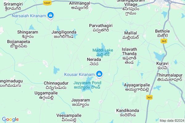
Boda Thanda Map
EDIT Map
Add Your House
 ..
..
Current Corona Virus Infected Patients Count in Warangal District
| City Name | District Name | Total Covid cases |
|---|---|---|
| Warangal Urban District | Warangal Urban | 23 |
| Mulugu District | Mulugu | 2 |
| Mahabubabad District | Mahabubabad | 1 |
Locality Name :
Boda Thanda
( బోధ తండా )
Mandal Name : Kuravi
District : Warangal
State : Telangana
Region : Telangana
Language : Telugu and Urdu
Current Time 12:38 PM
Date: Wednesday , Apr 30,2025 (IST)
Time zone: IST (UTC+5:30)
Elevation / Altitude: 200 meters. Above Seal level
Telephone Code / Std Code: 08719
Assembly constituency : Dornakal assembly constituency
Assembly MLA : Jatoth Ram Chander Naik
Lok Sabha constituency : Mahabubabad parliamentary constituency
Parliament MP : Kavitha Malothu
Serpanch Name :
Pin Code : 506104
Post Office Name : Neerada
Main Village Name : Nerada
Commodities Prices : Mahabubabad Market / Mandi
National Highways Reachable To Boda Thanda
Nationa High Way :NH163
Nationa High Way :NH563
Nationa High Way :NH163
Nationa High Way :NH563
Rivers Near Boda Thanda
Wyra River
Pedda Vagu
Wyra River
Pedda Vagu
About Boda Thanda
Correct below Info and add more info about Boda ThandaBoda Thanda is a small Village/hamlet in Kuravi Mandal in Warangal District of Telangana State, India. It comes under Nerada Panchayath. It belongs to Telangana region . It is located 72 KM towards South from District head quarters Warangal. 10 KM from Kuravi.
Boda Thanda Pin code is 506104 and postal head office is Neerada .
Boda Thanda is surrounded by Maripeda Mandal towards South , Mahbubabad Mandal towards East , Narsimhulapet Mandal towards west , Nallikudur Mandal towards west .
Khammam , Yellandu , Suryapet , Palwancha are the near by Cities to Boda Thanda.
This Place is in the border of the Warangal District and Khammam District. Khammam District Bayyaram is East towards this place .
Demographics of Boda Thanda
Telugu is the Local Language here. Total population of Boda Thanda is 4983 .Males are 2531 and Females are 2,452 living in 1039 Houses. Total area of Boda Thanda is 2334 hectares.Politics in Boda Thanda
TDP , TRS , INC are the major political parties in this area.Polling Stations /Booths near Boda Thanda
1)Nerada2)Nerada
3)Neelikurthi
4)Nerada
5)Tanamcherla
HOW TO REACH Boda Thanda
By Road
Warangal is the Nearest Town to Boda Thanda. Warangal is 80 km from Boda Thanda. Road connectivity is there from Warangal to Boda Thanda.By Rail
There is no railway station near to Boda Thanda in less than 10 km. How ever there are railway Stations from Near By town Warangal. are the railway Stations near to Warangal. You can reach from Warangal to Boda Thanda by road after .Colleges near Boda Thanda
Spurthi Juneyer College Kuravi Poliec Stasion Rote
Address : Kuravi Mandell Kuravi Villege Mrepedda Rotu
svs College
A P T W R S Jr College Kuravi
Address : A P T W R S Jr College Kuravi
Spurthi Jr College Kuravi
Address : Spurthi Jr College Kuravi
Schools in Boda Thanda
Zphs Nerada
Address : nerada , kuravi , warangal , Andhra Pradesh . PIN- 506104 , Post - Neerada
Govt Health Centers near Boda Thanda
1) SubCentre, Nereda 2 , Jan-94 , Busstand Bazar , G.p Office2) SubCentre, Nereda 1 , , Main centre , Opp:High School
3) SubCentre, Malyala , 1-165 , Sc colony , GP
Petrol Bunks in Boda Thanda,Kuravi
HP PETROL PUMP - SRI RAJAGOPALA FILLING STATION
Survey NO 429/A Mahabubabad TO Nellikuduru RD Mahabubabad Village; 506101; India
8.7 KM distance Detail
more ..
Colleges in Boda Thanda,Kuravi
మార్గధర్శి బి యి డి కళశాల
Sri Ram Nagar BC Colony 506102; Mahabubabad; Telangana 506101; India
10.3 KM distance Detail
మార్గధర్శీ టి టి సి కళాశాల
Sri Ram Nagar BC Colony 506102; Mahabubabad; Telangana 506101; India
10.4 KM distance Detail
more ..
Super Markets in Boda Thanda,Kuravi
Naga lakshmi Kiranam and General Stores
Dasharadhi street; Chinna gudur; Chinnagudur; Mahabubabad; Telangana 506104; India
5.7 KM distance Detail
Local Parks in Boda Thanda,Kuravi
BC Colony Park
Sri Ram Nagar BC Colony 506102; Mahabubabad; Telangana; India
11.0 KM distance Detail
Anu Balaji Function Hall & Coventional Center Garden
Anu Balaji Function Hall and Conventional Center Beside Sub Jail Sri Ram Nagar BC Colony Mahabubabad 506102; Mahabubabad; Telangana; India
11.1 KM distance Detail
About Boda Thanda &
History
How to reach Boda Thanda
Tourist Places Near By Boda Thanda
Schools in Boda Thanda
Colleges in Boda Thanda
Temperature & weather of Boda Thanda
places in Boda Thanda
Boda Thanda photos
More Information
How to reach Boda Thanda
Tourist Places Near By Boda Thanda
Schools in Boda Thanda
Colleges in Boda Thanda
Temperature & weather of Boda Thanda
places in Boda Thanda
Boda Thanda photos
More Information
Village Talk
Post News or Events about this Village
Near Cities
Khammam 44 KM near
Yellandu 48 KM near
Suryapet 60 KM near
Palwancha 63 KM near
Khammam 44 KM near
Yellandu 48 KM near
Suryapet 60 KM near
Palwancha 63 KM near
Near By Taluks
Kuravi 10 KM near
Maripeda 14 KM near
Mahbubabad 15 KM near
Narsimhulapet 18 KM near
Kuravi 10 KM near
Maripeda 14 KM near
Mahbubabad 15 KM near
Narsimhulapet 18 KM near
Near By Air Ports
Vijayawada Airport 162 KM near
Rajiv Gandhi International Airport 180 KM near
Rajahmundry Airport 231 KM near
Nanded Airport 370 KM near
Vijayawada Airport 162 KM near
Rajiv Gandhi International Airport 180 KM near
Rajahmundry Airport 231 KM near
Nanded Airport 370 KM near
Near By Tourist Places
Khammam 44 KM near
Warangal 68 KM near
Nagarjunakonda 101 KM near
Medaram 105 KM near
Bhadrachalam 116 KM near
Khammam 44 KM near
Warangal 68 KM near
Nagarjunakonda 101 KM near
Medaram 105 KM near
Bhadrachalam 116 KM near
Near By Districts
Khammam 44 KM near
Warangal 69 KM near
Nalgonda 98 KM near
Karimnagar 145 KM near
Khammam 44 KM near
Warangal 69 KM near
Nalgonda 98 KM near
Karimnagar 145 KM near
Near By RailWay Station
Mahbubabad Rail Way Station 12 KM near
Kesamudram Rail Way Station 19 KM near
Mahbubabad Rail Way Station 12 KM near
Kesamudram Rail Way Station 19 KM near