| Home | City Bus | Maps | Villages | Cities | Rail | Tourist Places | School | College | Pin Codes | Corona Cases Count |
| Distance Calculator Bus Services IFSC Codes Trace Mobile Number Weather Search Place Trace IP Available Cash ATM/Banks Locate Polling Booth Report an Error contact People |
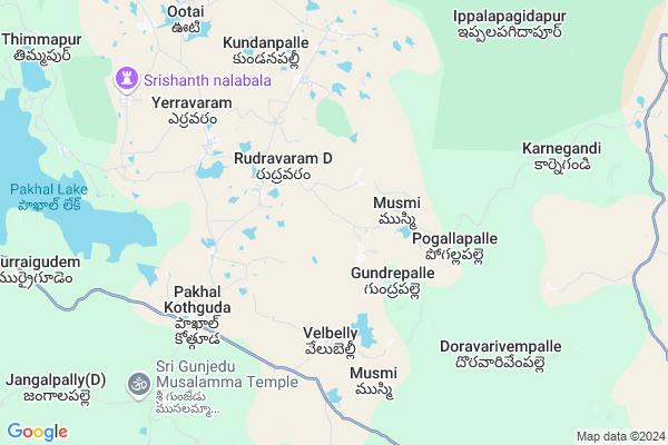
Ponugondla
Ponugondla Map
EDIT Map
Add Your House
 ..
..
Current Corona Virus Infected Patients Count in Warangal District
| City Name | District Name | Total Covid cases |
|---|---|---|
| Warangal Urban District | Warangal Urban | 23 |
| Mulugu District | Mulugu | 2 |
| Mahabubabad District | Mahabubabad | 1 |
Locality Name :
Ponugondla
( పూనుగొండ్ల )
Mandal Name : Kothagudem
District : Warangal
State : Telangana
Region : Telangana
Language : Telugu and Urdu
Current Time 12:50 PM
Date: Sunday , Apr 27,2025 (IST)
Time zone: IST (UTC+5:30)
Elevation / Altitude: 236 meters. Above Seal level
Telephone Code / Std Code: 08718
Assembly constituency : Mulug assembly constituency
Assembly MLA : Danasari Anasuya Seethakka
Lok Sabha constituency : Mahabubabad parliamentary constituency
Parliament MP : Kavitha Malothu
Serpanch Name :
Pin Code : 506135
Post Office Name : Kothaguda (Warangal)
Commodities Prices : Narsampet Market / Mandi
National Highways Reachable To Ponugondla
Nationa High Way :NH32
Nationa High Way :NH30
Nationa High Way :NH32
Nationa High Way :NH30
Rivers Near Ponugondla
Gadhavi
Tannor
Gadhavi
Tannor
About Ponugondla
Correct below Info and add more info about PonugondlaPonugondla is a Village in Kothagudem Mandal in Warangal District of Telangana State, India. It belongs to Telangana region . It is located 64 KM towards East from District head quarters Warangal.
Ponugondla Pin code is 506135 and postal head office is Kothaguda (Warangal).
Ponugondla is surrounded by Khanapur Mandal towards west , Gudur Mandal towards South , Narsampet Mandal towards west , Chennaraopet Mandal towards west .
Yellandu , Warangal , Kothagudem , Palwancha are the near by Cities to Ponugondla.
Ponugonda 2011 Census Details
Ponugondla Local Language is Telugu. Ponugonda Village Total population is 549 and number of houses are 177. Female Population is 48.5%. Village literacy rate is 47.9% and the Female Literacy rate is 16.4%.
Population
| Census Parameter | Census Data |
| Total Population | 549 |
| Total No of Houses | 177 |
| Female Population % | 48.5 % ( 266) |
| Total Literacy rate % | 47.9 % ( 263) |
| Female Literacy rate | 16.4 % ( 90) |
| Scheduled Tribes Population % | 98.7 % ( 542) |
| Scheduled Caste Population % | 0.0 % ( 0) |
| Working Population % | 81.2 % |
| Child(0 -6) Population by 2011 | 73 |
| Girl Child(0 -6) Population % by 2011 | 52.1 % ( 38) |
Ponugonda Census More Deatils.
Politics in Ponugondla
TDP , TRS , INC are the major political parties in this area.Polling Stations /Booths near Ponugondla
1)Kothur H/o Buttayagudem2)Muppana Palli
3)Peddapur
4)Rohir
5)Govinda Rao Pet
HOW TO REACH Ponugondla
By Road
Yellandu is the Nearest Town to Ponugondla. Yellandu is 44 km from Ponugondla. Road connectivity is there from Yellandu to Ponugondla.By Rail
There is no railway station near to Ponugondla in less than 10 km.Colleges near Ponugondla
Vmr Polytechnic College
Address :
Maharshi Degree$ P.g College Mulugu Code 280
Address : Main Road Mulugu Pincode 506343
Sri Vikas Junioer And Degree Collage
Address :
Nalanda Junior College
Address :
Sri Vivekandha Degree College
Address :
Schools near Ponugondla
Zpss Yedullapally
Address : yedullapalle , kothaguda , warangal , Andhra Pradesh . PIN- 506135 , Post - Kothaguda (Warangal)
Zphs Ootai
Address : ootai , kothaguda , warangal , Andhra Pradesh . PIN- 506135 , Post - Kothaguda (Warangal)
Twahs(g) Kothaguda
Address : kothagudem , kothaguda , warangal , Andhra Pradesh . PIN- 506135 , Post - Kothaguda (Warangal)
Zphs Komatla Gudem
Address : komatlagudem , kothaguda , warangal , Andhra Pradesh . PIN- 506135 , Post - Kothaguda (Warangal)
Govt Health Centers near Ponugondla
1) SubCentre, Musmi , 18-Jan , Near Watertank , Near Anganwadi Center2) SubCentre, Velubelly , 1-Apr , Velubelli , Main Road
3) SubCentre, Pogullapally , Feb-45 , Hanuman temple street , Anganvadi Centre
Schools in Ponugondla,Kothagudem
Andhrapradesh Tribal Welfare Residential School
Kothaguda; Govindapur; Telangana 506135; India
3.5 KM distance Detail
MPP School
H/o Velubelly Village;Kothaguda Mandal;; Chinthagattu Thanda; India
4.0 KM distance Detail
Electronic Shops in Ponugondla,Kothagudem
AMJAD Mobile Ship
Mahbubabad - Warangal Rd; Pocharam; Telangana 506332; India
17.7 KM distance Detail
Police Stations near Ponugondla,Kothagudem
MARRI SRIKANTH
OPP; Mandal Revenue Office; Khanapur; Telangana 504203; India
22.3 KM distance Detail
About Ponugondla &
History
How to reach Ponugondla
Tourist Places Near By Ponugondla
Schools in Ponugondla
Colleges in Ponugondla
Temperature & weather of Ponugondla
places in Ponugondla
Ponugondla photos
More Information
How to reach Ponugondla
Tourist Places Near By Ponugondla
Schools in Ponugondla
Colleges in Ponugondla
Temperature & weather of Ponugondla
places in Ponugondla
Ponugondla photos
More Information
Village Talk
Post News or Events about this Village
Near Cities
Yellandu 50 KM near
Warangal 60 KM near
Kothagudem 79 KM near
Palwancha 81 KM near
Yellandu 50 KM near
Warangal 60 KM near
Kothagudem 79 KM near
Palwancha 81 KM near
Near By Taluks
Kothagudem 0 KM near
Khanapur 19 KM near
Gudur 21 KM near
Narsampet 24 KM near
Kothagudem 0 KM near
Khanapur 19 KM near
Gudur 21 KM near
Narsampet 24 KM near
Near By Air Ports
Vijayawada Airport 194 KM near
Rajiv Gandhi International Airport 216 KM near
Rajahmundry Airport 229 KM near
Nanded Airport 363 KM near
Vijayawada Airport 194 KM near
Rajiv Gandhi International Airport 216 KM near
Rajahmundry Airport 229 KM near
Nanded Airport 363 KM near
Near By Tourist Places
Medaram 50 KM near
Warangal 58 KM near
Khammam 85 KM near
Bhadrachalam 99 KM near
Nagarjunakonda 154 KM near
Medaram 50 KM near
Warangal 58 KM near
Khammam 85 KM near
Bhadrachalam 99 KM near
Nagarjunakonda 154 KM near
Near By Districts
Warangal 61 KM near
Khammam 85 KM near
Karimnagar 129 KM near
Bijapur 136 KM near
Warangal 61 KM near
Khammam 85 KM near
Karimnagar 129 KM near
Bijapur 136 KM near
Near By RailWay Station
Nekonda Rail Way Station 39 KM near
Kesamudram Rail Way Station 39 KM near
Nekonda Rail Way Station 39 KM near
Kesamudram Rail Way Station 39 KM near