| Home | City Bus | Maps | Villages | Cities | Rail | Tourist Places | School | College | Pin Codes | Corona Cases Count |
| Distance Calculator Bus Services IFSC Codes Trace Mobile Number Weather Search Place Trace IP Available Cash ATM/Banks Locate Polling Booth Report an Error contact People |
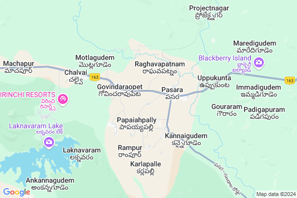
Rangapur
Rangapur Map
EDIT Map
Add Your House
 ..
..
Current Corona Virus Infected Patients Count in Warangal District
| City Name | District Name | Total Covid cases |
|---|---|---|
| Warangal Urban District | Warangal Urban | 23 |
| Mulugu District | Mulugu | 2 |
| Mahabubabad District | Mahabubabad | 1 |
Locality Name :
Rangapur
( రంగాపూర్ )
Mandal Name : Govindaraopet
District : Warangal
State : Telangana
Region : Telangana
Language : Telugu and Urdu
Current Time 09:20 AM
Date: Saturday , Apr 26,2025 (IST)
Time zone: IST (UTC+5:30)
Elevation / Altitude: 249 meters. Above Seal level
Telephone Code / Std Code: 08715
Assembly constituency : Mulug assembly constituency
Assembly MLA : Danasari Anasuya Seethakka
Lok Sabha constituency : Mahabubabad parliamentary constituency
Parliament MP : Kavitha Malothu
Serpanch Name :
Pin Code : 506344
Post Office Name : Govindaraopet
Main Village Name : Ramnagar
Commodities Prices : Ghanpur Market / Mandi
Rangapur Live Weather
Temperature: 35.0 °C
broken clouds
Humidity: 36%
Wind : 3.97 mt/sec towards S
StationName : "Warangal"
observed on 2 Mins Back
Temperature: 35.0 °C
broken clouds
Humidity: 36%
Wind : 3.97 mt/sec towards S
StationName : "Warangal"
observed on 2 Mins Back
Rangapur Weather Forecast for Next 5 days
27-04-2025
28.1°C to 39.5°C
broken clouds, light rain, moderate rain, overcast clouds
28.1°C to 39.5°C
broken clouds, light rain, moderate rain, overcast clouds
28-04-2025
27.5°C to 35.5°C
overcast clouds, few clouds, scattered clouds
27.5°C to 35.5°C
overcast clouds, few clouds, scattered clouds
29-04-2025
26.2°C to 42.0°C
few clouds, clear sky, broken clouds, scattered clouds
26.2°C to 42.0°C
few clouds, clear sky, broken clouds, scattered clouds
30-04-2025
26.9°C to 42.0°C
clear sky, few clouds, scattered clouds, broken clouds
26.9°C to 42.0°C
clear sky, few clouds, scattered clouds, broken clouds
01-05-2025
27.0°C to 43.1°C
scattered clouds, few clouds, clear sky, broken clouds
27.0°C to 43.1°C
scattered clouds, few clouds, clear sky, broken clouds
National Highways Reachable To Rangapur
Nationa High Way :NH365BB
Nationa High Way :NH16
Nationa High Way :NH365BB
Nationa High Way :NH16
Rivers Near Rangapur
Gadhavi
Pranhita
Gadhavi
Pranhita
About Rangapur
Correct below Info and add more info about RangapurRangapur is a small Village/hamlet in Govindaraopet Mandal in Warangal District of Telangana State, India. It comes under Ramnagar Panchayath. It belongs to Telangana region . As part Telangana Districts re-organisation , Rangapur Village Govindaraopet Mandal re organised from Warangal District to Jaya Shankar district. It is located 75 KM towards East from District head quarters Warangal.
Rangapur Pin code is 506344 and postal head office is Govindaraopet .
Rangapur is surrounded by Tadvai Mandal towards East , Mulug Mandal towards west , Venkatapur Mandal towards west , Kothagudem Mandal towards South .
Warangal , Yellandu , Manuguru , Kothagudem are the near by Cities to Rangapur.
Rangapur 2011 Census Details
Rangapur Local Language is Telugu. Rangapur Village Total population is 4678 and number of houses are 1271. Female Population is 50.4%. Village literacy rate is 66.3% and the Female Literacy rate is 29.9%.
Population
| Census Parameter | Census Data |
| Total Population | 4678 |
| Total No of Houses | 1271 |
| Female Population % | 50.4 % ( 2359) |
| Total Literacy rate % | 66.3 % ( 3103) |
| Female Literacy rate | 29.9 % ( 1401) |
| Scheduled Tribes Population % | 18.0 % ( 842) |
| Scheduled Caste Population % | 23.3 % ( 1091) |
| Working Population % | 58.0 % |
| Child(0 -6) Population by 2011 | 363 |
| Girl Child(0 -6) Population % by 2011 | 50.7 % ( 184) |
Rangapur Census More Deatils.
Politics in Rangapur
TDP , TRS , INC are the major political parties in this area.Polling Stations /Booths near Rangapur
1)Ladaigadda Thanda (mushmi)2)Govindarao Peta
3)Govindarao Peta
4)Eturunagaram
5)Gopala Puram
HOW TO REACH Rangapur
By Road
Warangal is the Nearest Town to Rangapur. Warangal is 68 km from Rangapur. Road connectivity is there from Warangal to Rangapur.By Rail
There is no railway station near to Rangapur in less than 10 km. How ever there are railway Stations from Near By town Warangal. are the railway Stations near to Warangal. You can reach from Warangal to Rangapur by road after .Colleges near Rangapur
Nalanda Junior College
Address :
Govt Jr College
Address :
Schools in Rangapur
Zphs(girls) Govindaraopet
Address : rangapur , govindaraopet , warangal , Andhra Pradesh . PIN- 506344 , Post - Govindaraopet
Puahs Merit School
Address : rangapur , govindaraopet , warangal , Andhra Pradesh . PIN- 506344 , Post - Govindaraopet
The Mothersintegral School
Address : rangapur , govindaraopet , warangal , Andhra Pradesh . PIN- 506344 , Post - Govindaraopet
Mpups Raghava Patnam
Address : rangapur , govindaraopet , warangal , Andhra Pradesh . PIN- 506344 , Post - Govindaraopet
Govt Health Centers near Rangapur
1) SubCentre Govindraopet , , Old MRO street , jr.college2) Primary Health Centre Govindaraopet , , Main Road , Behind MPDO office
3) SubCentre Gandhinagar , , mainroad , primary school
Sub Villages in Rangapur
Petrol Bunks in Rangapur,Govindaraopet
PADMA PRIYA PETROL PUMP
JANGALPALLY; MULUG (M); WARANGAL; Telangana 506352; India
19.8 KM distance Detail
more ..
Colleges in Rangapur,Govindaraopet
Government Junior College
National Highway 202; Tadvai; Telangana 506344; India
21.2 KM distance Detail
more ..
Schools in Rangapur,Govindaraopet
ribal Welfare Ashram High School Boys;
Govindaraopet; Laxmipuram; 506347; India
4.3 KM distance Detail
Electronic Shops in Rangapur,Govindaraopet
Sri Laxmi Automobiles Tallapadu; Venkatapur
Gollawada; Venkatapur; Telangana 506345; India
20.7 KM distance Detail
Super Markets in Rangapur,Govindaraopet
Police Stations near Rangapur,Govindaraopet
Police Station
Pasra; National Highway 163; Kannaigudem; Telangana 506347; India
4.7 KM distance Detail
Governement Offices near Rangapur,Govindaraopet
Grama Panchayath Office
Warangal-Hyderabad Road; Chalvai; Telangana 506344; India
6.7 KM distance Detail
About Rangapur &
History
How to reach Rangapur
Tourist Places Near By Rangapur
Schools in Rangapur
Colleges in Rangapur
Temperature & weather of Rangapur
places in Rangapur
Rangapur photos
More Information
How to reach Rangapur
Tourist Places Near By Rangapur
Schools in Rangapur
Colleges in Rangapur
Temperature & weather of Rangapur
places in Rangapur
Rangapur photos
More Information
Village Talk
Post News or Events about this Village
Near Cities
Warangal 69 KM near
Yellandu 76 KM near
Manuguru 85 KM near
Kothagudem 97 KM near
Warangal 69 KM near
Yellandu 76 KM near
Manuguru 85 KM near
Kothagudem 97 KM near
Near By Taluks
Govindaraopet 0 KM near
Tadvai 12 KM near
Mulug 24 KM near
Venkatapur 28 KM near
Govindaraopet 0 KM near
Tadvai 12 KM near
Mulug 24 KM near
Venkatapur 28 KM near
Near By Air Ports
Vijayawada Airport 220 KM near
Rajiv Gandhi International Airport 236 KM near
Rajahmundry Airport 239 KM near
Nanded Airport 356 KM near
Vijayawada Airport 220 KM near
Rajiv Gandhi International Airport 236 KM near
Rajahmundry Airport 239 KM near
Nanded Airport 356 KM near
Near By Tourist Places
Medaram 19 KM near
Warangal 68 KM near
Bhadrachalam 109 KM near
Khammam 116 KM near
Bhamragarh Wildlife Sanctuary 160 KM near
Medaram 19 KM near
Warangal 68 KM near
Bhadrachalam 109 KM near
Khammam 116 KM near
Bhamragarh Wildlife Sanctuary 160 KM near
Near By Districts
Warangal 72 KM near
Bijapur 109 KM near
Khammam 116 KM near
Karimnagar 123 KM near
Warangal 72 KM near
Bijapur 109 KM near
Khammam 116 KM near
Karimnagar 123 KM near
Near By RailWay Station
Nekonda Rail Way Station 64 KM near
Kesamudram Rail Way Station 69 KM near
Nekonda Rail Way Station 64 KM near
Kesamudram Rail Way Station 69 KM near