| Home | City Bus | Maps | Villages | Cities | Rail | Tourist Places | School | College | Pin Codes | Corona Cases Count |
| Distance Calculator Bus Services IFSC Codes Trace Mobile Number Weather Search Place Trace IP Available Cash ATM/Banks Locate Polling Booth Report an Error contact People |
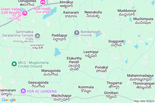
Elkurthy
Elkurthy Map
EDIT Map
Add Your House
 ..
..
Current Corona Virus Infected Patients Count in Warangal District
| City Name | District Name | Total Covid cases |
|---|---|---|
| Warangal Urban District | Warangal Urban | 23 |
| Mulugu District | Mulugu | 2 |
| Mahabubabad District | Mahabubabad | 1 |
Locality Name :
Elkurthy
( ఇక్కుర్తి )
Mandal Name : Geesugonda
District : Warangal
State : Telangana
Region : Telangana
Language : Telugu and Urdu
Current Time 10:57 AM
Date: Tuesday , Apr 29,2025 (IST)
Time zone: IST (UTC+5:30)
Elevation / Altitude: 261 meters. Above Seal level
Telephone Code / Std Code: 0870
Assembly constituency : Parkal assembly constituency
Assembly MLA : Revuri Prakash Reddy
Lok Sabha constituency : Warangal parliamentary constituency
Parliament MP : DAYAKAR PASUNOORI
Serpanch Name :
Pin Code : 506330
Post Office Name : Dharmaram (Warangal)
Commodities Prices : Warangal Market / Mandi
Elkurthy Live Weather
Temperature: 35.4 °C
clear sky
Humidity: 33%
Wind : 5.73 mt/sec towards S
StationName : "Warangal"
observed on 24 Mins Back
Temperature: 35.4 °C
clear sky
Humidity: 33%
Wind : 5.73 mt/sec towards S
StationName : "Warangal"
observed on 24 Mins Back
Elkurthy Weather Forecast for Next 5 days
30-04-2025
27.2°C to 40.4°C
clear sky, few clouds, scattered clouds
27.2°C to 40.4°C
clear sky, few clouds, scattered clouds
01-05-2025
26.3°C to 41.0°C
scattered clouds, broken clouds, clear sky, few clouds
26.3°C to 41.0°C
scattered clouds, broken clouds, clear sky, few clouds
02-05-2025
26.6°C to 42.2°C
few clouds, scattered clouds, clear sky
26.6°C to 42.2°C
few clouds, scattered clouds, clear sky
03-05-2025
27.3°C to 41.7°C
broken clouds, scattered clouds, clear sky, few clouds
27.3°C to 41.7°C
broken clouds, scattered clouds, clear sky, few clouds
04-05-2025
27.1°C to 42.7°C
scattered clouds, few clouds, clear sky, overcast clouds
27.1°C to 42.7°C
scattered clouds, few clouds, clear sky, overcast clouds
National Highways Reachable To Elkurthy
Nationa High Way :NH163
Nationa High Way :NH563
Nationa High Way :NH163
Nationa High Way :NH563
Rivers Near Elkurthy
Sali Vagu
Sali Vagu
About Elkurthy
Correct below Info and add more info about ElkurthyElkurthy is a Village in Geesugonda Mandal in Warangal District of Telangana State, India. It belongs to Telangana region . As part Telangana Districts re-organisation , Elkurthy Village Geesugonda Mandal re organised from Warangal District to Warangal Rural district. It is located 20 KM towards East from District head quarters Warangal. 7 KM from Geesgonda.
Elkurthy Pin code is 506330 and postal head office is Dharmaram (Warangal).
Anantharam ( 4 KM ) , Peddapur ( 4 KM ) , Ponakal ( 5 KM ) , Nagaiahpally ( 5 KM ) , Deshaipally ( 5 KM ) are the nearby Villages to Elkurthy. Elkurthy is surrounded by Duggondi Mandal towards East , Atmakur Mandal towards North , Shyampet Mandal towards North , Nalla Belli Mandal towards East .
Warangal , Jangaon , Yellandu , Karimnagar are the near by Cities to Elkurthy.
Elkurthy 2011 Census Details
Elkurthy Local Language is Telugu. Elkurthy Village Total population is 4195 and number of houses are 1135. Female Population is 51.0%. Village literacy rate is 59.9% and the Female Literacy rate is 24.9%.
Population
| Census Parameter | Census Data |
| Total Population | 4195 |
| Total No of Houses | 1135 |
| Female Population % | 51.0 % ( 2140) |
| Total Literacy rate % | 59.9 % ( 2512) |
| Female Literacy rate | 24.9 % ( 1043) |
| Scheduled Tribes Population % | 2.0 % ( 82) |
| Scheduled Caste Population % | 18.1 % ( 758) |
| Working Population % | 51.9 % |
| Child(0 -6) Population by 2011 | 348 |
| Girl Child(0 -6) Population % by 2011 | 50.6 % ( 176) |
Elkurthy Census More Deatils.
Politics in Elkurthy
TDP , TRS , YSCP , INC are the major political parties in this area.Polling Stations /Booths near Elkurthy
1)Elukurthy(h)2)Elukurti Haveli
3)Eluguru Station
4)Elukurti Haveli
5)Aarepalli
HOW TO REACH Elkurthy
By Road
Warangal is the Nearest Town to Elkurthy. Warangal is 25 km from Elkurthy. Road connectivity is there from Warangal to Elkurthy.By Rail
There is no railway station near to Elkurthy in less than 10 km. How ever there are railway Stations from Near By town Warangal. are the railway Stations near to Warangal. You can reach from Warangal to Elkurthy by road after .Colleges near Elkurthy
Sree Sai
Address :
Sravanthi Jr College Dharmaram
Address : Sravanthi Jr College Dharmaram
Schools in Elkurthy
Sri Saraswathi Shishu Man
Address : elkurthy , geesugonda , warangal , Andhra Pradesh . PIN- 506330 , Post - Dharmaram (Warangal)
Zphs Elukurthy Haveli
Address : elkurthy , geesugonda , warangal , Andhra Pradesh . PIN- 506330 , Post - Dharmaram (Warangal)
Govt Health Centers near Elkurthy
1) SubCentre, Elukurthy , "Govt. Building 1-3/1" , Elukurthy , Beside School2) SubCentre, Manugonda , 2/13/2002 , Manugonda , Near Bodrai
3) SubCentre NachinaPally , 2-234 , SC Colony , Near Rice Mill
Hospitals in Elkurthy,Geesugonda
Government Ayurvedic Hospital
Elukurthy Haveli Road; Elukurthy Haveli; Telangana 506330; India
2.1 KM distance Detail
Dr.prasad Rmp
Elukurthy Haveli Road; Tenuguvada; Elukurthy Haveli; Telangana 506330; India
2.1 KM distance Detail
more ..
Petrol Bunks in Elkurthy,Geesugonda
Amrut Sai Filling Station-Indian Oil Petrol Pump
Kommala; Warangal; NH-365; Warangal Narasampet Road; Geesu Gonda; Geesu Gonda; Telangana 506331; India
8.1 KM distance Detail
more ..
Colleges in Elkurthy,Geesugonda
Balaji Institute of Management Sciences
Narsampet; Laknepally; Telangana 506331; India
7.6 KM distance Detail
Government Junior College
Atmakur - Jogampally Rd; Atmakur; Telangana 506342; India
7.9 KM distance Detail
more ..
Schools in Elkurthy,Geesugonda
Anganwadi Center
Geesugonda Mandal; ZPSS Road; Elukurthy Haveli; 506330; India
2.2 KM distance Detail
ZPSS High School
Geesugonda Mandal; ZPSS Road; Elukurthy Haveli; 506330; India
2.2 KM distance Detail
Electronic Shops in Elkurthy,Geesugonda
Welding Shop;Surendra Cahry
1; Elukurthy Haveli Road; Manugonda; Telangana 506330; India
5.4 KM distance Detail
Local Parks in Elkurthy,Geesugonda
Labour Colony Public Park
Abbanikunta; Labour Colony; Warangal; Telangana 506013; India
16.6 KM distance Detail
Police Stations near Elkurthy,Geesugonda
Police station
Police Station; Geesugonda; wgl;AP; Geesugonda; Telangana 506330; India
8.8 KM distance Detail
Governement Offices near Elkurthy,Geesugonda
Grama Panchayath Office
Duggondi Mandal; Neerukulla-Mood Chintal Rd; Laxmipur; 506342; India
2.2 KM distance Detail
About Elkurthy &
History
How to reach Elkurthy
Tourist Places Near By Elkurthy
Schools in Elkurthy
Colleges in Elkurthy
Temperature & weather of Elkurthy
places in Elkurthy
Elkurthy photos
More Information
How to reach Elkurthy
Tourist Places Near By Elkurthy
Schools in Elkurthy
Colleges in Elkurthy
Temperature & weather of Elkurthy
places in Elkurthy
Elkurthy photos
More Information
Village Talk
Post News or Events about this Village
Near Cities
Warangal 18 KM near
Jangaon 78 KM near
Yellandu 85 KM near
Karimnagar 92 KM near
Warangal 18 KM near
Jangaon 78 KM near
Yellandu 85 KM near
Karimnagar 92 KM near
Near By Taluks
Duggondi 7 KM near
Geesugonda 8 KM near
Atmakur 9 KM near
Shyampet 13 KM near
Duggondi 7 KM near
Geesugonda 8 KM near
Atmakur 9 KM near
Shyampet 13 KM near
Near By Air Ports
Rajiv Gandhi International Airport 183 KM near
Vijayawada Airport 222 KM near
Rajahmundry Airport 270 KM near
Nanded Airport 322 KM near
Rajiv Gandhi International Airport 183 KM near
Vijayawada Airport 222 KM near
Rajahmundry Airport 270 KM near
Nanded Airport 322 KM near
Near By Tourist Places
Warangal 16 KM near
Medaram 69 KM near
Khammam 105 KM near
Bhadrachalam 142 KM near
Nagarjunakonda 161 KM near
Warangal 16 KM near
Medaram 69 KM near
Khammam 105 KM near
Bhadrachalam 142 KM near
Nagarjunakonda 161 KM near
Near By Districts
Warangal 20 KM near
Karimnagar 89 KM near
Khammam 105 KM near
Nalgonda 133 KM near
Warangal 20 KM near
Karimnagar 89 KM near
Khammam 105 KM near
Nalgonda 133 KM near
Near By RailWay Station
Warangal Rail Way Station 17 KM near
Nekonda Rail Way Station 27 KM near
Warangal Rail Way Station 17 KM near
Nekonda Rail Way Station 27 KM near