| Home | City Bus | Maps | Villages | Cities | Rail | Tourist Places | School | College | Pin Codes | Corona Cases Count |
| Distance Calculator Bus Services IFSC Codes Trace Mobile Number Weather Search Place Trace IP Available Cash ATM/Banks Locate Polling Booth Report an Error contact People |
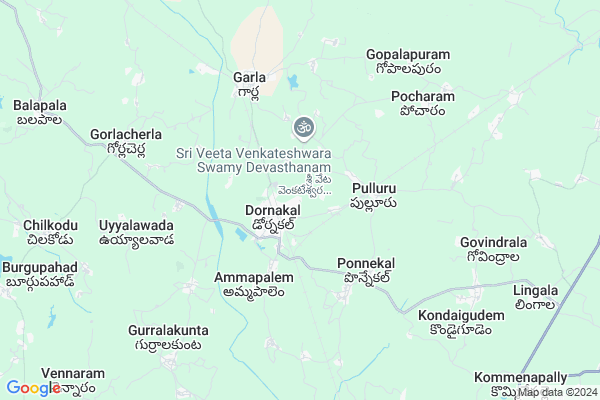
Dornakal Map
EDIT Map
Add Your House
 ..
..
Current Corona Virus Infected Patients Count in Warangal District
| City Name | District Name | Total Covid cases |
|---|---|---|
| Warangal Urban District | Warangal Urban | 23 |
| Mulugu District | Mulugu | 2 |
| Mahabubabad District | Mahabubabad | 1 |
Locality Name :
Dornakal
( డోర్నకల్ )
Mandal Name : Dornakal
District : Warangal
State : Telangana
Region : Telangana
Language : Telugu and Urdu
Current Time 12:29 AM
Date: Wednesday , Apr 30,2025 (IST)
Time zone: IST (UTC+5:30)
Elevation / Altitude: 153 meters. Above Seal level
Telephone Code / Std Code: 08719
Assembly constituency : Dornakal assembly constituency
Assembly MLA : Jatoth Ram Chander Naik
Lok Sabha constituency : Mahabubabad parliamentary constituency
Parliament MP : Kavitha Malothu
Serpanch Name :
Pin Code : 506381
Post Office Name : Dornakal
Commodities Prices : Khammam Market / Mandi
National Highways Reachable To Dornakal
Nationa High Way :NH38
Nationa High Way :NH563
Nationa High Way :NH38
Nationa High Way :NH563
Rivers Near Dornakal
Pedda Vagu
Ken
Pedda Vagu
Ken
About Dornakal
Correct below Info and add more info about DornakalDornakal is a Town in Dornakal Mandal in Warangal District of Telangana State, India. It belongs to Telangana region . It is located 100 KM towards East from District head quarters Warangal. It is a Mandal head quarter.
Dornakal Pin code is 506381 and postal head office is Dornakal .
Uyyalawada ( 6 KM ) , Gollacherla ( 7 KM ) , Vennaram ( 8 KM ) , Burgupahad ( 8 KM ) , Chilkodu ( 10 KM ) are the nearby Villages to Dornakal. Dornakal is surrounded by Dornakal Mandal towards west , Kamepally Mandal towards East , Kuravi Mandal towards west , Singareni Mandal towards East .
Khammam , Yellandu , Palwancha , Kothagudem are the nearby Cities to Dornakal.
This Place is in the border of the Warangal District and Khammam District. Khammam District Garla is North towards this place .
Demographics of Dornakal
Telugu is the Local Language here. Total population of Dornakal (CT) is 14425 according to census 2011.Among them Males are 7124 and Females are 7301 living in 3494 Houses. children's below 6 years are 1275 . Among them literate people are 10222. All the numbers are according to 2011 census.Politics in Dornakal
TDP , TRS , INC are the major political parties in this area.Polling Stations /Booths near Dornakal
1)Dornakal2)Dharmaram (thanda)
3)Dornakal
4)Dornakal
5)Dornakal
HOW TO REACH Dornakal
By Road
Khammam is the Nearest Town to Dornakal. Khammam is 24 km from Dornakal. Road connectivity is there from Khammam to Dornakal.By Rail
Dornakal Junction Rail Way Station , Garla Rail Way Station are the very nearby railway stations to Dornakal. Also you can consider railway Stations from Near By town Khammam. Khammam Rail Way Station , Mallemadugu Rail Way Station are the railway stations near to Khammam. You can reach from Khammam to Dornakal by road after .Govt Health Centers near Dornakal
1) SubCentre Dornakal II , 2/2/2003 , Pampubai thanda , Pampubai thanda2) Primary Health Centre Dornakal , Feb-42 , Main Road , Before Rajuthanda
3) SubCentre Dornakal I , 6-1-169 , A.B Nagar , Govt.Borewell
Sub Villages in Dornakal
Hospitals in Dornakal,Dornakal
Ayodhya R K (Dr)
Dornakal Road; Suryaraopet; Suryaraopet; Sahajpur; Telangana 520002; India
1.3 KM distance Detail
more ..
Schools in Dornakal,Dornakal
Dornakal Diocese High School; Dornakal; Telangana
Dornakal Diocese College; Rd; Dornakal; Telangana 506381; India
0.9 KM distance Detail
Electronic Shops in Dornakal,Dornakal
VEERABHADRAM DJ SOUNDS ;;DECORATIONS AND TENT HOUSE 9985960868
Shimla Thanda Rd; Dornakal; Telangana 507210; India
0.9 KM distance Detail
About Dornakal &
History
How to reach Dornakal
Tourist Places Near By Dornakal
Schools in Dornakal
Colleges in Dornakal
Temperature & weather of Dornakal
places in Dornakal
Dornakal photos
More Information
How to reach Dornakal
Tourist Places Near By Dornakal
Schools in Dornakal
Colleges in Dornakal
Temperature & weather of Dornakal
places in Dornakal
Dornakal photos
More Information
Town Talk
Post News or Events about this Town
Near Cities
Khammam 24 KM near
Yellandu 26 KM near
Palwancha 32 KM near
Kothagudem 57 KM near
Khammam 24 KM near
Yellandu 26 KM near
Palwancha 32 KM near
Kothagudem 57 KM near
Near By Taluks
Garla 5 KM near
Dornakal 7 KM near
Kamepally 12 KM near
Singareni 20 KM near
Garla 5 KM near
Dornakal 7 KM near
Kamepally 12 KM near
Singareni 20 KM near
Near By Air Ports
Vijayawada Airport 137 KM near
Rajahmundry Airport 201 KM near
Rajiv Gandhi International Airport 207 KM near
Vishakhapatnam Airport 365 KM near
Vijayawada Airport 137 KM near
Rajahmundry Airport 201 KM near
Rajiv Gandhi International Airport 207 KM near
Vishakhapatnam Airport 365 KM near
Near By Tourist Places
Khammam 24 KM near
Bhadrachalam 91 KM near
Warangal 94 KM near
Nagarjunakonda 97 KM near
Medaram 108 KM near
Khammam 24 KM near
Bhadrachalam 91 KM near
Warangal 94 KM near
Nagarjunakonda 97 KM near
Medaram 108 KM near
Near By Districts
Khammam 24 KM near
Warangal 95 KM near
Nalgonda 118 KM near
West Godavari 145 KM near
Khammam 24 KM near
Warangal 95 KM near
Nalgonda 118 KM near
West Godavari 145 KM near
Near By RailWay Station
Dornakal Junction Rail Way Station 1.0 KM near
Garla Rail Way Station 5.4 KM near
Pocharam Rail Way Station 8.0 KM near
Khammam Rail Way Station 25 KM near
Dornakal Junction Rail Way Station 1.0 KM near
Garla Rail Way Station 5.4 KM near
Pocharam Rail Way Station 8.0 KM near
Khammam Rail Way Station 25 KM near