| Home | City Bus | Maps | Villages | Cities | Rail | Tourist Places | School | College | Pin Codes | Corona Cases Count |
| Distance Calculator Bus Services IFSC Codes Trace Mobile Number Weather Search Place Trace IP Available Cash ATM/Banks Locate Polling Booth Report an Error contact People |
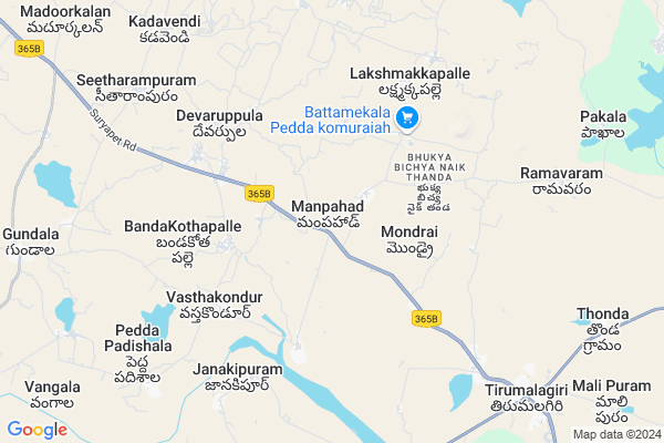
Manpahad
Manpahad Map
EDIT Map
Add Your House
 ..
..
Current Corona Virus Infected Patients Count in Warangal District
| City Name | District Name | Total Covid cases |
|---|---|---|
| Warangal Urban District | Warangal Urban | 23 |
| Mulugu District | Mulugu | 2 |
| Mahabubabad District | Mahabubabad | 1 |
Locality Name :
Manpahad
( మాన్పహాడ్ )
Mandal Name : Devaruppula
District : Warangal
State : Telangana
Region : Telangana
Language : Telugu and Urdu
Current Time 05:34 AM
Date: Saturday , Apr 26,2025 (IST)
Time zone: IST (UTC+5:30)
Elevation / Altitude: 357 meters. Above Seal level
Telephone Code / Std Code: 08716
Assembly constituency : Palakurthi assembly constituency
Assembly MLA : Yashaswini Mamidala
Lok Sabha constituency : Warangal parliamentary constituency
Parliament MP : DAYAKAR PASUNOORI
Serpanch Name :
Pin Code : 506302
Post Office Name : Devaruppal
Commodities Prices : Jangaon Market / Mandi
Manpahad Live Weather
Temperature: 27.7 °C
broken clouds
Humidity: 62%
Wind : 4.99 mt/sec towards SE
StationName : "Jangaon"
observed on 11 Mins Back
Temperature: 27.7 °C
broken clouds
Humidity: 62%
Wind : 4.99 mt/sec towards SE
StationName : "Jangaon"
observed on 11 Mins Back
Manpahad Weather Forecast for Next 5 days
27-04-2025
27.7°C to 40.6°C
broken clouds, few clouds, scattered clouds
27.7°C to 40.6°C
broken clouds, few clouds, scattered clouds
28-04-2025
27.5°C to 37.9°C
overcast clouds, few clouds, light rain, scattered clouds
27.5°C to 37.9°C
overcast clouds, few clouds, light rain, scattered clouds
29-04-2025
26.1°C to 40.5°C
scattered clouds, few clouds, clear sky, broken clouds
26.1°C to 40.5°C
scattered clouds, few clouds, clear sky, broken clouds
30-04-2025
26.1°C to 41.0°C
clear sky, light rain, scattered clouds, few clouds
26.1°C to 41.0°C
clear sky, light rain, scattered clouds, few clouds
Edit below overview about Manpahad
Edit below overview about Manpahad
OverView of Manpahad
MANPAHAD is combination of two words in Hindi. MAN means people's. PAHAD means Hill. People's who livings the near to hill. This is the story about my village name.Edit below overview about Manpahad
National Highways Reachable To Manpahad
Nationa High Way :NH161AA
Nationa High Way :Old NH202
Nationa High Way :NH161AA
Nationa High Way :Old NH202
Rivers Near Manpahad
Bukleru River
Mustanapalli Vagu
Bukleru River
Mustanapalli Vagu
About Manpahad
Manpahad is a Village in Devaruppula Mandal in Warangal District of Telangana State, India. It belongs to Telangana region . It is located 64 KM towards South from District head quarters Warangal. 10 KM from Devaruppula.
Manpahad Pin code is 506302 and postal head office is Devaruppal .
Devaruppula ( 4 KM ) , Kamareddi Gudem ( 5 KM ) , Lakshmakkapally ( 7 KM ) , Dharamapuram ( 8 KM ) , Seetharampur ( 8 KM ) are the nearby Villages to Manpahad. Manpahad is surrounded by Kodakandla Mandal towards East , Gundala Mandal towards west , Thirumalagiri Mandal towards East , Mothkur Mandal towards South .
Jangaon , Suryapet , Bhongir , Warangal are the near by Cities to Manpahad.
This Place is in the border of the Warangal District and Nalgonda District. Nalgonda District Gundala is west towards this place .
Manpahad 2011 Census Details
Manpahad Local Language is Telugu. Manpahad Village Total population is 836 and number of houses are 209. Female Population is 49.3%. Village literacy rate is 50.4% and the Female Literacy rate is 20.2%.
Population
| Census Parameter | Census Data |
| Total Population | 836 |
| Total No of Houses | 209 |
| Female Population % | 49.3 % ( 412) |
| Total Literacy rate % | 50.4 % ( 421) |
| Female Literacy rate | 20.2 % ( 169) |
| Scheduled Tribes Population % | 0.0 % ( 0) |
| Scheduled Caste Population % | 27.2 % ( 227) |
| Working Population % | 55.9 % |
| Child(0 -6) Population by 2011 | 99 |
| Girl Child(0 -6) Population % by 2011 | 50.5 % ( 50) |
Manpahad Census More Deatils.
Politics in Manpahad
TDP , TRS , INC are the major political parties in this area.Polling Stations /Booths near Manpahad
1)Manchuppula2)Matedu
3)Mondrai
4)Mondrai
5)Mondrai
HOW TO REACH Manpahad
By Road
Jangaon is the Nearest Town to Manpahad. Jangaon is 35 km from Manpahad. Road connectivity is there from Jangaon to Manpahad.By Rail
There is no railway station near to Manpahad in less than 10 km. How ever there are railway Stations from Near By town Jangaon. are the railway Stations near to Jangaon. You can reach from Jangaon to Manpahad by road after .Colleges near Manpahad
Govt Junior College Devaruppula
Address : Govt Junior College Devaruppula
S R Jr College Devaruppala
Address : S R Jr College Devaruppala
Governament College
Address : Devaruppula,kamareddy Guddem ,zphs,school
Schools in Manpahad
Mpups Manpahad
Address : manpahad , devaruppula , warangal , Andhra Pradesh . PIN- 506302 , Post - Devaruppal
Govt Health Centers near Manpahad
1) SubCentre, Thatipamula , 7--36 , Main road , Near AWC2) SubCentre, lakshmakkapally , Feb-43 , Main Road , Beside UPS
3) SubCentre, Nellibanda Thanda , 11/13/2006 , Old Water tank , Near Community halla
Petrol Bunks in Manpahad,Devaruppula
Someshwara Filling Station Indian Oil Petrol Pump
Mondrai; Warangal; SH-16; Jangaon Suryapet Road; Devaruppala; Devaruppala; Telangana 506302; India
0.5 KM distance Detail
Godavari Filling Station Bharat Petroleum
Gollapally; Warangal; SH-16; Jangaon Suryapet Road; Devaruppala; Devaruppala; Telangana 506302; India
3.5 KM distance Detail
more ..
Colleges in Manpahad,Devaruppula
SV Vocational College
Warangal; SH-16; Jangaon Suryapet Road; Devaruppala; Devaruppala; Telangana 506302; India
4.5 KM distance Detail
Thirumala Sahakara junior college
8-92; Adarsha Nagar; Mali Puram; Telangana 508223; India
9.3 KM distance Detail
ITI College
8-21; Jangaon - Tirumalagiri - Suryapet Rd; Mali Puram; Telangana 508223; India
9.5 KM distance Detail
more ..
Schools in Manpahad,Devaruppula
Mandal Praja Parishad Primary School
Manpahad; Warangal; SH-16; Jangaon Suryapet Road; Devaruppala; Devaruppala; Telangana 506302; India
1.0 KM distance Detail
UPS School Manpahad
जंगों - सूर्यापेट मार्ग; Manpahad; Telangana 506302; India
1.1 KM distance Detail
Electronic Shops in Manpahad,Devaruppula
Roja Dj sounds
Devarpula - Hanamkonda Road; Devarpula; Telangana 506303; India
4.7 KM distance Detail
Jagadesh Electronic
3/2/1;; 7-211/3/2/1; Jangaon - Tirumalagiri - Suryapet Rd; Mali Puram; Telangana 508223; India
9.9 KM distance Detail
Super Markets in Manpahad,Devaruppula
Paka Baiyanna and Paka Veeraswamy Land 1.27 Yekars
Nalgonda; Telangana 508223; India
4.1 KM distance Detail
Police Stations near Manpahad,Devaruppula
Thirumalagiri Police Station
8-21; Jangaon - Tirumalagiri - Suryapet Rd; Mali Puram; Telangana 508223; India
9.2 KM distance Detail
About Manpahad &
History
How to reach Manpahad
Tourist Places Near By Manpahad
Schools in Manpahad
Colleges in Manpahad
Temperature & weather of Manpahad
places in Manpahad
Manpahad photos
More Information
How to reach Manpahad
Tourist Places Near By Manpahad
Schools in Manpahad
Colleges in Manpahad
Temperature & weather of Manpahad
places in Manpahad
Manpahad photos
More Information
Village Talk
Post News or Events about this Village
Near Cities
Jangaon 36 KM near
Suryapet 54 KM near
Bhongir 58 KM near
Warangal 65 KM near
Jangaon 36 KM near
Suryapet 54 KM near
Bhongir 58 KM near
Warangal 65 KM near
Near By Taluks
Devaruppula 10 KM near
Kodakandla 14 KM near
Thirumalagiri 14 KM near
Gundala 15 KM near
Devaruppula 10 KM near
Kodakandla 14 KM near
Thirumalagiri 14 KM near
Gundala 15 KM near
Near By Air Ports
Rajiv Gandhi International Airport 119 KM near
Vijayawada Airport 208 KM near
Rajahmundry Airport 293 KM near
Nanded Airport 320 KM near
Rajiv Gandhi International Airport 119 KM near
Vijayawada Airport 208 KM near
Rajahmundry Airport 293 KM near
Nanded Airport 320 KM near
Near By Tourist Places
Warangal 64 KM near
Khammam 96 KM near
Hyderabad 108 KM near
Nagarjunakonda 114 KM near
Nagarjunsagar 118 KM near
Warangal 64 KM near
Khammam 96 KM near
Hyderabad 108 KM near
Nagarjunakonda 114 KM near
Nagarjunsagar 118 KM near
Near By Districts
Nalgonda 60 KM near
Warangal 61 KM near
Khammam 96 KM near
Hyderabad 109 KM near
Nalgonda 60 KM near
Warangal 61 KM near
Khammam 96 KM near
Hyderabad 109 KM near
Near By RailWay Station
Jangaon Rail Way Station 37 KM near
Ghanpur Rail Way Station 41 KM near
Jangaon Rail Way Station 37 KM near
Ghanpur Rail Way Station 41 KM near