| Home | City Bus | Maps | Villages | Cities | Rail | Tourist Places | School | College | Pin Codes | Corona Cases Count |
| Distance Calculator Bus Services IFSC Codes Trace Mobile Number Weather Search Place Trace IP Available Cash ATM/Banks Locate Polling Booth Report an Error contact People |
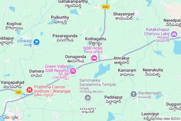
Penchikalapeta Map
EDIT Map
Add Your House
 ..
..
Current Corona Virus Infected Patients Count in Warangal District
| City Name | District Name | Total Covid cases |
|---|---|---|
| Warangal Urban District | Warangal Urban | 23 |
| Mulugu District | Mulugu | 2 |
| Mahabubabad District | Mahabubabad | 1 |
Locality Name :
Penchikalapeta
( పెంచికలపేట )
Mandal Name : Atmakur
District : Warangal
State : Telangana
Region : Telangana
Language : Telugu and Urdu
Current Time 08:58 AM
Date: Wednesday , Apr 30,2025 (IST)
Time zone: IST (UTC+5:30)
Elevation / Altitude: 271 meters. Above Seal level
Telephone Code / Std Code: 08713
Assembly constituency : Parkal assembly constituency
Assembly MLA : Revuri Prakash Reddy
Lok Sabha constituency : Warangal parliamentary constituency
Parliament MP : DAYAKAR PASUNOORI
Serpanch Name :
Pin Code : 506342
Post Office Name : Atmakur (Warangal)
Alternate Village Name : Penchikalpet
Commodities Prices : Parkal Market / Mandi
Penchikalapeta Live Weather
Temperature: 31.1 °C
scattered clouds
Humidity: 52%
Wind : 5.97 mt/sec towards S
StationName : "Warangal"
observed on 6 Mins Back
Temperature: 31.1 °C
scattered clouds
Humidity: 52%
Wind : 5.97 mt/sec towards S
StationName : "Warangal"
observed on 6 Mins Back
Penchikalapeta Weather Forecast for Next 5 days
01-05-2025
27.3°C to 41.2°C
scattered clouds, few clouds
27.3°C to 41.2°C
scattered clouds, few clouds
02-05-2025
26.8°C to 41.3°C
scattered clouds, few clouds, clear sky
26.8°C to 41.3°C
scattered clouds, few clouds, clear sky
03-05-2025
27.3°C to 42.1°C
scattered clouds, few clouds, clear sky, broken clouds
27.3°C to 42.1°C
scattered clouds, few clouds, clear sky, broken clouds
04-05-2025
26.5°C to 41.8°C
scattered clouds, few clouds, clear sky, light rain
26.5°C to 41.8°C
scattered clouds, few clouds, clear sky, light rain
05-05-2025
26.3°C to 40.5°C
light rain, overcast clouds, broken clouds, clear sky
26.3°C to 40.5°C
light rain, overcast clouds, broken clouds, clear sky
National Highways Reachable To Penchikalapeta
Nationa High Way :NH163
Nationa High Way :NH563
Nationa High Way :NH163
Nationa High Way :NH563
Rivers Near Penchikalapeta
Sali Vagu
Sali Vagu
About Penchikalapeta
Correct below Info and add more info about PenchikalapetaPenchikalapeta is a Village in Atmakur Mandal in Warangal District of Telangana State, India. It belongs to Telangana region . It is located 18 KM towards East from District head quarters Warangal.
Penchikalapeta Pin code is 506342 and postal head office is Atmakur (Warangal).
Penchikalapeta is surrounded by Shyampet Mandal towards North , Geesugonda Mandal towards South , Warangal Mandal towards west , Parkal Mandal towards North .
Warangal , Jangaon , Karimnagar , Ramagundam are the near by Cities to Penchikalapeta.
Penchikalpet 2011 Census Details
Penchikalapeta Local Language is Telugu. Penchikalpet Village Total population is 2579 and number of houses are 706. Female Population is 50.7%. Village literacy rate is 59.6% and the Female Literacy rate is 25.0%.
Population
| Census Parameter | Census Data |
| Total Population | 2579 |
| Total No of Houses | 706 |
| Female Population % | 50.7 % ( 1308) |
| Total Literacy rate % | 59.6 % ( 1536) |
| Female Literacy rate | 25.0 % ( 646) |
| Scheduled Tribes Population % | 4.2 % ( 109) |
| Scheduled Caste Population % | 23.2 % ( 599) |
| Working Population % | 53.7 % |
| Child(0 -6) Population by 2011 | 184 |
| Girl Child(0 -6) Population % by 2011 | 49.5 % ( 91) |
Penchikalpet Census More Deatils.
Politics in Penchikalapeta
TDP , TRS , YSCP , INC are the major political parties in this area.Polling Stations /Booths near Penchikalapeta
1)Dharmaram2)Damera
3)Ukal Haveli
4)Urugonda
5)Urugonda
HOW TO REACH Penchikalapeta
By Road
Warangal is the Nearest Town to Penchikalapeta. Road connectivity is there from Warangal to Penchikalapeta.By Rail
There is no railway station near to Penchikalapeta in less than 10 km. How ever there are railway Stations from Near By town Warangal. are the railway Stations near to Warangal. You can reach from Warangal to Penchikalapeta by road after .Colleges near Penchikalapeta
Vasavi Junior College Damera, Hanumakonda
Address : Hanumakonda
Warangal Institute Of Technology & Science
Address : Oorugonda (v), Athmakur (m), Warangal
Care College Of Pharmacy
Address : , Oglapur, Atmakur (m), Warangal Dist. - 506 006.
Schools in Penchikalapeta
Parween Viddya Nikethan
Address : penchikalapeta , atmakur , warangal , Andhra Pradesh . PIN- 506342 , Post - Atmakur (Warangal)
Mpups Penchikalapeta
Address : penchikalapeta , atmakur , warangal , Andhra Pradesh . PIN- 506342 , Post - Atmakur (Warangal)
Govt Health Centers near Penchikalapeta
1) SubCentre Oorugonda , ,3-61 , Near Govt.School , Near Govt.School2) SubCentre Gudepad , 3-072 , BC.Colony , Gudepad
3) SubCentre, Dhammannapet , 6-108 , SC Colony , Near Bustand
Petrol Bunks in Penchikalapeta,Atmakur
HP PETROL BUNK - G K FILLING STATION
SY NO 805/C/2; 805/D/2& 805/E Gudepahad Village Athmakur Mandal; Warangal; 506342; India
1.2 KM distance Detail
Keshava Filling Station
Parkal - Hanmakonda Rd; Guduppad; Telangana 506342; India
1.2 KM distance Detail
more ..
Colleges in Penchikalapeta,Atmakur
Warangal Institute of Technology and Science
Gudepadu X Roads; Oorugonda; Atmakur; Warangal; Telangana 506342; India
1.0 KM distance Detail
WITS
H.no: 1-339/3; srinagarcolony-1;Bheemaram;; Hanmakonda; Warangal; Telangana 506015; India
1.0 KM distance Detail
more ..
Electronic Shops in Penchikalapeta,Atmakur
PV Reddy Mansion
Near Shivalayam Temple; Oglapur Village Damera Mandal; Telangana 506342; India
4.6 KM distance Detail
Winner Solutions
Neerukulla-Mood Chintal Rd; Atmakur; Telangana 506342; India
4.6 KM distance Detail
Local Parks in Penchikalapeta,Atmakur
Rama - Lakshmi Gardens
Dr Colony Road; Doctor Colony; Powers Colony; Warangal; Telangana 506002; India
14.9 KM distance Detail
Sri Balaji Garden
Doctor Colony Road; Balaji Nagar; Warangal; Telangana 506002; India
15.0 KM distance Detail
About Penchikalapeta &
History
How to reach Penchikalapeta
Tourist Places Near By Penchikalapeta
Schools in Penchikalapeta
Colleges in Penchikalapeta
Temperature & weather of Penchikalapeta
places in Penchikalapeta
Penchikalapeta photos
More Information
How to reach Penchikalapeta
Tourist Places Near By Penchikalapeta
Schools in Penchikalapeta
Colleges in Penchikalapeta
Temperature & weather of Penchikalapeta
places in Penchikalapeta
Penchikalapeta photos
More Information
Village Talk
Post News or Events about this Village
Near Cities
Warangal 14 KM near
Jangaon 77 KM near
Karimnagar 83 KM near
Ramagundam 90 KM near
Warangal 14 KM near
Jangaon 77 KM near
Karimnagar 83 KM near
Ramagundam 90 KM near
Near By Taluks
Atmakur 0 KM near
Shyampet 7 KM near
Geesugonda 12 KM near
Warangal 15 KM near
Atmakur 0 KM near
Shyampet 7 KM near
Geesugonda 12 KM near
Warangal 15 KM near
Near By Air Ports
Rajiv Gandhi International Airport 182 KM near
Vijayawada Airport 231 KM near
Rajahmundry Airport 278 KM near
Nanded Airport 313 KM near
Rajiv Gandhi International Airport 182 KM near
Vijayawada Airport 231 KM near
Rajahmundry Airport 278 KM near
Nanded Airport 313 KM near
Near By Tourist Places
Warangal 14 KM near
Medaram 71 KM near
Khammam 115 KM near
Bhadrachalam 150 KM near
Hyderabad 167 KM near
Warangal 14 KM near
Medaram 71 KM near
Khammam 115 KM near
Bhadrachalam 150 KM near
Hyderabad 167 KM near
Near By Districts
Warangal 17 KM near
Karimnagar 80 KM near
Khammam 115 KM near
Nalgonda 137 KM near
Warangal 17 KM near
Karimnagar 80 KM near
Khammam 115 KM near
Nalgonda 137 KM near
Near By RailWay Station
Warangal Rail Way Station 16 KM near
Kazipet Junction Rail Way Station 25 KM near
Warangal Rail Way Station 16 KM near
Kazipet Junction Rail Way Station 25 KM near