| Home | City Bus | Maps | Villages | Cities | Rail | Tourist Places | School | College | Pin Codes | Corona Cases Count |
| Distance Calculator Bus Services IFSC Codes Trace Mobile Number Weather Search Place Trace IP Available Cash ATM/Banks Locate Polling Booth Report an Error contact People |
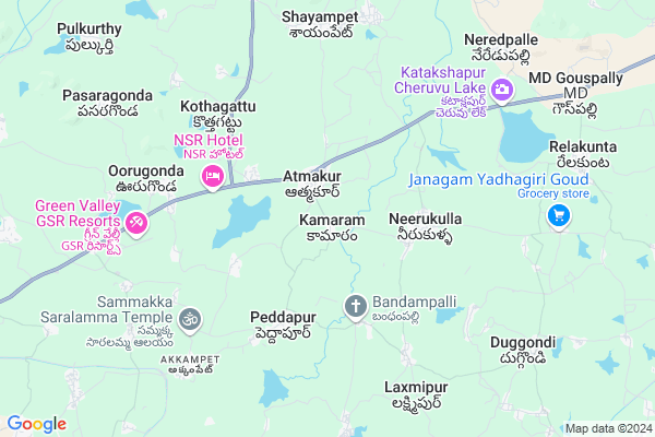
Kamaram Map
EDIT Map
Add Your House
 ..
..
Current Corona Virus Infected Patients Count in Warangal District
| City Name | District Name | Total Covid cases |
|---|---|---|
| Warangal Urban District | Warangal Urban | 23 |
| Mulugu District | Mulugu | 2 |
| Mahabubabad District | Mahabubabad | 1 |
Locality Name :
Kamaram
( కామారం )
Mandal Name : Atmakur
District : Warangal
State : Telangana
Region : Telangana
Language : Telugu and Urdu
Current Time 07:20 AM
Date: Saturday , Apr 26,2025 (IST)
Time zone: IST (UTC+5:30)
Elevation / Altitude: 271 meters. Above Seal level
Telephone Code / Std Code: 08713
Assembly constituency : Parkal assembly constituency
Assembly MLA : Revuri Prakash Reddy
Lok Sabha constituency : Warangal parliamentary constituency
Parliament MP : DAYAKAR PASUNOORI
Serpanch Name :
Pin Code : 506342
Post Office Name : Atmakur (Warangal)
Commodities Prices : Parkal Market / Mandi
Kamaram Live Weather
Temperature: 29.1 °C
overcast clouds
Humidity: 50%
Wind : 6.33 mt/sec towards S
StationName : "Warangal"
observed on 2 Hours Back
Temperature: 29.1 °C
overcast clouds
Humidity: 50%
Wind : 6.33 mt/sec towards S
StationName : "Warangal"
observed on 2 Hours Back
Kamaram Weather Forecast for Next 5 days
27-04-2025
29.3°C to 39.9°C
overcast clouds, few clouds, light rain
29.3°C to 39.9°C
overcast clouds, few clouds, light rain
28-04-2025
27.6°C to 38.4°C
overcast clouds, broken clouds, light rain, clear sky
27.6°C to 38.4°C
overcast clouds, broken clouds, light rain, clear sky
29-04-2025
26.7°C to 40.9°C
clear sky, few clouds, broken clouds, scattered clouds
26.7°C to 40.9°C
clear sky, few clouds, broken clouds, scattered clouds
30-04-2025
26.7°C to 41.8°C
clear sky, scattered clouds
26.7°C to 41.8°C
clear sky, scattered clouds
National Highways Reachable To Kamaram
Nationa High Way :NH163
Nationa High Way :NH563
Nationa High Way :NH163
Nationa High Way :NH563
Rivers Near Kamaram
Sali Vagu
Sali Vagu
About Kamaram
Correct below Info and add more info about KamaramKamaram is a Village in Atmakur Mandal in Warangal District of Telangana State, India. It belongs to Telangana region . It is located 22 KM towards East from District head quarters Warangal. 5 KM from Atmakur.
Kamaram Pin code is 506342 and postal head office is Atmakur (Warangal).
Keshwapur ( 3 KM ) , Peddapur ( 3 KM ) , Neerukulla ( 3 KM ) , Kothagattu ( 4 KM ) , Choudlapalle ( 4 KM ) are the nearby Villages to Kamaram. Kamaram is surrounded by Shyampet Mandal towards North , Duggondi Mandal towards South , Geesugonda Mandal towards South , Nalla Belli Mandal towards East .
Warangal , Jangaon , Karimnagar , Yellandu are the near by Cities to Kamaram.
Kamaram 2011 Census Details
Kamaram Local Language is Telugu. Kamaram Village Total population is 1107 and number of houses are 320. Female Population is 50.0%. Village literacy rate is 50.3% and the Female Literacy rate is 20.1%.
Population
| Census Parameter | Census Data |
| Total Population | 1107 |
| Total No of Houses | 320 |
| Female Population % | 50.0 % ( 553) |
| Total Literacy rate % | 50.3 % ( 557) |
| Female Literacy rate | 20.1 % ( 223) |
| Scheduled Tribes Population % | 1.1 % ( 12) |
| Scheduled Caste Population % | 27.6 % ( 305) |
| Working Population % | 52.4 % |
| Child(0 -6) Population by 2011 | 78 |
| Girl Child(0 -6) Population % by 2011 | 47.4 % ( 37) |
Kamaram Census More Deatils.
Politics in Kamaram
TDP , TRS , YSCP , INC are the major political parties in this area.Polling Stations /Booths near Kamaram
1)Hous Bujurg2)Athmakukr
3)Ashalapally
4)Atmakur
5)Atmakur
HOW TO REACH Kamaram
By Road
Warangal is the Nearest Town to Kamaram. Warangal is 25 km from Kamaram. Road connectivity is there from Warangal to Kamaram.By Rail
There is no railway station near to Kamaram in less than 10 km. How ever there are railway Stations from Near By town Warangal. are the railway Stations near to Warangal. You can reach from Warangal to Kamaram by road after .Colleges near Kamaram
Vasavi Junior College Damera, Hanumakonda
Address : Hanumakonda
Warangal Institute Of Technology & Science
Address : Oorugonda (v), Athmakur (m), Warangal
Care College Of Pharmacy
Address : , Oglapur, Atmakur (m), Warangal Dist. - 506 006.
Schools in Kamaram
Mpps Kamaram
Address : kamaram , atmakur , warangal , Andhra Pradesh . PIN- 506342 , Post - Atmakur (Warangal)
Govt Health Centers near Kamaram
1) Primary Health Centre Athmakur , , Main road , Opp: Police station2) SubCentre Athmakur , 4-064 , Shivalayamveedhi , Shivalayamveedhi
3) Primary Health Centre Keshavapur , 1-21/E , Main Road , Near Community Hall
Hospitals in Kamaram,Atmakur
Dileep Medical & General stores
Penchikalapeta; Athmakur; Telangana 506342; India
3.5 KM distance Detail
more ..
Petrol Bunks in Kamaram,Atmakur
HP PETROL BUNK - G K FILLING STATION
SY NO 805/C/2; 805/D/2& 805/E Gudepahad Village Athmakur Mandal; Warangal; 506342; India
4.0 KM distance Detail
Keshava Filling Station
Parkal - Hanmakonda Rd; Guduppad; Telangana 506342; India
4.0 KM distance Detail
more ..
Colleges in Kamaram,Atmakur
Government Junior College
Atmakur - Jogampally Rd; Atmakur; Telangana 506342; India
1.3 KM distance Detail
Warangal Institute of Technology and Science
Gudepadu X Roads; Oorugonda; Atmakur; Warangal; Telangana 506342; India
4.8 KM distance Detail
more ..
Electronic Shops in Kamaram,Atmakur
RAJKUMAR
2-11; ward-2; Kamaram - Neerukulla Rd; Kamaram; Telangana 506342; India
0.5 KM distance Detail
Winner Solutions
Neerukulla-Mood Chintal Rd; Atmakur; Telangana 506342; India
2.0 KM distance Detail
Governement Offices near Kamaram,Atmakur
MeeSeva Center
H.No:1-36;Near Mudiraj Sangam Building; Keshwapur(GP); Keshwapur(PO); Duggondi(M);; Atmakur - Jogampally Rd; Atmakur; Telangana 506342; India
1.1 KM distance Detail
About Kamaram &
History
How to reach Kamaram
Tourist Places Near By Kamaram
Schools in Kamaram
Colleges in Kamaram
Temperature & weather of Kamaram
places in Kamaram
Kamaram photos
More Information
How to reach Kamaram
Tourist Places Near By Kamaram
Schools in Kamaram
Colleges in Kamaram
Temperature & weather of Kamaram
places in Kamaram
Kamaram photos
More Information
Village Talk
Post News or Events about this Village
Near Cities
Warangal 18 KM near
Jangaon 80 KM near
Karimnagar 88 KM near
Yellandu 90 KM near
Warangal 18 KM near
Jangaon 80 KM near
Karimnagar 88 KM near
Yellandu 90 KM near
Near By Taluks
Atmakur 5 KM near
Shyampet 7 KM near
Geesugonda 12 KM near
Duggondi 12 KM near
Atmakur 5 KM near
Shyampet 7 KM near
Geesugonda 12 KM near
Duggondi 12 KM near
Near By Air Ports
Rajiv Gandhi International Airport 186 KM near
Vijayawada Airport 228 KM near
Rajahmundry Airport 273 KM near
Nanded Airport 318 KM near
Rajiv Gandhi International Airport 186 KM near
Vijayawada Airport 228 KM near
Rajahmundry Airport 273 KM near
Nanded Airport 318 KM near
Near By Tourist Places
Warangal 17 KM near
Medaram 67 KM near
Khammam 111 KM near
Bhadrachalam 145 KM near
Nagarjunakonda 167 KM near
Warangal 17 KM near
Medaram 67 KM near
Khammam 111 KM near
Bhadrachalam 145 KM near
Nagarjunakonda 167 KM near
Near By Districts
Warangal 21 KM near
Karimnagar 85 KM near
Khammam 111 KM near
Nalgonda 138 KM near
Warangal 21 KM near
Karimnagar 85 KM near
Khammam 111 KM near
Nalgonda 138 KM near
Near By RailWay Station
Warangal Rail Way Station 19 KM near
Kazipet Junction Rail Way Station 29 KM near
Warangal Rail Way Station 19 KM near
Kazipet Junction Rail Way Station 29 KM near