| Home | City Bus | Maps | Villages | Cities | Rail | Tourist Places | School | College | Pin Codes | Corona Cases Count |
| Distance Calculator Bus Services IFSC Codes Trace Mobile Number Weather Search Place Trace IP Available Cash ATM/Banks Locate Polling Booth Report an Error contact People |
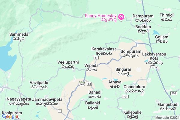
Kummapalli
Kummapalli Map
EDIT Map
Add Your House
 ..
..
Current Corona Virus Infected Patients Count in Vizianagaram District
| City Name | District Name | Total Covid cases |
|---|
Locality Name :
Kummapalli
( కుమ్మపల్లి )
Mandal Name : Vepada
District : Vizianagaram
State : Andhra Pradesh
Region : Andhra
Language : Telugu
Current Time 04:07 PM
Date: Monday , Apr 28,2025 (IST)
Time zone: IST (UTC+5:30)
Elevation / Altitude: 76 meters. Above Seal level
Telephone Code / Std Code: 08966
Assembly constituency : Panyam assembly constituency
Assembly MLA : Kadubandi Srinivasa Rao
Lok Sabha constituency : Kadapa parliamentary constituency
Parliament MP : M V V SATYANARAYANA
Serpanch Name :
Pin Code : 535183
Post Office Name : Kothavalasa
Alternate Village Name : Kompalle , Kompalli
Commodities Prices : Anakapally Market / Mandi
Kummapalli Live Weather
Temperature: 36.7 °C
clear sky
Humidity: 38%
Wind : 8.19 mt/sec towards S
StationName : "Chodavaram"
observed on 1 Hours Back
Temperature: 36.7 °C
clear sky
Humidity: 38%
Wind : 8.19 mt/sec towards S
StationName : "Chodavaram"
observed on 1 Hours Back
Kummapalli Weather Forecast for Next 5 days
29-04-2025
26.4°C to 34.7°C
light rain, broken clouds, scattered clouds, clear sky
26.4°C to 34.7°C
light rain, broken clouds, scattered clouds, clear sky
30-04-2025
25.5°C to 37.7°C
clear sky, scattered clouds, light rain, moderate rain
25.5°C to 37.7°C
clear sky, scattered clouds, light rain, moderate rain
01-05-2025
26.3°C to 38.0°C
clear sky, few clouds, scattered clouds, heavy intensity rain, light rain
26.3°C to 38.0°C
clear sky, few clouds, scattered clouds, heavy intensity rain, light rain
02-05-2025
26.4°C to 38.7°C
scattered clouds, clear sky, moderate rain, light rain
26.4°C to 38.7°C
scattered clouds, clear sky, moderate rain, light rain
03-05-2025
23.2°C to 37.9°C
scattered clouds, few clouds, light rain, heavy intensity rain, moderate rain
23.2°C to 37.9°C
scattered clouds, few clouds, light rain, heavy intensity rain, moderate rain
National Highways Reachable To Kummapalli
Nationa High Way :NH16
Nationa High Way :NH16
Rivers Near Kummapalli
Tandava
Sarada
Tandava
Sarada
About Kummapalli
Correct below Info and add more info about KummapalliKummapalli is a Village in Vepada Mandal in Vizianagaram District of Andhra Pradesh State, India. It belongs to Andhra region . It is located 42 KM towards west from District head quarters Vizianagaram. 575 KM from State capital Hyderabad
Kummapalli Pin code is 535183 and postal head office is Kothavalasa .
Kummapalli is surrounded by Lakkavarapukota Mandal towards East , Srungavarapukota Mandal towards North , Kothavalasa Mandal towards South , Devarapalle Mandal towards west .
Anakapalle , Vizianagaram , Visakhapatnam , Bheemunipatnam are the near by Cities to Kummapalli.
This Place is in the border of the Vizianagaram District and Visakhapatanam District. Visakhapatanam District Devarapalle is west towards this place .
Kummapalle 2011 Census Details
Kummapalli Local Language is Telugu. Kummapalle Village Total population is 1967 and number of houses are 501. Female Population is 50.8%. Village literacy rate is 43.7% and the Female Literacy rate is 17.8%.
Population
| Census Parameter | Census Data |
| Total Population | 1967 |
| Total No of Houses | 501 |
| Female Population % | 50.8 % ( 999) |
| Total Literacy rate % | 43.7 % ( 859) |
| Female Literacy rate | 17.8 % ( 351) |
| Scheduled Tribes Population % | 1.1 % ( 22) |
| Scheduled Caste Population % | 6.5 % ( 127) |
| Working Population % | 54.0 % |
| Child(0 -6) Population by 2011 | 211 |
| Girl Child(0 -6) Population % by 2011 | 50.7 % ( 107) |
Kummapalle Census More Deatils.
Politics in Kummapalli
TDP , YSRC , Yuvajana Sramika Rythu Congress Party , SDLPI , YSRCP , INC are the major political parties in this area.Polling Stations /Booths near Kummapalli
1)M P U P School South Wing Durvesi2)M P U P School West Portion
3).kalluru
4)M P E School(chinthalapalli)
5)M P U P School West Wing Pesaravai
HOW TO REACH Kummapalli
By Road
Visakhapatnam is the Nearest Town to Kummapalli. Visakhapatnam is 64 km from Kummapalli. Road connectivity is there from Visakhapatnam to Kummapalli.By Rail
There is no railway station near to Kummapalli in less than 10 km. How ever there are railway Stations from Near By town Visakhapatnam. are the railway Stations near to Visakhapatnam. You can reach from Visakhapatnam to Kummapalli by road after .By Bus
Srungavarapu Kota APSRTC Bus Station , Borra Caves APSRTC Bus Station , V.Madugula APSRTC Bus Station are the nearby by Bus Stations to Kummapalli .APSRTC runs Number of busses from major cities to here.Colleges near Kummapalli
Govt Jr College Vepada
Address : Govt Jr College Vepada
Schools near Kummapalli
Kgbv Vepada
Address : vepada , vepada , vizianagaram , Andhra Pradesh . PIN- 535281 , Post - Vepada
Zphs Vavilapadu
Address : vavilapadu , vepada , vizianagaram , Andhra Pradesh . PIN- 535281 , Post - Vepada
Svv Niketan Hs Vallampudi
Address : vallampudi , vepada , vizianagaram , Andhra Pradesh . PIN- 535281 , Post - Vepada
Victory Hs Vepada
Address : vepada , vepada , vizianagaram , Andhra Pradesh . PIN- 535281 , Post - Vepada
Govt Health Centers near Kummapalli
1) Vepada , , Golla Veedhi , Near MDO Office2) VEPADA , , Golla Veedhi , Near MDO Office
3) VALLAMPUDI , , Ramayalam Veedhi , Panchayat Building
Sub Villages in Kummapalli
Hospitals in Kummapalli,Vepada
Government Hospital
Araku - Visakhapatnam Rd; Lakkavarapu Kota; Andhra Pradesh 535161; India
9.0 KM distance Detail
more ..
Petrol Bunks in Kummapalli,Vepada
Hpcl Bunk
junction; Araku - Visakhapatnam Rd; Lakkavarapukota Seetharampuram; Andhra Pradesh 535161; India
8.8 KM distance Detail
HP PETROL PUMP - SRI LAKSHMI NARASHIMA F/STN L.KOT
S.NO:30/4; 30/5 & 30/6 Seetharampuram Village Lakkavarapukota Mandalam; Visakhapatnam; Andhra Pradesh 535161; India
8.8 KM distance Detail
boddan ferryport
Boddam - Kallempudi - Golzam Rd; Lakkavarapukota Seetharampuram; Andhra Pradesh 535161; India
9.3 KM distance Detail
more ..
Colleges in Kummapalli,Vepada
Punyagiri Degree & PG College
Srungavarapu kota; Andhra Pradesh 535145; India
12.3 KM distance Detail
more ..
Electronic Shops in Kummapalli,Vepada
S.A NAIDU BIKE MECHANIC WORKS
Sompuram Rd; Lakkavarapukota Seetharampuram; Andhra Pradesh 535161; India
8.8 KM distance Detail
Ob.palam Boddam
Obaliayapalem Village Rd; Mukundapuram; Andhra Pradesh 535145; India
10.4 KM distance Detail
Police Stations near Kummapalli,Vepada
L Kota Police station
Lakkavarapu Kota Rd; Lakkavarapu Kota; Andhra Pradesh 535161; India
9.5 KM distance Detail
S Kota Police Station
Araku - Visakhapatnam Rd; Srungavarapu kota; Andhra Pradesh 535145; India
14.2 KM distance Detail
About Kummapalli &
History
How to reach Kummapalli
Tourist Places Near By Kummapalli
Schools in Kummapalli
Colleges in Kummapalli
Temperature & weather of Kummapalli
places in Kummapalli
Kummapalli photos
More Information
How to reach Kummapalli
Tourist Places Near By Kummapalli
Schools in Kummapalli
Colleges in Kummapalli
Temperature & weather of Kummapalli
places in Kummapalli
Kummapalli photos
More Information
Village Talk
Post News or Events about this Village
Near Cities
Anakapalle 42 KM near
Vizianagaram 42 KM near
Visakhapatnam 43 KM near
Bheemunipatnam 46 KM near
Anakapalle 42 KM near
Vizianagaram 42 KM near
Visakhapatnam 43 KM near
Bheemunipatnam 46 KM near
Near By Taluks
Vepada 0 KM near
Lakkavarapukota 10 KM near
Srungavarapukota 15 KM near
Kothavalasa 16 KM near
Vepada 0 KM near
Lakkavarapukota 10 KM near
Srungavarapukota 15 KM near
Kothavalasa 16 KM near
Near By Air Ports
Vishakhapatnam Airport 40 KM near
Rajahmundry Airport 187 KM near
Vijayawada Airport 328 KM near
Raipur Airport 424 KM near
Vishakhapatnam Airport 40 KM near
Rajahmundry Airport 187 KM near
Vijayawada Airport 328 KM near
Raipur Airport 424 KM near
Near By Tourist Places
Simhachalam 38 KM near
Vizayanagaram 38 KM near
Visakhapatnam 44 KM near
Ananthagiri 46 KM near
Araku Valley 46 KM near
Simhachalam 38 KM near
Vizayanagaram 38 KM near
Visakhapatnam 44 KM near
Ananthagiri 46 KM near
Araku Valley 46 KM near
Near By Districts
Vizianagaram 41 KM near
Visakhapatanam 42 KM near
Srikakulam 102 KM near
Koraput 107 KM near
Vizianagaram 41 KM near
Visakhapatanam 42 KM near
Srikakulam 102 KM near
Koraput 107 KM near
Near By RailWay Station
Kottavalasa Junction Rail Way Station 20 KM near
Simhachalam Rail Way Station 38 KM near
Kottavalasa Junction Rail Way Station 20 KM near
Simhachalam Rail Way Station 38 KM near