| Home | City Bus | Maps | Villages | Cities | Rail | Tourist Places | School | College | Pin Codes | Corona Cases Count |
| Distance Calculator Bus Services IFSC Codes Trace Mobile Number Weather Search Place Trace IP Available Cash ATM/Banks Locate Polling Booth Report an Error contact People |
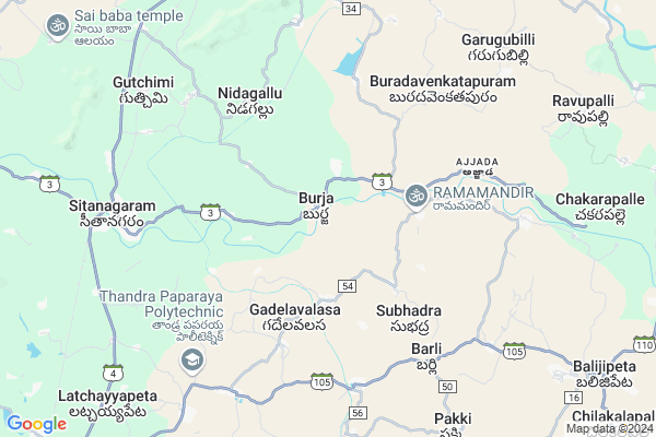
Burja
Burja Map
EDIT Map
Add Your House
 ..
..
Current Corona Virus Infected Patients Count in Vizianagaram District
| City Name | District Name | Total Covid cases |
|---|
Locality Name :
Burja
( బూర్జ )
Mandal Name : Seethanagaram
District : Vizianagaram
State : Andhra Pradesh
Region : Andhra
Language : Telugu
Current Time 10:46 AM
Date: Saturday , Apr 26,2025 (IST)
Time zone: IST (UTC+5:30)
Elevation / Altitude: 103 meters. Above Seal level
Telephone Code / Std Code: 08944
Assembly constituency : Jammalamadugu assembly constituency
Assembly MLA : Mule Sudheer Reddy
Lok Sabha constituency : Kurnool parliamentary constituency
Parliament MP : AYUSHMAN DOCTOR SANJEEV KUMAR
Serpanch Name :
Pin Code : 535546
Post Office Name : Seethanagaram
Commodities Prices : Kasinagar Market / Mandi
Burja Live Weather
Temperature: 31.5 °C
few clouds
Humidity: 61%
Wind : 1.81 mt/sec towards SE
StationName : "PÄ\u0081rvatipuram"
observed on 1 Hours Back
Temperature: 31.5 °C
few clouds
Humidity: 61%
Wind : 1.81 mt/sec towards SE
StationName : "PÄ\u0081rvatipuram"
observed on 1 Hours Back
Burja Weather Forecast for Next 5 days
27-04-2025
27.9°C to 38.9°C
clear sky, light rain, broken clouds, overcast clouds
27.9°C to 38.9°C
clear sky, light rain, broken clouds, overcast clouds
28-04-2025
26.9°C to 39.7°C
broken clouds, scattered clouds, light rain
26.9°C to 39.7°C
broken clouds, scattered clouds, light rain
29-04-2025
26.7°C to 39.0°C
broken clouds, few clouds, scattered clouds, light rain, clear sky
26.7°C to 39.0°C
broken clouds, few clouds, scattered clouds, light rain, clear sky
30-04-2025
25.2°C to 37.3°C
clear sky, light rain, scattered clouds
25.2°C to 37.3°C
clear sky, light rain, scattered clouds
01-05-2025
24.5°C to 37.2°C
clear sky, light rain, heavy intensity rain, overcast clouds, broken clouds
24.5°C to 37.2°C
clear sky, light rain, heavy intensity rain, overcast clouds, broken clouds
Edit below overview about Burja
Edit below overview about Burja
OverView of Burja
Burja is the largest village in seethanagaram mandal with highest rate of population and houses.Surpanch:Mudadla Appalanaidu. - satya GunupuruEdit below overview about Burja
Rivers Near Burja
Nagavali
Chitteelupu Gedda
Nagavali
Chitteelupu Gedda
About Burja
Burja is a Village in Seethanagaram Mandal in Vizianagaram District of Andhra Pradesh State, India. It belongs to Andhra region . It is located 70 KM towards North from District head quarters Vizianagaram. 6 KM from Seethanagaram. 634 KM from State capital Hyderabad
Burja Pin code is 535546 and postal head office is Seethanagaram .
Pedankalam ( 3 KM ) , Krishnarayapuram ( 3 KM ) , Dayanidhipuram ( 4 KM ) , Gadelavalasa ( 4 KM ) , Sumitrapuram ( 4 KM ) are the nearby Villages to Burja. Burja is surrounded by Balijipeta Mandal towards East , Garugubilli Mandal towards North , Bobbili Mandal towards South , Parvathipuram Mandal towards North .
Bobbili , Parvathipuram , Salur , Rajam are the near by Cities to Burja.
Burja 2011 Census Details
Burja Local Language is Telugu. Burja Village Total population is 3527 and number of houses are 910. Female Population is 47.7%. Village literacy rate is 57.9% and the Female Literacy rate is 20.9%.
Population
| Census Parameter | Census Data |
| Total Population | 3527 |
| Total No of Houses | 910 |
| Female Population % | 47.7 % ( 1681) |
| Total Literacy rate % | 57.9 % ( 2042) |
| Female Literacy rate | 20.9 % ( 737) |
| Scheduled Tribes Population % | 1.0 % ( 37) |
| Scheduled Caste Population % | 18.2 % ( 643) |
| Working Population % | 54.6 % |
| Child(0 -6) Population by 2011 | 317 |
| Girl Child(0 -6) Population % by 2011 | 53.0 % ( 168) |
Burja Census More Deatils.
Politics in Burja
TDP , YSRC , Yuvajana Sramika Rythu Congress Party , YSRCP , INC are the major political parties in this area.Polling Stations /Booths near Burja
1)Settyvaripalli2)Suddapalli
3)J. Kothapalli
4)Jammalamadugu
5)Jangalapalli
HOW TO REACH Burja
By Road
Bobbili is the Nearest Town to Burja. Bobbili is 19 km from Burja. Road connectivity is there from Bobbili to Burja.By Rail
Sitanagaram Rail Way Station , Narsipuram Halt Rail Way Station are the very nearby railway stations to Burja. Also you can consider railway Stations from Near By town Bobbili. Bobbili Junction Rail Way Station , Narayanappavalasa Halt Rail Way Station are the railway Stations near to Bobbili. You can reach from Bobbili to Burja by road after .By Bus
Parvathipuram APSRTC Bus Station , Bobbili APSRTC Bus Station , Ramabadrapuram APSRTC Bus Station are the nearby by Bus Stations to Burja .APSRTC runs Number of busses from major cities to here.Colleges near Burja
Govt Junior College Seethanagaram
Address : Govt Junior College Seethanagaram
Vivekavardhini Bhaskar Degree College
Address : D.no.8-5, Near Makkuva Rao, Chinabhogili-535546,
Schools in Burja
Zphs Burja
Address : burja , seethanagaram , vizianagaram , Andhra Pradesh . PIN- 535546 , Post - Seethanagaram
Balaji Up School
Address : burja , seethanagaram , vizianagaram , Andhra Pradesh . PIN- 535546 , Post - Seethanagaram
Govt Health Centers near Burja
1) PEDANKALAM , , Main Street , NEAR RAMAMANDIRAM2) Pedankalam , , Main Road , Near Annakattu
3) NIDAGALLU , , New Colony , Near Water Tank
Sub Villages in Burja
Petrol Bunks in Burja,Seethanagaram
HP PETROL PUMP - SRI KRISHNA SERVICE STN SEETANAGA
Hpcl Dealers China Bhogili Village Seethanagaram; Visakhapatnam; Andhra Pradesh 535546; India
9.2 KM distance Detail
HP PETROL PUMP - SRI SAI KRUPA FILLING STATION
Hpcl Dealers Vengapuram Village Baljipeta Mandal; Main Road; Visakhapatnam; Andhra Pradesh 535557; India
10.8 KM distance Detail
Sri Laxmi Oil Filling Station Indian Oil Petrol Pump
Addapusila; Vizianagaram; SH-37; ParvathiPuram Road; Parvathipuram; Parvathipuram; Andhra Pradesh 535501; India
14.1 KM distance Detail
more ..
Colleges in Burja,Seethanagaram
Sri Srinuvasa Deplamoa And Dide College Tirupatinaidu
Burja; Andhra Pradesh 535546; India
2.7 KM distance Detail
Maheswari College Of Education. bobbili
Kalavarai; Bobbili; Vizianagaram; Andhra Pradesh 535559; India
7.8 KM distance Detail
Swamy Vivekananda Engineering College
Balijipeta Rd; Andhra Pradesh 535558; India
7.9 KM distance Detail
more ..
Super Markets in Burja,Seethanagaram
Gramapanchayat Bazar
Narsipuram; Haripuram Karadavalasa; Andhra Pradesh 535522; India
11.4 KM distance Detail
Police Stations near Burja,Seethanagaram
Police Station
Seetanagaram; Vizianagaram(Dist); Sitanagaram; Andhra Pradesh 535546; India
8.5 KM distance Detail
Governement Offices near Burja,Seethanagaram
SRISAI COMPUTERS-MeeSeva Center
Garugubilli Rd; Garugubilli; Andhra Pradesh 535463; India
9.3 KM distance Detail
About Burja &
History
How to reach Burja
Tourist Places Near By Burja
Schools in Burja
Colleges in Burja
Temperature & weather of Burja
places in Burja
Burja photos
More Information
How to reach Burja
Tourist Places Near By Burja
Schools in Burja
Colleges in Burja
Temperature & weather of Burja
places in Burja
Burja photos
More Information
Village Talk
Post News or Events about this Village
Near Cities
Bobbili 14 KM near
Parvathipuram 15 KM near
Salur 32 KM near
Rajam 37 KM near
Bobbili 14 KM near
Parvathipuram 15 KM near
Salur 32 KM near
Rajam 37 KM near
Near By Taluks
Seethanagaram 6 KM near
Balijipeta 10 KM near
Garugubilli 11 KM near
Bobbili 13 KM near
Seethanagaram 6 KM near
Balijipeta 10 KM near
Garugubilli 11 KM near
Bobbili 13 KM near
Near By Air Ports
Vishakhapatnam Airport 118 KM near
Rajahmundry Airport 272 KM near
Bhubaneswar Airport 342 KM near
Raipur Airport 372 KM near
Vishakhapatnam Airport 118 KM near
Rajahmundry Airport 272 KM near
Bhubaneswar Airport 342 KM near
Raipur Airport 372 KM near
Near By Tourist Places
Vizayanagaram 69 KM near
Araku Valley 78 KM near
Ananthagiri 79 KM near
Jeypore 106 KM near
Simhachalam 115 KM near
Vizayanagaram 69 KM near
Araku Valley 78 KM near
Ananthagiri 79 KM near
Jeypore 106 KM near
Simhachalam 115 KM near
Near By Districts
Rayagada 63 KM near
Vizianagaram 67 KM near
Srikakulam 70 KM near
Koraput 87 KM near
Rayagada 63 KM near
Vizianagaram 67 KM near
Srikakulam 70 KM near
Koraput 87 KM near
Near By RailWay Station
Sitanagaram Rail Way Station 8.1 KM near
Parvatipuram Rail Way Station 13 KM near
Bobbili Junction Rail Way Station 15 KM near
Sitanagaram Rail Way Station 8.1 KM near
Parvatipuram Rail Way Station 13 KM near
Bobbili Junction Rail Way Station 15 KM near