| Home | City Bus | Maps | Villages | Cities | Rail | Tourist Places | School | College | Pin Codes | Corona Cases Count |
| Distance Calculator Bus Services IFSC Codes Trace Mobile Number Weather Search Place Trace IP Available Cash ATM/Banks Locate Polling Booth Report an Error contact People |
Guddanganivalasa
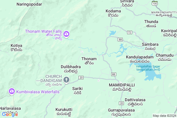
Guddanganivalasa Map
EDIT Map
Add Your House
 ..
..
Current Corona Virus Infected Patients Count in Vizianagaram District
| City Name | District Name | Total Covid cases |
|---|
Locality Name :
Guddanganivalasa
( గుడ్డంగానివలస )
Mandal Name : Salur
District : Vizianagaram
State : Andhra Pradesh
Region : Andhra
Language : Telugu
Current Time 05:34 PM
Date: Friday , Apr 25,2025 (IST)
Time zone: IST (UTC+5:30)
Elevation / Altitude: 158 meters. Above Seal level
Telephone Code / Std Code: 08964
Assembly constituency : Proddatur assembly constituency
Assembly MLA : Rachamallu Siva Prasad Reddy
Lok Sabha constituency : Kurnool parliamentary constituency
Parliament MP : AYUSHMAN DOCTOR SANJEEV KUMAR
Serpanch Name :
Pin Code : 535593
Post Office Name : Mamidipalle
Main Village Name : Thonam
Commodities Prices : Koraput(Semilguda) Market / Mandi
Guddanganivalasa Live Weather
Temperature: 37.0 °C
broken clouds
Humidity: 30%
Wind : 3.77 mt/sec towards SE
StationName : "SÄ\u0081lÅ«r"
observed on 12 Mins Back
Temperature: 37.0 °C
broken clouds
Humidity: 30%
Wind : 3.77 mt/sec towards SE
StationName : "SÄ\u0081lÅ«r"
observed on 12 Mins Back
Guddanganivalasa Weather Forecast for Next 5 days
26-04-2025
26.0°C to 35.4°C
broken clouds, scattered clouds, few clouds
26.0°C to 35.4°C
broken clouds, scattered clouds, few clouds
27-04-2025
25.9°C to 37.6°C
few clouds, light rain, overcast clouds
25.9°C to 37.6°C
few clouds, light rain, overcast clouds
28-04-2025
25.0°C to 37.2°C
broken clouds, light rain, moderate rain, overcast clouds
25.0°C to 37.2°C
broken clouds, light rain, moderate rain, overcast clouds
29-04-2025
25.2°C to 36.3°C
overcast clouds, broken clouds, scattered clouds, light rain, clear sky
25.2°C to 36.3°C
overcast clouds, broken clouds, scattered clouds, light rain, clear sky
30-04-2025
24.3°C to 35.7°C
scattered clouds, clear sky, light rain
24.3°C to 35.7°C
scattered clouds, clear sky, light rain
National Highways Reachable To Guddanganivalasa
Nationa High Way :NH16
Nationa High Way :NH16
Rivers Near Guddanganivalasa
Nagavali
Pedda Eru
Nagavali
Pedda Eru
About Guddanganivalasa
Correct below Info and add more info about GuddanganivalasaGuddanganivalasa is a small Village/hamlet in Salur Mandal in Vizianagaram District of Andhra Pradesh State, India. It comes under Thonam Panchayath. It belongs to Andhra region . It is located 75 KM towards North from District head quarters Vizianagaram. 6 KM from Salur. 598 KM from State capital Hyderabad
Guddanganivalasa Pin code is 535593 and postal head office is Mamidipalle .
Guddanganivalasa is surrounded by Makkuva Mandal towards East , Pottangi Mandal towards west , Narayan Patana Mandal towards North , Pachipenta Mandal towards South .
Salur , Bobbili , Sunabeda , Parvathipuram are the near by Cities to Guddanganivalasa.
Demographics of Guddanganivalasa
Telugu is the Local Language here. Total population of Guddanganivalasa is 2783 .Males are 1545 and Females are 1,238 living in 609 Houses. Total area of Guddanganivalasa is 529 hectares.Politics in Guddanganivalasa
TDP , YSRC , Yuvajana Sramika Rythu Congress Party , YSRCP , INC are the major political parties in this area.Polling Stations /Booths near Guddanganivalasa
1)Kottala H/o Tanguturu2). Chowduru
3). Proddutur
4)Kothapeta H/o Peddasettypalle
5)Parlapadu
HOW TO REACH Guddanganivalasa
By Road
Salur is the Nearest Town to Guddanganivalasa. Salur is 22 km from Guddanganivalasa. Road connectivity is there from Salur to Guddanganivalasa.By Rail
There is no railway station near to Guddanganivalasa in less than 10 km. How ever there are railway Stations from Near By town Salur. are the railway Stations near to Salur. You can reach from Salur to Guddanganivalasa by road after .By Bus
Salur APSRTC Bus Station , Ramabadrapuram APSRTC Bus Station , Bobbili APSRTC Bus Station are the nearby by Bus Stations to Guddanganivalasa .APSRTC runs Number of busses from major cities to here.Colleges near Guddanganivalasa
Nekkanti Agricultural Polytechnic College
Address :
Sri Satya Sai Jr College Salur
Address : Sri Satya Sai Jr College Salur
Sri Vasavi Jr College? Salur
Address : Sri Vasavi Jr College? Salur
Govt Junior College Salur
Address : Govt Junior College Salur
St Agnes Jr College, Kothavalasa
Address : Kothavalasa
Schools in Guddanganivalasa
Twahs Thonam
Address : thonam , saluru , vizianagaram , Andhra Pradesh . PIN- 535593 , Post - Mamidipalle
Govt Health Centers near Guddanganivalasa
1) Kandulapuram , , ST STREET , BESIDE AW CENTRE2) Thonam , , Main Road , Thonam subcentre
3) Thonam , , Main Road , Thonam phc
Hospitals in Guddanganivalasa,Salur
The Leprosy Mission Philadelphia Community Hospital
Vizianagaram Road; Kota Veedhi; Salur; Andhra Pradesh 535591; India
17.2 KM distance Detail
more ..
Petrol Bunks in Guddanganivalasa,Salur
HP PETROL PUMP - KARUNAMAYA PETRO STATION P.KONAVA
S.NO:12/3; Plot NO 86; NH-43 Gavirammapeta Pachipenta Mandalam; Visakhapatnam; Andhra Pradesh 535592; India
14.8 KM distance Detail
HP PETROL PUMP - SRI RAMA TRANSPORTS CHERUKUPALLY
Cherukupalli Village P. Konavalasa Panchayat Pachipenta Mandalam; Visakhapatnam; Andhra Pradesh 535592; India
15.1 KM distance Detail
more ..
Colleges in Guddanganivalasa,Salur
Sri Chaitanya Polytechnic College
Pachipenta; Vizianagaram; NH-26; Saluru Road; Saluru; Salur; Andhra Pradesh 535591; India
15.1 KM distance Detail
more ..
Schools in Guddanganivalasa,Salur
జిల్లా పరిషత్ ఉన్నత పాఠశాల - యమ్.మామిడిపల్లి
Maripalle; Andhra Pradesh 535593; India
5.5 KM distance Detail
Electronic Shops in Guddanganivalasa,Salur
Lakshmi Engineering and Electronics Store
Dugdasagaram; Salur; Andhra Pradesh 535591; India
17.8 KM distance Detail
Srinivasa Engg & Electricals
golla veedhi junction; opp Apollo pharmacy; Jeypore Rd; Salur; Andhra Pradesh; India
17.8 KM distance Detail
Local Parks in Guddanganivalasa,Salur
Apex Salur Railway Station Property
Vizianagaram; Andhra Pradesh 535591; India
16.6 KM distance Detail
Police Stations near Guddanganivalasa,Salur
Makkuva Police Station
Sambara-Kaviripalli Road; Makkuva; Andhra Pradesh 535547; India
15.8 KM distance Detail
Town Police Station Urban
jeypore road; Salur Municipal Park; Jeypore - Vizianagaram Rd - NH26; Salur; Andhra Pradesh 535591; India
17.5 KM distance Detail
Governement Offices near Guddanganivalasa,Salur
Sub Registrar Office; Salur
Ramnagar Colony; Salur; Andhra Pradesh 535591; India
17.7 KM distance Detail
About Guddanganivalasa &
History
How to reach Guddanganivalasa
Tourist Places Near By Guddanganivalasa
Schools in Guddanganivalasa
Colleges in Guddanganivalasa
Temperature & weather of Guddanganivalasa
places in Guddanganivalasa
Guddanganivalasa photos
More Information
How to reach Guddanganivalasa
Tourist Places Near By Guddanganivalasa
Schools in Guddanganivalasa
Colleges in Guddanganivalasa
Temperature & weather of Guddanganivalasa
places in Guddanganivalasa
Guddanganivalasa photos
More Information
Village Talk
Post News or Events about this Village
Near Cities
Salur 17 KM near
Bobbili 25 KM near
Sunabeda 38 KM near
Parvathipuram 38 KM near
Salur 17 KM near
Bobbili 25 KM near
Sunabeda 38 KM near
Parvathipuram 38 KM near
Near By Taluks
Salur 5 KM near
Makkuva 15 KM near
Narayan Patana 24 KM near
Pottangi 24 KM near
Salur 5 KM near
Makkuva 15 KM near
Narayan Patana 24 KM near
Pottangi 24 KM near
Near By Air Ports
Vishakhapatnam Airport 114 KM near
Rajahmundry Airport 246 KM near
Raipur Airport 356 KM near
Bhubaneswar Airport 373 KM near
Vishakhapatnam Airport 114 KM near
Rajahmundry Airport 246 KM near
Raipur Airport 356 KM near
Bhubaneswar Airport 373 KM near
Near By Tourist Places
Araku Valley 49 KM near
Ananthagiri 50 KM near
Vizayanagaram 72 KM near
Jeypore 73 KM near
Simhachalam 111 KM near
Araku Valley 49 KM near
Ananthagiri 50 KM near
Vizayanagaram 72 KM near
Jeypore 73 KM near
Simhachalam 111 KM near
Near By Districts
Koraput 54 KM near
Vizianagaram 72 KM near
Rayagada 73 KM near
Srikakulam 99 KM near
Koraput 54 KM near
Vizianagaram 72 KM near
Rayagada 73 KM near
Srikakulam 99 KM near
Near By RailWay Station
Bobbili Junction Rail Way Station 25 KM near
Parvatipuram Rail Way Station 37 KM near
Bobbili Junction Rail Way Station 25 KM near
Parvatipuram Rail Way Station 37 KM near