| Home | City Bus | Maps | Villages | Cities | Rail | Tourist Places | School | College | Pin Codes | Corona Cases Count |
| Distance Calculator Bus Services IFSC Codes Trace Mobile Number Weather Search Place Trace IP Available Cash ATM/Banks Locate Polling Booth Report an Error contact People |
Pathabaggam
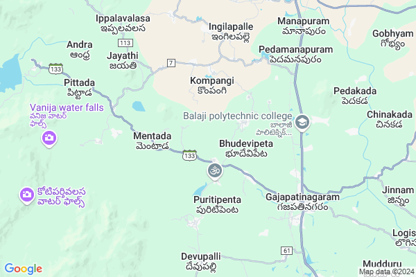
Pathabaggam Map
EDIT Map
Add Your House
 ..
..
Current Corona Virus Infected Patients Count in Vizianagaram District
| City Name | District Name | Total Covid cases |
|---|
Locality Name :
Pathabaggam
( పాతబగ్గం )
Mandal Name : Gajapathinagaram
District : Vizianagaram
State : Andhra Pradesh
Region : Andhra
Language : Telugu
Current Time 12:19 PM
Date: Monday , Apr 28,2025 (IST)
Time zone: IST (UTC+5:30)
Elevation / Altitude: 72 meters. Above Seal level
Telephone Code / Std Code: 08965
Assembly constituency : Srisailam assembly constituency
Assembly MLA : APPALANARASAYYA BOTCHA
Lok Sabha constituency : Hindupur parliamentary constituency
Parliament MP : KURUVA GORANTLA MADHAV
Serpanch Name :
Pin Code : 535270
Post Office Name : Gajapathinagaram
Commodities Prices : Koraput(Semilguda) Market / Mandi
Pathabaggam Live Weather
Temperature: 35.1 °C
clear sky
Humidity: 41%
Wind : 1.95 mt/sec towards S
StationName : "Vizianagaram"
observed on 1 Hours Back
Temperature: 35.1 °C
clear sky
Humidity: 41%
Wind : 1.95 mt/sec towards S
StationName : "Vizianagaram"
observed on 1 Hours Back
Pathabaggam Weather Forecast for Next 5 days
29-04-2025
27.2°C to 37.8°C
clear sky, light rain, broken clouds, few clouds
27.2°C to 37.8°C
clear sky, light rain, broken clouds, few clouds
30-04-2025
26.1°C to 37.0°C
clear sky, scattered clouds, light rain
26.1°C to 37.0°C
clear sky, scattered clouds, light rain
01-05-2025
25.9°C to 37.4°C
clear sky, few clouds, light rain
25.9°C to 37.4°C
clear sky, few clouds, light rain
02-05-2025
25.5°C to 37.6°C
clear sky, light rain, scattered clouds
25.5°C to 37.6°C
clear sky, light rain, scattered clouds
03-05-2025
25.3°C to 38.8°C
scattered clouds, clear sky, light rain, heavy intensity rain
25.3°C to 38.8°C
scattered clouds, clear sky, light rain, heavy intensity rain
National Highways Reachable To Pathabaggam
Nationa High Way :NH16
Nationa High Way :NH16
Rivers Near Pathabaggam
Nagavali
Pedda Eru
Nagavali
Pedda Eru
About Pathabaggam
Correct below Info and add more info about PathabaggamPathabaggam is a Village in Gajapathinagaram Mandal in Vizianagaram District of Andhra Pradesh State, India. It belongs to Andhra region . It is located 29 KM towards North from District head quarters Vizianagaram. 7 KM from Gajapatinagaram. 606 KM from State capital Hyderabad
Pathabaggam Pin code is 535270 and postal head office is Gajapathinagaram .
Salipeta ( 1 KM ) , Konisa ( 2 KM ) , Bhudevipeta ( 2 KM ) , Rabanda ( 3 KM ) , Iddanavalasa ( 3 KM ) are the nearby Villages to Pathabaggam. Pathabaggam is surrounded by Gajapathinagaram Mandal towards East , Bondapalle Mandal towards South , Dattirajeru Mandal towards East , Ramabhadrapuram Mandal towards North .
Salur , Vizianagaram , Bobbili , Rajam are the near by Cities to Pathabaggam.
Pathabaggam 2011 Census Details
Pathabaggam Local Language is Telugu. Pathabaggam Village Total population is 1857 and number of houses are 436. Female Population is 51.1%. Village literacy rate is 35.2% and the Female Literacy rate is 14.8%.
Population
| Census Parameter | Census Data |
| Total Population | 1857 |
| Total No of Houses | 436 |
| Female Population % | 51.1 % ( 949) |
| Total Literacy rate % | 35.2 % ( 654) |
| Female Literacy rate | 14.8 % ( 275) |
| Scheduled Tribes Population % | 6.1 % ( 113) |
| Scheduled Caste Population % | 8.4 % ( 156) |
| Working Population % | 57.9 % |
| Child(0 -6) Population by 2011 | 206 |
| Girl Child(0 -6) Population % by 2011 | 49.5 % ( 102) |
Pathabaggam Census More Deatils.
Politics in Pathabaggam
TDP , YSRC , Yuvajana Sramika Rythu Congress Party , YSRCP , INC are the major political parties in this area.Polling Stations /Booths near Pathabaggam
1)Srisailam2)Srisailam
3)Sripati Rao Peta
4)Srisailam
5)Sunnipenta
HOW TO REACH Pathabaggam
By Road
Vizianagaram is the Nearest Town to Pathabaggam. Vizianagaram is 29 km from Pathabaggam. Road connectivity is there from Vizianagaram to Pathabaggam.By Rail
Gajapatinagaram Rail Way Station , Garudubilli Rail Way Station are the very nearby railway stations to Pathabaggam. Also you can consider railway Stations from Near By town Vizianagaram. Vizianagaram Junction Rail Way Station , Nellimarla Rail Way Station are the railway Stations near to Vizianagaram. You can reach from Vizianagaram to Pathabaggam by road after .By Bus
Gajapathinagaram APSRTC Bus Station , Manapuram APSRTC Bus Station , Ramabadrapuram APSRTC Bus Station are the nearby by Bus Stations to Pathabaggam .APSRTC runs Number of busses from major cities to here.Colleges near Pathabaggam
Nekkanti Agricultural Polytechnic College
Address :
Government Junior College,gurla
Address :
Bhaskara Institute Of Pharmacy
Address :
Sssr College
Address :
Srinivasa Junior College
Address :
Schools in Pathabaggam
Mpups Pathabaggam
Address : pathabaggam , gajapathinagaram , vizianagaram , Andhra Pradesh . PIN- 535270 , Post - Gajapathinagaram
Govt Health Centers near Pathabaggam
1) KONISA , , Pedda veedhi ,2) MENTADA , 9-4, , Mandala street , Near Panchayat Office
3) Mentada , , Main Street , Near ZPH School
Hospitals in Pathabaggam,Gajapathinagaram
Govt Primary Health Center Mentada
Mentada Rd; Mentada; Andhra Pradesh 535273; India
3.1 KM distance Detail
Suncity Homoeo Clinic
Railway Station Overpass; Railway Colony; Gajapatinagaram; Andhra Pradesh 535270; India
6.1 KM distance Detail
more ..
Petrol Bunks in Pathabaggam,Gajapathinagaram
HP Petrol Bunk
D.NO. 155/13 Madhup0adu Village Gajapathinagarm; Visakhapatnam; Andhra Pradesh 535270; India
6.4 KM distance Detail
Krishna Agencies Hindustan Petroleum
Gajapathi Nagaram; Vizianagaram; NH-26; Vizianagaram Ramabhadrapuram Road; Vizianagaram; Vizianagaram; Andhra Pradesh 535579; India
6.4 KM distance Detail
Vijaya Gajapathi Filling Station Indian Oil Petrol Pump
Bodasingipet; Vizianagaram; NH-43; Jeypore Vizanagaram Road; Vizianagaram; Vizianagaram; Andhra Pradesh 535003; India
8.1 KM distance Detail
more ..
Colleges in Pathabaggam,Gajapathinagaram
Balaji polytechnic college
Jeypore-Vizianagaram Rd; Andhra Pradesh 535270; India
5.8 KM distance Detail
Balajee Polytechnic College
Marupalli Village; Gajapathinagaram Mandal; Vizianagaram; Andhra Pradesh 535270; India
7.0 KM distance Detail
Sri Sai College Of Pharmacy
Seetharampuram; Vizianagaram; Gajapathinagaram; Andhra Pradesh 535270; India
7.1 KM distance Detail
Aditya Junior And Degree College
Bodasingipeta; Gajapatinagaram; Andhra Pradesh 535270; India
7.3 KM distance Detail
more ..
Schools in Pathabaggam,Gajapathinagaram
Gurajada SCHOOL
Vizianagaram; contonment; Salipeta; Andhra Pradesh 535003; India
1.6 KM distance Detail
Zilla Panchayath High School
Vizianagaram District; Mentada; Andhra Pradesh; India
3.2 KM distance Detail
Electronic Shops in Pathabaggam,Gajapathinagaram
Vinayaka Engineering works
Jayanthi colony; Gajapatinagaram; Andhra Pradesh 535270; India
6.6 KM distance Detail
Yedukondalu Engineering Works
Pedamanapram; 535580; Pedamanapuram; Andhra Pradesh; India
7.5 KM distance Detail
Super Markets in Pathabaggam,Gajapathinagaram
Sri Kheteshwara Plywood &Hardware Gajapathinagaram
Gajapatinagaram; Andhra Pradesh 535270; India
6.8 KM distance Detail
A.V.BANGARRAGU WHOLESALE SHOP
Gajapathi Nagaram Rd; Gajapatinagaram; Andhra Pradesh 535270; India
7.2 KM distance Detail
Local Parks in Pathabaggam,Gajapathinagaram
Vanamitra;Forest Office; Bondapalli
Vizianagaram; Andhra Pradesh 535260; India
9.2 KM distance Detail
Police Stations near Pathabaggam,Gajapathinagaram
Police Station
Jeypore-Vizianagaram Rd; Gajapatinagaram; Andhra Pradesh 535270; India
6.9 KM distance Detail
Governement Offices near Pathabaggam,Gajapathinagaram
MeeSeva Center
Challapeta Village Rd; Challapeta; Andhra Pradesh 535581; India
4.6 KM distance Detail
About Pathabaggam &
History
How to reach Pathabaggam
Tourist Places Near By Pathabaggam
Schools in Pathabaggam
Colleges in Pathabaggam
Temperature & weather of Pathabaggam
places in Pathabaggam
Pathabaggam photos
More Information
How to reach Pathabaggam
Tourist Places Near By Pathabaggam
Schools in Pathabaggam
Colleges in Pathabaggam
Temperature & weather of Pathabaggam
places in Pathabaggam
Pathabaggam photos
More Information
Village Talk
Post News or Events about this Village
Near Cities
Salur 27 KM near
Vizianagaram 30 KM near
Bobbili 34 KM near
Rajam 47 KM near
Salur 27 KM near
Vizianagaram 30 KM near
Bobbili 34 KM near
Rajam 47 KM near
Near By Taluks
Mentada 5 KM near
Gajapathinagaram 6 KM near
Bondapalle 13 KM near
Dattirajeru 14 KM near
Mentada 5 KM near
Gajapathinagaram 6 KM near
Bondapalle 13 KM near
Dattirajeru 14 KM near
Near By Air Ports
Vishakhapatnam Airport 72 KM near
Rajahmundry Airport 229 KM near
Vijayawada Airport 369 KM near
Bhubaneswar Airport 383 KM near
Vishakhapatnam Airport 72 KM near
Rajahmundry Airport 229 KM near
Vijayawada Airport 369 KM near
Bhubaneswar Airport 383 KM near
Near By Tourist Places
Vizayanagaram 28 KM near
Ananthagiri 50 KM near
Araku Valley 50 KM near
Simhachalam 70 KM near
Visakhapatnam 78 KM near
Vizayanagaram 28 KM near
Ananthagiri 50 KM near
Araku Valley 50 KM near
Simhachalam 70 KM near
Visakhapatnam 78 KM near
Near By Districts
Vizianagaram 27 KM near
Srikakulam 71 KM near
Visakhapatanam 75 KM near
Koraput 92 KM near
Vizianagaram 27 KM near
Srikakulam 71 KM near
Visakhapatanam 75 KM near
Koraput 92 KM near
Near By RailWay Station
Gajapatinagaram Rail Way Station 5.9 KM near
Vizianagaram Junction Rail Way Station 27 KM near
Chipurupalle Rail Way Station 33 KM near
Gajapatinagaram Rail Way Station 5.9 KM near
Vizianagaram Junction Rail Way Station 27 KM near
Chipurupalle Rail Way Station 33 KM near