| Home | City Bus | Maps | Villages | Cities | Rail | Tourist Places | School | College | Pin Codes | Corona Cases Count |
| Distance Calculator Bus Services IFSC Codes Trace Mobile Number Weather Search Place Trace IP Available Cash ATM/Banks Locate Polling Booth Report an Error contact People |
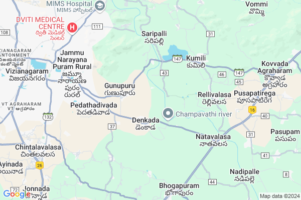
Denkada
Denkada Map
EDIT Map
Add Your House
 ..
..
Current Corona Virus Infected Patients Count in Vizianagaram District
| City Name | District Name | Total Covid cases |
|---|
Locality Name :
Denkada
( డెంకాడ )
Mandal Name : Denkada
District : Vizianagaram
State : Andhra Pradesh
Region : Andhra
Language : Telugu
Current Time 06:58 AM
Date: Saturday , Apr 26,2025 (IST)
Time zone: IST (UTC+5:30)
Elevation / Altitude: 63 meters. Above Seal level
Telephone Code / Std Code: 08922
Assembly constituency : Nandikotkur assembly constituency
Assembly MLA : APPALA NAIDU BADDUKONDA
Lok Sabha constituency : Hindupur parliamentary constituency
Parliament MP : KURUVA GORANTLA MADHAV
Serpanch Name :
Pin Code : 535003
Post Office Name : Vzm R.S
Commodities Prices : Anakapally Market / Mandi
Denkada Live Weather
Temperature: 28.3 °C
broken clouds
Humidity: 78%
Wind : 4.96 mt/sec towards SW
StationName : "Vizianagaram"
observed on 2 Hours Back
Temperature: 28.3 °C
broken clouds
Humidity: 78%
Wind : 4.96 mt/sec towards SW
StationName : "Vizianagaram"
observed on 2 Hours Back
Denkada Weather Forecast for Next 5 days
27-04-2025
27.5°C to 37.8°C
broken clouds, scattered clouds, clear sky, few clouds, overcast clouds
27.5°C to 37.8°C
broken clouds, scattered clouds, clear sky, few clouds, overcast clouds
28-04-2025
26.9°C to 37.6°C
broken clouds, scattered clouds, light rain, few clouds
26.9°C to 37.6°C
broken clouds, scattered clouds, light rain, few clouds
29-04-2025
26.4°C to 37.6°C
scattered clouds, few clouds, broken clouds
26.4°C to 37.6°C
scattered clouds, few clouds, broken clouds
30-04-2025
25.4°C to 37.2°C
clear sky, moderate rain, light rain
25.4°C to 37.2°C
clear sky, moderate rain, light rain
National Highways Reachable To Denkada
Nationa High Way :NH16
Nationa High Way :NH16
Rivers Near Denkada
Champavati
Potula Gedda
Champavati
Potula Gedda
About Denkada
Correct below Info and add more info about DenkadaDenkada is a Town in Denkada Mandal in Vizianagaram District of Andhra Pradesh State, India. It belongs to Andhra region . It is located 8 KM towards East from District head quarters Vizianagaram. It is a Mandal head quarter.
Denkada Pin code is 535003 and postal head office is Vzm R.S .
Chollangipeta Palem ( 2 KM ) , Pinatadivada ( 3 KM ) , Pedatadivada ( 4 KM ) , Saripalli ( 5 KM ) , Vedullavalasa ( 5 KM ) are the nearby Villages to Denkada. Denkada is surrounded by Vizianagaram Mandal towards west , Nellimarla Mandal towards North , Bhoghapuram Mandal towards South , Pusapatirega Mandal towards East .
Vizianagaram , Bheemunipatnam , Rajam , Visakhapatnam are the nearby Cities to Denkada.
This Place is in the border of the Vizianagaram District and Visakhapatanam District. Visakhapatanam District Padmanabham is west towards this place . It is near to bay of bengal. There is a chance of humidity in the weather.
Denkada 2011 Census Details
Denkada Local Language is Telugu. Denkada town Total population is 4774 and number of houses are 1274. Female Population is 49.7%. town literacy rate is 54.1% and the Female Literacy rate is 23.5%.
Population
| Census Parameter | Census Data |
| Total Population | 4774 |
| Total No of Houses | 1274 |
| Female Population % | 49.7 % ( 2375) |
| Total Literacy rate % | 54.1 % ( 2582) |
| Female Literacy rate | 23.5 % ( 1122) |
| Scheduled Tribes Population % | 0.3 % ( 12) |
| Scheduled Caste Population % | 22.6 % ( 1077) |
| Working Population % | 47.7 % |
| Child(0 -6) Population by 2011 | 501 |
| Girl Child(0 -6) Population % by 2011 | 48.1 % ( 241) |
Denkada Census More Deatils.
Demographics of Denkada
Telugu is the Local Language here. Total population of Denkada is 4664 .Males are 2351 and Females are 2,313 living in 1141 Houses. Total area of Denkada is 1244 hectares.Politics in Denkada
TDP , YSRC , Yuvajana Sramika Rythu Congress Party , YSRCP , INC are the major political parties in this area.Polling Stations /Booths near Denkada
1)Sivapuram2)Kothapalle
3)Kotha Mucchumarri
4)Kothapalle
5)Siddeswaram
HOW TO REACH Denkada
By Road
Vizianagaram is the Nearest Town to Denkada. Vizianagaram is 5 km from Denkada. Road connectivity is there from Vizianagaram to Denkada.By Rail
Vizianagaram Junction Rail Way Station are the very nearby railway stations to Denkada. Also you can consider railway Stations from Near By town Vizianagaram. Vizianagaram Junction Rail Way Station , Nellimarla Rail Way Station are the railway stations near to Vizianagaram. You can reach from Vizianagaram to Denkada by road after .By Bus
Bhogapuram APSRTC Bus Station , Poosapati Rega APSRTC Bus Station , Nellimarla APSRTC Bus Station are the nearby by Bus Stations to Denkada .APSRTC runs Number of busses from major cities to here.Govt Health Centers near Denkada
1) PACHILAVALASA , , Sumalaveedhi , Ramalayam2) PEDAVEGI Sub Centre , 3 58 , MAIN ROAD , Last of the Village
3) BHOGAPURAM Sub Centre , , ,
Sub Villages in Denkada
Hospitals in Denkada,Denkada
Janaseva Bone Fracture Clinic
Plot 495/MIG; Babametta; Vizianagaram; Andhra Pradesh 535002; India
7.6 KM distance Detail
more ..
Petrol Bunks in Denkada,Denkada
HP PETROL PUMP - SAI SRINIVASA AGENCIES
Survey NO. 160-1 Denkada Village Denkada; Visakhapatnam; Andhra Pradesh 535006; India
1.8 KM distance Detail
Petrol Bunk Jammu
petrol bunk;Hanuman temple; Jammu Rd; Vizianagaram; Andhra Pradesh 535002; India
6.5 KM distance Detail
HP PETROL PUMP - JANAKIRAMA NATHAVALASA
NH - 5 Singavaram Village Nathavalasa Denkada Mandal; Visakhapatnam; Andhra Pradesh 531216; India
6.7 KM distance Detail
more ..
Colleges in Denkada,Denkada
Sri Ashok B.Ed & D.Ed College Of Education
Pedathadivada; Andhra Pradesh 535002; India
5.9 KM distance Detail
United Hotel Management Academy
17-11-12 A; 3rd; Floor; Jeear Complex; Next to Fort; A G Road; Vizianagaram; Andhra Pradesh 535002; India
6.5 KM distance Detail
more ..
Schools in Denkada,Denkada
SRINIVASA SMART Schoolt Schoolt
kovvada Road; Chollangipeta; Denkada; Andhra Pradesh 535204; India
1.7 KM distance Detail
Electronic Shops in Denkada,Denkada
Mobile care
Jammu Narayana Puram road; beside maramma temple ; anandhapuram.; Vizinagaram; Andhra Pradesh 535002; India
6.7 KM distance Detail
LG Electronics
Fairgrowth Marketing; Kota JN Jibbivari Vedhi; Vizianagaram; AP 535002; India
6.9 KM distance Detail
Super Markets in Denkada,Denkada
Midhunam Value Store
304; 100 Feet Ring Rd; MSN Colony MSN Colony Jammu Narayana Puram Rural; Andhra Pradesh 535002; India
8.1 KM distance Detail
Local Parks in Denkada,Denkada
vizianagaram
Baba Metta Rd; Vyasnarayanmet; Phool Bagh; Vizianagaram; Andhra Pradesh 535002; India
7.2 KM distance Detail
Police Stations near Denkada,Denkada
old two town police station
Palli Veedhi Area; Vizianagaram; Andhra Pradesh 535002; India
9.0 KM distance Detail
Traffic Police Station
Padmavathi Colony; Vizianagaram; Andhra Pradesh 535002; India
9.0 KM distance Detail
About Denkada &
History
How to reach Denkada
Tourist Places Near By Denkada
Schools in Denkada
Colleges in Denkada
Temperature & weather of Denkada
places in Denkada
Denkada photos
More Information
How to reach Denkada
Tourist Places Near By Denkada
Schools in Denkada
Colleges in Denkada
Temperature & weather of Denkada
places in Denkada
Denkada photos
More Information
Town Talk
Post News or Events about this Town
Near Cities
Vizianagaram 6 KM near
Bheemunipatnam 25 KM near
Rajam 49 KM near
Visakhapatnam 55 KM near
Vizianagaram 6 KM near
Bheemunipatnam 25 KM near
Rajam 49 KM near
Visakhapatnam 55 KM near
Near By Taluks
Denkada 5 KM near
Vizianagaram 9 KM near
Nellimarla 10 KM near
Pusapatirega 12 KM near
Denkada 5 KM near
Vizianagaram 9 KM near
Nellimarla 10 KM near
Pusapatirega 12 KM near
Near By Air Ports
Vishakhapatnam Airport 54 KM near
Rajahmundry Airport 231 KM near
Vijayawada Airport 373 KM near
Bhubaneswar Airport 384 KM near
Vishakhapatnam Airport 54 KM near
Rajahmundry Airport 231 KM near
Vijayawada Airport 373 KM near
Bhubaneswar Airport 384 KM near
Near By Tourist Places
Vizayanagaram 10 KM near
Simhachalam 51 KM near
Visakhapatnam 59 KM near
Ananthagiri 78 KM near
Araku Valley 78 KM near
Vizayanagaram 10 KM near
Simhachalam 51 KM near
Visakhapatnam 59 KM near
Ananthagiri 78 KM near
Araku Valley 78 KM near
Near By Districts
Vizianagaram 8 KM near
Srikakulam 55 KM near
Visakhapatanam 55 KM near
Koraput 127 KM near
Vizianagaram 8 KM near
Srikakulam 55 KM near
Visakhapatanam 55 KM near
Koraput 127 KM near
Near By RailWay Station
Vizianagaram Junction Rail Way Station 10 KM near
Chipurupalle Rail Way Station 30 KM near
Vizianagaram Junction Rail Way Station 10 KM near
Chipurupalle Rail Way Station 30 KM near