| Home | City Bus | Maps | Villages | Cities | Rail | Tourist Places | School | College | Pin Codes | Corona Cases Count |
| Distance Calculator Bus Services IFSC Codes Trace Mobile Number Weather Search Place Trace IP Available Cash ATM/Banks Locate Polling Booth Report an Error contact People |
 ..
..
Current Corona Virus Infected Patients Count in Vizianagaram District
| City Name | District Name | Total Covid cases |
|---|
Mandal Name : Balijipeta
District : Vizianagaram
State : Andhra Pradesh
Region : Andhra
Language : Telugu
Current Time 10:49 AM
Date: Monday , Apr 28,2025 (IST)
Time zone: IST (UTC+5:30)
Elevation / Altitude: 137 meters. Above Seal level
Telephone Code / Std Code: 08944
Assembly constituency : Jammalamadugu assembly constituency
Assembly MLA : Mule Sudheer Reddy
Lok Sabha constituency : Kurnool parliamentary constituency
Parliament MP : AYUSHMAN DOCTOR SANJEEV KUMAR
Serpanch Name :
Pin Code : 535557
Post Office Name : Balijipeta
Alternate Village Name : Thumarada
Commodities Prices : Kasinagar Market / Mandi
Temperature: 31.2 °C
clear sky
Humidity: 55%
Wind : 1.57 mt/sec towards S
StationName : "Bobbili"
observed on 2 Hours Back
27.4°C to 38.4°C
clear sky, broken clouds, scattered clouds
26.2°C to 37.5°C
few clouds, clear sky, scattered clouds, light rain, broken clouds
25.7°C to 37.9°C
clear sky, moderate rain, light rain, broken clouds
25.3°C to 40.2°C
scattered clouds, few clouds, clear sky, light rain, broken clouds
23.8°C to 39.0°C
clear sky, light rain, moderate rain
OverView of Tumarada
Ch. Arjun singh gurjar :zamindar of village tudila and near by other 11 villages(gurikha, ekhara, tukeda, nounera, mahe, lahchura, katwah haji, malanpur, singhwari, madhou ka pura, jhawalpura) who was famous for his self-styled kingship. He rose his sword against scindia to safe guard famous dacoits donger and buturi sikarwar from scindia and opposed his offer of zagir of two more village in return of the dacoits. He attacked many zamindar's of bhind, gwalior and collected taxes from them. He gave thousands of land to jats, brahmans, harijans in his tenure.
Edit below overview about Tumarada
Champavati
Boduru Gedda
About Tumarada
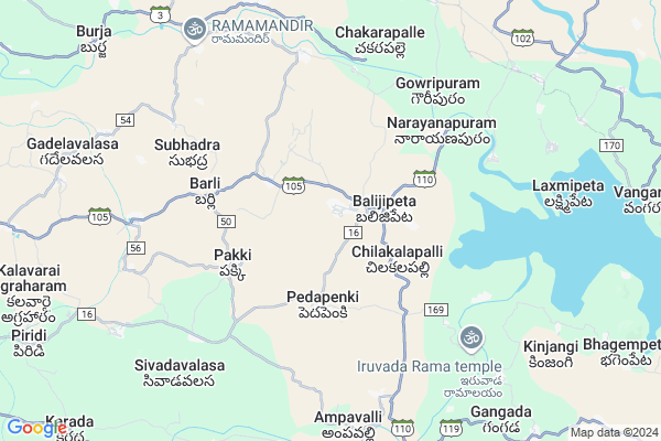
Tumarada is a Village in Balijipeta Mandal in Vizianagaram District of Andhra Pradesh State, India. It belongs to Andhra region . It is located 65 KM towards North from District head quarters Vizianagaram. 0 KM from Balijipeta. 642 KM from State capital Hyderabad
Tumarada Pin code is 535557 and postal head office is Balijipeta .
Mirthivalasa ( 2 KM ) , Palagara ( 2 KM ) , Chilakalapalli ( 2 KM ) , Padamayavalasa ( 3 KM ) , Pedapenki ( 3 KM ) are the nearby Villages to Tumarada. Tumarada is surrounded by Vangara Mandal towards East , Garugubilli Mandal towards North , Veeraghattam Mandal towards East , Seethanagaram Mandal towards west .
Bobbili , Parvathipuram , Rajam , Salur are the near by Cities to Tumarada.
This Place is in the border of the Vizianagaram District and Srikakulam District. Srikakulam District Vangara is East towards this place .
Tumarada 2011 Census Details
Tumarada Local Language is Telugu. Tumarada Village Total population is 2072 and number of houses are 601. Female Population is 51.6%. Village literacy rate is 43.0% and the Female Literacy rate is 18.6%.
Population
| Census Parameter | Census Data |
| Total Population | 2072 |
| Total No of Houses | 601 |
| Female Population % | 51.6 % ( 1070) |
| Total Literacy rate % | 43.0 % ( 891) |
| Female Literacy rate | 18.6 % ( 385) |
| Scheduled Tribes Population % | 0.0 % ( 0) |
| Scheduled Caste Population % | 18.5 % ( 384) |
| Working Population % | 53.5 % |
| Child(0 -6) Population by 2011 | 203 |
| Girl Child(0 -6) Population % by 2011 | 44.3 % ( 90) |
Tumarada Census More Deatils.
Politics in Tumarada
TDP , YSRC , Yuvajana Sramika Rythu Congress Party , YSRCP , INC are the major political parties in this area.Polling Stations /Booths near Tumarada
1)Settyvaripalli2)Suddapalli
3)J. Kothapalli
4)Jammalamadugu
5)Jangalapalli
HOW TO REACH Tumarada
By Road
Bobbili is the Nearest Town to Tumarada. Bobbili is 24 km from Tumarada. Road connectivity is there from Bobbili to Tumarada.By Rail
There is no railway station near to Tumarada in less than 10 km. How ever there are railway Stations from Near By town Bobbili. are the railway Stations near to Bobbili. You can reach from Bobbili to Tumarada by road after .By Bus
Bobbili APSRTC Bus Station , Parvathipuram APSRTC Bus Station , Rajam APSRTC Bus Station are the nearby by Bus Stations to Tumarada .APSRTC runs Number of busses from major cities to here.Colleges near Tumarada
P S N Junior Coll, Vengapuram, Balijipeta(m)Schools in Tumarada
Sri Bharathi Hs TumaradaGovt Health Centers near Tumarada
1) VENGAPURAM , '2-39 , Peda Veedi , opp: Rama mandiram2) VANTARAM , 29-Apr , MainRoad , MainRoad
3) PEDAPENKI , Mar-39 , S.C.Colony , S.C.Colony
Hospitals in Tumarada,Balijipeta
sri venkateswara medical and general shops
Balijipeta; Andhra Pradesh 535557; India
2.1 KM distance Detail
more ..
Petrol Bunks in Tumarada,Balijipeta
HP PETROL PUMP - SRI SAI KRUPA FILLING STATION
Hpcl Dealers Vengapuram Village Baljipeta Mandal; Main Road; Visakhapatnam; Andhra Pradesh 535557; India
1.1 KM distance Detail
more ..
Colleges in Tumarada,Balijipeta
Ranumudri Degree College; Balijipeta to Rajam
; Chilakalapalli; Andhra Pradesh 535557; India
2.1 KM distance Detail
Rangumudri Educaitional Instituations
VANI NAGAR ; CHILAKALAPALLI POST.;(VILL.) ; BALIJIPETA MANDAL ; VIZIANAGAARAM DIST.; ANDHRA PRADESH - 535 557; Andhra Pradesh 535557; India
2.2 KM distance Detail
more ..
How to reach Tumarada
Tourist Places Near By Tumarada
Schools in Tumarada
Colleges in Tumarada
Temperature & weather of Tumarada
places in Tumarada
Tumarada photos
More Information
Village Talk
Post News or Events about this Village
Bobbili 19 KM near
Parvathipuram 23 KM near
Rajam 27 KM near
Salur 37 KM near
Balijipeta 0 KM near
Vangara 9 KM near
Garugubilli 15 KM near
Seethanagaram 15 KM near
Vishakhapatnam Airport 114 KM near
Rajahmundry Airport 273 KM near
Bhubaneswar Airport 339 KM near
Raipur Airport 381 KM near
Vizayanagaram 64 KM near
Araku Valley 83 KM near
Ananthagiri 83 KM near
Simhachalam 111 KM near
Jeypore 116 KM near
Srikakulam 60 KM near
Vizianagaram 62 KM near
Rayagada 70 KM near
Koraput 97 KM near
Bobbili Junction Rail Way Station 19 KM near
Parvatipuram Rail Way Station 22 KM near