| Home | City Bus | Maps | Villages | Cities | Rail | Tourist Places | School | College | Pin Codes | Corona Cases Count |
| Distance Calculator Bus Services IFSC Codes Trace Mobile Number Weather Search Place Trace IP Available Cash ATM/Banks Locate Polling Booth Report an Error contact People |
 ..
..
Current Corona Virus Infected Patients Count in Virudhunagar District
| City Name | District Name | Total Covid cases |
|---|---|---|
| Virudhunagar District | Virudhunagar | 31 |
| Rajapalayam | Virudhunagar | 1 |
Block Name : Aruppukottai
District : Virudhunagar
State : Tamil Nadu
Language : Tamil and Urdu And English
Current Time 12:35 PM
Date: Sunday , Apr 27,2025 (IST)
Time zone: IST (UTC+5:30)
Elevation / Altitude: 103 meters. Above Seal level
Telephone Code / Std Code: 04566
Assembly constituency : Aruppukkottai assembly constituency
Assembly MLA : K.K.S.S.R.Ramachandran
Lok Sabha constituency : Virudhunagar parliamentary constituency
Parliament MP : MANICKAM TAGORE, B.
Serpanch Name :
Pin Code : 626134
Post Office Name : Chettikurichi
Commodities Prices : Thirumangalam Market / Mandi
Temperature: 34.5 °C
broken clouds
Humidity: 44%
Wind : 1.58 mt/sec towards SE
StationName : "Pudūr"
observed on 50 Mins Back
29.0°C to 35.1°C
overcast clouds, broken clouds
28.3°C to 37.4°C
scattered clouds, overcast clouds, broken clouds
28.6°C to 38.3°C
broken clouds, scattered clouds, few clouds, light rain, overcast clouds
28.7°C to 38.6°C
broken clouds, overcast clouds
28.7°C to 38.5°C
overcast clouds, broken clouds, moderate rain, light rain
OverView of Chettikurichi
meaning: chettiairs dominated original village; lived merrily with others- 8 surrendering villages-headed by Chettiar's kurichi(living place=kurichi)
history: Way back, it is about 8-9 centuries back, people from these part of villages predominantly chettiars by caste who undertook voyage to far flung earstern countries Burma and Rangoon (now Mianmmar) by ship. Thier main trade was diamond and their entire travel would be towards Srilanka (those days water ways were not developed as at present)
Formation: When more & more chettiars travelled and gathered money, their areas of habitation moved length and breadth aidn invariably they occupied/inherited the sorroundering villages although they were not belonging to their caste but their agricultural lands were maintained/leased to other communities.
Unique: It is that friendly and co-habitant nature of those at that point of time.
There are two old temples(Siva and Perumal-aged about 500 years) and there were huge properties belonging to the temple's earnings of which the Siva temple for taken over by Rameshwaram Devasthanam and still under their control.
Village deities of Reddys/Naidus were worshipped "periana
Edit below overview about Chettikurichi
Nationa High Way :NH744
Kousiga Maga Nadhi
Kiruthumal :Kiruthumal :கிருதுமால் நதி
About Chettikurichi
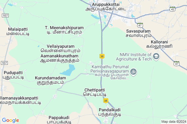
Chettikurichi is a Village in Aruppukottai Block in Virudhunagar District of Tamil Nadu State, India. It is located 25 KM towards East from District head quarters Virudhunagar. 8 KM from Aruppukottai. 544 KM from State capital Chennai
Chettikurichi Pin code is 626134 and postal head office is Chettikurichi .
Thiruvirunthalpuram ( 3 KM ) , Sethurajapuram ( 4 KM ) , Sukkilanatham ( 4 KM ) , Chidambarapuram ( 4 KM ) , T.meenakshipuram ( 5 KM ) are the nearby Villages to Chettikurichi. Chettikurichi is surrounded by Tiruchuli Block towards East , Virudhunagar Block towards west , Pudur Block towards South , Kariapatti Block towards North .
Aruppukkottai , Virudhunagar , Sattur , Pallapatti are the near by Cities to Chettikurichi.
Chettikurichi 2011 Census Details
Chettikurichi Local Language is Tamil. Chettikurichi Village Total population is 4958 and number of houses are 1487. Female Population is 50.4%. Village literacy rate is 73.8% and the Female Literacy rate is 33.8%.
Population
| Census Parameter | Census Data |
| Total Population | 4958 |
| Total No of Houses | 1487 |
| Female Population % | 50.4 % ( 2500) |
| Total Literacy rate % | 73.8 % ( 3658) |
| Female Literacy rate | 33.8 % ( 1675) |
| Scheduled Tribes Population % | 0.0 % ( 0) |
| Scheduled Caste Population % | 16.2 % ( 805) |
| Working Population % | 53.0 % |
| Child(0 -6) Population by 2011 | 408 |
| Girl Child(0 -6) Population % by 2011 | 48.3 % ( 197) |
Chettikurichi Census More Deatils.
Politics in Chettikurichi
DMK , AIADMK , ADMK , DMK , ADMK are the major political parties in this area.Polling Stations /Booths near Chettikurichi
1)Gandhi Kalvi Nilayam2)Panchayat Union Primary School
3)Panchayat Union Primary School
4)Panchayat Union Primary School
5)Ramanujam Primary School
HOW TO REACH Chettikurichi
By Rail
Aruppukkottai Rail Way Station is the very nearby railway stations to Chettikurichi.Colleges near Chettikurichi
Sri Sowdambika Polytechnic CollegeSchools near Chettikurichi
G.h.s (g) .,pandalkudiGovt Health Centers near Chettikurichi
1) GOMATHI HOSPITAL , 1 , 52,South street, , 52,South street,2) SRI RAM HOSPITAL -SUGASTHALA , 33 , Pattabiramar kovil street , Near Ahamudiyar mahal
3) VIGNESWAR HOSPITAL , 65 , South st, , South st,
Sub Villages in Chettikurichi
Hospitals in Chettikurichi,Aruppukottai
Aruppukottai Goverment Hospital
Vellai Kottai; Aruppukkottai; Tamil Nadu 626101; India
6.8 KM distance Detail
more ..
Petrol Bunks in Chettikurichi,Aruppukottai
Reliance Petroleum
RELIANCE PETRO MARKETING PVT LTD;OLD SURVEY NO.192/10 ;NEW TS NO:6/10 WARD F; Aruppukkottai; Tamil Nadu 626159; India
7.5 KM distance Detail
Bharat Petroleum
Old Bus Stand Rd; P.Puliampatti; Aruppukkottai; Tamil Nadu 626101; India
7.6 KM distance Detail
more ..
Colleges in Chettikurichi,Aruppukottai
E&I Block
Chettikurichi; Aruppukottai; National Highway 45B; Tamil Nadu 626134; India
1.9 KM distance Detail
more ..
Schools in Chettikurichi,Aruppukottai
EEE Block
Chettikurichi; Aruppukottai; National Highway 45B; Tamil Nadu 626112; India
1.9 KM distance Detail
Electronic Shops in Chettikurichi,Aruppukottai
Star Car Accessories
Chokkalingapuram; Aruppukkottai; Tamil Nadu 626105; India
7.5 KM distance Detail
Pandi Work Shop
South St; Vellai Kottai; Aruppukkottai; Tamil Nadu 626101; India
7.5 KM distance Detail
Super Markets in Chettikurichi,Aruppukottai
Rajco Supermarkets
2/315;; Srivilliputhur-Sivakasi-Virudhunagar-Aruppukottai-Tiruchuli-Narikudi-Parthibanoo; Road; Rajiv Nagar; Kanja Nayakkan Patti; gandhinagar Bus stop; Aruppukkottai; Tamil Nadu 626101; India
7.4 KM distance Detail
Inimai daily fresh
157-Karuippaya Pillai Compound; Pandalgudi Road; Aruppukottai - 626101.;; State Highway 42; Aruppukkottai; Tamil Nadu 626101; India
7.5 KM distance Detail
Venkateshwara Store
Jayaram; Rajiv Nagar; Aruppukkottai; Tamil Nadu 626105; India
7.6 KM distance Detail
Local Parks in Chettikurichi,Aruppukottai
Jeya Garden Aruppikottai
Aruppukkottai - Thoothukudi high Road; Tamil Nadu; India
2.6 KM distance Detail
Municipal Park and Siren center
SH 42; Vellai Kottai; Aruppukkottai; Tamil Nadu 626101; India
7.4 KM distance Detail
Police Stations near Chettikurichi,Aruppukottai
Police Station (Pandalgudi)
4/21; Pandalkudi Main Road; Sooranayakkanpatti; Pandalkudi; Tamil Nadu 626113; India
7.9 KM distance Detail
Dhaluka Police Station
626101; 1-26-20/5; Madurai Road; Shanmugavel Nagar; Madurai Rd; Shanmugavel Nagar; Palayampatti; Aruppukkottai; Tamil Nadu 626101; India
10.3 KM distance Detail
Governement Offices near Chettikurichi,Aruppukottai
panchayat office
114/20; Kanjanaickenpatti Rd; Kanja Nayakkan Patti; Aruppukkottai; Tamil Nadu 626105; India
6.3 KM distance Detail
Aruppukottai Municipality Office
Vellai Kottai; Aruppukkottai; Tamil Nadu 626101; India
6.6 KM distance Detail
How to reach Chettikurichi
Tourist Places Near By Chettikurichi
Schools in Chettikurichi
Colleges in Chettikurichi
Temperature & weather of Chettikurichi
places in Chettikurichi
Chettikurichi photos
More Information
Village Talk
Post News or Events about this Village
Aruppukkottai 8 KM near
Virudhunagar 24 KM near
Sattur 24 KM near
Pallapatti 32 KM near
Aruppukottai 7 KM near
Tiruchuli 15 KM near
Virudhunagar 21 KM near
Kariapatti 24 KM near
Madurai Airport 48 KM near
Tuticorin Airport 91 KM near
Civil Airport 180 KM near
Trivandrum International Airport 188 KM near
Sivakasi 35 KM near
Madurai 59 KM near
Tuticorin 87 KM near
Tirunelveli 101 KM near
Thekkady/Periyar 110 KM near
Virudhunagar 24 KM near
Madurai 59 KM near
Sivaganga 69 KM near
Tuticorin 80 KM near
Satur Rail Way Station 23 KM near
Virudunagar Junction Rail Way Station 24 KM near