| Home | City Bus | Maps | Villages | Cities | Rail | Tourist Places | School | College | Pin Codes | Corona Cases Count |
| Distance Calculator Bus Services IFSC Codes Trace Mobile Number Weather Search Place Trace IP Available Cash ATM/Banks Locate Polling Booth Report an Error contact People |
Katharikuppam
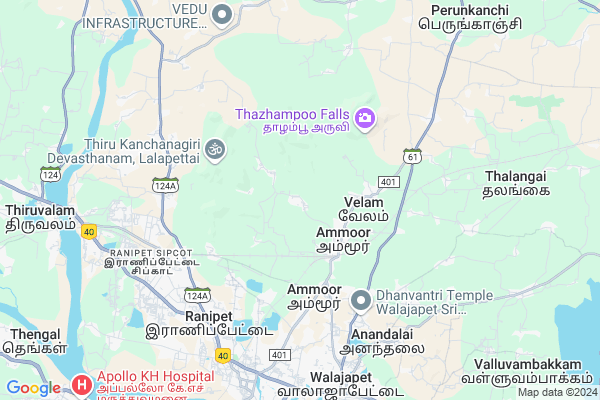
Katharikuppam Map
EDIT Map
Add Your House
 ..
..
Current Corona Virus Infected Patients Count in Vellore District
| City Name | District Name | Total Covid cases |
|---|---|---|
| Vellore District | Vellore | 22 |
| Katpadi | Vellore | 1 |
Locality Name :
Katharikuppam
( கத்தரிக்குப்பம் )
Block Name : Walajapet
District : Vellore
State : Tamil Nadu
Language : Tamil and Telugu, Urdu, Malayalam And Kannada
Current Time 04:43 PM
Date: Tuesday , Apr 29,2025 (IST)
Time zone: IST (UTC+5:30)
Elevation / Altitude: 178 meters. Above Seal level
Telephone Code / Std Code: 04172
Assembly constituency : Ranipet assembly constituency
Assembly MLA : R.Gandhi
Lok Sabha constituency : Arakkonam parliamentary constituency
Parliament MP : S. JAGATHRAKSHAKAN
Serpanch Name :
Pin Code : 632405
Post Office Name : Mukundarayapuram
Alternate Village Name : Katharikuppam Kootroad
Commodities Prices : Ammoor Market / Mandi
Katharikuppam Live Weather
Temperature: 38.6 °C
broken clouds
Humidity: 23%
Wind : 3.27 mt/sec towards E
StationName : "Walajapet"
observed on 21 Mins Back
Temperature: 38.6 °C
broken clouds
Humidity: 23%
Wind : 3.27 mt/sec towards E
StationName : "Walajapet"
observed on 21 Mins Back
Katharikuppam Weather Forecast for Next 5 days
30-04-2025
26.7°C to 37.2°C
broken clouds, overcast clouds
26.7°C to 37.2°C
broken clouds, overcast clouds
01-05-2025
25.7°C to 39.5°C
broken clouds, scattered clouds, few clouds, clear sky
25.7°C to 39.5°C
broken clouds, scattered clouds, few clouds, clear sky
02-05-2025
27.8°C to 41.7°C
broken clouds, overcast clouds, scattered clouds, moderate rain, light rain
27.8°C to 41.7°C
broken clouds, overcast clouds, scattered clouds, moderate rain, light rain
03-05-2025
27.2°C to 39.9°C
overcast clouds, broken clouds, scattered clouds, clear sky
27.2°C to 39.9°C
overcast clouds, broken clouds, scattered clouds, clear sky
04-05-2025
27.6°C to 41.5°C
few clouds, clear sky, light rain, moderate rain, overcast clouds
27.6°C to 41.5°C
few clouds, clear sky, light rain, moderate rain, overcast clouds
National Highways Reachable To Katharikuppam
Nationa High Way :NH48
Nationa High Way :NH132B
Nationa High Way :NH48
Nationa High Way :NH132B
Rivers Near Katharikuppam
Adyar River
Adyar River
Adyar River
Adyar River
About Katharikuppam
Correct below Info and add more info about KatharikuppamKatharikuppam is a Village in Walajapet Block in Vellore District of Tamil Nadu State, India. It is located 29 KM towards East from District head quarters Vellore. 8 KM from Walajapet. 114 KM from State capital Chennai
Katharikuppam Pin code is 632405 and postal head office is Mukundarayapuram .
Arumbakkam ( 3 KM ) , Kalmelkuppam ( 3 KM ) , Chettithangal ( 5 KM ) , Kolatheri ( 5 KM ) , Manthangal ( 5 KM ) are the nearby Villages to Katharikuppam. Katharikuppam is surrounded by Walajapet Block towards South , Arcot Block towards South , R.K.Pet Block towards North , Kaveripakkam Block towards East .
Arcot , Sholingur , Vellore , Tiruttani are the near by Cities to Katharikuppam.
Katharikuppam 2011 Census Details
Katharikuppam Local Language is Tamil. Katharikuppam Village Total population is 1307 and number of houses are 312. Female Population is 48.0%. Village literacy rate is 67.2% and the Female Literacy rate is 28.1%.
Population
| Census Parameter | Census Data |
| Total Population | 1307 |
| Total No of Houses | 312 |
| Female Population % | 48.0 % ( 628) |
| Total Literacy rate % | 67.2 % ( 878) |
| Female Literacy rate | 28.1 % ( 367) |
| Scheduled Tribes Population % | 0.0 % ( 0) |
| Scheduled Caste Population % | 1.4 % ( 18) |
| Working Population % | 49.0 % |
| Child(0 -6) Population by 2011 | 145 |
| Girl Child(0 -6) Population % by 2011 | 42.1 % ( 61) |
Katharikuppam Census More Deatils.
Politics in Katharikuppam
DMK , AIADMK , ADMK are the major political parties in this area.HOW TO REACH Katharikuppam
By Rail
Walajah Road Junction Rail Way Station , Marudalam Rail Way Station are the very nearby railway stations to Katharikuppam.Colleges near Katharikuppam
Ranipet Engineering College
Address : Thenkadappanthangal Wallajah Taluk Vellore Dist.
Arignar Anna Govt. Arts College For Women
Address : Walajapet, Vellore-632 513
Schools near Katharikuppam
Nag Matriculation School
Address : sumaithangai , walajah west , vellore , Tamil Nadu . PIN- 632508 , Post - Kaveripak
Dav Bhel Hss Narasingapuram
Address : narasingapuram , walajah west , vellore , Tamil Nadu . PIN- 632406 , Post - Bhel Ranipet
S.d Govt Hs, Thiruparkadal
Address : thiruparkadal , walajah west , vellore , Tamil Nadu . PIN- 632508 , Post - Kaveripak
Gangadara Mat S Navalp.ranipet
Address : ranipet municipality , walajah east , vellore , Tamil Nadu . PIN- 632402
Govt Health Centers near Katharikuppam
1) Ammoor , PHC Ammoor , SHOLINGHUR ROAD , COMMITY BACKSIDE2) Ruba NH, Ranipet , 1-A-18 , Othavadai Street, Navalpur, Ranipettai , Ranipet
3) Maniyampattu , HSC Maniyampattu , SCHOOL STREET , SCHOOL
Hospitals in Katharikuppam,Walajapet
Dr.G.Kumaran Ayurvedic Hospital
1st. Floor; 221; MDR401; Ammoor; Tamil Nadu 632501; India
2.8 KM distance Detail
more ..
Petrol Bunks in Katharikuppam,Walajapet
Kps Agencies
Ammoor sholingar Road Nadabai 401; Kolatheri; Tamil Nadu 632501; India
4.3 KM distance Detail
more ..
Colleges in Katharikuppam,Walajapet
Parimala Pandurangan Polytechnic College
Chithathoor; Tamil Nadu 632501; India
4.7 KM distance Detail
Sri Ramachandra ITI
Bharathi Nagar; Sathya Nagar; SIPCOT; Ranipet; Tamil Nadu 632403; India
6.3 KM distance Detail
Navelpur Bbharathiyar Nursing Colege
Bharathiyar Street; Manthangal; Ranipet; Tamil Nadu 632401; India
7.0 KM distance Detail
more ..
Schools in Katharikuppam,Walajapet
Govt Higher Sec School;Ammoor
South Saidapet; Ammoor; Tamil Nadu 632501; India
2.3 KM distance Detail
Local Parks in Katharikuppam,Walajapet
Jawaharlal Nehru Park
Rd towards BHEL Company; BHEL Township; Mukundarayapuram; Ranipet; Tamil Nadu 632406; India
7.8 KM distance Detail
Governement Offices near Katharikuppam,Walajapet
Tamil Nadu Warehousing Corporation Ranipet
No.12B; Sipcot Industrial Complex; Ponnai - Thiruvalam Rd; Ranipet; Tamil Nadu; India
6.2 KM distance Detail
About Katharikuppam &
History
How to reach Katharikuppam
Tourist Places Near By Katharikuppam
Schools in Katharikuppam
Colleges in Katharikuppam
Temperature & weather of Katharikuppam
places in Katharikuppam
Katharikuppam photos
More Information
How to reach Katharikuppam
Tourist Places Near By Katharikuppam
Schools in Katharikuppam
Colleges in Katharikuppam
Temperature & weather of Katharikuppam
places in Katharikuppam
Katharikuppam photos
More Information
Village Talk
Post News or Events about this Village
Near Cities
Arcot 11 KM near
Sholingur 18 KM near
Vellore 27 KM near
Tiruttani 39 KM near
Arcot 11 KM near
Sholingur 18 KM near
Vellore 27 KM near
Tiruttani 39 KM near
Near By Taluks
Sholinghur 7 KM near
Walajapet 8 KM near
Arcot 14 KM near
R.K.Pet 19 KM near
Sholinghur 7 KM near
Walajapet 8 KM near
Arcot 14 KM near
R.K.Pet 19 KM near
Near By Air Ports
Tirupati Airport 83 KM near
Chennai Airport 98 KM near
Bengaluru International Airport 201 KM near
Salem Airport 220 KM near
Tirupati Airport 83 KM near
Chennai Airport 98 KM near
Bengaluru International Airport 201 KM near
Salem Airport 220 KM near
Near By Tourist Places
vellore 27 KM near
Thiruthani 39 KM near
Chittoor 41 KM near
Kanchipuram 46 KM near
Sriperumbudur 72 KM near
vellore 27 KM near
Thiruthani 39 KM near
Chittoor 41 KM near
Kanchipuram 46 KM near
Sriperumbudur 72 KM near
Near By Districts
Vellore 28 KM near
Chittoor 41 KM near
Kanchipuram 46 KM near
Thiruvallur 70 KM near
Vellore 28 KM near
Chittoor 41 KM near
Kanchipuram 46 KM near
Thiruvallur 70 KM near
Near By RailWay Station
Walajah Road Junction Rail Way Station 2.8 KM near
Marudalam Rail Way Station 6.4 KM near
Mukundarayapuram Rail Way Station 7.9 KM near
Walajah Road Junction Rail Way Station 2.8 KM near
Marudalam Rail Way Station 6.4 KM near
Mukundarayapuram Rail Way Station 7.9 KM near