| Home | City Bus | Maps | Villages | Cities | Rail | Tourist Places | School | College | Pin Codes | Corona Cases Count |
| Distance Calculator Bus Services IFSC Codes Trace Mobile Number Weather Search Place Trace IP Available Cash ATM/Banks Locate Polling Booth Report an Error contact People |
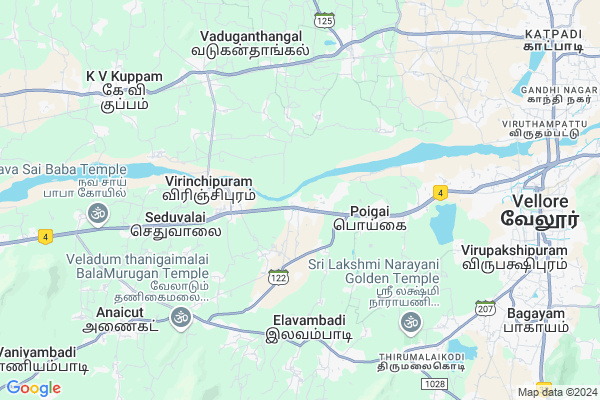
Poigai
Poigai Map
EDIT Map
Add Your House
 ..
..
Current Corona Virus Infected Patients Count in Vellore District
| City Name | District Name | Total Covid cases |
|---|---|---|
| Vellore District | Vellore | 22 |
| Katpadi | Vellore | 1 |
Village Name :
Poigai
( பொய்கை )
City Name : Vellore
District : Vellore
State : Tamil Nadu
Language : Tamil and Telugu, Urdu, Malayalam And Kannada
Current Time 09:28 PM
Date: Thursday , Apr 24,2025 (IST)
Time zone: IST (UTC+5:30)
Elevation / Altitude: 215 meters. Above Seal level
Telephone Code / Std Code: 0416
Ward : Ward
Assembly constituency : Anaikattu assembly constituency
Assembly MLA : A.P.Nandakumar
Lok Sabha constituency : Vellore parliamentary constituency
Parliament MP :
Commodities Prices : Vellore Market / Mandi
Poigai Live Weather
Temperature: 34.9 °C
overcast clouds
Humidity: 27%
Wind : 3.23 mt/sec towards E
StationName : "Pallikondai"
observed on 2 Hours Back
Temperature: 34.9 °C
overcast clouds
Humidity: 27%
Wind : 3.23 mt/sec towards E
StationName : "Pallikondai"
observed on 2 Hours Back
Poigai Weather Forecast for Next 5 days
25-04-2025
26.8°C to 35.0°C
overcast clouds
26.8°C to 35.0°C
overcast clouds
26-04-2025
25.7°C to 40.2°C
overcast clouds, scattered clouds, few clouds, clear sky
25.7°C to 40.2°C
overcast clouds, scattered clouds, few clouds, clear sky
27-04-2025
25.0°C to 39.7°C
few clouds, broken clouds, scattered clouds
25.0°C to 39.7°C
few clouds, broken clouds, scattered clouds
28-04-2025
25.4°C to 39.5°C
few clouds, broken clouds, scattered clouds
25.4°C to 39.5°C
few clouds, broken clouds, scattered clouds
29-04-2025
26.0°C to 40.3°C
scattered clouds, broken clouds, few clouds, clear sky, overcast clouds
26.0°C to 40.3°C
scattered clouds, broken clouds, few clouds, clear sky, overcast clouds
National Highways Reachable To Poigai
Nationa High Way :NH48
Nationa High Way :NH132B
Nationa High Way :NH48
Nationa High Way :NH132B
Rivers Near Poigai
Kortalaiyar :Kosasthalaiyar River
Kortalaiyar :Kosasthalaiyar River
About Poigai
Correct below Info and add more info about PoigaiPoigai is a Locality in Vellore City in Tamil Nadu State, India.
Poigai , Kothamangalam , Seduvalai , Virinchipuram , Thellur are the nearby Localities to Poigai.
Vellore , Pallikonda , Arcot , Chittoor are the nearby Cities to Vellore.
Demographics of Poigai
Tamil is the Local Language here.Politics in Poigai
DMDK , DMK , PMK are the major political parties in this area.HOW TO REACH Poigai
By Rail
Virinchipuram Rail Way Station , Latteri Rail Way Station are the very nearby railway station to Poigai.Pincodes near Poigai
632114 ( Sathyamangalam (Vellore) ) , 632010 ( Abdullapuram ) , 632104 ( Virnjipuram )Govt Health Centers near Poigai
1) Ussoor , 2/291 , Vellore to Odugathur Main Road , Opp. P.V Office2) KASPA UHP , No 1 , Adavanthaleri Street, Kaspa , Near Vellore Cantonment Rail Way Station
3) AMBEDKAR NAGAR UHP , UHP AMBEDKAR NAGAR , Bangalore road, Vellore , Near Vellore Fort Round
Petrol Bunks in Poigai,Vellore
Petrol Bunk
National Highway 46; Abdullah puram; Vellore; Tamil Nadu 632114; India
1.9 KM distance Detail
Sri Balaji Agency
Kodambakkam - Mumbai Highway; Anpundi; Tamil Nadu 632010; India
2.4 KM distance Detail
more ..
Colleges in Poigai,Vellore
Kumaran Educational College
National Highway 46; Abdullah puram; Vellore; Tamil Nadu 632010; India
3.8 KM distance Detail
Pallavan College Of Education
632010; SH 122; Abdullah puram; Vellore; Tamil Nadu 632114; India
3.8 KM distance Detail
Melmonavoor Palavan College of Educational
Abdullah puram; Vellore; Tamil Nadu 632010; India
3.8 KM distance Detail
more ..
Schools in Poigai,Vellore
Government Elementary School
Nallathayaman Kovil Street; Sathiyamangalam; Vellore; Tamil Nadu 632114; India
0.7 KM distance Detail
Government Boys Higher Secondary School
Poigai; National Highway 46; Vellore; Tamil Nadu 632114; India
1.0 KM distance Detail
Electronic Shops in Poigai,Vellore
Chakraa Automobbiles
SF NO.220/2G; Airport bus stop near; Abdullah puram; Vellore; Tamil Nadu 632114; India
2.3 KM distance Detail
Local Parks in Poigai,Vellore
Sri Krishna Garden; Okkanapuram;; Vellore; Tamil Nadu
NH 46; Sethuvalai; Tamil Nadu 632104; India
5.2 KM distance Detail
Dr.B.R.Ambedkar
Ajipura; National Highway 48; Melmonavoor; Karugampudur; Vellore; Tamil Nadu 632010; India
6.3 KM distance Detail
Governement Offices near Poigai,Vellore
Government Primary Health Center
National Highway 46; Poigai; Tamil Nadu 632114; India
1.0 KM distance Detail
Co-optex Regional Office; Vellore
Abdullah puram; Vellore; Tamil Nadu 632010; India
4.8 KM distance Detail
Panchayat Office
Melmonavoor; Aavarampalayam; Vellore; Tamil Nadu 632010; India
5.1 KM distance Detail
About Poigai &
History
How to reach Poigai
Tourist Places Near By Poigai
Schools in Poigai
Colleges in Poigai
Temperature & weather of Poigai
places in Poigai
Poigai photos
More Information
How to reach Poigai
Tourist Places Near By Poigai
Schools in Poigai
Colleges in Poigai
Temperature & weather of Poigai
places in Poigai
Poigai photos
More Information
Locality Talk
Post News or Events about this Locality
Near Cities
Vellore 10 KM near
Pallikonda 14 KM near
Arcot 33 KM near
Chittoor 36 KM near
Vellore 10 KM near
Pallikonda 14 KM near
Arcot 33 KM near
Chittoor 36 KM near
Near By Taluks
K.V.Kuppam 6 KM near
Vellore 9 KM near
Anaicut 11 KM near
Katpadi 14 KM near
K.V.Kuppam 6 KM near
Vellore 9 KM near
Anaicut 11 KM near
Katpadi 14 KM near
Near By Air Ports
Tirupati Airport 107 KM near
Chennai Airport 135 KM near
Bengaluru International Airport 166 KM near
Salem Airport 191 KM near
Tirupati Airport 107 KM near
Chennai Airport 135 KM near
Bengaluru International Airport 166 KM near
Salem Airport 191 KM near
Near By Tourist Places
vellore 10 KM near
Chittoor 37 KM near
Yelagiri 65 KM near
Thiruthani 75 KM near
Kanchipuram 79 KM near
vellore 10 KM near
Chittoor 37 KM near
Yelagiri 65 KM near
Thiruthani 75 KM near
Kanchipuram 79 KM near
Near By Districts
Vellore 10 KM near
Chittoor 36 KM near
Kanchipuram 79 KM near
Tiruvannamalai 85 KM near
Vellore 10 KM near
Chittoor 36 KM near
Kanchipuram 79 KM near
Tiruvannamalai 85 KM near
Near By RailWay Station
Virinchipuram Rail Way Station 6.2 KM near
Latteri Rail Way Station 6.4 KM near
Vellore Cantt. Rail Way Station 9 KM near
Katpadi Junction Rail Way Station 12 KM near
Virinchipuram Rail Way Station 6.2 KM near
Latteri Rail Way Station 6.4 KM near
Vellore Cantt. Rail Way Station 9 KM near
Katpadi Junction Rail Way Station 12 KM near