| Home | City Bus | Maps | Villages | Cities | Rail | Tourist Places | School | College | Pin Codes | Corona Cases Count |
| Distance Calculator Bus Services IFSC Codes Trace Mobile Number Weather Search Place Trace IP Available Cash ATM/Banks Locate Polling Booth Report an Error contact People |
Vedal
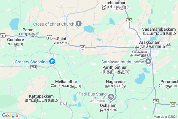
Vedal Map
EDIT Map
Add Your House
 ..
..
Current Corona Virus Infected Patients Count in Vellore District
| City Name | District Name | Total Covid cases |
|---|---|---|
| Vellore District | Vellore | 22 |
| Katpadi | Vellore | 1 |
Locality Name :
Vedal
( வேடன் )
Block Name : Kaveripakkam
District : Vellore
State : Tamil Nadu
Language : Tamil and Telugu, Urdu, Malayalam And Kannada
Current Time 06:53 AM
Date: Saturday , Apr 26,2025 (IST)
Time zone: IST (UTC+5:30)
Elevation / Altitude: 147 meters. Above Seal level
Telephone Code / Std Code: 04172
Assembly constituency : Arakkonam assembly constituency
Assembly MLA : S.Ravi
Lok Sabha constituency : Arakkonam parliamentary constituency
Parliament MP : S. JAGATHRAKSHAKAN
Serpanch Name :
Pin Code : 632502
Post Office Name : Anvardhikhanpet
Alternate Village Name : Vedal colony
Commodities Prices : Kaveripakkam Market / Mandi
Vedal Live Weather
Temperature: 26.3 °C
overcast clouds
Humidity: 87%
Wind : 0.35 mt/sec towards S
StationName : "Arakkonam"
observed on 1 Hours Back
Temperature: 26.3 °C
overcast clouds
Humidity: 87%
Wind : 0.35 mt/sec towards S
StationName : "Arakkonam"
observed on 1 Hours Back
Vedal Weather Forecast for Next 5 days
27-04-2025
26.5°C to 40.0°C
overcast clouds, broken clouds
26.5°C to 40.0°C
overcast clouds, broken clouds
28-04-2025
26.0°C to 38.6°C
overcast clouds, broken clouds, scattered clouds
26.0°C to 38.6°C
overcast clouds, broken clouds, scattered clouds
29-04-2025
27.0°C to 39.4°C
broken clouds, few clouds, scattered clouds, clear sky
27.0°C to 39.4°C
broken clouds, few clouds, scattered clouds, clear sky
30-04-2025
27.3°C to 39.8°C
few clouds, clear sky
27.3°C to 39.8°C
few clouds, clear sky
Edit below overview about Vedal
Edit below overview about Vedal
OverView of Vedal
Vedal village is located in Vellore district Arakkonam taluk, pin 632502. Around 5000 peoples are living. Religious Hindu, 2/3 people's are SURAMUDU, Most of the people are Farmer's, they cultivating crops and grains, And they cultivate Jasmine and Mulla for money.Edit below overview about Vedal
National Highways Reachable To Vedal
Nationa High Way :NH48
Nationa High Way :NH32
Nationa High Way :NH48
Nationa High Way :NH32
Rivers Near Vedal
Adyar River
Adyar River
Adyar River
Adyar River
About Vedal
Vedal is a Village in Kaveripakkam Block in Vellore District of Tamil Nadu State, India. It is located 63 KM towards East from District head quarters Vellore. 12 KM from Kaveripakkam. 82 KM from State capital Chennai
Vedal Pin code is 632502 and postal head office is Anvardhikhanpet .
Chitheri ( 2 KM ) , Arumbakkam ( 4 KM ) , Thandalam ( 4 KM ) , Nagavedu ( 5 KM ) , Selvamandai ( 5 KM ) are the nearby Villages to Vedal. Vedal is surrounded by Arakkonam Block towards East , Kaveripakkam Block towards west , Tiruttani Block towards North , Tiruvelangadu Block towards East .
Arakkonam , Tiruttani , Sholingur , Nagari are the near by Cities to Vedal.
Vedal 2011 Census Details
Vedal Local Language is Tamil. Vedal Village Total population is 2781 and number of houses are 691. Female Population is 50.8%. Village literacy rate is 57.1% and the Female Literacy rate is 24.3%.
Population
| Census Parameter | Census Data |
| Total Population | 2781 |
| Total No of Houses | 691 |
| Female Population % | 50.8 % ( 1412) |
| Total Literacy rate % | 57.1 % ( 1588) |
| Female Literacy rate | 24.3 % ( 675) |
| Scheduled Tribes Population % | 3.1 % ( 85) |
| Scheduled Caste Population % | 13.4 % ( 374) |
| Working Population % | 55.8 % |
| Child(0 -6) Population by 2011 | 352 |
| Girl Child(0 -6) Population % by 2011 | 49.7 % ( 175) |
Vedal Census More Deatils.
Politics in Vedal
DMK , AIADMK , VCK , ADMK , PMK are the major political parties in this area.Polling Stations /Booths near Vedal
1)Panchayat Union Middle School Sembedu-631101HOW TO REACH Vedal
By Rail
Chitteri Rail Way Station , Anavardikhanpettai Rail Way Station are the very nearby railway stations to Vedal.Colleges near Vedal
The Vestley Teacher Training Institute
Address : Koothadivayal Aranthangi
Kaveripakkam Arts & Science College
Address : Thiruparkadal Road Arthipattu Panchayat Kaveripakk
Arakkonam Arts And Science College
Address : Itchiputhur Arakkonam Vellore District Pin Code 63
Schools in Vedal
Pums,vedal
Address : vedal , kaveripakkam , vellore , Tamil Nadu . PIN- 632502 , Post - Anvardhikhanpet
Govt Health Centers near Vedal
1) Melkalathur , , Sudukadu way , Near By Sudukadu2) Minnal , 400 , Bangala Street , Vetnari Hospital
3) Arakkonam , No.154A , Gandhi Road,Arakkonam , Nearer By CSI School,Arakkonam
Sub Villages in Vedal
Petrol Bunks in Vedal,Kaveripakkam
Hari Krishna Agencies HPcl Bunk
KRP Nagar; Perumal Rajpet; Tamil Nadu 631003; India
2.1 KM distance Detail
Harikrishna Petrol Agency
KRP Nagar; Perumal Rajpet; Tamil Nadu 631003; India
2.1 KM distance Detail
Indian Oil Petrol Pump
Melpakkam; Arakkonam; Vellore; SH-126; Arakkonam Ocheri Road; Arcot; Arcot; 631002; India
4.6 KM distance Detail
more ..
Colleges in Vedal,Kaveripakkam
Sri Krishna College of Education
TRS Campus; Sri Krishna Nagar; Tiruttani High Road; Arakkonam; Tamil Nadu 631003; India
7.1 KM distance Detail
more ..
Schools in Vedal,Kaveripakkam
Government Elementary School Chitteri
Chitteri; Vedal; Tamil Nadu 631003; India
0.8 KM distance Detail
Government Higher Secondary School; Chitteri
Chitteri; Vedal; Tamil Nadu 631003; India
1.0 KM distance Detail
Electronic Shops in Vedal,Kaveripakkam
Sss Mobiles Sales And Service
SH 61; Perumal Rajpet; Tamil Nadu 631101; India
4.6 KM distance Detail
Super Markets in Vedal,Kaveripakkam
Elangovan Store
16; Anvarthikanpet Rd; Anvarthikanpet; Avadham; Tamil Nadu 632502; India
4.8 KM distance Detail
Local Parks in Vedal,Kaveripakkam
Vivek Garden
Deavadanam; 631002; Othavadai Street; Arakkonam; Tamil Nadu 631001; India
7.0 KM distance Detail
Kareem Garden
Nehruji Nagar 5th Street 1st Cross; Arakkonam North; Arakkonam; Tamil Nadu 631001; India
8.2 KM distance Detail
Green Park
12; Abdul Majeeth St; Arakkonam North; Arakkonam; Tamil Nadu 631001; India
8.4 KM distance Detail
Police Stations near Vedal,Kaveripakkam
Women Police Station
SH58; Arakkonam North; Arakkonam; Tamil Nadu 631001; India
8.3 KM distance Detail
Railway Protection Force
Arakkonam North; Arakkonam; Tamil Nadu 631001; India
8.6 KM distance Detail
assistant superintendent of police Office
631001; Tamil Nadu Housing Board; Arakkonam North; Arakkonam; Tamil Nadu 631001; India
8.7 KM distance Detail
About Vedal &
History
How to reach Vedal
Tourist Places Near By Vedal
Schools in Vedal
Colleges in Vedal
Temperature & weather of Vedal
places in Vedal
Vedal photos
More Information
How to reach Vedal
Tourist Places Near By Vedal
Schools in Vedal
Colleges in Vedal
Temperature & weather of Vedal
places in Vedal
Vedal photos
More Information
Village Talk
Post News or Events about this Village
Near Cities
Arakkonam 8 KM near
Tiruttani 13 KM near
Sholingur 22 KM near
Nagari 30 KM near
Arakkonam 8 KM near
Tiruttani 13 KM near
Sholingur 22 KM near
Nagari 30 KM near
Near By Taluks
Nemili 9 KM near
Arakkonam 11 KM near
Kaveripakkam 11 KM near
Tiruttani 14 KM near
Nemili 9 KM near
Arakkonam 11 KM near
Kaveripakkam 11 KM near
Tiruttani 14 KM near
Near By Air Ports
Chennai Airport 69 KM near
Tirupati Airport 70 KM near
Bengaluru International Airport 230 KM near
Salem Airport 248 KM near
Chennai Airport 69 KM near
Tirupati Airport 70 KM near
Bengaluru International Airport 230 KM near
Salem Airport 248 KM near
Near By Tourist Places
Thiruthani 13 KM near
Kanchipuram 31 KM near
Sriperumbudur 44 KM near
vellore 59 KM near
Chittoor 63 KM near
Thiruthani 13 KM near
Kanchipuram 31 KM near
Sriperumbudur 44 KM near
vellore 59 KM near
Chittoor 63 KM near
Near By Districts
Kanchipuram 30 KM near
Thiruvallur 38 KM near
Vellore 60 KM near
Chittoor 64 KM near
Kanchipuram 30 KM near
Thiruvallur 38 KM near
Vellore 60 KM near
Chittoor 64 KM near
Near By RailWay Station
Chitteri Rail Way Station 1.9 KM near
Anavardikhanpettai Rail Way Station 4.8 KM near
Arakkonam Junction Rail Way Station 8.7 KM near
Tiruttani Rail Way Station 13 KM near
Chitteri Rail Way Station 1.9 KM near
Anavardikhanpettai Rail Way Station 4.8 KM near
Arakkonam Junction Rail Way Station 8.7 KM near
Tiruttani Rail Way Station 13 KM near