| Home | City Bus | Maps | Villages | Cities | Rail | Tourist Places | School | College | Pin Codes | Corona Cases Count |
| Distance Calculator Bus Services IFSC Codes Trace Mobile Number Weather Search Place Trace IP Available Cash ATM/Banks Locate Polling Booth Report an Error contact People |
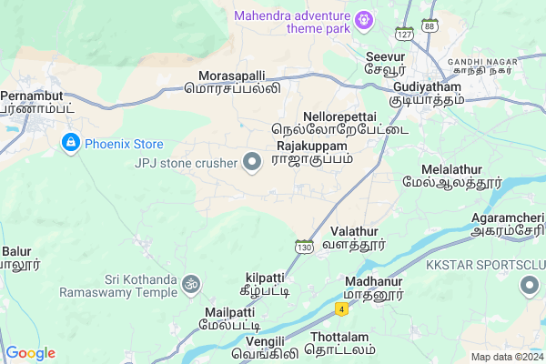
Sembedu
Sembedu Map
EDIT Map
Add Your House
 ..
..
Current Corona Virus Infected Patients Count in Vellore District
| City Name | District Name | Total Covid cases |
|---|---|---|
| Vellore District | Vellore | 22 |
| Katpadi | Vellore | 1 |
Locality Name :
Sembedu
( சேம்பேடு )
Block Name : Gudiyattam
District : Vellore
State : Tamil Nadu
Language : Tamil and Telugu, Urdu, Malayalam And Kannada
Current Time 10:19 AM
Date: Wednesday , Apr 30,2025 (IST)
Time zone: IST (UTC+5:30)
Elevation / Altitude: 269 meters. Above Seal level
Telephone Code / Std Code: 04171
Assembly constituency : Kilvaithinankuppam assembly constituency
Assembly MLA : Amulu.V
Lok Sabha constituency : Vellore parliamentary constituency
Parliament MP :
Serpanch Name :
Pin Code : 635813
Post Office Name : Valathoor
Commodities Prices : Gudiyatham Market / Mandi
Sembedu Live Weather
Temperature: 33.0 °C
broken clouds
Humidity: 43%
Wind : 1.03 mt/sec towards SE
StationName : "Gudiyatham"
observed on 54 Mins Back
Temperature: 33.0 °C
broken clouds
Humidity: 43%
Wind : 1.03 mt/sec towards SE
StationName : "Gudiyatham"
observed on 54 Mins Back
Sembedu Weather Forecast for Next 5 days
01-05-2025
27.0°C to 39.6°C
broken clouds, scattered clouds, overcast clouds
27.0°C to 39.6°C
broken clouds, scattered clouds, overcast clouds
02-05-2025
25.6°C to 40.1°C
overcast clouds, light rain
25.6°C to 40.1°C
overcast clouds, light rain
03-05-2025
27.2°C to 41.8°C
overcast clouds, scattered clouds, few clouds, light rain, broken clouds
27.2°C to 41.8°C
overcast clouds, scattered clouds, few clouds, light rain, broken clouds
04-05-2025
27.2°C to 40.9°C
overcast clouds, broken clouds, scattered clouds, light rain
27.2°C to 40.9°C
overcast clouds, broken clouds, scattered clouds, light rain
05-05-2025
26.0°C to 40.1°C
overcast clouds, broken clouds, clear sky, moderate rain, light rain
26.0°C to 40.1°C
overcast clouds, broken clouds, clear sky, moderate rain, light rain
Edit below overview about Sembedu
Edit below overview about Sembedu
OverView of Sembedu
Sembedu is a village in Vellore district, Tamil Nadu. Sembadu is situated in between Arcot and Kalavai road. It is 16 km from Arcot and 7 km from Kalavai. It belongs to Sembedu village panchayat. The surrounding nearby villages and its distance from Sembedu are Ussoor, Pulimedu, Palamathi, Anpoondi, Kilmonavoor, Konavattam, Alamelumangapuram, Sekkanur, Thellur, Melmonavoor, Palavansathu Kuppam, Karugambathur, Abdullapuram, Ariyur, Athiyur, Chitteri, Perumugai, Vellore, Budur, Kuppam, Saduperi, Sirukanchi, Venkatapuram. The Official Language Of Sembedu The native language of Sembedu is Tamil and most of the village people speak Tamil. Sembedu people use Tamil language for communication Politics in Sembedu DMDK, DMK, AIADMK are the major political parties in this area. Temples in Sembedu Sree Vanalavan Maha Muneeshwarar Temple Kaaliyamman Temple Nearest Railway Station to Sembedu Ponpadi railway station is the nearest railway station from Sembedu. The straight line distance from Sembedu to Ponpadi railway station is around 13.8 kilometre. The nearest railway station and its distance from Sembedu are follows. Ponpadi railway station 13.8 KM. Sholinghur railway station 14.0 KM. Arakkonam railway station 15.0 KM. Puliyamangalam railway station 15.6 KM. Mosur railway station 19.2 KM. Nearest Airport In Sembedu Nearest airport from Sembedu‘s is INS Rajali Naval Air Station which is situated around 16.5 KM distance. INS Rajali Naval Air Station 16.5 KM. Tirupati Airport 56.6 KM. Vellore Airport 57.6 KM. Schools in Sembedu Ghs Sembedu Address: sembedu, gudiyattam, vellore, Tamil Nadu. PIN- 635813, Post - Valathoor.Edit below overview about Sembedu
National Highways Reachable To Sembedu
Nationa High Way :NH75
Nationa High Way :NH42
Nationa High Way :NH75
Nationa High Way :NH42
Rivers Near Sembedu
Palar :ಪಾಲಾರ್ :பாலா
Kortalaiyar :Kosasthalaiyar River
Palar :ಪಾಲಾರ್ :பாலா
Kortalaiyar :Kosasthalaiyar River
About Sembedu
Sembedu is a Village in Gudiyattam Block in Vellore District of Tamil Nadu State, India. It is located 40 KM towards west from District head quarters Vellore. 7 KM from Gudiyattam. 183 KM from State capital Chennai
Sembedu Pin code is 635813 and postal head office is Valathoor .
Bojanapuram ( 2 KM ) , Rajakuppam ( 2 KM ) , Paravakkal ( 2 KM ) , Chettikuppam ( 3 KM ) , Valathur ( 3 KM ) are the nearby Villages to Sembedu. Sembedu is surrounded by Madhanur Block towards South , Peranambattu Block towards west , Anaicut Block towards East , K.V.Kuppam Block towards East .
Pernampattu , Pallikonda , Vaniyambadi , Vellore are the near by Cities to Sembedu.
Sembedu 2011 Census Details
Sembedu Local Language is Tamil. Sembedu Village Total population is 1801 and number of houses are 429. Female Population is 51.0%. Village literacy rate is 76.1% and the Female Literacy rate is 35.8%.
Population
| Census Parameter | Census Data |
| Total Population | 1801 |
| Total No of Houses | 429 |
| Female Population % | 51.0 % ( 919) |
| Total Literacy rate % | 76.1 % ( 1370) |
| Female Literacy rate | 35.8 % ( 645) |
| Scheduled Tribes Population % | 0.0 % ( 0) |
| Scheduled Caste Population % | 69.8 % ( 1257) |
| Working Population % | 40.6 % |
| Child(0 -6) Population by 2011 | 213 |
| Girl Child(0 -6) Population % by 2011 | 53.5 % ( 114) |
Sembedu Census More Deatils.
Politics in Sembedu
DMK , AIADMK are the major political parties in this area.HOW TO REACH Sembedu
By Rail
Valathoor Rail Way Station , Melpatti Rail Way Station are the very nearby railway stations to Sembedu.Colleges near Sembedu
Government. Thirumagal Mills College
Address : Gtm College, Gandhi Nagar, Gudiyattam Vellore Dis
Gudiyattam Polytechnic College
Address : Gudiyattam Polytechnic College, Kakathoppu, Gudiya
Vidhya Sagar Women's College
Address : G.s.t Road, Vedanarayanapuram, Chengalpattu-603111
Indira Gandhi College Of Engineering & Technology For Women
Address : Athur Village (p.o), Chengalpattu - Kancheepuram
C.k.s. Teacher Training Institute
Address : No.75, Railway Station Road Gudiyattam
Schools in Sembedu
Ghs Sembedu
Address : sembedu , gudiyattam , vellore , Tamil Nadu . PIN- 635813 , Post - Valathoor
Govt Health Centers near Sembedu
1) Pogalur , Pogalur Hsc , GUDIYATTAM ROAD , NEAR RATION SHOP2) Ulli , Ulli HSC , Ulli , Near Ration shop, VAO Office
3) Sendathur , Sendathur Hsc , GUDIYATTAM ROAD , NEAR BUS STOP
Sub Villages in Sembedu
Hospitals in Sembedu,Gudiyattam
அரசு ஆரம்ப சுகாதார நிலையம் மருத்துவமனை டிடி மோட்டூர்
Morasapalli; Tamil Nadu 635810; India
5.4 KM distance Detail
Acupuncture Clinic
Acupuncture clinic; Vardapalayam; dist; Gudiyattam; Tamil Nadu; India
5.5 KM distance Detail
more ..
Petrol Bunks in Sembedu,Gudiyattam
Hindustan Petroleum
Melpatti; Vellore; SH-130; Vaniyambadi Gudiyattam Road; Vellore; Vellore; 635805; India
6.0 KM distance Detail
Indian Oil Petrol Pump
JJ Nagar; Vellore; SH-130; Vaniyambadi Gudiyattam Road; Vellore; Vellore; 635806; India
6.4 KM distance Detail
more ..
Colleges in Sembedu,Gudiyattam
Vellalar College of Education
Gudiyattam; Vellore; SH-130; Vaniyambadi Gudiyattam Road; Vellore; Vellore; 635813; India
5.7 KM distance Detail
Gudiyattam Polytechnic College
Kakathoppu;Gudiyattam; Vellore District; Vellore; Tamil Nadu 632601; India
5.8 KM distance Detail
Sathyam International Institute of hotel management
NO. 145/1; OPP TO NOKIA FACTORY; Chennai - Bengaluru Hwy; Sriperumbudur; Tamil Nadu 602105; India
7.1 KM distance Detail
more ..
Super Markets in Sembedu,Gudiyattam
Tamil Selvi Fancy Store
Lingundram village; Earthangal post; Gudiyattam; Tamil Nadu 635813; India
5.6 KM distance Detail
Sakthi Stores A to Z General Store
No: 15-G; Veerapathiran Street; Near Old Sub Court; Dharnampet; Gudiyattam; Tamil Nadu 632602; India
6.0 KM distance Detail
Local Parks in Sembedu,Gudiyattam
INDIRA HOUSING BOARD
INDIRA HOUSING BOARD; Melalathur; Tamil Nadu 635806; India
9.6 KM distance Detail
Governement Offices near Sembedu,Gudiyattam
Tax saving policies in Vellore
No-35;Public Road; Dharnampet;Gudiyatham; Vellore; Tamil Nadu 632602; India
7.9 KM distance Detail
About Sembedu &
History
How to reach Sembedu
Tourist Places Near By Sembedu
Schools in Sembedu
Colleges in Sembedu
Temperature & weather of Sembedu
places in Sembedu
Sembedu photos
More Information
How to reach Sembedu
Tourist Places Near By Sembedu
Schools in Sembedu
Colleges in Sembedu
Temperature & weather of Sembedu
places in Sembedu
Sembedu photos
More Information
Village Talk
Post News or Events about this Village
Near Cities
Pernampattu 10 KM near
Pallikonda 14 KM near
Vaniyambadi 38 KM near
Vellore 39 KM near
Pernampattu 10 KM near
Pallikonda 14 KM near
Vaniyambadi 38 KM near
Vellore 39 KM near
Near By Taluks
Gudiyattam 7 KM near
Peranambattu 14 KM near
Madhanur 14 KM near
Anaicut 20 KM near
Gudiyattam 7 KM near
Peranambattu 14 KM near
Madhanur 14 KM near
Anaicut 20 KM near
Near By Air Ports
Tirupati Airport 126 KM near
Bengaluru International Airport 138 KM near
Chennai Airport 164 KM near
Salem Airport 175 KM near
Tirupati Airport 126 KM near
Bengaluru International Airport 138 KM near
Chennai Airport 164 KM near
Salem Airport 175 KM near
Near By Tourist Places
vellore 39 KM near
Yelagiri 46 KM near
Chittoor 52 KM near
Thiruvannamalai 91 KM near
Thiruthani 103 KM near
vellore 39 KM near
Yelagiri 46 KM near
Chittoor 52 KM near
Thiruvannamalai 91 KM near
Thiruthani 103 KM near
Near By Districts
Vellore 39 KM near
Chittoor 50 KM near
Krishnagiri 85 KM near
Kolar 86 KM near
Vellore 39 KM near
Chittoor 50 KM near
Krishnagiri 85 KM near
Kolar 86 KM near
Near By RailWay Station
Valathoor Rail Way Station 4.6 KM near
Melpatti Rail Way Station 6.7 KM near
Melalathur Rail Way Station 8.4 KM near
Gudiyattam Rail Way Station 10 KM near
Ambur Rail Way Station 19 KM near
Valathoor Rail Way Station 4.6 KM near
Melpatti Rail Way Station 6.7 KM near
Melalathur Rail Way Station 8.4 KM near
Gudiyattam Rail Way Station 10 KM near
Ambur Rail Way Station 19 KM near