| Home | City Bus | Maps | Villages | Cities | Rail | Tourist Places | School | College | Pin Codes | Corona Cases Count |
| Distance Calculator Bus Services IFSC Codes Trace Mobile Number Weather Search Place Trace IP Available Cash ATM/Banks Locate Polling Booth Report an Error contact People |
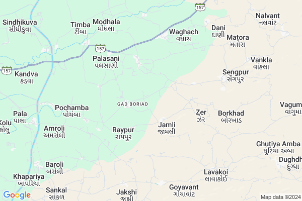
Khenda Map
EDIT Map
Add Your House
 ..
..
Current Corona Virus Infected Patients Count in Vadodara District
| City Name | District Name | Total Covid cases |
|---|---|---|
| Vadodara District | Vadodara | 222 |
| Vadodara | Vadodara | 9 |
Locality Name :
Khenda
( ખેંદ )
Taluka Name : Naswadi
District : Vadodara
State : Gujarat
Language : Gujarati and Hindi, Marathi, English
Current Time 11:33 AM
Date: Friday , Apr 25,2025 (IST)
Time zone: IST (UTC+5:30)
Elevation / Altitude: 90 meters. Above Seal level
Telephone Code / Std Code: 02661
Assembly constituency : Sankheda assembly constituency
Assembly MLA : Abhesinh Motibhai Tadvi
Lok Sabha constituency : Chhota Udaipur parliamentary constituency
Parliament MP : RATHVA GITABEN VAJESINGBHAI
Serpanch Name :
Pin Code : 391150
Post Office Name : Naswadi
Main Village Name : Khenda
Commodities Prices : Bodeli(Modasar) Market / Mandi
Khenda Live Weather
Temperature: 37.5 °C
clear sky
Humidity: 19%
Wind : 4.08 mt/sec towards W
StationName : "KawÄ\u0081nt"
observed on 8 Mins Back
Temperature: 37.5 °C
clear sky
Humidity: 19%
Wind : 4.08 mt/sec towards W
StationName : "KawÄ\u0081nt"
observed on 8 Mins Back
Khenda Weather Forecast for Next 5 days
26-04-2025
28.6°C to 41.3°C
clear sky, scattered clouds, few clouds
28.6°C to 41.3°C
clear sky, scattered clouds, few clouds
27-04-2025
27.3°C to 41.3°C
clear sky, scattered clouds, few clouds
27.3°C to 41.3°C
clear sky, scattered clouds, few clouds
28-04-2025
26.3°C to 42.1°C
clear sky
26.3°C to 42.1°C
clear sky
29-04-2025
27.1°C to 42.9°C
clear sky
27.1°C to 42.9°C
clear sky
30-04-2025
27.4°C to 43.2°C
clear sky
27.4°C to 43.2°C
clear sky
National Highways Reachable To Khenda
Nationa High Way :NH965
Nationa High Way :NH61
Nationa High Way :NH965
Nationa High Way :NH61
Rivers Near Khenda
Mangla
Sukar
Mangla
Sukar
About Khenda
Correct below Info and add more info about KhendaKhenda is a small Village/hamlet in Naswadi Taluka in Vadodara District of Gujarat State, India. It comes under Khenda Panchayath. It is located 89 KM towards East from District head quarters Vadodara. 212 KM from State capital Gandhinagar
Khenda Pin code is 391150 and postal head office is Naswadi .
Khenda is surrounded by Kawant Taluka towards East , Tilakwada Taluka towards west , Jetpur Pavi Taluka towards North , Sankheda Taluka towards west .
Rajpipla , Karjan , Vadodara , Padra are the near by Cities to Khenda.
This Place is in the border of the Vadodara District and Narmada District. Narmada District Tilakwada is west towards this place .
Khenda 2011 Census Details
Khenda Local Language is Gujarati. Khenda Village Total population is 450 and number of houses are 64. Female Population is 49.6%. Village literacy rate is 34.7% and the Female Literacy rate is 16.0%.
Population
| Census Parameter | Census Data |
| Total Population | 450 |
| Total No of Houses | 64 |
| Female Population % | 49.6 % ( 223) |
| Total Literacy rate % | 34.7 % ( 156) |
| Female Literacy rate | 16.0 % ( 72) |
| Scheduled Tribes Population % | 99.8 % ( 449) |
| Scheduled Caste Population % | 0.0 % ( 0) |
| Working Population % | 53.6 % |
| Child(0 -6) Population by 2011 | 102 |
| Girl Child(0 -6) Population % by 2011 | 47.1 % ( 48) |
Khenda Census More Deatils.
Politics in Khenda
Bharatiya Janata Party , BJP , INC are the major political parties in this area.Polling Stations /Booths near Khenda
1)Jamba2)Bortlav
3)Kandevar
4)Jeetangar
5)Navapura
HOW TO REACH Khenda
By Rail
Sandhia Rail Way Station , Tankhala Rail Way Station are the very nearby railway stations to Khenda.Colleges near Khenda
Govt.arts & Com.college & Govt.b.ed.college
Address :
Schools in Khenda
Khenda Primary School
Address : khenda , naswadi , vadodara , Gujarat . PIN- 391150 , Post - Naswadi
Govt Health Centers near Khenda
1) Garudeswar , , Near Bus Stand , Near Bus Stand2) Tilakwada , Tilakwada , Bavdi Faliya , Bavdi Faliya
3) Bujetha , Bujetha , Main Road ,
Petrol Bunks in Khenda,Naswadi
Gurukirpa Bharat Petroleum
Chhota Udaipur; NH-953; Chhataydapur Road; Naswadi; Nasvadi; Gujarat 391170; India
15.1 KM distance Detail
more ..
Colleges in Khenda,Naswadi
Shri Chunilal Himattbhai Bhil Sarkari Arts & commerce College
Valpura; Gujarat 391150; India
14.1 KM distance Detail
more ..
About Khenda &
History
How to reach Khenda
Tourist Places Near By Khenda
Schools in Khenda
Colleges in Khenda
Temperature & weather of Khenda
places in Khenda
Khenda photos
More Information
How to reach Khenda
Tourist Places Near By Khenda
Schools in Khenda
Colleges in Khenda
Temperature & weather of Khenda
places in Khenda
Khenda photos
More Information
Village Talk
Post News or Events about this Village
Near Cities
Rajpipla 43 KM near
Karjan 82 KM near
Vadodara 88 KM near
Padra 90 KM near
Rajpipla 43 KM near
Karjan 82 KM near
Vadodara 88 KM near
Padra 90 KM near
Near By Taluks
Naswadi 0 KM near
Kawant 24 KM near
Tilakwada 25 KM near
Sankheda 33 KM near
Naswadi 0 KM near
Kawant 24 KM near
Tilakwada 25 KM near
Sankheda 33 KM near
Near By Air Ports
Vadodara Airport 81 KM near
Ahmedabad Airport 190 KM near
Bhavnagar Airport 194 KM near
Indore Airport 242 KM near
Vadodara Airport 81 KM near
Ahmedabad Airport 190 KM near
Bhavnagar Airport 194 KM near
Indore Airport 242 KM near
Near By Tourist Places
Kevadia Narmada 25 KM near
Champaner 66 KM near
Pavagadh 67 KM near
Toranmal 74 KM near
Baroda 83 KM near
Kevadia Narmada 25 KM near
Champaner 66 KM near
Pavagadh 67 KM near
Toranmal 74 KM near
Baroda 83 KM near
Near By Districts
Narmada 43 KM near
Alirajpur 68 KM near
Vadodara 84 KM near
Nandurbar 94 KM near
Narmada 43 KM near
Alirajpur 68 KM near
Vadodara 84 KM near
Nandurbar 94 KM near
Near By RailWay Station
Sandhia Rail Way Station 9.0 KM near
Miyagam Karjan Rail Way Station 83 KM near
Vadodara Junction Rail Way Station 83 KM near
Sandhia Rail Way Station 9.0 KM near
Miyagam Karjan Rail Way Station 83 KM near
Vadodara Junction Rail Way Station 83 KM near