| Home | City Bus | Maps | Villages | Cities | Rail | Tourist Places | School | College | Pin Codes | Corona Cases Count |
| Distance Calculator Bus Services IFSC Codes Trace Mobile Number Weather Search Place Trace IP Available Cash ATM/Banks Locate Polling Booth Report an Error contact People |
Doolalli
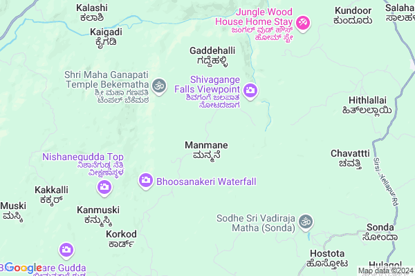
Doolalli Map
EDIT Map
Add Your House
 ..
..
Current Corona Virus Infected Patients Count in Uttar Kannad District
| City Name | District Name | Total Covid cases |
|---|---|---|
| Bhatkal | Uttara Kannada | 7 |
| Uttara Kannada District | Uttara Kannada | 4 |
Locality Name :
Doolalli
( ದೂಳಲ್ಲಿ )
Taluk Name : Sirsi
District : Uttar Kannad
State : Karnataka
Division : Belgaum
Language : Kannada and Konkani, Marathi
Current Time 07:00 PM
Date: Tuesday , Apr 29,2025 (IST)
Time zone: IST (UTC+5:30)
Elevation / Altitude: 576 meters. Above Seal level
Telephone Code / Std Code: 08384
Assembly constituency : Sirsi assembly constituency
Assembly MLA : Bhimanna T. Naik
Lok Sabha constituency : Uttara Kannada parliamentary constituency
Parliament MP : ANANTKUMAR HEGDE
Serpanch Name :
Pin Code : 581336
Post Office Name : Hulekal
Main Village Name : Kodnagadde
Commodities Prices : Yellapur Market / Mandi
Doolalli Live Weather
Temperature: 34.1 °C
scattered clouds
Humidity: 43%
Wind : 4.48 mt/sec towards SW
StationName : "YellÄ\u0081pur"
observed on 2 Hours Back
Temperature: 34.1 °C
scattered clouds
Humidity: 43%
Wind : 4.48 mt/sec towards SW
StationName : "YellÄ\u0081pur"
observed on 2 Hours Back
Doolalli Weather Forecast for Next 5 days
30-04-2025
22.5°C to 30.8°C
scattered clouds
22.5°C to 30.8°C
scattered clouds
01-05-2025
22.2°C to 39.6°C
scattered clouds, broken clouds, clear sky, few clouds, overcast clouds
22.2°C to 39.6°C
scattered clouds, broken clouds, clear sky, few clouds, overcast clouds
02-05-2025
22.3°C to 39.9°C
broken clouds, clear sky, few clouds, overcast clouds
22.3°C to 39.9°C
broken clouds, clear sky, few clouds, overcast clouds
03-05-2025
22.6°C to 39.2°C
broken clouds, few clouds, clear sky, scattered clouds
22.6°C to 39.2°C
broken clouds, few clouds, clear sky, scattered clouds
04-05-2025
22.8°C to 38.6°C
broken clouds, few clouds, clear sky
22.8°C to 38.6°C
broken clouds, few clouds, clear sky
National Highways Reachable To Doolalli
Nationa High Way :NH766E
Nationa High Way :NH66
Nationa High Way :NH766E
Nationa High Way :NH66
Rivers Near Doolalli
Varada :ವರದಾ
Goli Hole :ಗೋಳಿ ಹೊಳೆ
Varada :ವರದಾ
Goli Hole :ಗೋಳಿ ಹೊಳೆ
About Doolalli
Correct below Info and add more info about DoolalliDoolalli is a small Village/hamlet in Sirsi Taluk in Uttar Kannad District of Karnataka State, India. It comes under Kodnagadde Panchayath. It belongs to Belgaum Division . It is located 74 KM towards East from District head quarters Karwar. 23 KM from Sirsi. 431 KM from State capital Bangalore
Doolalli Pin code is 581336 and postal head office is Hulekal .
Doolalli is surrounded by Yellapur Taluk towards North , Mundgod Taluk towards East , Ankola Taluk towards west , Siddapur Taluk towards South .
Sirsi , Shiggaon , Karwar , Savanur are the near by Cities to Doolalli.
Demographics of Doolalli
Kannada is the Local Language here.Politics in Doolalli
Bharatiya Janata Party , BJP , Bharatiya Janata Party (BJP) , INC are the major political parties in this area.Polling Stations /Booths near Doolalli
1)Govt.urdu Model Higher Primary School Nehru Nagar Sirsi (south Wing)2)Govt Higher Primary School Isloor
3)Govt Lower Primary School Landakanalli
4)Govt Higher Primary School Agsal Bommanalli (west Wing)
5)Govt Higher Primary School Terakanalli
HOW TO REACH Doolalli
By Rail
There is no railway station near to Doolalli in less than 10 km. are the Rail way stations reachable from near by towns.By Road
Sirsi , Hangal , Sorab are the nearby by towns to Doolalli having road connectivity to DoolalliColleges near Doolalli
Gajanana Secondery School Vanalli
Address :
Schools near Doolalli
Govt Health Centers near Doolalli
1) G.Basavanakoppa , panchayathi Building , Near Anganwadi ,2) Tambur , panchayathi Building , bommigatti Road ,
3) Bammigatti , , ,
Colleges in Doolalli,Sirsi
Govt. Polytech College
Sirsi - Yellapur Rd; Hasanagi; Karnataka 581347; India
14.7 KM distance Detail
more ..
Schools in Doolalli,Sirsi
Narasimha Temple Bennegadde
bennegadde;bakkal; Sirsi; Karnataka 581336; India
10.7 KM distance Detail
Electronic Shops in Doolalli,Sirsi
Meghana Electricals
hegdekatta; Panchalinga Rd; Sirsi; Karnataka 581403; India
22.7 KM distance Detail
About Doolalli &
History
How to reach Doolalli
Tourist Places Near By Doolalli
Schools in Doolalli
Colleges in Doolalli
Temperature & weather of Doolalli
places in Doolalli
Doolalli photos
More Information
How to reach Doolalli
Tourist Places Near By Doolalli
Schools in Doolalli
Colleges in Doolalli
Temperature & weather of Doolalli
places in Doolalli
Doolalli photos
More Information
Village Talk
Post News or Events about this Village
Near Cities
Sirsi 23 KM near
Shiggaon 63 KM near
Karwar 71 KM near
Savanur 76 KM near
Sirsi 23 KM near
Shiggaon 63 KM near
Karwar 71 KM near
Savanur 76 KM near
Near By Taluks
Sirsi 22 KM near
Yellapur 23 KM near
Mundgod 35 KM near
Siddapur 50 KM near
Sirsi 22 KM near
Yellapur 23 KM near
Mundgod 35 KM near
Siddapur 50 KM near
Near By Air Ports
Hubli Airport 83 KM near
Dabolim Airport 130 KM near
Sambre Airport 134 KM near
Bajpe Airport 227 KM near
Hubli Airport 83 KM near
Dabolim Airport 130 KM near
Sambre Airport 134 KM near
Bajpe Airport 227 KM near
Near By Tourist Places
Uttara Kannada 22 KM near
Yana 30 KM near
Siddapur 57 KM near
Gokarna 57 KM near
Dandeli 65 KM near
Uttara Kannada 22 KM near
Yana 30 KM near
Siddapur 57 KM near
Gokarna 57 KM near
Dandeli 65 KM near
Near By Districts
Uttar Kannad 71 KM near
Haveri 81 KM near
Dharwad 89 KM near
South Goa 110 KM near
Uttar Kannad 71 KM near
Haveri 81 KM near
Dharwad 89 KM near
South Goa 110 KM near
Near By RailWay Station
Gokarna Road Rail Way Station 50 KM near
Ankola Rail Way Station 50 KM near
Gokarna Road Rail Way Station 50 KM near
Ankola Rail Way Station 50 KM near