| Home | City Bus | Maps | Villages | Cities | Rail | Tourist Places | School | College | Pin Codes | Corona Cases Count |
| Distance Calculator Bus Services IFSC Codes Trace Mobile Number Weather Search Place Trace IP Available Cash ATM/Banks Locate Polling Booth Report an Error contact People |
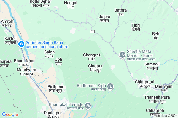
Ghangret
Ghangret Map
EDIT Map
Add Your House
 ..
..
Current Corona Virus Infected Patients Count in Una District
| City Name | District Name | Total Covid cases |
|---|---|---|
| Una District | Una | 15 |
Locality Name :
Ghangret
( घंगरेट )
Tehsil Name : Amb
District : Una
State : Himachal Pradesh
Language : Devanagiri and Punjabi, Paharihindi
Current Time 10:38 AM
Date: Friday , Apr 25,2025 (IST)
Time zone: IST (UTC+5:30)
Elevation / Altitude: 478 meters. Above Seal level
Telephone Code / Std Code: 01976
Assembly constituency : Chintpurni assembly constituency
Assembly MLA : Sudarshan Singh Babloo
Lok Sabha constituency : Hamirpur parliamentary constituency
Parliament MP : ANURAG SINGH THAKUR
Serpanch Name :
Pin Code : 177204
Post Office Name : Daulatpurchowk
Commodities Prices : Hamirpur(Nadaun) Market / Mandi
Ghangret Live Weather
Temperature: 35.0 °C
clear sky
Humidity: 12%
Wind : 1.17 mt/sec towards SE
StationName : "Daulatpur"
observed on 13 Mins Back
Temperature: 35.0 °C
clear sky
Humidity: 12%
Wind : 1.17 mt/sec towards SE
StationName : "Daulatpur"
observed on 13 Mins Back
Ghangret Weather Forecast for Next 5 days
26-04-2025
25.2°C to 36.5°C
clear sky, scattered clouds, overcast clouds, broken clouds
25.2°C to 36.5°C
clear sky, scattered clouds, overcast clouds, broken clouds
27-04-2025
24.0°C to 37.9°C
clear sky, few clouds
24.0°C to 37.9°C
clear sky, few clouds
28-04-2025
23.9°C to 38.2°C
clear sky
23.9°C to 38.2°C
clear sky
29-04-2025
24.3°C to 38.6°C
clear sky
24.3°C to 38.6°C
clear sky
30-04-2025
24.9°C to 38.7°C
clear sky
24.9°C to 38.7°C
clear sky
National Highways Reachable To Ghangret
Nationa High Way :NH503A
Nationa High Way :NH3
Nationa High Way :NH503A
Nationa High Way :NH3
Rivers Near Ghangret
Kanjali River
Beas
Kanjali River
Beas
About Ghangret
Correct below Info and add more info about GhangretGhangret is a Village in Amb Tehsil in Una District of Himachal Pradesh State, India. It is located 53 KM towards North from District head quarters Una. 23 KM from Amb. 157 KM from State capital Shimla
Ghangret Pin code is 177204 and postal head office is Daulatpurchowk .
Joh ( 4 KM ) , Badhmana ( 4 KM ) , Saloh ( 5 KM ) , Saloh Beri ( 5 KM ) , Nari(chintpurni) ( 5 KM ) are the nearby Villages to Ghangret. Ghangret is surrounded by Gagret Tehsil towards South , Talwara Tehsil towards west , Amb Tehsil towards South , Dehra Gopipur Tehsil towards East .
Hoshiarpur , Dasua , Talwara , Urmar Tanda are the near by Cities to Ghangret.
This Place is in the border of the Una District and Kangra District. Kangra District Pragpur is East towards this place .
Ghangret 2011 Census Details
Ghangret Local Language is Devanagiri. Ghangret Village Total population is 1178 and number of houses are 269. Female Population is 49.8%. Village literacy rate is 78.9% and the Female Literacy rate is 37.2%.
Population
| Census Parameter | Census Data |
| Total Population | 1178 |
| Total No of Houses | 269 |
| Female Population % | 49.8 % ( 587) |
| Total Literacy rate % | 78.9 % ( 929) |
| Female Literacy rate | 37.2 % ( 438) |
| Scheduled Tribes Population % | 0.0 % ( 0) |
| Scheduled Caste Population % | 48.6 % ( 572) |
| Working Population % | 29.6 % |
| Child(0 -6) Population by 2011 | 127 |
| Girl Child(0 -6) Population % by 2011 | 41.7 % ( 53) |
Ghangret Census More Deatils.
Politics in Ghangret
Bharatiya Janata Party , BJP , INC are the major political parties in this area.Polling Stations /Booths near Ghangret
1)G.m.s. Dharamshal Mahanta (harijan Basti)2)G.p.s. Tyar
3)G.h.s Bhaira
4)G.s.s.s. Ghangret
5)G.m.s. Chuwar
HOW TO REACH Ghangret
By Rail
There is no railway station near to Ghangret in less than 10 km.Colleges near Ghangret
Govt Degree College Bangana
Address :
S.v. S. D College Bhatoli
Address :
Dev Bhumy Group Of Institutes
Address :
Kc Group Of Institute Pandoga Una H.p
Address :
Ayurvedic Hospital In Mehatpur
Address : Una-nangal Highway, Opposite Police Station Mehatpur, Distt. Una, H.p. (india)
Schools in Ghangret
Gsss Ghangret
Address : ghangret , gagret-2 , una , Himachal Pradesh . PIN- 177110 , Post - Chintpurni
Govt Health Centers near Ghangret
1) Phahal SC , V.P.O. Phahal Tehsil Nadaun Distt. Hamirpur H.P. , Phahal ,2) Chauri PHC , VPO Chauri Tehsil Sujanpur Distt. Hamirpur H.P. , Chauri ,
3) Dhaned Seribaloni PHC , VPO Dhaned Tehsil &Distt. Hamirpur H.P. , Dhaned ,
Hospitals in Ghangret,Amb
Kharoh Hosiptal
Village Kharoh;Post Office Gindpur Malon;Teh. Amb; Una; Himachal Pradesh 177110; India
0.9 KM distance Detail
Dr.A.S Vartia (Ayurvedacharya)
Main Bazaar; Bhaderkali; Himachal Pradesh 177204; India
6.6 KM distance Detail
more ..
Petrol Bunks in Ghangret,Amb
B P C L Chalet
Gagret-Ghanari-Daulatpur Rd; Chalet; Himachal Pradesh 177206; India
9.0 KM distance Detail
HP Petrol Pump - Adhoc HANSRAJ HP CENTRE
Hpcl Petrol Pump Daulatpur Chowk Village: Daulatpur Tehsil: AMB; Himachal Pradesh 177208; India
9.0 KM distance Detail
more ..
Colleges in Ghangret,Amb
DDM College of Science & Technology
Gondpur Banehra (upper);; Himachal Pradesh 177213; India
8.5 KM distance Detail
Government College
Daulatpur Chowk; SH 25; Daulatpur; Himachal Pradesh 144206; India
8.6 KM distance Detail
Government College. Daulatpur Chowk
Daulatpur; Himachal Pradesh 144206; India
8.6 KM distance Detail
HOTEL KOHINOOR
VPO CHAIALI TEH; DEHRA DISST. KANGRA; Chalali; Himachal Pradesh 177103; India
11.2 KM distance Detail
more ..
Super Markets in Ghangret,Amb
Ram Kapatiya
177110; Jawal - Dhalwari Rd; Jawal; Himachal Pradesh 177109; India
7.2 KM distance Detail
Chintpurni Sweet House (Mr. Shiv Kumar)
Moien; Chintpurni; Himachal Pradesh 177109; India
7.5 KM distance Detail
JS Carpenter House
ward no. 04 village kailash nagar; p. o. nakroh; teh. ghanari ; distt; Himachal Pradesh 177213; India
9.2 KM distance Detail
Governement Offices near Ghangret,Amb
Panchayat Ghar Badhmana
Jalo Barh - Badhmana Rd; Badhmana; Himachal Pradesh 177110; India
5.7 KM distance Detail
The Dangoh Ad-dharmian Co-op Agri Service Society
Una; Himachal Pradesh; India
6.7 KM distance Detail
About Ghangret &
History
How to reach Ghangret
Tourist Places Near By Ghangret
Schools in Ghangret
Colleges in Ghangret
Temperature & weather of Ghangret
places in Ghangret
Ghangret photos
More Information
How to reach Ghangret
Tourist Places Near By Ghangret
Schools in Ghangret
Colleges in Ghangret
Temperature & weather of Ghangret
places in Ghangret
Ghangret photos
More Information
Village Talk
Post News or Events about this Village
Near Cities
Hoshiarpur 39 KM near
Dasua 40 KM near
Talwara 42 KM near
Urmar Tanda 46 KM near
Hoshiarpur 39 KM near
Dasua 40 KM near
Talwara 42 KM near
Urmar Tanda 46 KM near
Near By Taluks
Gagret 16 KM near
Pragpur 16 KM near
Talwara 19 KM near
Amb 22 KM near
Gagret 16 KM near
Pragpur 16 KM near
Talwara 19 KM near
Amb 22 KM near
Near By Air Ports
Gaggal Airport 63 KM near
Pathankot Airport 64 KM near
Bhuntar Airport 113 KM near
Ludhiana Airport 117 KM near
Gaggal Airport 63 KM near
Pathankot Airport 64 KM near
Bhuntar Airport 113 KM near
Ludhiana Airport 117 KM near
Near By Tourist Places
Jawalaji 30 KM near
Hoshiarpur 39 KM near
Una 51 KM near
Mcleodganj 59 KM near
Dharamsala 59 KM near
Jawalaji 30 KM near
Hoshiarpur 39 KM near
Una 51 KM near
Mcleodganj 59 KM near
Dharamsala 59 KM near
Near By Districts
Hoshiarpur 39 KM near
Una 51 KM near
Hamirpur 54 KM near
Kangra 55 KM near
Hoshiarpur 39 KM near
Una 51 KM near
Hamirpur 54 KM near
Kangra 55 KM near
Near By RailWay Station
Dasuya Rail Way Station 40 KM near
Tanda Urmar Rail Way Station 46 KM near
Dasuya Rail Way Station 40 KM near
Tanda Urmar Rail Way Station 46 KM near