| Home | City Bus | Maps | Villages | Cities | Rail | Tourist Places | School | College | Pin Codes | Corona Cases Count |
| Distance Calculator Bus Services IFSC Codes Trace Mobile Number Weather Search Place Trace IP Available Cash ATM/Banks Locate Polling Booth Report an Error contact People |
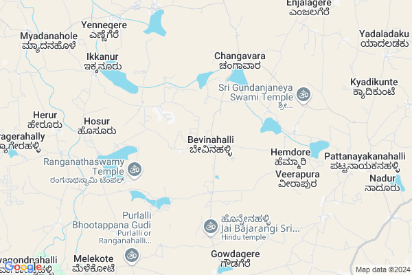
Brahamasandra Map
EDIT Map
Add Your House
 ..
..
Current Corona Virus Infected Patients Count in Tumkur District
| City Name | District Name | Total Covid cases |
|---|---|---|
| Tumakuru District | Tumakuru | 1 |
| Tumkur | Tumakuru | 1 |
| Jamalpur | Tumakuru | 1 |
Locality Name :
Brahamasandra
( ಬ್ರಾಹಮಸಂದ್ರ )
Taluk Name : Sira
District : Tumkur
State : Karnataka
Division : Bangalore
Language : Kannada
Current Time 10:24 AM
Date: Wednesday , Apr 30,2025 (IST)
Time zone: IST (UTC+5:30)
Elevation / Altitude: 802 meters. Above Seal level
Telephone Code / Std Code: 08135
Assembly constituency : Sira assembly constituency
Assembly MLA : T B Jayachandra
Lok Sabha constituency : Chitradurga parliamentary constituency
Parliament MP : A NARAYANASWAMY
Serpanch Name :
Pin Code : 572125
Post Office Name : Kallambella
Main Village Name : Bevinahalli
Alternate Village Name : Bramhasandra
Commodities Prices : Sira Market / Mandi
Brahamasandra Live Weather
Temperature: 30.0 °C
broken clouds
Humidity: 43%
Wind : 1.88 mt/sec towards SW
StationName : "Hiriyūr"
observed on 1 Hours Back
Temperature: 30.0 °C
broken clouds
Humidity: 43%
Wind : 1.88 mt/sec towards SW
StationName : "Hiriyūr"
observed on 1 Hours Back
Brahamasandra Weather Forecast for Next 5 days
01-05-2025
27.1°C to 37.7°C
broken clouds, scattered clouds, overcast clouds
27.1°C to 37.7°C
broken clouds, scattered clouds, overcast clouds
02-05-2025
26.4°C to 37.8°C
overcast clouds, broken clouds, light rain
26.4°C to 37.8°C
overcast clouds, broken clouds, light rain
03-05-2025
25.7°C to 37.9°C
broken clouds, overcast clouds, scattered clouds
25.7°C to 37.9°C
broken clouds, overcast clouds, scattered clouds
04-05-2025
24.8°C to 37.7°C
scattered clouds, few clouds, broken clouds, light rain
24.8°C to 37.7°C
scattered clouds, few clouds, broken clouds, light rain
05-05-2025
24.5°C to 37.4°C
light rain, clear sky, scattered clouds, few clouds
24.5°C to 37.4°C
light rain, clear sky, scattered clouds, few clouds
National Highways Reachable To Brahamasandra
Nationa High Way :NH275
Nationa High Way :NH50
Nationa High Way :NH275
Nationa High Way :NH50
Rivers Near Brahamasandra
Shimsha :ಶಿಂಶಾ
Jayamangali :ಜಯಮಂಗಲಿ
Shimsha :ಶಿಂಶಾ
Jayamangali :ಜಯಮಂಗಲಿ
About Brahamasandra
Correct below Info and add more info about BrahamasandraBrahamasandra is a small Village/hamlet in Sira Taluk in Tumkur District of Karnataka State, India. It comes under Bevinahalli Panchayath. It belongs to Bangalore Division . It is located 80 KM towards North from District head quarters Tumakuru. 25 KM from Sira. 153 KM from State capital Bangalore
Brahamasandra Pin code is 572125 and postal head office is Kallambella .
Brahamasandra is surrounded by Hiriyur Taluk towards west , Agali Taluk towards East , Amarapuram Taluk towards North , Rolla Taluk towards East .
Sira , Madhugiri , Pavagada , Chitradurga are the near by Cities to Brahamasandra.
This Place is in the border of the Tumkur District and Anantapur District. Anantapur District Agali is East towards this place . It is near to the Andhra Pradesh State Border.
Demographics of Brahamasandra
Kannada is the Local Language here.Politics in Brahamasandra
JD(U) , Bharatiya Janata Party , JD(S) , BJP , Janata Dal (Secular) (JD(S)) , INC are the major political parties in this area.Polling Stations /Booths near Brahamasandra
1)Government Higher Primary School Bejjihalli2)Govt. Urdu Lps Mehaboob Nagara
3)Government Lower Primary School Siddanahalli
4)Government Lower Primary School Bidarekere
5)Government Lower Primary School Devarahalli
HOW TO REACH Brahamasandra
By Rail
There is no railway station near to Brahamasandra in less than 10 km. Tumakuru Rail Way Station (near to Tumkur) , Heggere Halt Rail Way Station (near to Tumkur) are the Rail way stations reachable from near by towns.By Road
Sira , Tumkur are the nearby by towns to Brahamasandra having road connectivity to BrahamasandraColleges near Brahamasandra
ಶ್ರೀ ಬೊಮ್ಮಲಿಂಗೇಶ್ವರ ಸಂಯುಕ್ತ ಪದವಿ ಪೂರ್ವ ಕಾಲೇಜು.
Address : Sidlekona, Gopaladevarahalli Post; Sira Taluk Tumkur District. 572125
R. Maddarangegowda College Of Education
Address : R. Maddarangegowda Collegeof Education,gokula Bada
Schools in Brahamasandra
G.u.p.s. Bramhasandra
Address : bramhasandra , sira , madhugiri , Karnataka . PIN- 572125 , Post - Kallambella
Govt Health Centers near Brahamasandra
1) V.V.PURA (24X7) , PHC V.V.Pura , Hosadarga Road , Beside Grama panchayath office2) Chandragiri , Chandragiri , Chandragiri DODDERI , Chandragiri DODDERI
3) Neralekere , PRIMARY HEALTH CENTRE, Neralekere , Neralekere , Neralekere, MADHUGIRI
Hospitals in Brahamasandra,Sira
Governament Health Hospital J.G.Halli
Pune - Bengaluru Hwy; Karnataka 577511; India
14.5 KM distance Detail
Primary Healthcare Center; Ranganathapura
Ranganathapura; Karnataka 577511; India
17.9 KM distance Detail
more ..
Petrol Bunks in Brahamasandra,Sira
Sri Lakshmi Ranganatha Kissan Seva Kendra(K.S.K).Bevinahalli(P);Sira Taluq..
Bevinahalli Road; Bevinahalli; Karnataka 572135; India
0.6 KM distance Detail
Bhagawan Sri Kalleshwara Swamy Filling Station
Pattanayakanahalli; Karnataka 572135; India
10.2 KM distance Detail
more ..
Colleges in Brahamasandra,Sira
Government First Grade College Javanagondanahalli
Chitradurga; Karnataka 577511; India
13.7 KM distance Detail
Govt First Grede College Javanagondanahally
Chitradurga; Karnataka 577511; India
13.8 KM distance Detail
Government First Grand College javanagondanahalli
Chitradurga; Karnataka 577511; India
13.9 KM distance Detail
more ..
Schools in Brahamasandra,Sira
Govt Primary School
150; Bevinahalli Road; Siddapura; Bevinahalli Road; Siddapura; Karnataka 572135; India
0.5 KM distance Detail
Super Markets in Brahamasandra,Sira
SS Super Market
No. 3; AM Palya Road; Near Sira Gate; Kanaka Nagara; Tumakuru; Karnataka 572106; India
20.8 KM distance Detail
New Bustand Road Sira
New Bus Stand Rd; Banninagar; Sira; Karnataka 572137; India
21.0 KM distance Detail
Police Stations near Brahamasandra,Sira
Pattanayakanahalli police station
Pattanayakanahalli; Karnataka 572135; India
10.3 KM distance Detail
Governement Offices near Brahamasandra,Sira
karnataka coir industries limited branch
Hiriyur; Ranganathapura; Karnataka; India
18.2 KM distance Detail
Assistant Engineer Office
Sira; Tumkur; NH-234; Villupuram Mangalore Road; Tumkur; Tumkur; Karnataka 572137; India
20.8 KM distance Detail
About Brahamasandra &
History
How to reach Brahamasandra
Tourist Places Near By Brahamasandra
Schools in Brahamasandra
Colleges in Brahamasandra
Temperature & weather of Brahamasandra
places in Brahamasandra
Brahamasandra photos
More Information
How to reach Brahamasandra
Tourist Places Near By Brahamasandra
Schools in Brahamasandra
Colleges in Brahamasandra
Temperature & weather of Brahamasandra
places in Brahamasandra
Brahamasandra photos
More Information
Village Talk
Post News or Events about this Village
Near Cities
Sira 19 KM near
Madhugiri 54 KM near
Pavagada 61 KM near
Chitradurga 66 KM near
Sira 19 KM near
Madhugiri 54 KM near
Pavagada 61 KM near
Chitradurga 66 KM near
Near By Taluks
Sira 24 KM near
Hiriyur 25 KM near
Agali 26 KM near
Amarapuram 27 KM near
Sira 24 KM near
Hiriyur 25 KM near
Agali 26 KM near
Amarapuram 27 KM near
Near By Air Ports
Bengaluru International Airport 136 KM near
Mysore Airport 200 KM near
Bajpe Airport 263 KM near
Hubli Airport 278 KM near
Bengaluru International Airport 136 KM near
Mysore Airport 200 KM near
Bajpe Airport 263 KM near
Hubli Airport 278 KM near
Near By Tourist Places
Chitradurga 66 KM near
Lepakshi 93 KM near
Shivagange 101 KM near
Puttaparthi 119 KM near
Nandi Hills 120 KM near
Chitradurga 66 KM near
Lepakshi 93 KM near
Shivagange 101 KM near
Puttaparthi 119 KM near
Nandi Hills 120 KM near
Near By Districts
Chitradurga 66 KM near
Tumkur 76 KM near
Chikballapur 122 KM near
Davangere 132 KM near
Chitradurga 66 KM near
Tumkur 76 KM near
Chikballapur 122 KM near
Davangere 132 KM near
Near By RailWay Station
Tumakuru Rail Way Station 77 KM near
Hindupur Rail Way Station 80 KM near
Tumakuru Rail Way Station 77 KM near
Hindupur Rail Way Station 80 KM near