| Home | City Bus | Maps | Villages | Cities | Rail | Tourist Places | School | College | Pin Codes | Corona Cases Count |
| Distance Calculator Bus Services IFSC Codes Trace Mobile Number Weather Search Place Trace IP Available Cash ATM/Banks Locate Polling Booth Report an Error contact People |
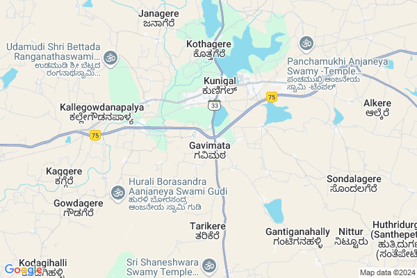
Herur Map
EDIT Map
Add Your House
 ..
..
Current Corona Virus Infected Patients Count in Tumkur District
| City Name | District Name | Total Covid cases |
|---|---|---|
| Jamalpur | Tumakuru | 1 |
| Tumakuru District | Tumakuru | 1 |
| Tumkur | Tumakuru | 1 |
Locality Name :
Herur
( ಹೆರೂರ್ )
Taluk Name : Kunigal
District : Tumkur
State : Karnataka
Division : Bangalore
Language : Kannada
Current Time 12:51 PM
Date: Thursday , Apr 24,2025 (IST)
Time zone: IST (UTC+5:30)
Elevation / Altitude: 780 meters. Above Seal level
Telephone Code / Std Code: 08132
Assembly constituency : Kunigal assembly constituency
Assembly MLA : Dr|| H D Ranganath
Lok Sabha constituency : Bangalore Rural parliamentary constituency
Parliament MP : D.K. SURESH
Serpanch Name :
Pin Code : 572130
Post Office Name : Kunigal
Commodities Prices : Nagamangala Market / Mandi
Herur Live Weather
Temperature: 32.3 °C
scattered clouds
Humidity: 33%
Wind : 0.54 mt/sec towards NW
StationName : "Kunigal"
observed on 2 Hours Back
Temperature: 32.3 °C
scattered clouds
Humidity: 33%
Wind : 0.54 mt/sec towards NW
StationName : "Kunigal"
observed on 2 Hours Back
Herur Weather Forecast for Next 5 days
25-04-2025
24.6°C to 37.6°C
scattered clouds, clear sky
24.6°C to 37.6°C
scattered clouds, clear sky
26-04-2025
23.5°C to 37.1°C
clear sky, few clouds, scattered clouds, overcast clouds, light rain
23.5°C to 37.1°C
clear sky, few clouds, scattered clouds, overcast clouds, light rain
27-04-2025
25.4°C to 35.5°C
broken clouds, overcast clouds, light rain
25.4°C to 35.5°C
broken clouds, overcast clouds, light rain
28-04-2025
24.4°C to 35.8°C
broken clouds, scattered clouds, overcast clouds, light rain
24.4°C to 35.8°C
broken clouds, scattered clouds, overcast clouds, light rain
29-04-2025
23.9°C to 34.7°C
overcast clouds, broken clouds, light rain
23.9°C to 34.7°C
overcast clouds, broken clouds, light rain
Edit below overview about Herur
Edit below overview about Herur
OverView of Herur
Herur has 2 temples which are very old, one is sri Lakshminarayana temple and Lord Eshwara temple , National Highway connecting Bangalore and Mangalore passes thru Herur and shortly we are expecting railway connection also the work is under progress.Edit below overview about Herur
National Highways Reachable To Herur
Nationa High Way :NH44
Nationa High Way :NH42
Nationa High Way :NH44
Nationa High Way :NH42
Rivers Near Herur
Chikkahole :ಚಿಕ್ಕಹೊಳೆ
Chikkahole :ಚಿಕ್ಕಹೊಳೆ
About Herur
Herur is a Village in Kunigal Taluk in Tumkur District of Karnataka State, India. It belongs to Bangalore Division . It is located 44 KM towards South from District head quarters Tumakuru. 4 KM from Kunigal. 72 KM from State capital Bangalore
Herur Pin code is 572130 and postal head office is Kunigal .
Kunigal ( 4 KM ) , Bilidevalaya ( 4 KM ) , Kithanamangala ( 5 KM ) , Kothagere ( 5 KM ) , Madikehalli ( 6 KM ) are the nearby Villages to Herur. Herur is surrounded by Magadi Taluk towards East , Tumkur Taluk towards North , Nagamangala Taluk towards west , Turuvekere Taluk towards west .
Magadi , Ramanagaram , Tumkur , Maddur are the near by Cities to Herur.
Herur 2011 Census Details
Herur Local Language is Kannada. Herur Village Total population is 1519 and number of houses are 384. Female Population is 48.8%. Village literacy rate is 59.0% and the Female Literacy rate is 25.9%.
Population
| Census Parameter | Census Data |
| Total Population | 1519 |
| Total No of Houses | 384 |
| Female Population % | 48.8 % ( 741) |
| Total Literacy rate % | 59.0 % ( 896) |
| Female Literacy rate | 25.9 % ( 393) |
| Scheduled Tribes Population % | 0.0 % ( 0) |
| Scheduled Caste Population % | 17.4 % ( 264) |
| Working Population % | 46.1 % |
| Child(0 -6) Population by 2011 | 149 |
| Girl Child(0 -6) Population % by 2011 | 47.0 % ( 70) |
Herur Census More Deatils.
Politics in Herur
Indian National Congress , JD(S) , BJP , Indian National Congress (INC) , INC are the major political parties in this area.Polling Stations /Booths near Herur
1)Government Lower Primary School Kodipalya2)Government Higher Primary School Herohalli
3)Government Lower Primary School Gantagana Halli
4)Government Higher Primary School Shettibeedu
5)Government Higher Primary School Gowdagere
HOW TO REACH Herur
By Rail
There is no railway station near to Herur in less than 10 km. Maddur Rail Way Station (near to Maddur) , Settihalli Rail Way Station (near to Channapatna) , Channapatna Rail Way Station (near to Channapatna) , Nidaghatta Rail Way Station (near to Maddur) are the Rail way stations reachable from near by towns.By Road
Kunigal , Magadi , Nagamangala , Channapatna , Maddur are the nearby by towns to Herur having road connectivity to HerurColleges near Herur
Chanukya Academy Of Management
Address : B.m. Road, Kunigal, Tumkur.
Govt. First Grade Arts, Science And Commerce College
Address : Science And Commerce College, Kunigal, Tumkur
Sri. Siddartha Institute Of Management Studies
Address : Sri. Siddartha Institute Of Management Studies (mb
Supha Institute Of Management Studies
Address : Supha Institute Of Management Studies, Gulur, Kuni
Schools in Herur
Ghps Herur
Address : herur , kunigal , tumkur , Karnataka . PIN- 572130 , Post - Kunigal
Govt Health Centers near Herur
1) KAMBALAPALYA , , Sirivara Road , Kambala Palya2) AJJANAHALLI , Ajjanahalli PHC , ,
3) MALLASANDRA(R-1) , , ,
Sub Villages in Herur
Hospitals in Herur,Kunigal
Government. Hospital
Mangalore - Bangalore Hwy; Kunigal; Karnataka 572130; India
3.2 KM distance Detail
more ..
Petrol Bunks in Herur,Kunigal
KSN FUEL STATION INDIAN OIL OUTLET
opposite railway station Rd; Kunigal; Kunigal; Karnataka 572130; India
2.8 KM distance Detail
HP PETROL PUMP - PRABHA PETROL STATION
Dealers H P C L BUS Stand Kunigal; Gangadahalli; Karnataka 572130; India
3.4 KM distance Detail
more ..
Colleges in Herur,Kunigal
Government Junior College
Bangalore - Mangalore Hwy; Kunigal; Karnataka 572130; India
2.9 KM distance Detail
more ..
Schools in Herur,Kunigal
Morarji Desai Residential School For Minorities
Morarji Desai Residential School; Maddur Road; -572130; Kunigal; Karnataka 572130; India
2.5 KM distance Detail
Super Markets in Herur,Kunigal
Vinayaka Enterprises
Kunigal Town Rd; Gottikere; Anchepalya; Karnataka 572130; India
3.7 KM distance Detail
Governement Offices near Herur,Kunigal
DHFL Housing Finance
Maddur Railway Station Rd; K.Kodihalli; Karnataka 571429; India
2.5 KM distance Detail
About Herur &
History
How to reach Herur
Tourist Places Near By Herur
Schools in Herur
Colleges in Herur
Temperature & weather of Herur
places in Herur
Herur photos
More Information
How to reach Herur
Tourist Places Near By Herur
Schools in Herur
Colleges in Herur
Temperature & weather of Herur
places in Herur
Herur photos
More Information
Village Talk
Post News or Events about this Village
Near Cities
Magadi 25 KM near
Ramanagaram 46 KM near
Tumkur 47 KM near
Maddur 51 KM near
Magadi 25 KM near
Ramanagaram 46 KM near
Tumkur 47 KM near
Maddur 51 KM near
Near By Taluks
Kunigal 3 KM near
Magadi 22 KM near
Nagamangala 40 KM near
Turuvekere 40 KM near
Kunigal 3 KM near
Magadi 22 KM near
Nagamangala 40 KM near
Turuvekere 40 KM near
Near By Air Ports
Bengaluru International Airport 86 KM near
Mysore Airport 98 KM near
Salem Airport 218 KM near
Peelamedu Airport 245 KM near
Bengaluru International Airport 86 KM near
Mysore Airport 98 KM near
Salem Airport 218 KM near
Peelamedu Airport 245 KM near
Near By Tourist Places
Shivagange 33 KM near
Savandurga 36 KM near
Sravanabelagola 67 KM near
Bangalore 69 KM near
Srirangapatna 83 KM near
Shivagange 33 KM near
Savandurga 36 KM near
Sravanabelagola 67 KM near
Bangalore 69 KM near
Srirangapatna 83 KM near
Near By Districts
Tumkur 43 KM near
Ramanagara 46 KM near
Mandya 60 KM near
Bangalore 71 KM near
Tumkur 43 KM near
Ramanagara 46 KM near
Mandya 60 KM near
Bangalore 71 KM near
Near By RailWay Station
Tumakuru Rail Way Station 42 KM near
Ramanagaram Rail Way Station 47 KM near
Tumakuru Rail Way Station 42 KM near
Ramanagaram Rail Way Station 47 KM near