| Home | City Bus | Maps | Villages | Cities | Rail | Tourist Places | School | College | Pin Codes | Corona Cases Count |
| Distance Calculator Bus Services IFSC Codes Trace Mobile Number Weather Search Place Trace IP Available Cash ATM/Banks Locate Polling Booth Report an Error contact People |
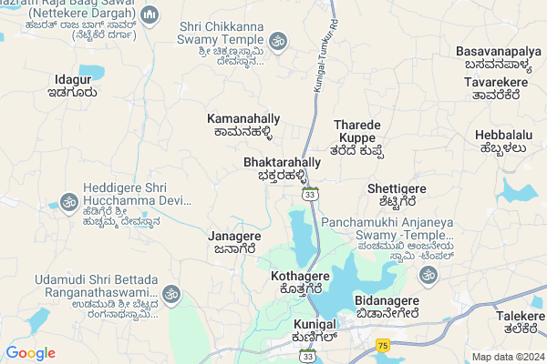
Baktharahalli Map
EDIT Map
Add Your House
 ..
..
Current Corona Virus Infected Patients Count in Tumkur District
| City Name | District Name | Total Covid cases |
|---|---|---|
| Jamalpur | Tumakuru | 1 |
| Tumakuru District | Tumakuru | 1 |
| Tumkur | Tumakuru | 1 |
Locality Name :
Baktharahalli
( ಭಕ್ತರಹಳ್ಳಿ )
Taluk Name : Kunigal
District : Tumkur
State : Karnataka
Division : Bangalore
Language : Kannada
Current Time 12:30 PM
Date: Thursday , Apr 24,2025 (IST)
Time zone: IST (UTC+5:30)
Elevation / Altitude: 780 meters. Above Seal level
Telephone Code / Std Code: 08132
Assembly constituency : Kunigal assembly constituency
Assembly MLA : Dr|| H D Ranganath
Lok Sabha constituency : Bangalore Rural parliamentary constituency
Parliament MP : D.K. SURESH
Serpanch Name :
Commodities Prices : Gubbi Market / Mandi
Baktharahalli Live Weather
Temperature: 32.4 °C
scattered clouds
Humidity: 33%
Wind : 0.58 mt/sec towards NW
StationName : "Kunigal"
observed on 1 Hours Back
Temperature: 32.4 °C
scattered clouds
Humidity: 33%
Wind : 0.58 mt/sec towards NW
StationName : "Kunigal"
observed on 1 Hours Back
Baktharahalli Weather Forecast for Next 5 days
25-04-2025
24.4°C to 37.3°C
scattered clouds, broken clouds, clear sky
24.4°C to 37.3°C
scattered clouds, broken clouds, clear sky
26-04-2025
23.4°C to 36.8°C
few clouds, clear sky, scattered clouds, overcast clouds, light rain
23.4°C to 36.8°C
few clouds, clear sky, scattered clouds, overcast clouds, light rain
27-04-2025
25.6°C to 35.1°C
broken clouds, overcast clouds, light rain
25.6°C to 35.1°C
broken clouds, overcast clouds, light rain
28-04-2025
24.5°C to 35.2°C
broken clouds, scattered clouds, overcast clouds, light rain
24.5°C to 35.2°C
broken clouds, scattered clouds, overcast clouds, light rain
29-04-2025
23.6°C to 34.6°C
overcast clouds, broken clouds, light rain, moderate rain
23.6°C to 34.6°C
overcast clouds, broken clouds, light rain, moderate rain
National Highways Reachable To Baktharahalli
Nationa High Way :NH44
Nationa High Way :NH42
Nationa High Way :NH44
Nationa High Way :NH42
Rivers Near Baktharahalli
Chikkahole :ಚಿಕ್ಕಹೊಳೆ
Chikkahole :ಚಿಕ್ಕಹೊಳೆ
About Baktharahalli
Correct below Info and add more info about BaktharahalliBaktharahalli is a Village in Kunigal Taluk in Tumkur District of Karnataka State, India. It belongs to Bangalore Division . It is located 35 KM towards South from District head quarters Tumakuru. 14 KM from Kunigal. 75 KM from State capital Bangalore
Baagenahalli ( 5 KM ) , Madikehalli ( 5 KM ) , Bilidevalaya ( 8 KM ) , Kunigal ( 8 KM ) , Chengavi ( 8 KM ) are the nearby Villages to Baktharahalli. Baktharahalli is surrounded by Magadi Taluk towards East , Tumkur Taluk towards North , Turuvekere Taluk towards west , Gubbi Taluk towards North .
Magadi , Tumkur , Ramanagaram , Nelamangala are the near by Cities to Baktharahalli.
Baktharahalli 2011 Census Details
Baktharahalli Local Language is Kannada. Baktharahalli Village Total population is 631 and number of houses are 157. Female Population is 51.8%. Village literacy rate is 65.0% and the Female Literacy rate is 30.4%.
Population
| Census Parameter | Census Data |
| Total Population | 631 |
| Total No of Houses | 157 |
| Female Population % | 51.8 % ( 327) |
| Total Literacy rate % | 65.0 % ( 410) |
| Female Literacy rate | 30.4 % ( 192) |
| Scheduled Tribes Population % | 1.0 % ( 6) |
| Scheduled Caste Population % | 14.6 % ( 92) |
| Working Population % | 63.2 % |
| Child(0 -6) Population by 2011 | 61 |
| Girl Child(0 -6) Population % by 2011 | 47.5 % ( 29) |
Baktharahalli Census More Deatils.
Politics in Baktharahalli
Indian National Congress , JD(S) , BJP , Indian National Congress (INC) , INC are the major political parties in this area.Polling Stations /Booths near Baktharahalli
1)Government Higher Primary School. Huthridurga2)Government Model Higher Primary School Kothagere
3)Government Higher Primary School Sulekuppe Kaval
4)Government Higher Primary School Bomenahalli
5)Government Lower Primary School Musalmanara Palya
HOW TO REACH Baktharahalli
By Rail
There is no railway station near to Baktharahalli in less than 10 km. Maddur Rail Way Station (near to Maddur) , Settihalli Rail Way Station (near to Channapatna) , Channapatna Rail Way Station (near to Channapatna) , Nidaghatta Rail Way Station (near to Maddur) are the Rail way stations reachable from near by towns.By Road
Kunigal , Magadi , Nagamangala , Channapatna , Maddur are the nearby by towns to Baktharahalli having road connectivity to BaktharahalliPincodes near Baktharahalli
572120 ( Hebbur ) , 572130 ( Kunigal ) , 572213 ( Chandrashekarapura )Colleges near Baktharahalli
Chanukya Academy Of Management
Address : B.m. Road, Kunigal, Tumkur.
Govt. First Grade Arts, Science And Commerce College
Address : Science And Commerce College, Kunigal, Tumkur
Sri. Siddartha Institute Of Management Studies
Address : Sri. Siddartha Institute Of Management Studies (mb
Supha Institute Of Management Studies
Address : Supha Institute Of Management Studies, Gulur, Kuni
Schools near Baktharahalli
Murarji Resi School Malnayknalli
Address : yediyur , kunigal , tumkur , Karnataka . PIN- 572130 , Post - Kunigal
Murajidesai Resi Schl Ankanalli Mat
Address : ankanahalli matt , kunigal , tumkur , Karnataka . PIN- 572123 , Post - Huliyur Durga
Jnanabharati Hps Huliyurdurga
Address : huliyurdurga , kunigal , tumkur , Karnataka . PIN- 572123 , Post - Huliyur Durga
Stellameri Hs Kunigal Ward-18
Address : kunigal (tmc) ward 18 , kunigal , tumkur , Karnataka . PIN- 572130 , Post - Kunigal
Govt Health Centers near Baktharahalli
1) KAMBALAPALYA , , Sirivara Road , Kambala Palya2) MALLASANDRA(R-1) , , ,
3) GCR Colony , , GCR COLONY , GCR COLONY
Sub Villages in Baktharahalli
Hospitals in Baktharahalli,Kunigal
Sri Manjunatha Orthopedic Centre
C.K.Complex;beside Gangadhareshwara choultry; Tumkur Main Rd; Kunigal; 572130; India
7.3 KM distance Detail
more ..
Petrol Bunks in Baktharahalli,Kunigal
HP PETROL PUMP - PRABHA PETROL STATION
Dealers H P C L BUS Stand Kunigal; Gangadahalli; Karnataka 572130; India
7.3 KM distance Detail
more ..
Colleges in Baktharahalli,Kunigal
Government Junior College
Bangalore - Mangalore Hwy; Kunigal; Karnataka 572130; India
7.6 KM distance Detail
more ..
Super Markets in Baktharahalli,Kunigal
Vinayaka Enterprises
Kunigal Town Rd; Gottikere; Anchepalya; Karnataka 572130; India
7.2 KM distance Detail
About Baktharahalli &
History
How to reach Baktharahalli
Tourist Places Near By Baktharahalli
Schools in Baktharahalli
Colleges in Baktharahalli
Temperature & weather of Baktharahalli
places in Baktharahalli
Baktharahalli photos
More Information
How to reach Baktharahalli
Tourist Places Near By Baktharahalli
Schools in Baktharahalli
Colleges in Baktharahalli
Temperature & weather of Baktharahalli
places in Baktharahalli
Baktharahalli photos
More Information
Village Talk
Post News or Events about this Village
Near Cities
Magadi 29 KM near
Tumkur 38 KM near
Ramanagaram 55 KM near
Nelamangala 58 KM near
Magadi 29 KM near
Tumkur 38 KM near
Ramanagaram 55 KM near
Nelamangala 58 KM near
Near By Taluks
Kunigal 13 KM near
Magadi 25 KM near
Tumkur 31 KM near
Turuvekere 36 KM near
Kunigal 13 KM near
Magadi 25 KM near
Tumkur 31 KM near
Turuvekere 36 KM near
Near By Air Ports
Bengaluru International Airport 85 KM near
Mysore Airport 106 KM near
Salem Airport 226 KM near
Peelamedu Airport 255 KM near
Bengaluru International Airport 85 KM near
Mysore Airport 106 KM near
Salem Airport 226 KM near
Peelamedu Airport 255 KM near
Near By Tourist Places
Shivagange 29 KM near
Savandurga 41 KM near
Sravanabelagola 69 KM near
Bangalore 72 KM near
Nandi Hills 88 KM near
Shivagange 29 KM near
Savandurga 41 KM near
Sravanabelagola 69 KM near
Bangalore 72 KM near
Nandi Hills 88 KM near
Near By Districts
Tumkur 33 KM near
Ramanagara 55 KM near
Mandya 69 KM near
Bangalore 73 KM near
Tumkur 33 KM near
Ramanagara 55 KM near
Mandya 69 KM near
Bangalore 73 KM near
Near By RailWay Station
Tumakuru Rail Way Station 33 KM near
Ramanagaram Rail Way Station 55 KM near
Tumakuru Rail Way Station 33 KM near
Ramanagaram Rail Way Station 55 KM near