| Home | City Bus | Maps | Villages | Cities | Rail | Tourist Places | School | College | Pin Codes | Corona Cases Count |
| Distance Calculator Bus Services IFSC Codes Trace Mobile Number Weather Search Place Trace IP Available Cash ATM/Banks Locate Polling Booth Report an Error contact People |
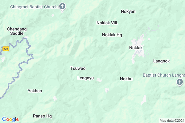
Dan Map
EDIT Map
Add Your House
 ..
..
Current Corona Virus Infected Patients Count in Tuensang District
| City Name | District Name | Total Covid cases |
|---|
Locality Name :
Dan
( दान )
Tehsil Name : Noklak
District : Tuensang
State : Nagaland
Language : English and Khasi, Garo
Current Time 12:29 PM
Date: Monday , Apr 28,2025 (IST)
Time zone: IST (UTC+5:30)
Assembly constituency : assembly constituency
Assembly MLA :
Lok Sabha constituency : parliamentary constituency
Parliament MP :
Serpanch Name :
Commodities Prices : Tuensang Market / Mandi
National Highways Reachable To Dan
Nationa High Way :NH202
Nationa High Way :NH2
Nationa High Way :NH202
Nationa High Way :NH2
Rivers Near Dan
Zunki
Tzula Tributary
Zunki
Tzula Tributary
About Dan
Correct below Info and add more info about DanDan is a Village in Noklak Tehsil in Tuensang District of Nagaland State, India. It is located 19 KM towards East from District head quarters Tuensang. 370 KM from State capital Shillong
Dan is surrounded by Tuensang Tehsil towards west , Sangsangyu Tehsil towards west , Shamator Tehsil towards west , Thonoknyu Tehsil towards South .
Tuensang , Mokokchung , Zunheboto , Wokha are the near by Cities to Dan.
Dan 2011 Census Details
Dan Local Language is English. Dan Village Total population is 636 and number of houses are 122. Female Population is 41.7%. Village literacy rate is 37.9% and the Female Literacy rate is 15.3%.
Population
| Census Parameter | Census Data |
| Total Population | 636 |
| Total No of Houses | 122 |
| Female Population % | 41.7 % ( 265) |
| Total Literacy rate % | 37.9 % ( 241) |
| Female Literacy rate | 15.3 % ( 97) |
| Scheduled Tribes Population % | 94.7 % ( 602) |
| Scheduled Caste Population % | 0.0 % ( 0) |
| Working Population % | 54.7 % |
| Child(0 -6) Population by 2011 | 183 |
| Girl Child(0 -6) Population % by 2011 | 43.7 % ( 80) |
Dan Census More Deatils.
HOW TO REACH Dan
By Rail
There is no railway station near to Dan in less than 10 km.Pincodes near Dan
798626 ( Noklak ) , 798612 ( Tuensang ) , 798603 ( Champang )Schools near Dan
Electronic Shops in Dan,Noklak
Himlyn Music & Media Lab
Tuensang-Mon-Naginimora Rd; Tuensang; Nagaland 798612; India
19.3 KM distance Detail
Super Markets in Dan,Noklak
Governement Offices near Dan,Noklak
Veterinary Office Pathso Nokeng Village
Pathso Nokeng; Tuensang; Nagaland 798612; India
11.1 KM distance Detail
About Dan &
History
How to reach Dan
Tourist Places Near By Dan
Schools in Dan
Colleges in Dan
Temperature & weather of Dan
places in Dan
Dan photos
More Information
How to reach Dan
Tourist Places Near By Dan
Schools in Dan
Colleges in Dan
Temperature & weather of Dan
places in Dan
Dan photos
More Information
Village Talk
Post News or Events about this Village
Near Cities
Tuensang 17 KM near
Mokokchung 50 KM near
Zunheboto 57 KM near
Wokha 79 KM near
Tuensang 17 KM near
Mokokchung 50 KM near
Zunheboto 57 KM near
Wokha 79 KM near
Near By Taluks
Noklak 0 KM near
Tuensang 18 KM near
Sangsangyu 18 KM near
Shamator 21 KM near
Noklak 0 KM near
Tuensang 18 KM near
Sangsangyu 18 KM near
Shamator 21 KM near
Near By Air Ports
Rowriah Airport 110 KM near
Dimapur Airport 139 KM near
Chabua Airport 161 KM near
Lilabari Airport 168 KM near
Rowriah Airport 110 KM near
Dimapur Airport 139 KM near
Chabua Airport 161 KM near
Lilabari Airport 168 KM near
Near By Tourist Places
Tuensang 17 KM near
Mokokchung 54 KM near
Mon 71 KM near
Wokha 79 KM near
Phek 83 KM near
Tuensang 17 KM near
Mokokchung 54 KM near
Mon 71 KM near
Wokha 79 KM near
Phek 83 KM near
Near By Districts
Tuensang 18 KM near
Longleng 40 KM near
Kiphire 43 KM near
Mokokchung 50 KM near
Tuensang 18 KM near
Longleng 40 KM near
Kiphire 43 KM near
Mokokchung 50 KM near
Near By RailWay Station
Amguri Junction Rail Way Station 92 KM near
Mariani Junction Rail Way Station 93 KM near
Amguri Junction Rail Way Station 92 KM near
Mariani Junction Rail Way Station 93 KM near