| Home | City Bus | Maps | Villages | Cities | Rail | Tourist Places | School | College | Pin Codes | Corona Cases Count |
| Distance Calculator Bus Services IFSC Codes Trace Mobile Number Weather Search Place Trace IP Available Cash ATM/Banks Locate Polling Booth Report an Error contact People |
Konsa
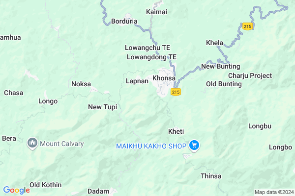
Konsa Map
EDIT Map
Add Your House
 ..
..
Current Corona Virus Infected Patients Count in Tirap District
| City Name | District Name | Total Covid cases |
|---|
Locality Name :
Konsa
( कोंसा )
Tehsil Name : Pongchau
District : Tirap
State : Arunachal Pradesh
Language : English
Current Time 03:25 PM
Date: Wednesday , Feb 05,2025 (IST)
Time zone: IST (UTC+5:30)
Elevation / Altitude: 131 meters. Above Seal level
Telephone Code / Std Code: 03786
Assembly constituency : Khonsa West assembly constituency
Assembly MLA : Tirong Aboh
Lok Sabha constituency : parliamentary constituency
Parliament MP :
Serpanch Name :
Commodities Prices : Naginimora Market / Mandi
Konsa Live Weather
Temperature: 20.9 °C
overcast clouds
Humidity: 53%
Wind : 1.15 mt/sec towards NW
StationName : "Khonsa"
observed on 6 Mins Back
Temperature: 20.9 °C
overcast clouds
Humidity: 53%
Wind : 1.15 mt/sec towards NW
StationName : "Khonsa"
observed on 6 Mins Back
Konsa Weather Forecast for Next 5 days
06-02-2025
15.7°C to 20.2°C
overcast clouds, broken clouds
15.7°C to 20.2°C
overcast clouds, broken clouds
07-02-2025
14.5°C to 22.4°C
light rain, broken clouds, clear sky, few clouds
14.5°C to 22.4°C
light rain, broken clouds, clear sky, few clouds
08-02-2025
14.5°C to 24.5°C
clear sky, scattered clouds, broken clouds
14.5°C to 24.5°C
clear sky, scattered clouds, broken clouds
09-02-2025
14.7°C to 24.8°C
scattered clouds, clear sky, few clouds
14.7°C to 24.8°C
scattered clouds, clear sky, few clouds
10-02-2025
15.2°C to 24.9°C
scattered clouds, clear sky, few clouds
15.2°C to 24.9°C
scattered clouds, clear sky, few clouds
National Highways Reachable To Konsa
Nationa High Way :NH215
Nationa High Way :NH215
Rivers Near Konsa
Namchik River :নামচিক
Disang
Namchik River :নামচিক
Disang
About Konsa
Correct below Info and add more info about KonsaKonsa is a Village in Pongchau Tehsil in Tirap District of Arunachal Pradesh State, India. It is located 2 KM towards west from District head quarters Khonsa. 209 KM from State capital Itanagar
Khonsa ( 1 KM ) , Kheti ( 3 KM ) , Borduria ( 6 KM ) , Khela ( 6 KM ) , Kaimai ( 7 KM ) are the nearby Villages to Konsa. Konsa is surrounded by Khela Lamsa Tehsil towards North , Khonsa Tehsil towards North , Dadam Tehsil towards South , Laju Tehsil towards South .
Margherita , Digboi , Duliajan Oil Town , Tinsukia are the near by Cities to Konsa.
Konsa 2011 Census Details
Konsa Local Language is English. Konsa Village Total population is and number of houses are . Female Population is -1.0%. Village literacy rate is -1.0% and the Female Literacy rate is -1.0%.
Population
| Census Parameter | Census Data |
| Total Population | |
| Total No of Houses | |
| Female Population % | -1.0 % ( ) |
| Total Literacy rate % | -1.0 % ( ) |
| Female Literacy rate | -1.0 % ( ) |
| Scheduled Tribes Population % | -1.0 % ( ) |
| Scheduled Caste Population % | -1.0 % ( ) |
| Working Population % | -1.0 % |
| Child(0 -6) Population by 2011 | |
| Girl Child(0 -6) Population % by 2011 | -1.0 % ( ) |
Konsa Census More Deatils.
Politics in Konsa
PPA , INC(I) , National People s Party , JNP , INC are the major political parties in this area.Polling Stations /Booths near Konsa
1)Dadam-i M.e. School2)Govt. Pry. School Bokfam-ii
3)Raho Primary School
4)Govt Pry. School Moktowa
5)Chinkoi Primary School
HOW TO REACH Konsa
By Rail
There is no railway station near to Konsa in less than 10 km.Pincodes near Konsa
792120 ( Changlang ) , 792121 ( Jairampur (Changlang) ) , 792123 ( Nampong )Colleges near Konsa
Wangcha Rajkumar Government College
Address : Ntc Colony Road, Deomali, Arunachal Pradesh
Schools in Konsa
Govt Pry School Konsa
Address : konsa , pongchau-wakka , tirap , Arunachal Pradesh . PIN- 786631
Govt Health Centers near Konsa
1) PHC Yatdam , PHC Yatdam , ,2) SC Lamsa , SC Lamsa , ,
3) SC Kolagaon , SC Kolagaon , ,
Schools in Konsa,Pongchau
Govt. Hr. Sec. School
Longding; Via Khonsa; Dt- Tirap; Arunachal Pradesh- 786631; Tirap; Arunachal Pradesh 786631; India
2.1 KM distance Detail
Electronic Shops in Konsa,Pongchau
Super Markets in Konsa,Pongchau
Police Stations near Konsa,Pongchau
Police Station
Longding - Khonsa Road; longding headquarter; Arunachal Pradesh; India
2.2 KM distance Detail
About Konsa &
History
How to reach Konsa
Tourist Places Near By Konsa
Schools in Konsa
Colleges in Konsa
Temperature & weather of Konsa
places in Konsa
Konsa photos
More Information
How to reach Konsa
Tourist Places Near By Konsa
Schools in Konsa
Colleges in Konsa
Temperature & weather of Konsa
places in Konsa
Konsa photos
More Information
Village Talk
Post News or Events about this Village
Near Cities
Margherita 43 KM near
Digboi 50 KM near
Duliajan Oil Town 51 KM near
Tinsukia 65 KM near
Margherita 43 KM near
Digboi 50 KM near
Duliajan Oil Town 51 KM near
Tinsukia 65 KM near
Near By Taluks
Pongchau 0 KM near
Khela Lamsa 1 KM near
Khonsa 2 KM near
Dadam 9 KM near
Pongchau 0 KM near
Khela Lamsa 1 KM near
Khonsa 2 KM near
Dadam 9 KM near
Near By Air Ports
Chabua Airport 81 KM near
Rowriah Airport 148 KM near
Lilabari Airport 160 KM near
Dimapur Airport 235 KM near
Chabua Airport 81 KM near
Rowriah Airport 148 KM near
Lilabari Airport 160 KM near
Dimapur Airport 235 KM near
Near By Tourist Places
Khonsa 2 KM near
Changlang 33 KM near
Tirap 41 KM near
Mon 51 KM near
Tinsukia 65 KM near
Khonsa 2 KM near
Changlang 33 KM near
Tirap 41 KM near
Mon 51 KM near
Tinsukia 65 KM near
Near By Districts
Tirap 2 KM near
Changlang 33 KM near
Mon 62 KM near
Tinsukia 64 KM near
Tirap 2 KM near
Changlang 33 KM near
Mon 62 KM near
Tinsukia 64 KM near
Near By RailWay Station
Naharkatiya Rail Way Station 42 KM near
New Tinsukia Junction Rail Way Station 64 KM near
Naharkatiya Rail Way Station 42 KM near
New Tinsukia Junction Rail Way Station 64 KM near