| Home | City Bus | Maps | Villages | Cities | Rail | Tourist Places | School | College | Pin Codes | Corona Cases Count |
| Distance Calculator Bus Services IFSC Codes Trace Mobile Number Weather Search Place Trace IP Available Cash ATM/Banks Locate Polling Booth Report an Error contact People |
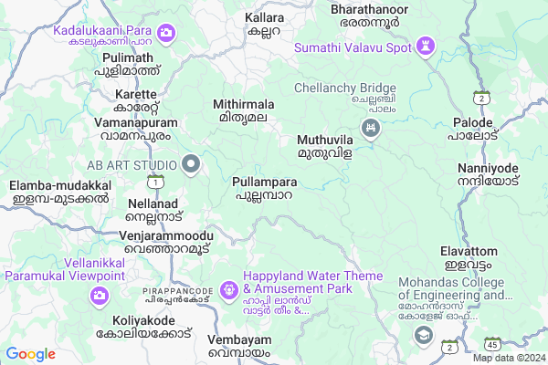
Pullampara
Pullampara Map
EDIT Map
Add Your House
 ..
..
Current Corona Virus Infected Patients Count in Thiruvananthapuram District
| City Name | District Name | Total Covid cases |
|---|---|---|
| Thiruvananthapuram District | Thiruvananthapuram | 11 |
| Thiruvananthapuram | Thiruvananthapuram | 2 |
| Varkala | Thiruvananthapuram | 1 |
| Nedumangad | Thiruvananthapuram | 1 |
Locality Name :
Pullampara
( പുല്ലമ്പാറ )
Block Name : Vamanapuram
District : Thiruvananthapuram
State : Kerala
Division : South Kerala
Language : Malayalam and English, Tamil, Hindi, Tulu, Konkani
Current Time 09:17 AM
Date: Wednesday , Apr 30,2025 (IST)
Time zone: IST (UTC+5:30)
Elevation / Altitude: 18 meters. Above Seal level
Telephone Code / Std Code: 04728
Assembly constituency : Vamanapuram assembly constituency
Assembly MLA : Adv. D. K. Murali
Lok Sabha constituency : Attingal parliamentary constituency
Parliament MP : Adv. ADOOR PRAKASH
Serpanch Name :
Pin Code : 695607
Post Office Name : Venjaramoodu
Commodities Prices : Vamanapuram Market / Mandi
National Highways Reachable To Pullampara
Nationa High Way :NH766;NH150A
Nationa High Way :NH766
Nationa High Way :NH766;NH150A
Nationa High Way :NH766
Rivers Near Pullampara
Noyyal River
Noyyal River
About Pullampara
Correct below Info and add more info about PullamparaPullampara is a Village in Vamanapuram Block in Thiruvananthapuram District of Kerala State, India. It belongs to South Kerala Division . It is located 27 KM towards North from District head quarters Thiruvananthapuram. 0 KM from Vamanapuram. 27 KM from State capital Thiruvananthapuram
Pullampara Pin code is 695607 and postal head office is Venjaramoodu .
Panavoor ( 6 KM ) , Vamanapuram ( 6 KM ) , Manickal ( 7 KM ) , Kallara ( 7 KM ) , Vembayam ( 8 KM ) are the nearby Villages to Pullampara. Pullampara is surrounded by Nedumangad Block towards South , Kilimanoor Block towards west , Kazhakuttam Block towards South , Chirayinkeezhu Block towards west .
Nedumangad , Attingal , Thiruvananthapuram , Varkala are the near by Cities to Pullampara.
This Place is in the border of the Thiruvananthapuram District and Kollam District. Kollam District Chadayamangalam is North towards this place .
Pullampara 2011 Census Details
Pullampara Local Language is Malayalam. Pullampara Village Total population is 21817 and number of houses are 5570. Female Population is 53.7%. Village literacy rate is 81.6% and the Female Literacy rate is 42.8%.
Population
| Census Parameter | Census Data |
| Total Population | 21817 |
| Total No of Houses | 5570 |
| Female Population % | 53.7 % ( 11706) |
| Total Literacy rate % | 81.6 % ( 17808) |
| Female Literacy rate | 42.8 % ( 9330) |
| Scheduled Tribes Population % | 0.6 % ( 124) |
| Scheduled Caste Population % | 16.7 % ( 3647) |
| Working Population % | 37.5 % |
| Child(0 -6) Population by 2011 | 2192 |
| Girl Child(0 -6) Population % by 2011 | 49.0 % ( 1074) |
Pullampara Census More Deatils.
Politics in Pullampara
CPM , JPSS , Indian National Congress , CPI(M) , INC are the major political parties in this area.Polling Stations /Booths near Pullampara
1)Sent George Lps Palode South Portion2)Service Co .op. Society Pullampara
3)Govt L P S Poovanammoodu South Portion
4)J M L P S Parameswaram North Portion
5)Janatha H S S Thembamoodu North Portion
HOW TO REACH Pullampara
By Rail
There is no railway station near to Pullampara in less than 10 km.Colleges near Pullampara
Government Arts & Science College Kulathoor
Address : Government Arts & Science College Kulathoor,uchakkada P.o Pin : 695506
Sivagiri Sree Narayana College , Varkala
Address :
Saraswathy College Of Nursing
Address :
Heera College Of Engineering And Technology
Address :
Iqbal College Peringammala
Address :
Schools in Pullampara
Janatha Hss Thempammood
Address : pullampara , attingal , thiruvananthapuram , Kerala . PIN- 0
Mb Kups Vayyakkavu
Address : pullampara , attingal , thiruvananthapuram , Kerala . PIN- 695568 , Post - Panavoor
K V Ups Vellamannady
Address : pullampara , attingal , thiruvananthapuram , Kerala . PIN- 69560
Govt Health Centers near Pullampara
1) PHC CHITTAR , Chittar Community health centre , Chittar Maniyar road , police stationSub Villages in Pullampara
Hospitals in Pullampara,Vamanapuram
Primary Health Centre Kurinchilakkadu
Kallara Muthuvila Road; Kerala 695610; India
1.4 KM distance Detail
more ..
Petrol Bunks in Pullampara,Vamanapuram
Star Fuels Indian Oil Petrol Pump
Keezhayikonam; Thiruvananthapuram; SH-1; MC Road; Venjaramoodu; Venjaramoodu; Kerala 695607; India
5.8 KM distance Detail
Bharat Petroleum
Vattappara - Thattathumala Rd; Keezhayikonam; Nellanad; Kerala 695606; India
6.0 KM distance Detail
more ..
Schools in Pullampara,Vamanapuram
GLPS Vellumannadi
Vamanapuram Aramthanam Road; Pullampara; Kerala 695607; India
2.1 KM distance Detail
Electronic Shops in Pullampara,Vamanapuram
Arapath Communication
Nedumangad; Panavoor Venjaramood Rd; Thempammoodu; Kerala 695568; Nedumangad; Panavoor - Venjaramood Rd; Thempammoodu; Kerala 695568; India
2.7 KM distance Detail
Grand Electrical and Plumbing
Vembayam Thalayil Thembamoodu Rd; Manikkal; Kerala 695607; India
2.8 KM distance Detail
Super Markets in Pullampara,Vamanapuram
SR Provision Store
Panavoor - Venjaramood Rd; Pullampara; Kerala 695568; India
1.8 KM distance Detail
Starkhan Provision Store
Kuttimoodu Vellumannadi Rd; Pullampara; Kerala 695607; India
3.9 KM distance Detail
Police Stations near Pullampara,Vamanapuram
Pangode Police Station
Vamanapuram - Chittar Rd; Pangodu; Kerala 695609; India
8.9 KM distance Detail
Janamaithri Police Station Palode
Palode; Near Government Community Health Center; Thiruvananthapuram; Kerala 695562; India
10.4 KM distance Detail
About Pullampara &
History
How to reach Pullampara
Tourist Places Near By Pullampara
Schools in Pullampara
Colleges in Pullampara
Temperature & weather of Pullampara
places in Pullampara
Pullampara photos
More Information
How to reach Pullampara
Tourist Places Near By Pullampara
Schools in Pullampara
Colleges in Pullampara
Temperature & weather of Pullampara
places in Pullampara
Pullampara photos
More Information
Village Talk
Post News or Events about this Village
Near Cities
Nedumangad 13 KM near
Attingal 14 KM near
Thiruvananthapuram 27 KM near
Varkala 29 KM near
Nedumangad 13 KM near
Attingal 14 KM near
Thiruvananthapuram 27 KM near
Varkala 29 KM near
Near By Taluks
Vamanapuram 0 KM near
Nedumangad 12 KM near
Kilimanoor 13 KM near
Kazhakuttam 16 KM near
Vamanapuram 0 KM near
Nedumangad 12 KM near
Kilimanoor 13 KM near
Kazhakuttam 16 KM near
Near By Air Ports
Trivandrum International Airport 28 KM near
Tuticorin Airport 133 KM near
Kochi Airport 193 KM near
Madurai Airport 199 KM near
Trivandrum International Airport 28 KM near
Tuticorin Airport 133 KM near
Kochi Airport 193 KM near
Madurai Airport 199 KM near
Near By Tourist Places
Ponmudi 21 KM near
Trivandrum 25 KM near
Varkala 29 KM near
Thenmala 34 KM near
Kovalam 37 KM near
Ponmudi 21 KM near
Trivandrum 25 KM near
Varkala 29 KM near
Thenmala 34 KM near
Kovalam 37 KM near
Near By Districts
Thiruvananthapuram 26 KM near
Kollam 52 KM near
Pathanamthitta 73 KM near
Kanniyakumari 88 KM near
Thiruvananthapuram 26 KM near
Kollam 52 KM near
Pathanamthitta 73 KM near
Kanniyakumari 88 KM near
Near By RailWay Station
Kazhakkuttam Rail Way Station 20 KM near
Chirayinkeezhu Rail Way Station 20 KM near
Kazhakkuttam Rail Way Station 20 KM near
Chirayinkeezhu Rail Way Station 20 KM near