| Home | City Bus | Maps | Villages | Cities | Rail | Tourist Places | School | College | Pin Codes | Corona Cases Count |
| Distance Calculator Bus Services IFSC Codes Trace Mobile Number Weather Search Place Trace IP Available Cash ATM/Banks Locate Polling Booth Report an Error contact People |
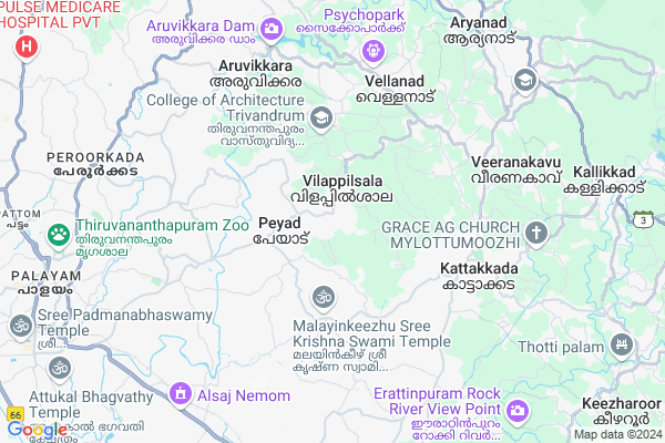
Vilappil
Vilappil Map
EDIT Map
Add Your House
 ..
..
Current Corona Virus Infected Patients Count in Thiruvananthapuram District
| City Name | District Name | Total Covid cases |
|---|---|---|
| Thiruvananthapuram District | Thiruvananthapuram | 11 |
| Thiruvananthapuram | Thiruvananthapuram | 2 |
| Varkala | Thiruvananthapuram | 1 |
| Nedumangad | Thiruvananthapuram | 1 |
Locality Name :
Vilappil
( വിളപ്പിൽ )
City Name : Nemom
District : Thiruvananthapuram
State : Kerala
Division : South Kerala
Language : Malayalam and English, Tamil, Hindi, Tulu, Konkani
Current Time 11:18 AM
Date: Sunday , Apr 27,2025 (IST)
Time zone: IST (UTC+5:30)
Elevation / Altitude: 28 meters. Above Seal level
Telephone Code / Std Code: 0471
Assembly constituency : Kattakkada assembly constituency
Assembly MLA : Adv I B Satheesh
Lok Sabha constituency : Attingal parliamentary constituency
Parliament MP : Adv. ADOOR PRAKASH
Pin Code : 695311
Post Office Name : Edava
Commodities Prices : Kattakada Market / Mandi
Vilappil Live Weather
Temperature: 32.9 °C
haze
Humidity: 70%
Wind : 2.57 mt/sec towards W
StationName : "Vazhuthacaud"
observed on 1 Hours Back
Temperature: 32.9 °C
haze
Humidity: 70%
Wind : 2.57 mt/sec towards W
StationName : "Vazhuthacaud"
observed on 1 Hours Back
Vilappil Weather Forecast for Next 5 days
28-04-2025
25.9°C to 32.5°C
light rain, overcast clouds
25.9°C to 32.5°C
light rain, overcast clouds
29-04-2025
25.5°C to 31.8°C
light rain, overcast clouds, broken clouds, scattered clouds
25.5°C to 31.8°C
light rain, overcast clouds, broken clouds, scattered clouds
30-04-2025
25.3°C to 32.0°C
scattered clouds, few clouds, light rain, clear sky
25.3°C to 32.0°C
scattered clouds, few clouds, light rain, clear sky
01-05-2025
26.3°C to 31.9°C
light rain, overcast clouds, scattered clouds
26.3°C to 31.9°C
light rain, overcast clouds, scattered clouds
02-05-2025
26.3°C to 31.6°C
light rain, overcast clouds
26.3°C to 31.6°C
light rain, overcast clouds
National Highways Reachable To Vilappil
Nationa High Way :NH744
Nationa High Way :NH66
Nationa High Way :NH744
Nationa High Way :NH66
Rivers Near Vilappil
Periyar :പെരിയാർ
Periyar :പെരിയാർ
Periyar :പെരിയാർ
Periyar :പെരിയാർ
About Vilappil
Correct below Info and add more info about VilappilVilappil is a Locality in Nemom City in Kerala State, India. It is belongs to South Kerala Division .
Vilappil Pin code is 695311 and postal head office is Edava .
Vilavoorkkal , Valiyavila , Vellanad , Aruvikkara , Karimankulam are the nearby Localities to Vilappil.
Nedumangad , Thiruvananthapuram , Neyyattinkara , Kollankodu are the nearby Cities to Nemom.
It is near to arabian sea. There is a chance of humidity in the weather.
Demographics of Vilappil
Malayalam is the Local Language here.Politics in Vilappil
CPM , Indian National Congress , INC are the major political parties in this area.Polling Stations /Booths near Vilappil
1)Government Upper Primary School Vilappilsala (west Building South Portion)2)Government Highschool Vilavoorkkal Lp Section (east Portion)
3)Government Upper Primary School Vilappilsala (main Building Ground Level Middle Portion)
4)Government Lower Primary School Vilappil(west Building Northportion)
5)Government Lower Primary School Vilappil (west Portion)
HOW TO REACH Vilappil
By Rail
Nemom Rail Way Station are the very nearby railway station to Vilappil.Govt Health Centers near Vilappil
1) PHC CHITTAR , Chittar Community health centre , Chittar Maniyar road , police stationSub Villages in Vilappil
Hospitals in Vilappil,Nemom
Government Community Health Center; Vilappil
Vilappilsala; Kerala 695573; India
0.2 KM distance Detail
Dr Sathish Kumar's Clinic
Damam manzil; Nooliyode Rd; Vilappilsala; Kerala 695573; India
0.6 KM distance Detail
Sanjeevani siddha hospital
Manchadi; Anthiyoorkkonam Road; Thachottukavu; Peyad; Kerala 695573; India
1.8 KM distance Detail
Sanjeevani Siddha Ayurveda Hospital
Thachottukavu; Peyad; Thiruvananthapuram; Kerala 695573; India
1.8 KM distance Detail
more ..
Petrol Bunks in Vilappil,Nemom
SAI FUELS
TRIVANDRUM -KATAKADA ROAD; THIRUVANANTHAPURAM; Kerala 695571; India
2.9 KM distance Detail
more ..
Colleges in Vilappil,Nemom
Saraswathi College Of Arts And Science Vilapilsala
Vilappilsala; Kerala 695573; India
1.7 KM distance Detail
Bishop Jesudasan CSI Arts And Science College
Mulayara; Vilappilsala; Kerala 695543; India
3.1 KM distance Detail
COLLEGE OF ARCHITECTURE TRIVANDRUM
Mulayara; Thiruvananthapuram; Kerala 695543; India
3.5 KM distance Detail
more ..
Schools in Vilappil,Nemom
Shanthinikethan School; Kunnumpuram
Peyad-Cherukode Rd; Peyad; Kerala 695573; India
0.6 KM distance Detail
Anganvaadi Karuvilanji ; Mahathma Grandhashala
Peyad - Vellanad Rd; Vilappilsala; Kerala 695573; India
0.8 KM distance Detail
Fern Hill English School
Vilapilsala; Thiruvananthapuram; Kerala 695573; India
0.9 KM distance Detail
Electronic Shops in Vilappil,Nemom
VARUN MOBILES; THACHOTTUKAVU
Thachottukavu Anthiyoorkkonam Rd; Thachottukavu; Peyad; Kerala 695573; India
2.3 KM distance Detail
Super Markets in Vilappil,Nemom
Amma Superhit Bazaar
Karipur; Thirumala Peyad Malayinkeezhu Rd; Thachottukavu; Peyad; Kerala 695571; India
2.5 KM distance Detail
Attoor Store
Aruvippuram - peyad Road; Aruvippuram; Peyad; Kerala 695573; India
2.7 KM distance Detail
A R Margin Free Supermarket
Aruvippuram - peyad Road; Aruvippuram; Peyad; Kerala 695573; India
2.8 KM distance Detail
Local Parks in Vilappil,Nemom
Mangattukadavu Ground.
Mangattukadavu; Thiruvananthapuram; Kerala 695006; India
5.4 KM distance Detail
Police Stations near Vilappil,Nemom
Malayinkeezhu Police Station
Thiruvananthapuram - Neyyar Dam Rd; Malayinkeezh; Kerala 695571; India
3.9 KM distance Detail
Vattiyoorkavu Police Station
Bus Stop;; Vattiyoorkavu; Nettayam; Thiruvananthapuram; Kerala 695013; India
6.6 KM distance Detail
Governement Offices near Vilappil,Nemom
LS ASSSOCIATES
Lekshmi; Palottuvila; Malayinkeezhu; Thiruvananthapuram; Kerala 695571; India
3.8 KM distance Detail
Malayinkeezhu Panchayath Office
Pappanamcode Malayinkeezhu Rd; Malayinkeezh; Kerala 695571; India
4.1 KM distance Detail
About Vilappil &
History
How to reach Vilappil
Tourist Places Near By Vilappil
Schools in Vilappil
Colleges in Vilappil
Temperature & weather of Vilappil
places in Vilappil
Vilappil photos
More Information
How to reach Vilappil
Tourist Places Near By Vilappil
Schools in Vilappil
Colleges in Vilappil
Temperature & weather of Vilappil
places in Vilappil
Vilappil photos
More Information
Locality Talk
Post News or Events about this Locality
Near Cities
Nedumangad 11 KM near
Thiruvananthapuram 15 KM near
Neyyattinkara 16 KM near
Kollankodu 29 KM near
Nedumangad 11 KM near
Thiruvananthapuram 15 KM near
Neyyattinkara 16 KM near
Kollankodu 29 KM near
Near By Taluks
Nemom 6 KM near
Vellanad 8 KM near
Thiruvananthapuram 11 KM near
Nedumangad 12 KM near
Nemom 6 KM near
Vellanad 8 KM near
Thiruvananthapuram 11 KM near
Nedumangad 12 KM near
Near By Air Ports
Trivandrum International Airport 15 KM near
Tuticorin Airport 124 KM near
Madurai Airport 208 KM near
Kochi Airport 218 KM near
Trivandrum International Airport 15 KM near
Tuticorin Airport 124 KM near
Madurai Airport 208 KM near
Kochi Airport 218 KM near
Near By Tourist Places
Trivandrum 11 KM near
Kovalam 16 KM near
Poovar 27 KM near
Ponmudi 30 KM near
Varkala 50 KM near
Trivandrum 11 KM near
Kovalam 16 KM near
Poovar 27 KM near
Ponmudi 30 KM near
Varkala 50 KM near
Near By Districts
Thiruvananthapuram 11 KM near
Kanniyakumari 64 KM near
Kollam 74 KM near
Tirunelveli 81 KM near
Thiruvananthapuram 11 KM near
Kanniyakumari 64 KM near
Kollam 74 KM near
Tirunelveli 81 KM near
Near By RailWay Station
Nemom Rail Way Station 9.3 KM near
Thiruvananthapuram Central Rail Way Station 11 KM near
Thiruvananthapuram Pettah Rail Way Station 13 KM near
Nemom Rail Way Station 9.3 KM near
Thiruvananthapuram Central Rail Way Station 11 KM near
Thiruvananthapuram Pettah Rail Way Station 13 KM near