| Home | City Bus | Maps | Villages | Cities | Rail | Tourist Places | School | College | Pin Codes | Corona Cases Count |
| Distance Calculator Bus Services IFSC Codes Trace Mobile Number Weather Search Place Trace IP Available Cash ATM/Banks Locate Polling Booth Report an Error contact People |
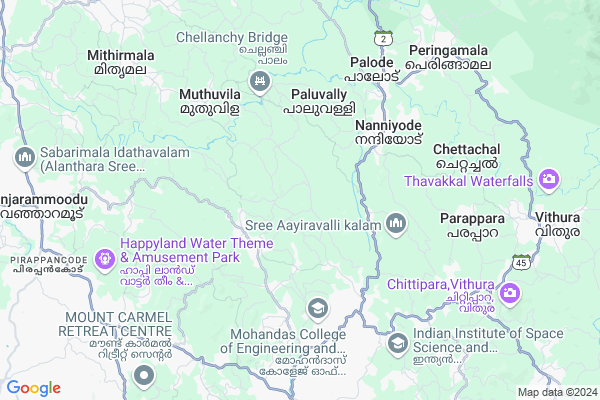
Kochupalode
Kochupalode Map
EDIT Map
Add Your House
 ..
..
Current Corona Virus Infected Patients Count in Thiruvananthapuram District
| City Name | District Name | Total Covid cases |
|---|---|---|
| Thiruvananthapuram District | Thiruvananthapuram | 11 |
| Thiruvananthapuram | Thiruvananthapuram | 2 |
| Varkala | Thiruvananthapuram | 1 |
| Nedumangad | Thiruvananthapuram | 1 |
Locality Name :
Kochupalode
( കൊച്ചുപാലോടെ )
Block Name : Nedumangad
District : Thiruvananthapuram
State : Kerala
Division : South Kerala
Language : Malayalam and English, Tamil, Hindi, Tulu, Konkani
Current Time 09:03 PM
Date: Sunday , Apr 27,2025 (IST)
Time zone: IST (UTC+5:30)
Elevation / Altitude: 12 meters. Above Seal level
Telephone Code / Std Code: 04728
Assembly constituency : Vamanapuram assembly constituency
Assembly MLA : Adv. D. K. Murali
Lok Sabha constituency : Attingal parliamentary constituency
Parliament MP : Adv. ADOOR PRAKASH
Serpanch Name :
Pin Code : 695568
Post Office Name : Panavoor
Main Village Name : Panavoor
Commodities Prices : Nedumangadu Market / Mandi
National Highways Reachable To Kochupalode
Nationa High Way :NH544
Nationa High Way :NH66
Nationa High Way :NH544
Nationa High Way :NH66
Rivers Near Kochupalode
Achenkovil
Chikkahole :ಚಿಕ್ಕಹೊಳೆ
Achenkovil
Chikkahole :ಚಿಕ್ಕಹೊಳೆ
About Kochupalode
Correct below Info and add more info about KochupalodeKochupalode is a small Village/hamlet in Nedumangad Block in Thiruvananthapuram District of Kerala State, India. It comes under Panavoor Panchayath. It belongs to South Kerala Division . It is located 26 KM towards North from District head quarters Thiruvananthapuram. 9 KM from Nedumangad. 26 KM from State capital Thiruvananthapuram
Kochupalode Pin code is 695568 and postal head office is Panavoor .
Pullampara ( 6 KM ) , Anad ( 6 KM ) , Tholicode ( 9 KM ) , Pazhakutty ( 9 KM ) , Vembayam ( 9 KM ) are the nearby Villages to Kochupalode. Kochupalode is surrounded by Nedumangad Block towards South , Vellanad Block towards South , Kazhakuttam Block towards west , Kilimanoor Block towards west .
Nedumangad , Attingal , Thiruvananthapuram , Varkala are the near by Cities to Kochupalode.
Demographics of Kochupalode
Malayalam is the Local Language here.Politics in Kochupalode
CPM , JPSS , Indian National Congress , CPI(M) , INC are the major political parties in this area.Polling Stations /Booths near Kochupalode
1)Govt L P S Panavoor North Portion2)U P S Anachal West Building Sounth End
3)Community Centre Kalamachal
4)K V U P S Pangode South Portion
5)B R M H S Elavattom
HOW TO REACH Kochupalode
By Rail
There is no railway station near to Kochupalode in less than 10 km.Colleges near Kochupalode
Heera College Of Engineering And Technology
Address :
Iqbal College Peringammala
Address :
P.a Aziz College Of Engineering And Technology
Address : Karakulam, Trivandrum 695564
Mohandas College Of Engineering & Technology
Address : Nedumangad, Anad (p.o), Tvm-695 544.
Schools in Kochupalode
Phkmhs Panavoor
Address : panavoor , nedumangadu , thiruvananthapuram , Kerala . PIN- 695568 , Post - Panavoor
P.ups Attinpuram
Address : panavoor , nedumangadu , thiruvananthapuram , Kerala . PIN- 695568 , Post - Panavoor
Govt Ups Attukal
Address : panavoor , nedumangadu , thiruvananthapuram , Kerala . PIN- 695561 , Post - Pazhakutty
Govt. Ups Perayam
Address : panavoor , nedumangadu , thiruvananthapuram , Kerala . PIN- 695562 , Post - Pacha
Govt Health Centers near Kochupalode
1) PHC CHITTAR , Chittar Community health centre , Chittar Maniyar road , police stationHospitals in Kochupalode,Nedumangad
Mannam Ayurveda Hospital; Valiya thannimoodu
Thiruvananthapuram - Thenmala Rd; Elavattom; Kerala 695562; India
2.8 KM distance Detail
more ..
Petrol Bunks in Kochupalode,Nedumangad
Vilayil Fuels.IOC
Panavoor Nedumangad; Panavoor - Puthenpalam Rd; Karikkuzhy; Panavoor; Kerala 695568; India
3.0 KM distance Detail
BP Petrol Pump
Thiruvananthapuram-Thenmala Road; Plavara; Nanniyode; Kerala 695562; India
5.5 KM distance Detail
Indian Oil Petrol Pump
Nanniyode; Thiruvananthapuram; SH-2; Trivandrum Thenmala Road; Pacha; Pacha; Kerala 695562; India
5.5 KM distance Detail
more ..
Colleges in Kochupalode,Nedumangad
Muslim Association College of Arts and Science
Panavoor - Attinpuram Rd; Panavoor; Kerala 695568; India
1.7 KM distance Detail
Heera College Of Science & Technology
Thiruvananthapuram; Kerala 695561; India
4.2 KM distance Detail
Heera College Of Engineering; Panavoor; Nedumangadu
nedumangadu heera college; og engineering; Nedumangad; Kerala; India
4.4 KM distance Detail
Heera College of Engineering and Technology
Panavoor - Nedumangad Road; Anad; Kerala 695541; India
5.4 KM distance Detail
more ..
Schools in Kochupalode,Nedumangad
Malayadi Pre School
Malayadi pampadi road Panayamuttom PO; Nedumangad; Kerala; India
0.7 KM distance Detail
Nursery School
Attinpuram-Panayam-Perayam Rd; Attinpuram; Kerala 695568; India
1.6 KM distance Detail
Electronic Shops in Kochupalode,Nedumangad
Pooram Light and Sound
Thekkada - Panavoor Rd; Panavoor; Kerala 695568; India
4.7 KM distance Detail
Super Markets in Kochupalode,Nedumangad
Melekkadayil Stores and Bakery
Paluvally-Aanakkuzy-Kudavanadu Rd; Palode; Kerala 695562; India
3.0 KM distance Detail
Local Parks in Kochupalode,Nedumangad
Childrens Park L P S Nedumangad
Nedumangad Town Rd; Pazhakutty; Pazhavadi; Nedumangad; Kerala 695541; India
9.1 KM distance Detail
Suseela Gopalan Memorial Park;Roadside Resting Centre
Nedumangad; Kerala 695541; India
10.0 KM distance Detail
Police Stations near Kochupalode,Nedumangad
Janamaithri Police Station Palode
Palode; Near Government Community Health Center; Thiruvananthapuram; Kerala 695562; India
5.9 KM distance Detail
Governement Offices near Kochupalode,Nedumangad
Panavoor Panchayath Office
Panavoor - Chullimanoor Road; Panavoor; Kerala 695568; India
3.0 KM distance Detail
About Kochupalode &
History
How to reach Kochupalode
Tourist Places Near By Kochupalode
Schools in Kochupalode
Colleges in Kochupalode
Temperature & weather of Kochupalode
places in Kochupalode
Kochupalode photos
More Information
How to reach Kochupalode
Tourist Places Near By Kochupalode
Schools in Kochupalode
Colleges in Kochupalode
Temperature & weather of Kochupalode
places in Kochupalode
Kochupalode photos
More Information
Village Talk
Post News or Events about this Village
Near Cities
Nedumangad 9 KM near
Attingal 20 KM near
Thiruvananthapuram 26 KM near
Varkala 36 KM near
Nedumangad 9 KM near
Attingal 20 KM near
Thiruvananthapuram 26 KM near
Varkala 36 KM near
Near By Taluks
Vamanapuram 7 KM near
Nedumangad 8 KM near
Vellanad 17 KM near
Kazhakuttam 19 KM near
Vamanapuram 7 KM near
Nedumangad 8 KM near
Vellanad 17 KM near
Kazhakuttam 19 KM near
Near By Air Ports
Trivandrum International Airport 27 KM near
Tuticorin Airport 127 KM near
Madurai Airport 196 KM near
Kochi Airport 198 KM near
Trivandrum International Airport 27 KM near
Tuticorin Airport 127 KM near
Madurai Airport 196 KM near
Kochi Airport 198 KM near
Near By Tourist Places
Ponmudi 17 KM near
Trivandrum 24 KM near
Kovalam 34 KM near
Thenmala 35 KM near
Varkala 36 KM near
Ponmudi 17 KM near
Trivandrum 24 KM near
Kovalam 34 KM near
Thenmala 35 KM near
Varkala 36 KM near
Near By Districts
Thiruvananthapuram 24 KM near
Kollam 58 KM near
Pathanamthitta 77 KM near
Kanniyakumari 82 KM near
Thiruvananthapuram 24 KM near
Kollam 58 KM near
Pathanamthitta 77 KM near
Kanniyakumari 82 KM near
Near By RailWay Station
Kazhakkuttam Rail Way Station 21 KM near
Thiruvananthapuram Pettah Rail Way Station 24 KM near
Kazhakkuttam Rail Way Station 21 KM near
Thiruvananthapuram Pettah Rail Way Station 24 KM near