| Home | City Bus | Maps | Villages | Cities | Rail | Tourist Places | School | College | Pin Codes | Corona Cases Count |
| Distance Calculator Bus Services IFSC Codes Trace Mobile Number Weather Search Place Trace IP Available Cash ATM/Banks Locate Polling Booth Report an Error contact People |
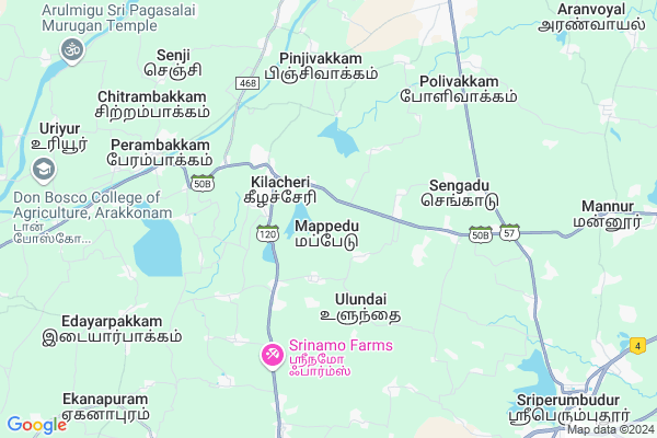
Mappedu
Mappedu Map
EDIT Map
Add Your House
 ..
..
Current Corona Virus Infected Patients Count in Thiruvallur District
| City Name | District Name | Total Covid cases |
|---|---|---|
| Thiruvallur District | Thiruvallur | 54 |
Locality Name :
Mappedu
( மப்பேடு )
Block Name : Kadambathur
District : Thiruvallur
State : Tamil Nadu
Language : Tamil
Current Time 11:28 AM
Date: Sunday , Apr 27,2025 (IST)
Time zone: IST (UTC+5:30)
Elevation / Altitude: 50 meters. Above Seal level
Telephone Code / Std Code: 044
Assembly constituency : Thiruvallur assembly constituency
Assembly MLA : Raajendran, V.G.
Lok Sabha constituency : Tiruvallur parliamentary constituency
Parliament MP : Dr.K.Jayakumar
Serpanch Name :
Pin Code : 631402
Post Office Name : Perambakkam
Commodities Prices : Kanchipuram Market / Mandi
Mappedu Live Weather
Temperature: 31.0 °C
overcast clouds
Humidity: 58%
Wind : 1.87 mt/sec towards S
StationName : "Srīperumbūdūr"
observed on 2 Hours Back
Temperature: 31.0 °C
overcast clouds
Humidity: 58%
Wind : 1.87 mt/sec towards S
StationName : "Srīperumbūdūr"
observed on 2 Hours Back
Mappedu Weather Forecast for Next 5 days
28-04-2025
27.4°C to 38.5°C
overcast clouds, broken clouds
27.4°C to 38.5°C
overcast clouds, broken clouds
29-04-2025
26.6°C to 38.6°C
scattered clouds, broken clouds, few clouds
26.6°C to 38.6°C
scattered clouds, broken clouds, few clouds
30-04-2025
26.9°C to 40.3°C
few clouds, scattered clouds, clear sky
26.9°C to 40.3°C
few clouds, scattered clouds, clear sky
01-05-2025
27.2°C to 40.9°C
scattered clouds, overcast clouds, broken clouds
27.2°C to 40.9°C
scattered clouds, overcast clouds, broken clouds
02-05-2025
28.0°C to 41.4°C
overcast clouds, broken clouds
28.0°C to 41.4°C
overcast clouds, broken clouds
Edit below overview about Mappedu
Edit below overview about Mappedu
OverView of Mappedu
The new proposed Green Field Airport of Chennai is Mappedu.ITC has located it for their next new 5 star hotel here.Soil is too good. Red Sand.Water Reservoir is too good.The Tamilnadu Government has allocated "Dry Port" area of 125 acre here.Express Highway (6 way track) is on processEdit below overview about Mappedu
National Highways Reachable To Mappedu
Nationa High Way :NH45
Nationa High Way :NH45
About Mappedu
Mappedu is a Village in Kadambathur Block in Thiruvallur District of Tamil Nadu State, India. It is located 17 KM towards South from District head quarters Tiruvallur. 6 KM from Kadambathur. 48 KM from State capital Chennai
Mappedu Pin code is 631402 and postal head office is Perambakkam .
Mudugur ( 2 KM ) , Ulundai ( 3 KM ) , Erayamangalam ( 4 KM ) , Kondancheri ( 5 KM ) , Kannur ( 5 KM ) are the nearby Villages to Mappedu. Mappedu is surrounded by Sriperumbudur Block towards South , Thiruvallur Block towards North , Tiruvallur Block towards North , Tiruvelangadu Block towards North .
Thiruvallur , Thirunindravur , Arakkonam , Kanchipuram are the near by Cities to Mappedu.
This Place is in the border of the Thiruvallur District and Kanchipuram District. Kanchipuram District Sriperumbudur is South towards this place .
Mappedu 2011 Census Details
Mappedu Local Language is Tamil. Mappedu Village Total population is 4205 and number of houses are 1083. Female Population is 50.1%. Village literacy rate is 68.2% and the Female Literacy rate is 30.8%.
Population
| Census Parameter | Census Data |
| Total Population | 4205 |
| Total No of Houses | 1083 |
| Female Population % | 50.1 % ( 2107) |
| Total Literacy rate % | 68.2 % ( 2867) |
| Female Literacy rate | 30.8 % ( 1294) |
| Scheduled Tribes Population % | 1.5 % ( 64) |
| Scheduled Caste Population % | 44.9 % ( 1886) |
| Working Population % | 45.0 % |
| Child(0 -6) Population by 2011 | 461 |
| Girl Child(0 -6) Population % by 2011 | 54.0 % ( 249) |
Mappedu Census More Deatils.
Politics in Mappedu
DMK , AIADMK are the major political parties in this area.HOW TO REACH Mappedu
By Rail
Senji Panambakkam Rail Way Station is the very nearby railway stations to Mappedu.Colleges near Mappedu
Christ College
Address :
Schools in Mappedu
St Joseph Nur&pri,mappedu
Address : mappedu , kadambathur , thiruvallur , Tamil Nadu . PIN- 631105
Telc Ps, Mappedu
Address : mappedu , kadambathur , thiruvallur , Tamil Nadu . PIN- 631402 , Post - Perambakkam
Pups, Mappedu
Address : mappedu , kadambathur , thiruvallur , Tamil Nadu . PIN- 631402 , Post - Perambakkam
Govt Health Centers near Mappedu
1) Ulundai , Primary Health Centre , HOSPITAL ROAD , GOVT SCHOOL2) Kondancheri , Health Sub centre , MATHA KOVIL STREET , DEVAN SHOP
3) Pandiyan Hospital , 19 , Mahatma Gandhi Road ,
Sub Villages in Mappedu
Petrol Bunks in Mappedu,Kadambathur
Indian Oil Petrol Pump
Mappedu Melnellathur Road; Thiruvallur; Tamil Nadu 631402; India
2.8 KM distance Detail
more ..
Colleges in Mappedu,Kadambathur
Christ Arts and Science College Tav
SH 120; Tiruvallur district; Keelachery; Tamil Nadu 631402; India
2.8 KM distance Detail
Cosmopolitan Technology Of Maritime College Sengadu
Near Karttkut Road; India
4.8 KM distance Detail
Kalaimagal Group of College
Kondancherry; Perambakkam; Thiruvallur; SH-50B; Thandalam Perambakkam Thakkolam Road; Thiruvallur; Thiruvallur; 631402; India
5.7 KM distance Detail
Vishwaksena College of Education
Pollivakkam; Sriperumbudur; Kanchipuram; SH-57; Sriperumbudur Oragadam Thiruvallur Road; Kanchipuram; Kanchipuram; 602002; India
6.7 KM distance Detail
more ..
Schools in Mappedu,Kadambathur
St Joseph Nursery and Primary School
Gandhipet; Thiruvallur; SH-50B; Korattur Thinnanur Periyapalayam Road; Thiruvallur; Thiruvallur; 631402; India
2.1 KM distance Detail
St. Josephs Boys Higher Secondary School
Keelachery; Thiruvallur; SH-120; Walajabad Sunguvarchathiram Keelachery Road; Thiruvallur; Thiruvallur; 631402; India
2.4 KM distance Detail
Sacred Heart Girls High School
Keelachery; Thiruvallur; SH-120; Walajabad Sunguvarchathiram Keelachery Road; Thiruvallur; Thiruvallur; 631402; India
2.5 KM distance Detail
Super Markets in Mappedu,Kadambathur
PRR PROVISIONAL & FANCY STORE
Big St; Narasingaparam; Tamil Nadu 631210; India
8.5 KM distance Detail
About Mappedu &
History
How to reach Mappedu
Tourist Places Near By Mappedu
Schools in Mappedu
Colleges in Mappedu
Temperature & weather of Mappedu
places in Mappedu
Mappedu photos
More Information
How to reach Mappedu
Tourist Places Near By Mappedu
Schools in Mappedu
Colleges in Mappedu
Temperature & weather of Mappedu
places in Mappedu
Mappedu photos
More Information
Village Talk
Post News or Events about this Village
Near Cities
Thiruvallur 15 KM near
Thirunindravur 23 KM near
Arakkonam 25 KM near
Kanchipuram 31 KM near
Thiruvallur 15 KM near
Thirunindravur 23 KM near
Arakkonam 25 KM near
Kanchipuram 31 KM near
Near By Taluks
Kadambathur 6 KM near
Sriperumbudur 12 KM near
Thiruvallur 15 KM near
Tiruvallur 19 KM near
Kadambathur 6 KM near
Sriperumbudur 12 KM near
Thiruvallur 15 KM near
Tiruvallur 19 KM near
Near By Air Ports
Chennai Airport 35 KM near
Tirupati Airport 86 KM near
Bengaluru International Airport 263 KM near
Salem Airport 268 KM near
Chennai Airport 35 KM near
Tirupati Airport 86 KM near
Bengaluru International Airport 263 KM near
Salem Airport 268 KM near
Near By Tourist Places
Sriperumbudur 11 KM near
Kanchipuram 31 KM near
Thiruthani 36 KM near
Chennai 46 KM near
Covelong 55 KM near
Sriperumbudur 11 KM near
Kanchipuram 31 KM near
Thiruthani 36 KM near
Chennai 46 KM near
Covelong 55 KM near
Near By Districts
Thiruvallur 16 KM near
Kanchipuram 29 KM near
Chennai 45 KM near
Vellore 90 KM near
Thiruvallur 16 KM near
Kanchipuram 29 KM near
Chennai 45 KM near
Vellore 90 KM near
Near By RailWay Station
Tiruvallur Rail Way Station 13 KM near
Arakkonam Junction Rail Way Station 25 KM near
Tiruvallur Rail Way Station 13 KM near
Arakkonam Junction Rail Way Station 25 KM near