| Home | City Bus | Maps | Villages | Cities | Rail | Tourist Places | School | College | Pin Codes | Corona Cases Count |
| Distance Calculator Bus Services IFSC Codes Trace Mobile Number Weather Search Place Trace IP Available Cash ATM/Banks Locate Polling Booth Report an Error contact People |
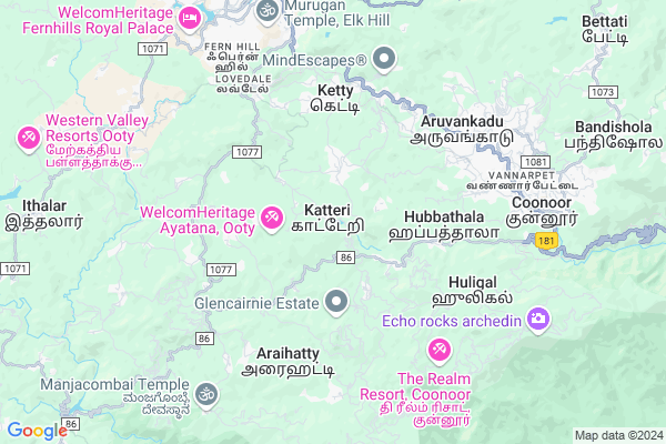
Battakorai
Battakorai Map
EDIT Map
Add Your House
 ..
..
Current Corona Virus Infected Patients Count in The Nilgiris District
| City Name | District Name | Total Covid cases |
|---|
Locality Name :
Battakorai
( பட்டகொறை )
Block Name : Kotagiri
District : The Nilgiris
State : Tamil Nadu
Language : Tamil and Badaga, Kannada, Hindi
Current Time 11:04 AM
Date: Monday , Apr 28,2025 (IST)
Time zone: IST (UTC+5:30)
Elevation / Altitude: 823 meters. Above Seal level
Telephone Code / Std Code: 04266
Assembly constituency : Coonoor assembly constituency
Assembly MLA : Ramachandran, K.
Lok Sabha constituency : Nilgiris parliamentary constituency
Parliament MP : RAJA, A.
Serpanch Name :
Pin Code : 643213
Post Office Name : Katary
Main Village Name : Naduhatty
Commodities Prices : Karamadai Market / Mandi
Battakorai Live Weather
Temperature: 20.0 °C
overcast clouds
Humidity: 59%
Wind : 1.67 mt/sec towards E
StationName : "Aruvankad"
observed on 1 Hours Back
Temperature: 20.0 °C
overcast clouds
Humidity: 59%
Wind : 1.67 mt/sec towards E
StationName : "Aruvankad"
observed on 1 Hours Back
Battakorai Weather Forecast for Next 5 days
29-04-2025
14.0°C to 22.6°C
light rain
14.0°C to 22.6°C
light rain
30-04-2025
13.1°C to 23.1°C
light rain, moderate rain
13.1°C to 23.1°C
light rain, moderate rain
01-05-2025
13.1°C to 23.1°C
overcast clouds, broken clouds, light rain
13.1°C to 23.1°C
overcast clouds, broken clouds, light rain
02-05-2025
13.6°C to 23.6°C
overcast clouds, broken clouds, light rain, heavy intensity rain
13.6°C to 23.6°C
overcast clouds, broken clouds, light rain, heavy intensity rain
03-05-2025
13.4°C to 23.1°C
overcast clouds, broken clouds, light rain, heavy intensity rain, moderate rain
13.4°C to 23.1°C
overcast clouds, broken clouds, light rain, heavy intensity rain, moderate rain
National Highways Reachable To Battakorai
Nationa High Way :NH766;NH150A
Nationa High Way :NH766
Nationa High Way :NH766;NH150A
Nationa High Way :NH766
Rivers Near Battakorai
Noyyal River
Noyyal River
About Battakorai
Correct below Info and add more info about BattakoraiBattakorai is a small Village/hamlet in Kotagiri Block in The Nilgiris District of Tamil Nadu State, India. It comes under Naduhatty Panchayath. It is located 9 KM towards South from District head quarters Udhagamandalam. 23 KM from Kotagiri. 500 KM from State capital Chennai
Battakorai Pin code is 643213 and postal head office is Katary .
Battakorai is surrounded by The Nilgiris Block towards North , Udhagamandalam Block towards North , Kotagiri Block towards East , Karamadai Block towards East .
Coonoor , Udhagamandalam , Gudalur , Coimbatore are the near by Cities to Battakorai.
Demographics of Battakorai
Tamil is the Local Language here.Politics in Battakorai
DMK , AIADMK , TMC(M) , ADMK , CPI , DMK are the major political parties in this area.Polling Stations /Booths near Battakorai
1)Nallayian Aided Middle School U0027 ( Right Side) Kerben2)Community Hall U0027currency Bazaar
3)Community Hall U0027periyabikkatty
4)Community Hall U0027valluvar Nagar
5)Government Boarding School Garikaiur ( New Building) U0027garikaiyur
HOW TO REACH Battakorai
By Rail
Ketti Rail Way Station , Aravankadu Rail Way Station are the very nearby railway stations to Battakorai.Colleges near Battakorai
Kaypeeyes College Of Arts And Science
Address : Karuniyapuram, Kotagiri, The Nilgiris - 643 217.
Schools in Battakorai
Ghs, Kattabetu
Address : naduhatty , kotagiri , the nilgiris , Tamil Nadu . PIN- 643214 , Post - Kattabettu
Pums, Gundada
Address : naduhatty , kotagiri , the nilgiris , Tamil Nadu . PIN- 643217 , Post - Kotagiri
Govt Health Centers near Battakorai
1) Hubbathalai , 2/226 , Near Panchayat office , Gandhi nagar2) CFA Hospital , CFA Hospital , Aruvankadu ,
3) Kattery , Primary Health Centre , , Ketty
Hospitals in Battakorai,Kotagiri
Government Primary Health Centre
Ketti Palada road; Ketti; Tamil Nadu 643215; India
4.2 KM distance Detail
Arya Vaidya Sala Charitable Hospital Kottakkal
Ketti Valley; Tamil Nadu 643215; India
4.5 KM distance Detail
Cordite Factory Hospital
Coimbatore Ooty Gundelpet Highway; Aruvankadu; Tamil Nadu 643202; India
5.8 KM distance Detail
more ..
Petrol Bunks in Battakorai,Kotagiri
NEEDLE INDUSTRIES INDIA PRIVATE LTD
KETTY NILGIRIS; THE NILGIRIS; Tamil Nadu 643225; India
5.6 KM distance Detail
Hindustan Petroleum Petrol Pump
Coonoor; Mettupalayam; Nilgiris; NH-67; Coimbatore Ooty Gundlupet Highway; Ooty; Ooty; 643102; India
7.3 KM distance Detail
more ..
Colleges in Battakorai,Kotagiri
Light And Life Academy
Gandhi Pettai ; Lovedale; Ooty; Tamil Nadu 643003; India
3.8 KM distance Detail
Green Medical Agencies Kathadimattam
Kathadimattam Rd; Balacola; Tamil Nadu 643203; India
5.4 KM distance Detail
more ..
Schools in Battakorai,Kotagiri
Laidlaw Memorial School & Junior College
Ketti Valley; Tamil Nadu 643215; India
3.8 KM distance Detail
Electronic Shops in Battakorai,Kotagiri
Pkp Tyres
pkp tyres; Authorized Bridgestone tyre dealer; karumbalam; Coonoor; Tamil Nadu; India
4.0 KM distance Detail
Super Markets in Battakorai,Kotagiri
BOMBAY PAN HOUSE COONOOR
BOMBAY PAN HOUSE MOUNT ROAD 643231; Coonoor; Tamil Nadu; India
8.4 KM distance Detail
Governement Offices near Battakorai,Kotagiri
FORMER GOVERNOR OF TAMILNADU PRESIDENCY REST HOUSE
Ketti; Tamil Nadu 643215; India
4.8 KM distance Detail
Jegathala Town Panchayat
jegathala town panchayat;; Aruvankadu; Tamil Nadu; India
6.2 KM distance Detail
About Battakorai &
History
How to reach Battakorai
Tourist Places Near By Battakorai
Schools in Battakorai
Colleges in Battakorai
Temperature & weather of Battakorai
places in Battakorai
Battakorai photos
More Information
How to reach Battakorai
Tourist Places Near By Battakorai
Schools in Battakorai
Colleges in Battakorai
Temperature & weather of Battakorai
places in Battakorai
Battakorai photos
More Information
Village Talk
Post News or Events about this Village
Near Cities
Coonoor 8 KM near
Udhagamandalam 8 KM near
Gudalur 39 KM near
Coimbatore 47 KM near
Coonoor 8 KM near
Udhagamandalam 8 KM near
Gudalur 39 KM near
Coimbatore 47 KM near
Near By Taluks
Coonoor 7 KM near
The Nilgiris 9 KM near
Udhagamandalam 9 KM near
Kotagiri 23 KM near
Coonoor 7 KM near
The Nilgiris 9 KM near
Udhagamandalam 9 KM near
Kotagiri 23 KM near
Near By Air Ports
Peelamedu Airport 53 KM near
Calicut Airport 98 KM near
Mysore Airport 119 KM near
Kochi Airport 153 KM near
Peelamedu Airport 53 KM near
Calicut Airport 98 KM near
Mysore Airport 119 KM near
Kochi Airport 153 KM near
Near By Tourist Places
Coonoor 7 KM near
Ooty 9 KM near
Red Hills 14 KM near
Bellikkal 16 KM near
Kotagiri 18 KM near
Coonoor 7 KM near
Ooty 9 KM near
Red Hills 14 KM near
Bellikkal 16 KM near
Kotagiri 18 KM near
Near By Districts
The Nilgiris 9 KM near
Coimbatore 51 KM near
Palakkad 69 KM near
Chamarajanagar 79 KM near
The Nilgiris 9 KM near
Coimbatore 51 KM near
Palakkad 69 KM near
Chamarajanagar 79 KM near
Near By RailWay Station
Ketti Rail Way Station 5.6 KM near
Aravankadu Rail Way Station 5.7 KM near
Lovedale Rail Way Station 6.5 KM near
Coimbatore Main Junction Rail Way Station 51 KM near
Podanur Junction Rail Way Station 56 KM near
Ketti Rail Way Station 5.6 KM near
Aravankadu Rail Way Station 5.7 KM near
Lovedale Rail Way Station 6.5 KM near
Coimbatore Main Junction Rail Way Station 51 KM near
Podanur Junction Rail Way Station 56 KM near