| Home | City Bus | Maps | Villages | Cities | Rail | Tourist Places | School | College | Pin Codes | Corona Cases Count |
| Distance Calculator Bus Services IFSC Codes Trace Mobile Number Weather Search Place Trace IP Available Cash ATM/Banks Locate Polling Booth Report an Error contact People |
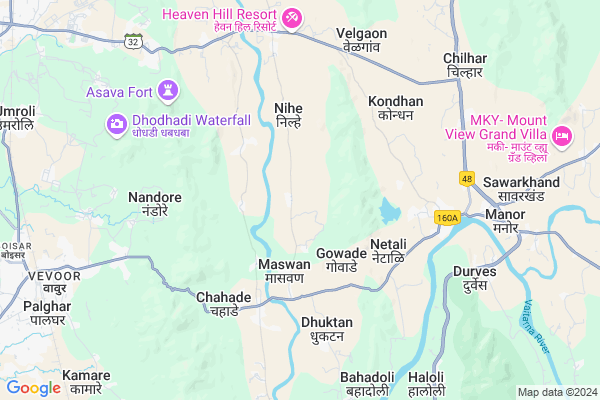
Katale
Katale Map
EDIT Map
Add Your House
 ..
..
Current Corona Virus Infected Patients Count in Thane District
| City Name | District Name | Total Covid cases |
|---|---|---|
| Thane | Thane | 108 |
| Navi Mumbai | Thane | 70 |
| Thane District | Thane | 67 |
| Mira-Bhayandar | Thane | 53 |
| Kalyan-Dombivali | Thane | 50 |
| Thane Rural | Thane | 29 |
| MBMC | Thane | 11 |
| Thane Corp | Thane | 6 |
| KDMC | Thane | 5 |
| Bhiwandi | Thane | 4 |
| Ulhasnagar | Thane | 1 |
| Thane - Vashi | Thane | 1 |
Locality Name :
Katale
( कातले )
Taluka Name : Palghar
District : Thane
State : Maharashtra
Region : Konkan
Division : Konkan
Language : Marathi and Sindhi, Gujarati And Hindi
Current Time 02:24 PM
Date: Monday , Apr 28,2025 (IST)
Time zone: IST (UTC+5:30)
Elevation / Altitude: 19 meters. Above Seal level
Telephone Code / Std Code: 02525
Assembly constituency : Boisar assembly constituency
Assembly MLA : Rajesh Raghunath Patil
Lok Sabha constituency : Palghar parliamentary constituency
Parliament MP : Rajendra Dhedya Gavit
Serpanch Name :
Pin Code : 401404
Post Office Name : Palghar
Commodities Prices : Vasai Market / Mandi
National Highways Reachable To Katale
Nationa High Way :NH160
Nationa High Way :NH48
Nationa High Way :NH160
Nationa High Way :NH48
Rivers Near Katale
Vaitarna River
Surya
Vaitarna River
Surya
About Katale
Correct below Info and add more info about KataleKatale is a Village in Palghar Taluka in Thane District of Maharashtra State, India. It belongs to Konkan region . It belongs to Konkan Division . It is located 62 KM towards North from District head quarters Thane. 7 KM from Palghar. 92 KM from State capital Mumbai
Katale Pin code is 401404 and postal head office is Palghar .
Loware ( 2 KM ) , Girnoli ( 3 KM ) , Nihe ( 3 KM ) , Gowade ( 3 KM ) , Masvan ( 4 KM ) are the nearby Villages to Katale. Katale is surrounded by Dahanu Taluka towards North , Vikramgad Taluka towards East , Wada Taluka towards East , Virar Taluka towards South .
Palghar , Nawapur , Chinchani , Virar are the near by Cities to Katale.
Katale 2011 Census Details
Katale Local Language is Marathi. Katale Village Total population is 1241 and number of houses are 276. Female Population is 48.9%. Village literacy rate is 63.9% and the Female Literacy rate is 27.6%.
Population
| Census Parameter | Census Data |
| Total Population | 1241 |
| Total No of Houses | 276 |
| Female Population % | 48.9 % ( 607) |
| Total Literacy rate % | 63.9 % ( 793) |
| Female Literacy rate | 27.6 % ( 343) |
| Scheduled Tribes Population % | 39.4 % ( 489) |
| Scheduled Caste Population % | 1.0 % ( 13) |
| Working Population % | 42.5 % |
| Child(0 -6) Population by 2011 | 176 |
| Girl Child(0 -6) Population % by 2011 | 49.4 % ( 87) |
Katale Census More Deatils.
Politics in Katale
BJP , BVA , Shivsena , SHS are the major political parties in this area.Polling Stations /Booths near Katale
1)Z. P. Pra. Marathi Shala Savarakhand2)Z. P. Pramari Marathi School Katale Room No. 3
3)Z. P. Prath. Marathi School Bandhan
4)Z. P. Marathi School Room No. 2
5)Z. P. Marathi School Gaudale South Room No.2
HOW TO REACH Katale
By Rail
Palghar Rail Way Station is the very nearby railway stations to Katale. Palghar Rail Way Station (near to Palghar) , Umroli Rail Way Station (near to Palghar) are the Rail way stations reachable from near by towns.By Road
Palghar are the nearby by towns to Katale having road connectivity to KataleColleges near Katale
Adhikari Jr. College Of Arts Com.&sci.
Address : Nagzari . Boisar- Chilhar Road .palghar 401404
Sonopant Dandekar Shikshan Mandali
Address :
Theem College Of Engineering
Address :
H. J. Thim Trust's Theem College Of Engineering
Address :
Schools in Katale
Z.p.school, Moripada
Address : katale , palghar , thane , Maharashtra . PIN- 401404 , Post - Palghar
Z.p.school, Kolhemal
Address : katale , palghar , thane , Maharashtra . PIN- 401404 , Post - Palghar
Z.p. Central School, Katale
Address : katale , palghar , thane , Maharashtra . PIN- 401404 , Post - Palghar
Govt Health Centers near Katale
1) Katale , Sc Katale , Telipada Katale , Samaj Mandir2) Maswan , PHC Maswan , Kokner Khutadpada Road , Near Bording Highschool
3) Kondhan , Sub Center Kondhan , Manor Velgoan Road , Pramiary School near Tamrin tree
Sub Villages in Katale
Schools in Katale,Palghar
Electronic Shops in Katale,Palghar
Super Markets in Katale,Palghar
Local Parks in Katale,Palghar
Police Stations near Katale,Palghar
Governement Offices near Katale,Palghar
About Katale &
History
How to reach Katale
Tourist Places Near By Katale
Schools in Katale
Colleges in Katale
Temperature & weather of Katale
places in Katale
Katale photos
More Information
How to reach Katale
Tourist Places Near By Katale
Schools in Katale
Colleges in Katale
Temperature & weather of Katale
places in Katale
Katale photos
More Information
Village Talk
Post News or Events about this Village
Near Cities
Palghar 12 KM near
Nawapur 21 KM near
Chinchani 25 KM near
Virar 34 KM near
Palghar 12 KM near
Nawapur 21 KM near
Chinchani 25 KM near
Virar 34 KM near
Near By Taluks
Palghar 7 KM near
Dahanu 27 KM near
Vikramgad 27 KM near
Wada 32 KM near
Palghar 7 KM near
Dahanu 27 KM near
Vikramgad 27 KM near
Wada 32 KM near
Near By Air Ports
Chhatrapati Shivaji International Airport 79 KM near
Gandhinagar Airport 115 KM near
Lohegaon Airport 189 KM near
Diu Airport 258 KM near
Chhatrapati Shivaji International Airport 79 KM near
Gandhinagar Airport 115 KM near
Lohegaon Airport 189 KM near
Diu Airport 258 KM near
Near By Tourist Places
Dahanu 33 KM near
Vikramgad 49 KM near
Bordi 50 KM near
Mahuli Fort 54 KM near
Gorai 62 KM near
Dahanu 33 KM near
Vikramgad 49 KM near
Bordi 50 KM near
Mahuli Fort 54 KM near
Gorai 62 KM near
Near By Districts
Thane 60 KM near
Dadra And Nagar Haveli 69 KM near
Diu 85 KM near
Daman 85 KM near
Thane 60 KM near
Dadra And Nagar Haveli 69 KM near
Diu 85 KM near
Daman 85 KM near
Near By RailWay Station
Palghar Rail Way Station 11 KM near
Boisar Rail Way Station 14 KM near
Palghar Rail Way Station 11 KM near
Boisar Rail Way Station 14 KM near