| Home | City Bus | Maps | Villages | Cities | Rail | Tourist Places | School | College | Pin Codes | Corona Cases Count |
| Distance Calculator Bus Services IFSC Codes Trace Mobile Number Weather Search Place Trace IP Available Cash ATM/Banks Locate Polling Booth Report an Error contact People |
Rahatoli
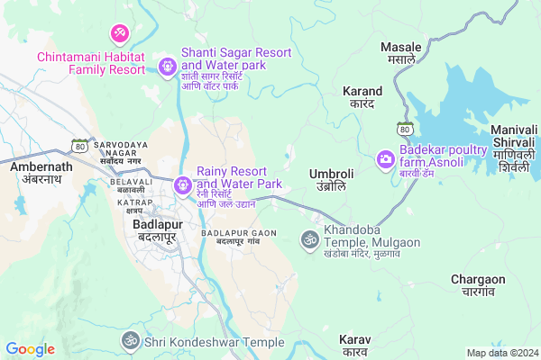
Rahatoli Map
EDIT Map
Add Your House
 ..
..
Current Corona Virus Infected Patients Count in Thane District
| City Name | District Name | Total Covid cases |
|---|---|---|
| Thane | Thane | 108 |
| Navi Mumbai | Thane | 70 |
| Thane District | Thane | 67 |
| Mira-Bhayandar | Thane | 53 |
| Kalyan-Dombivali | Thane | 50 |
| Thane Rural | Thane | 29 |
| MBMC | Thane | 11 |
| Thane Corp | Thane | 6 |
| KDMC | Thane | 5 |
| Bhiwandi | Thane | 4 |
| Ulhasnagar | Thane | 1 |
| Thane - Vashi | Thane | 1 |
Locality Name :
Rahatoli
( राहाटोळी )
City Name : Ambernath
District : Thane
State : Maharashtra
Region : Konkan
Division : Konkan
Language : Marathi and Sindhi, Gujarati And Hindi
Current Time 12:19 PM
Date: Sunday , Apr 27,2025 (IST)
Time zone: IST (UTC+5:30)
Elevation / Altitude: 23 meters. Above Seal level
Telephone Code / Std Code: 0251
Assembly constituency : Murbad assembly constituency
Assembly MLA : Kisan Shankar Kathore
Lok Sabha constituency : Bhiwandi parliamentary constituency
Parliament MP : KAPIL MORESHWAR PATIL
Pin Code : 421503
Post Office Name : Kulgaon
Commodities Prices : Ulhasnagar Market / Mandi
National Highways Reachable To Rahatoli
Nationa High Way :NH48
Nationa High Way :NH160
Nationa High Way :NH48
Nationa High Way :NH160
About Rahatoli
Correct below Info and add more info about RahatoliRahatoli is a Locality in Ambernath City in Maharashtra State, India. It belongs to Konkan region . It is belongs to Konkan Division .
Rahatoli Pin code is 421503 and postal head office is Kulgaon .
Mulgaon , Kanhor , Manjarli , Sai , Dahagaon are the nearby Localities to Rahatoli.
Ambernath , Ulhasnagar , Kalyan , Dombivli are the nearby Cities to Ambernath.
Demographics of Rahatoli
Marathi is the Local Language here.Politics in Rahatoli
Bharatiya Janata Party , BJP , NCP , INC are the major political parties in this area.Polling Stations /Booths near Rahatoli
1)Z.p.school Potgaon Room No.12)Z.p.school Jadai R.no.1
3)Z.p.school Ambele (b R.no.1
4)Z.p.school Dhawalepada R.no.1
5)Z.p.school Chinchawali R.no.1
HOW TO REACH Rahatoli
By Rail
Badlapur Rail Way Station , Vangani Rail Way Station are the very nearby railway station to Rahatoli.By Road
Badlapur , Ambernath , Ulhasnagar , Kalyan are the nearby by towns to Ambernath having road connectivity to Ambernath and RahatoliGovt Health Centers near Rahatoli
1) Ambeshiv , At Ambeshiv , Sonawala ,2) Badlapur , At Badlapur , Badlapur Gaon ,
3) Chon , At Chon , Sonawala ,
Hospitals in Rahatoli,Ambernath
Sai Medical & General Store
Shop No 8000074;Dutt Chowk;; Panvelkar Amrut Vishwa(Badlapur west); Badlapur; Maharashtra 421503; India
3.2 KM distance Detail
Government Hospital Badlapur
; Shivaji Pada; Badlapur Gaon; Badlapur; Maharashtra 421503; India
3.3 KM distance Detail
more ..
Petrol Bunks in Rahatoli,Ambernath
Essar Petrol CNG Station; Kharvai
Neral-Badlapur Rd; Maharashtra Industrial Development Corporation; Badlapur; Maharashtra 421503; India
5.6 KM distance Detail
Shree Ganesh Krupa Petrolieum And Cng Station
Badlapur;; Kharvai; Badlapur; Maharashtra 421503; India
5.8 KM distance Detail
more ..
Colleges in Rahatoli,Ambernath
Baba Marine Institute (BMI)
Ullash nadi brdge; Badlapur Gaon Rd; Badlapur; Maharashtra 421503; India
3.7 KM distance Detail
Airson English School and Govt. Paramedical College
Hendre Pada; Badlapur; Thane; Maharashtra 421503; India
4.1 KM distance Detail
Leelavati Awhad Institute Of Technology M S & R
Kanhor; Badlapur (West); Thane; Maharashtra 421503; India
4.1 KM distance Detail
more ..
Electronic Shops in Rahatoli,Ambernath
VIPOS TECHNOLOGY
F 305 JADE JEWEL ARISTA; SONIVALI; Badlapur west; Maharashtra 421503; India
2.7 KM distance Detail
Binary System
No. 27; Kartik Complex; Near Railway Station; Badlapur; Thane - 421503; India
4.2 KM distance Detail
Grace Care Services
Mahalaxmi Building; Badlapur Kulgaiv Road; Badlapur; Thane - 421503; India
4.2 KM distance Detail
Super Markets in Rahatoli,Ambernath
Nagrik Masala
Kanhor Village Road; Badlapur Gaon; Badlapur; Maharashtra 421503; India
3.5 KM distance Detail
Shreesiddhivinayak Departmental Stores
Rameshwadi; Badlapur; Maharashtra 421503; India
4.4 KM distance Detail
Police Stations near Rahatoli,Ambernath
Badlapur Police Station (West)
348/1; Badlapur Gaon Rd; Badlapur Gaon; Badlapur; Maharashtra 421503; India
3.4 KM distance Detail
Barrage Road Police Station
Barrage Rd; Rameshwadi; Badlapur; Maharashtra 421503; India
4.7 KM distance Detail
Governement Offices near Rahatoli,Ambernath
Maa Santoshi Co-operative Housing Society
Church Road; Mohan Tulsi Vihar; Hendre Pada; Badlapur; Maharashtra 421503; India
4.0 KM distance Detail
About Rahatoli &
History
How to reach Rahatoli
Tourist Places Near By Rahatoli
Schools in Rahatoli
Colleges in Rahatoli
Temperature & weather of Rahatoli
places in Rahatoli
Rahatoli photos
More Information
How to reach Rahatoli
Tourist Places Near By Rahatoli
Schools in Rahatoli
Colleges in Rahatoli
Temperature & weather of Rahatoli
places in Rahatoli
Rahatoli photos
More Information
Locality Talk
Post News or Events about this Locality
Near Cities
Ambernath 12 KM near
Ulhasnagar 16 KM near
Kalyan 20 KM near
Dombivli 23 KM near
Ambernath 12 KM near
Ulhasnagar 16 KM near
Kalyan 20 KM near
Dombivli 23 KM near
Near By Taluks
Ambernath 6 KM near
Ulhasnagar 14 KM near
Kalyan 17 KM near
Dombivli 22 KM near
Ambernath 6 KM near
Ulhasnagar 14 KM near
Kalyan 17 KM near
Dombivli 22 KM near
Near By Air Ports
Chhatrapati Shivaji International Airport 48 KM near
Lohegaon Airport 106 KM near
Gandhinagar Airport 116 KM near
Chikkalthana Airport 262 KM near
Chhatrapati Shivaji International Airport 48 KM near
Lohegaon Airport 106 KM near
Gandhinagar Airport 116 KM near
Chikkalthana Airport 262 KM near
Near By Tourist Places
Matheran 24 KM near
Bhimashankar 32 KM near
Karjat 34 KM near
Navi-Mumbai 36 KM near
Mahuli Fort 37 KM near
Matheran 24 KM near
Bhimashankar 32 KM near
Karjat 34 KM near
Navi-Mumbai 36 KM near
Mahuli Fort 37 KM near
Near By Districts
Thane 43 KM near
Mumbai 59 KM near
Raigad 81 KM near
Pune 106 KM near
Thane 43 KM near
Mumbai 59 KM near
Raigad 81 KM near
Pune 106 KM near
Near By RailWay Station
Badlapur Rail Way Station 5.3 KM near
Kalyan Junction Rail Way Station 18 KM near
Bhiwandi Road Rail Way Station 29 KM near
Badlapur Rail Way Station 5.3 KM near
Kalyan Junction Rail Way Station 18 KM near
Bhiwandi Road Rail Way Station 29 KM near