| Home | City Bus | Maps | Villages | Cities | Rail | Tourist Places | School | College | Pin Codes | Corona Cases Count |
| Distance Calculator Bus Services IFSC Codes Trace Mobile Number Weather Search Place Trace IP Available Cash ATM/Banks Locate Polling Booth Report an Error contact People |
Kewli
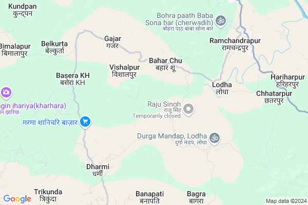
Kewli Map
EDIT Map
Add Your House
 ..
..
Current Corona Virus Infected Patients Count in Surguja District
| City Name | District Name | Total Covid cases |
|---|
Locality Name :
Kewli
( केवली )
Tehsil Name : Ramchandrapur
District : Surguja
State : Chattisgarh
Language : Chhattisgarhi and Hindi, Bharia
Current Time 12:40 PM
Date: Sunday , Apr 27,2025 (IST)
Time zone: IST (UTC+5:30)
Elevation / Altitude: 533 meters. Above Seal level
Telephone Code / Std Code: 07779
Assembly constituency : Ramanujganj assembly constituency
Assembly MLA : Ram Vichar Netam
Lok Sabha constituency : Surguja parliamentary constituency
Parliament MP : Renuka Singh Saruta
Serpanch Name :
Commodities Prices : Ramanujganj Market / Mandi
Rivers Near Kewli
Rihand
Danru
Rihand
Danru
About Kewli
Correct below Info and add more info about KewliKewli is a Village in Ramchandrapur Tehsil in Surguja District of Chattisgarh State, India. It is located 102 KM towards North from District head quarters Ambikapur. 406 KM from State capital Raipur
Kewli is surrounded by Chinia Tehsil towards East , Ranka Tehsil towards East , Wadrafnagar Tehsil towards west , Dandai Tehsil towards North .
Garhwa , Renukoot , Daltonganj , Kota are the near by Cities to Kewli.
This Place is in the border of the Surguja District and Garhwa District. Garhwa District Chinia is East towards this place . It is near to the Jharkhand State Border.
Kewali 2011 Census Details
Kewli Local Language is Chhattisgarhi. Kewali Village Total population is 823 and number of houses are 178. Female Population is 48.0%. Village literacy rate is 60.6% and the Female Literacy rate is 23.2%.
Population
| Census Parameter | Census Data |
| Total Population | 823 |
| Total No of Houses | 178 |
| Female Population % | 48.0 % ( 395) |
| Total Literacy rate % | 60.6 % ( 499) |
| Female Literacy rate | 23.2 % ( 191) |
| Scheduled Tribes Population % | 63.7 % ( 524) |
| Scheduled Caste Population % | 0.0 % ( 0) |
| Working Population % | 27.2 % |
| Child(0 -6) Population by 2011 | 108 |
| Girl Child(0 -6) Population % by 2011 | 48.1 % ( 52) |
Kewali Census More Deatils.
Politics in Kewli
Bharatiya Janata Party , BJP , INC are the major political parties in this area.Polling Stations /Booths near Kewli
1)Lurgi2)Vimlapur
3)Dhanwarkala-3
4)Bagra
5)Annadpur
HOW TO REACH Kewli
By Rail
There is no railway station near to Kewli in less than 10 km.Pincodes near Kewli
497220 ( Ramanujganj ) , 497225 ( Wadrafnagar ) , 497119 ( Balrampur )Colleges near Kewli
Gorment Up Collage Ramchandrapur
Address : Village+post Ramchandrapur
Gorment Iti Ramchandrapur
Address : Village+post+ps+tehsil Ramchandrapur
Schools near Kewli
M.s. Chhattarpur
Address : chhatarpur , ramchandrapur , surguja , Chattisgarh . PIN- 497220 , Post - Ramanujganj
M.s. Bhawarmal (model)
Address : bhavarmal , ramchandrapur , surguja , Chattisgarh . PIN- 497220 , Post - Ramanujganj
M.s. Dugru
Address : sundarpur , ramchandrapur , surguja , Chattisgarh . PIN- 497220 , Post - Ramanujganj
M.s. Dhoratola
Address : bhitiyahi , ramchandrapur , surguja , Chattisgarh . PIN- 497220 , Post - Ramanujganj
Govt Health Centers near Kewli
1) SHC Baharchura , , VILLAGE-BAHARCHURA ,2) SHC Dindo , , VILLAGE-DINDO ,
3) SHC Lodha , , VILLAGE-LODHA ,
Schools in Kewli,Ramchandrapur
KINDER GARTEN PUBLIC SCHOOL- NAWADIH
Balbhadra Nagar; Chhattisgarh 497220; India
9.4 KM distance Detail
Government High School; Trikunda
Balbhadra Nagar; Chhattisgarh 497220; India
10.3 KM distance Detail
Government Middle School
Banapati; Chumra; Surguja; SH-3; Ramanuganj; Ramanuganj; Chhattisgarh 497220; India
10.5 KM distance Detail
Badra Boys School
Badra; Chumra; Surguja; SH-3; Ramanuganj; Ramanuganj; Chhattisgarh 497220; India
10.8 KM distance Detail
Police Stations near Kewli,Ramchandrapur
About Kewli &
History
How to reach Kewli
Tourist Places Near By Kewli
Schools in Kewli
Colleges in Kewli
Temperature & weather of Kewli
places in Kewli
Kewli photos
More Information
How to reach Kewli
Tourist Places Near By Kewli
Schools in Kewli
Colleges in Kewli
Temperature & weather of Kewli
places in Kewli
Kewli photos
More Information
Village Talk
Post News or Events about this Village
Near Cities
Garhwa 54 KM near
Renukoot 60 KM near
Daltonganj 76 KM near
Kota 78 KM near
Garhwa 54 KM near
Renukoot 60 KM near
Daltonganj 76 KM near
Kota 78 KM near
Near By Taluks
Ramchandrapur 0 KM near
Chinia 24 KM near
Ranka 32 KM near
Wadrafnagar 33 KM near
Ramchandrapur 0 KM near
Chinia 24 KM near
Ranka 32 KM near
Wadrafnagar 33 KM near
Near By Air Ports
Gaya Airport 201 KM near
Varanasi Airport 205 KM near
Ranchi Airport 226 KM near
Bamrauli Airport 272 KM near
Gaya Airport 201 KM near
Varanasi Airport 205 KM near
Ranchi Airport 226 KM near
Bamrauli Airport 272 KM near
Near By Tourist Places
Sarguja 73 KM near
Betla National Park 88 KM near
Palamu 97 KM near
Ambikapur 100 KM near
Rohtasgarh Fort 105 KM near
Sarguja 73 KM near
Betla National Park 88 KM near
Palamu 97 KM near
Ambikapur 100 KM near
Rohtasgarh Fort 105 KM near
Near By Districts
Garhwa 54 KM near
Palamu 73 KM near
Singrauli 94 KM near
Surguja 98 KM near
Garhwa 54 KM near
Palamu 73 KM near
Singrauli 94 KM near
Surguja 98 KM near
Near By RailWay Station
Duddhinagar Rail Way Station 46 KM near
Wyndhamganj Rail Way Station 46 KM near
Duddhinagar Rail Way Station 46 KM near
Wyndhamganj Rail Way Station 46 KM near