| Home | City Bus | Maps | Villages | Cities | Rail | Tourist Places | School | College | Pin Codes | Corona Cases Count |
| Distance Calculator Bus Services IFSC Codes Trace Mobile Number Weather Search Place Trace IP Available Cash ATM/Banks Locate Polling Booth Report an Error contact People |
Chera
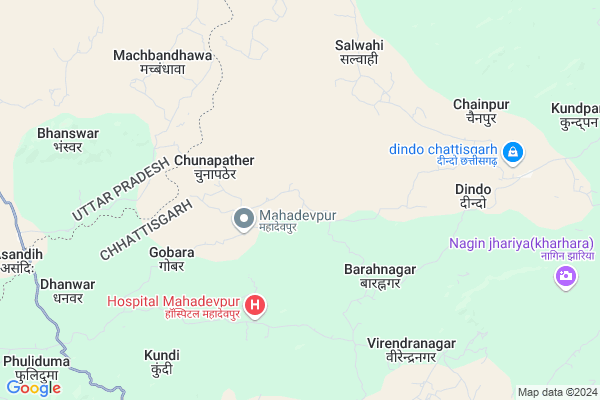
Chera Map
EDIT Map
Add Your House
 ..
..
Current Corona Virus Infected Patients Count in Surguja District
| City Name | District Name | Total Covid cases |
|---|
Locality Name :
Chera
( चेरा )
Tehsil Name : Ramchandrapur
District : Surguja
State : Chattisgarh
Language : Chhattisgarhi and Hindi, Bharia
Current Time 08:28 AM
Date: Wednesday , Apr 30,2025 (IST)
Time zone: IST (UTC+5:30)
Elevation / Altitude: 533 meters. Above Seal level
Telephone Code / Std Code: 07779
Assembly constituency : Ramanujganj assembly constituency
Assembly MLA : Ram Vichar Netam
Lok Sabha constituency : Surguja parliamentary constituency
Parliament MP : Renuka Singh Saruta
Serpanch Name :
Pin Code : 497220
Post Office Name : Ramanujganj
Commodities Prices : Dudhi Market / Mandi
Rivers Near Chera
Rihand
Danru
Rihand
Danru
About Chera
Correct below Info and add more info about CheraChera is a Village in Ramchandrapur Tehsil in Surguja District of Chattisgarh State, India. It is located 102 KM towards North from District head quarters Ambikapur. 22 KM from Ramchadrapur. 398 KM from State capital Raipur
Chera Pin code is 497220 and postal head office is Ramanujganj .
Mahadevpur ( 4 KM ) , Kurludih ( 4 KM ) , Dumarpan ( 4 KM ) , Dindo ( 6 KM ) , Virendranagar ( 7 KM ) are the nearby Villages to Chera. Chera is surrounded by Wadrafnagar Tehsil towards South , Ramchandrapur Tehsil towards East , Myorpur Tehsil towards west , Dudhi Tehsil towards North .
Renukoot , Kota , Obra , Garhwa are the near by Cities to Chera.
This Place is in the border of the Surguja District and Garhwa District. Garhwa District Chinia is East towards this place . It is near to the Jharkhand State Border.
Chera 2011 Census Details
Chera Local Language is Chhattisgarhi. Chera Village Total population is 1494 and number of houses are 355. Female Population is 49.6%. Village literacy rate is 59.3% and the Female Literacy rate is 23.2%.
Population
| Census Parameter | Census Data |
| Total Population | 1494 |
| Total No of Houses | 355 |
| Female Population % | 49.6 % ( 741) |
| Total Literacy rate % | 59.3 % ( 886) |
| Female Literacy rate | 23.2 % ( 347) |
| Scheduled Tribes Population % | 37.1 % ( 554) |
| Scheduled Caste Population % | 5.2 % ( 77) |
| Working Population % | 42.4 % |
| Child(0 -6) Population by 2011 | 267 |
| Girl Child(0 -6) Population % by 2011 | 50.6 % ( 135) |
Chera Census More Deatils.
Politics in Chera
Bharatiya Janata Party , BJP , INC are the major political parties in this area.Polling Stations /Booths near Chera
1)Chargarh2)Sagarpur
3)Lurgikhurd
4)Dumrkhola
5)Mahadevpur
HOW TO REACH Chera
By Rail
There is no railway station near to Chera in less than 10 km.Colleges near Chera
Gorment Up Collage Ramchandrapur
Address : Village+post Ramchandrapur
Gorment Iti Ramchandrapur
Address : Village+post+ps+tehsil Ramchandrapur
Schools in Chera
M.s. Chera
Address : chera , ramchandrapur , surguja , Chattisgarh . PIN- 497220 , Post - Ramanujganj
M.s. Varunpara
Address : chera , ramchandrapur , surguja , Chattisgarh . PIN- 497220 , Post - Ramanujganj
Govt Health Centers near Chera
1) SHC Dumerpan , , VILLAGE-DINDO ,2) PHC Dindo , , VILLAGE-DINDO ,
3) SHC Salwahi , , VILLAGE-SALWAHI ,
Petrol Bunks in Chera,Ramchandrapur
VIJAY SHREE FILLING STATION
BABHANI;DUDHI;DST SONEBHAD; SONBHADRA; Uttar Pradesh 231208; India
20.6 KM distance Detail
HP PETROL PUMP - HAMARA PUMP MAHAVIR PRASAD FUELS
Village-babhani;thana-babhani Tehsil-duddhi ON Babhani-ashandeeh Road; Varanasi; Uttar Pradesh 231208; India
21.1 KM distance Detail
more ..
About Chera &
History
How to reach Chera
Tourist Places Near By Chera
Schools in Chera
Colleges in Chera
Temperature & weather of Chera
places in Chera
Chera photos
More Information
How to reach Chera
Tourist Places Near By Chera
Schools in Chera
Colleges in Chera
Temperature & weather of Chera
places in Chera
Chera photos
More Information
Village Talk
Post News or Events about this Village
Near Cities
Renukoot 42 KM near
Kota 67 KM near
Obra 69 KM near
Garhwa 70 KM near
Renukoot 42 KM near
Kota 67 KM near
Obra 69 KM near
Garhwa 70 KM near
Near By Taluks
Babhani 15 KM near
Wadrafnagar 17 KM near
Ramchandrapur 22 KM near
Myorpur 34 KM near
Babhani 15 KM near
Wadrafnagar 17 KM near
Ramchandrapur 22 KM near
Myorpur 34 KM near
Near By Air Ports
Varanasi Airport 195 KM near
Gaya Airport 218 KM near
Ranchi Airport 248 KM near
Bamrauli Airport 255 KM near
Varanasi Airport 195 KM near
Gaya Airport 218 KM near
Ranchi Airport 248 KM near
Bamrauli Airport 255 KM near
Near By Tourist Places
Sarguja 72 KM near
Ambikapur 100 KM near
Betla National Park 110 KM near
Rohtasgarh Fort 115 KM near
Baikunthpur 115 KM near
Sarguja 72 KM near
Ambikapur 100 KM near
Betla National Park 110 KM near
Rohtasgarh Fort 115 KM near
Baikunthpur 115 KM near
Near By Districts
Garhwa 70 KM near
Singrauli 72 KM near
Palamu 93 KM near
Sonbhadra 97 KM near
Garhwa 70 KM near
Singrauli 72 KM near
Palamu 93 KM near
Sonbhadra 97 KM near
Near By RailWay Station
Duddhinagar Rail Way Station 35 KM near
Renukut Rail Way Station 42 KM near
Duddhinagar Rail Way Station 35 KM near
Renukut Rail Way Station 42 KM near