| Home | City Bus | Maps | Villages | Cities | Rail | Tourist Places | School | College | Pin Codes | Corona Cases Count |
| Distance Calculator Bus Services IFSC Codes Trace Mobile Number Weather Search Place Trace IP Available Cash ATM/Banks Locate Polling Booth Report an Error contact People |
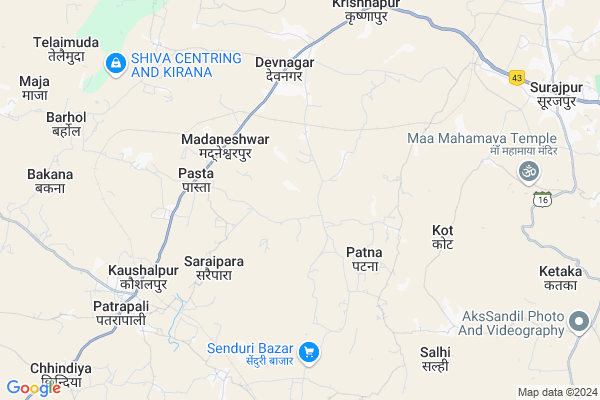
Pasta
Pasta Map
EDIT Map
Add Your House
 ..
..
Current Corona Virus Infected Patients Count in Surguja District
| City Name | District Name | Total Covid cases |
|---|
Locality Name :
Pasta
( पास्ता )
Tehsil Name : Ramanujnagar
District : Surguja
State : Chattisgarh
Language : Chhattisgarhi and Hindi, Bharia
Current Time 10:47 AM
Date: Tuesday , Apr 29,2025 (IST)
Time zone: IST (UTC+5:30)
Elevation / Altitude: 563 meters. Above Seal level
Telephone Code / Std Code: 07849
Assembly constituency : Premnagar assembly constituency
Assembly MLA : Bhulan Singh Marabi
Lok Sabha constituency : Surguja parliamentary constituency
Parliament MP : Renuka Singh Saruta
Serpanch Name :
Pin Code : 497333
Post Office Name : Ramanujnagar
Commodities Prices : Surajpur Market / Mandi
Pasta Live Weather
Temperature: 33.2 °C
clear sky
Humidity: 28%
Wind : 5.93 mt/sec towards SW
StationName : "Baikunthpur"
observed on 31 Mins Back
Temperature: 33.2 °C
clear sky
Humidity: 28%
Wind : 5.93 mt/sec towards SW
StationName : "Baikunthpur"
observed on 31 Mins Back
Pasta Weather Forecast for Next 5 days
30-04-2025
21.8°C to 35.2°C
clear sky, scattered clouds, overcast clouds, broken clouds
21.8°C to 35.2°C
clear sky, scattered clouds, overcast clouds, broken clouds
01-05-2025
21.0°C to 38.3°C
few clouds, clear sky, light rain
21.0°C to 38.3°C
few clouds, clear sky, light rain
02-05-2025
21.3°C to 38.5°C
clear sky, scattered clouds, broken clouds
21.3°C to 38.5°C
clear sky, scattered clouds, broken clouds
03-05-2025
21.0°C to 38.7°C
clear sky, few clouds, moderate rain, overcast clouds, broken clouds
21.0°C to 38.7°C
clear sky, few clouds, moderate rain, overcast clouds, broken clouds
04-05-2025
21.6°C to 38.6°C
clear sky, moderate rain, broken clouds, scattered clouds, light rain
21.6°C to 38.6°C
clear sky, moderate rain, broken clouds, scattered clouds, light rain
National Highways Reachable To Pasta
Nationa High Way :NH343
Nationa High Way :NH343
Rivers Near Pasta
Jhink
Gara Silii
Jhink
Gara Silii
About Pasta
Correct below Info and add more info about PastaPasta is a Village in Ramanujnagar Tehsil in Surguja District of Chattisgarh State, India. It is located 51 KM towards west from District head quarters Ambikapur. 7 KM from Ramanujnagar. 286 KM from State capital Raipur
Pasta Pin code is 497333 and postal head office is Ramanujnagar .
Gopipur ( 3 KM ) , Patna ( 3 KM ) , Chandarpur ( 3 KM ) , Kailaspur ( 4 KM ) , Saraipara ( 4 KM ) are the nearby Villages to Pasta. Pasta is surrounded by Surajpur Tehsil towards East , Bhaiyathan Tehsil towards North , Premnagar Tehsil towards South , Baikunthpur Tehsil towards west .
Ambikapur , Chirmiri , Kotma , Pasan are the near by Cities to Pasta.
Pasta 2011 Census Details
Pasta Local Language is Chhattisgarhi. Pasta Village Total population is 2517 and number of houses are 558. Female Population is 49.6%. Village literacy rate is 47.0% and the Female Literacy rate is 18.4%.
Population
| Census Parameter | Census Data |
| Total Population | 2517 |
| Total No of Houses | 558 |
| Female Population % | 49.6 % ( 1248) |
| Total Literacy rate % | 47.0 % ( 1183) |
| Female Literacy rate | 18.4 % ( 463) |
| Scheduled Tribes Population % | 33.7 % ( 847) |
| Scheduled Caste Population % | 4.5 % ( 114) |
| Working Population % | 62.0 % |
| Child(0 -6) Population by 2011 | 410 |
| Girl Child(0 -6) Population % by 2011 | 45.6 % ( 187) |
Pasta Census More Deatils.
Politics in Pasta
Bharatiya Janata Party , BJP , INC are the major political parties in this area.Polling Stations /Booths near Pasta
1)Sagarpur2)Chandarpur
3)Pasta- 1
4)Patna- 1
5)Jaipur
HOW TO REACH Pasta
By Rail
There is no railway station near to Pasta in less than 10 km.Colleges near Pasta
Shri Sai Baba Aadarsh Mahavidyalaya,ambikapur
Address :
Govt. College Silphili
Address :
K.d Collage Pratapur
Address :
Government Iti
Address :
Gorment Up Collage Ramchandrapur
Address : Village+post Ramchandrapur
Schools in Pasta
M.s. A.v.s.a. Pasta
Address : pasta , ramanujnagar , surguja , Chattisgarh . PIN- 497333 , Post - Ramanujnagar
Ms Pasta
Address : pasta , ramanujnagar , surguja , Chattisgarh . PIN- 497333 , Post - Ramanujnagar
Govt Health Centers near Pasta
1) SHC Pasta , SHC Pasta , Pasta ,2) SHC Vishunpur , SHC Vishunpur , Vishunpur ,
3) SHC Narayanpur , SHC Narayanpur , Narayanpur ,
Hospitals in Pasta,Ramanujnagar
Govt Sub Health Centre Madneswarpur
Madneshwarpur; Chhattisgarh 497333; India
7.5 KM distance Detail
more ..
Petrol Bunks in Pasta,Ramanujnagar
Bharat Petroleum
Korea; NH-78; Ambikapur Highway; Surajpur; Surajpur; Chhattisgarh 497331; India
10.0 KM distance Detail
Indian Oil Petrol Pump
Wakeel Colony; Korea; NH-78; Ambikapur Highway; Surajpur; Surajpur; Chhattisgarh 497229; India
11.3 KM distance Detail
more ..
Schools in Pasta,Ramanujnagar
Vijay Raj Public High School Bhuneshwar Pur
Bhuwneshwarpur; Chhattisgarh 497333; India
4.8 KM distance Detail
government high secondary school deonagar
Deonagar Alias Dedri; Chhattisgarh 497229; India
5.7 KM distance Detail
Electronic Shops in Pasta,Ramanujnagar
Pandey Electronics Deonagar
; 497333; Deonagar Alias Dedri; Chhattisgarh; India
5.9 KM distance Detail
Local Parks in Pasta,Ramanujnagar
Shiv Park (Surajpur)
Gayatri Mandir Road; Surajpur; Chhattisgarh 497229; India
13.2 KM distance Detail
About Pasta &
History
How to reach Pasta
Tourist Places Near By Pasta
Schools in Pasta
Colleges in Pasta
Temperature & weather of Pasta
places in Pasta
Pasta photos
More Information
How to reach Pasta
Tourist Places Near By Pasta
Schools in Pasta
Colleges in Pasta
Temperature & weather of Pasta
places in Pasta
Pasta photos
More Information
Village Talk
Post News or Events about this Village
Near Cities
Ambikapur 48 KM near
Chirmiri 49 KM near
Kotma 91 KM near
Pasan 94 KM near
Ambikapur 48 KM near
Chirmiri 49 KM near
Kotma 91 KM near
Pasan 94 KM near
Near By Taluks
Ramanujnagar 7 KM near
Surajpur 21 KM near
Bhaiyathan 22 KM near
Premnagar 24 KM near
Ramanujnagar 7 KM near
Surajpur 21 KM near
Bhaiyathan 22 KM near
Premnagar 24 KM near
Near By Air Ports
Raipur Airport 275 KM near
Varanasi Airport 282 KM near
Ranchi Airport 291 KM near
Bamrauli Airport 305 KM near
Raipur Airport 275 KM near
Varanasi Airport 282 KM near
Ranchi Airport 291 KM near
Bamrauli Airport 305 KM near
Near By Tourist Places
Baikunthpur 27 KM near
Ambikapur 48 KM near
Sarguja 51 KM near
Korba 103 KM near
Amarkantak 132 KM near
Baikunthpur 27 KM near
Ambikapur 48 KM near
Sarguja 51 KM near
Korba 103 KM near
Amarkantak 132 KM near
Near By Districts
Korea 27 KM near
Surguja 48 KM near
Korba 104 KM near
Anuppur 124 KM near
Korea 27 KM near
Surguja 48 KM near
Korba 104 KM near
Anuppur 124 KM near
Near By RailWay Station
Jaithari Rail Way Station 107 KM near
Pendra Road Rail Way Station 113 KM near
Jaithari Rail Way Station 107 KM near
Pendra Road Rail Way Station 113 KM near