| Home | City Bus | Maps | Villages | Cities | Rail | Tourist Places | School | College | Pin Codes | Corona Cases Count |
| Distance Calculator Bus Services IFSC Codes Trace Mobile Number Weather Search Place Trace IP Available Cash ATM/Banks Locate Polling Booth Report an Error contact People |
Raghunathpur
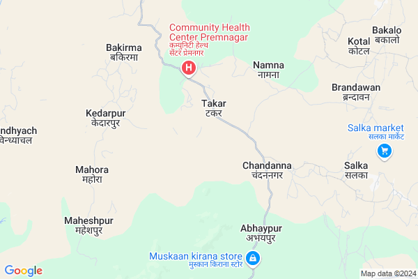
Raghunathpur Map
EDIT Map
Add Your House
 ..
..
Current Corona Virus Infected Patients Count in Surguja District
| City Name | District Name | Total Covid cases |
|---|
Locality Name :
Raghunathpur
( रघुनाथपुर )
Tehsil Name : Premnagar
District : Surguja
State : Chattisgarh
Language : Chhattisgarhi and Hindi, Bharia
Current Time 11:10 AM
Date: Tuesday , Apr 29,2025 (IST)
Time zone: IST (UTC+5:30)
Elevation / Altitude: 210 meters. Above Seal level
Telephone Code / Std Code: 07776
Assembly constituency : Premnagar assembly constituency
Assembly MLA : Bhulan Singh Marabi
Lok Sabha constituency : Surguja parliamentary constituency
Parliament MP : Renuka Singh Saruta
Serpanch Name :
Pin Code : 497333
Post Office Name : Ramanujnagar
Commodities Prices : Udaypur Market / Mandi
National Highways Reachable To Raghunathpur
Nationa High Way :NH343
Nationa High Way :NH343
Rivers Near Raghunathpur
Manasi
Jhink
Manasi
Jhink
About Raghunathpur
Correct below Info and add more info about RaghunathpurRaghunathpur is a Village in Premnagar Tehsil in Surguja District of Chattisgarh State, India. It is located 64 KM towards west from District head quarters Ambikapur. 8 KM from Premnagar. 254 KM from State capital Raipur
Raghunathpur Pin code is 497333 and postal head office is Ramanujnagar .
Premnagar ( 3 KM ) , Namna ( 5 KM ) , Kantaroli ( 8 KM ) , Bakalo ( 8 KM ) , Kedarpur ( 8 KM ) are the nearby Villages to Raghunathpur. Raghunathpur is surrounded by Udaipur Tehsil towards East , Ramanujnagar Tehsil towards North , Khadgawana Tehsil towards west , Podi Uparoda Tehsil towards South .
Chirmiri , Ambikapur , Korba , Dipka are the near by Cities to Raghunathpur.
Raghunathpur 2011 Census Details
Raghunathpur Local Language is Chhattisgarhi. Raghunathpur Village Total population is 1708 and number of houses are 392. Female Population is 49.6%. Village literacy rate is 45.1% and the Female Literacy rate is 18.3%.
Population
| Census Parameter | Census Data |
| Total Population | 1708 |
| Total No of Houses | 392 |
| Female Population % | 49.6 % ( 847) |
| Total Literacy rate % | 45.1 % ( 770) |
| Female Literacy rate | 18.3 % ( 312) |
| Scheduled Tribes Population % | 35.6 % ( 608) |
| Scheduled Caste Population % | 6.3 % ( 107) |
| Working Population % | 54.9 % |
| Child(0 -6) Population by 2011 | 265 |
| Girl Child(0 -6) Population % by 2011 | 49.1 % ( 130) |
Raghunathpur Census More Deatils.
Politics in Raghunathpur
Bharatiya Janata Party , BJP , INC are the major political parties in this area.Polling Stations /Booths near Raghunathpur
1)Kotal2)Umeshvarpur- 2
3)Anantpur
4)Premnagar- 2
5)Beltikari
HOW TO REACH Raghunathpur
By Rail
There is no railway station near to Raghunathpur in less than 10 km.Colleges near Raghunathpur
Shri Sai Baba Aadarsh Mahavidyalaya,ambikapur
Address :
Govt. College Silphili
Address :
K.d Collage Pratapur
Address :
Government Iti
Address :
Gorment Up Collage Ramchandrapur
Address : Village+post Ramchandrapur
Schools in Raghunathpur
M.s. Raghunath Pur
Address : raghunathpur , premnagar , surguja , Chattisgarh . PIN- 497333 , Post - Ramanujnagar
Govt Health Centers near Raghunathpur
1) SHC Raghunathpur , SHC Raghunathpur , Tara , Premnagar2) CHC Premnagar , CHC-Premnagar , premnagar , prermnagar
3) SHC Premnagar , SHC Premnagar , Premnagar , Premnagar
Hospitals in Raghunathpur,Premnagar
CHC Hospital; Premnagar; Distt- Surajpur (CG)
Premnagar; Chhattisgarh 497333; India
3.8 KM distance Detail
more ..
Schools in Raghunathpur,Premnagar
ANUGRAH VIDYA NIKETAN
Korba - Banki Mongra Road; Prem Nagar; Chhattisgarh 497333; India
2.4 KM distance Detail
Electronic Shops in Raghunathpur,Premnagar
Mukesh Telecom Raghunathpur
Premnagar; Baikunthpur; road; Raghunathpur; Chhattisgarh; India
2.3 KM distance Detail
Police Stations near Raghunathpur,Premnagar
Governement Offices near Raghunathpur,Premnagar
About Raghunathpur &
History
How to reach Raghunathpur
Tourist Places Near By Raghunathpur
Schools in Raghunathpur
Colleges in Raghunathpur
Temperature & weather of Raghunathpur
places in Raghunathpur
Raghunathpur photos
More Information
How to reach Raghunathpur
Tourist Places Near By Raghunathpur
Schools in Raghunathpur
Colleges in Raghunathpur
Temperature & weather of Raghunathpur
places in Raghunathpur
Raghunathpur photos
More Information
Village Talk
Post News or Events about this Village
Near Cities
Chirmiri 51 KM near
Ambikapur 61 KM near
Korba 74 KM near
Dipka 75 KM near
Chirmiri 51 KM near
Ambikapur 61 KM near
Korba 74 KM near
Dipka 75 KM near
Near By Taluks
Premnagar 7 KM near
Udaipur 25 KM near
Ramanujnagar 25 KM near
Khadgawana 34 KM near
Premnagar 7 KM near
Udaipur 25 KM near
Ramanujnagar 25 KM near
Khadgawana 34 KM near
Near By Air Ports
Raipur Airport 245 KM near
Ranchi Airport 304 KM near
Varanasi Airport 313 KM near
Jabalpur Airport 320 KM near
Raipur Airport 245 KM near
Ranchi Airport 304 KM near
Varanasi Airport 313 KM near
Jabalpur Airport 320 KM near
Near By Tourist Places
Baikunthpur 42 KM near
Ambikapur 61 KM near
Korba 73 KM near
Sarguja 75 KM near
Janjgir-Champa 102 KM near
Baikunthpur 42 KM near
Ambikapur 61 KM near
Korba 73 KM near
Sarguja 75 KM near
Janjgir-Champa 102 KM near
Near By Districts
Korea 43 KM near
Surguja 62 KM near
Korba 73 KM near
Anuppur 117 KM near
Korea 43 KM near
Surguja 62 KM near
Korba 73 KM near
Anuppur 117 KM near
Near By RailWay Station
Pendra Road Rail Way Station 94 KM near
Jaithari Rail Way Station 95 KM near
Pendra Road Rail Way Station 94 KM near
Jaithari Rail Way Station 95 KM near