| Home | City Bus | Maps | Villages | Cities | Rail | Tourist Places | School | College | Pin Codes | Corona Cases Count |
| Distance Calculator Bus Services IFSC Codes Trace Mobile Number Weather Search Place Trace IP Available Cash ATM/Banks Locate Polling Booth Report an Error contact People |
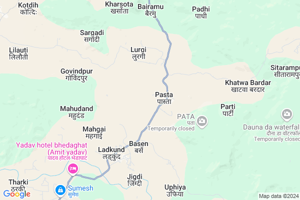
Pasta
Pasta Map
EDIT Map
Add Your House
 ..
..
Current Corona Virus Infected Patients Count in Surguja District
| City Name | District Name | Total Covid cases |
|---|
Locality Name :
Pasta
( पास्ता )
Tehsil Name : Balrampur
District : Surguja
State : Chattisgarh
Language : Chhattisgarhi and Hindi, Bharia
Current Time 11:02 AM
Date: Tuesday , Apr 29,2025 (IST)
Time zone: IST (UTC+5:30)
Elevation / Altitude: 619 meters. Above Seal level
Telephone Code / Std Code: 07831
Assembly constituency : Ramanujganj assembly constituency
Assembly MLA : Ram Vichar Netam
Lok Sabha constituency : Surguja parliamentary constituency
Parliament MP : Renuka Singh Saruta
Serpanch Name :
Pin Code : 497118
Post Office Name : Rajpur (SIJ)
Commodities Prices : Kakni Market / Mandi
Rivers Near Pasta
Kohbarwa Nala
Burha
Kohbarwa Nala
Burha
About Pasta
Correct below Info and add more info about PastaPasta is a Village in Balrampur Tehsil in Surguja District of Chattisgarh State, India. It is located 57 KM towards North from District head quarters Ambikapur. 23 KM from Balrampur. 365 KM from State capital Raipur
Pasta Pin code is 497118 and postal head office is Rajpur (SIJ) .
Parti ( 6 KM ) , Jigdi ( 7 KM ) , Karra ( 12 KM ) , Jhalariya ( 12 KM ) , Lilauti ( 14 KM ) are the nearby Villages to Pasta. Pasta is surrounded by Balrampur Tehsil towards North , Rajpur Tehsil towards west , Pratappur Tehsil towards west , Lundra Tehsil towards South .
Ambikapur , Garhwa , Jashpurnagar , Daltonganj are the near by Cities to Pasta.
Pasta 2011 Census Details
Pasta Local Language is Chhattisgarhi. Pasta Village Total population is 1807 and number of houses are 372. Female Population is 47.5%. Village literacy rate is 50.3% and the Female Literacy rate is 19.6%.
Population
| Census Parameter | Census Data |
| Total Population | 1807 |
| Total No of Houses | 372 |
| Female Population % | 47.5 % ( 859) |
| Total Literacy rate % | 50.3 % ( 909) |
| Female Literacy rate | 19.6 % ( 355) |
| Scheduled Tribes Population % | 68.5 % ( 1238) |
| Scheduled Caste Population % | 2.7 % ( 49) |
| Working Population % | 36.2 % |
| Child(0 -6) Population by 2011 | 286 |
| Girl Child(0 -6) Population % by 2011 | 54.9 % ( 157) |
Pasta Census More Deatils.
Politics in Pasta
Bharatiya Janata Party , BJP , INC are the major political parties in this area.Polling Stations /Booths near Pasta
1)Parhiya Dih2)Pachawl ~2
3)Padhi ~1
4)Sargadi
5)Lurghuta
HOW TO REACH Pasta
By Rail
There is no railway station near to Pasta in less than 10 km.Colleges near Pasta
Shri Sai Baba Aadarsh Mahavidyalaya,ambikapur
Address :
Govt. College Silphili
Address :
K.d Collage Pratapur
Address :
Government Iti
Address :
Gorment Up Collage Ramchandrapur
Address : Village+post Ramchandrapur
Schools in Pasta
M.s. Pasta
Address : pasta , balrampur , surguja , Chattisgarh . PIN- 497118 , Post - Rajpur (SIJ)
Govt Health Centers near Pasta
1) SHC Pasta , , ,2) PHC Pasta , , ,
3) SHC Jigdi , , ,
Hospitals in Pasta,Balrampur
Primary Health Center
Kamari; Bhadar; Surguja; SH-12; Jashpur Road; Rajpur; Raipur; Chhattisgarh 497118; India
17.0 KM distance Detail
more ..
Petrol Bunks in Pasta,Balrampur
HP PETROL PUMP VIKAS PETROL PUMP
Hpcl Petrol Pump Main Road; Jhingo; Rajpur; Chhattisgarh 497118; India
16.2 KM distance Detail
more ..
Colleges in Pasta,Balrampur
Shubh Computer Education
Near High School; Stadium Ground; Mahuapara; Chhattisgarh 497118; India
18.8 KM distance Detail
Azan Computer Institute Balrampur
Balrampur Rd; Balrampur; Chhattisgarh 497119; India
23.0 KM distance Detail
more ..
Schools in Pasta,Balrampur
Dara High School
Dara; Daura; Surguja; SH-12B; Balrampur Road; Balarampur; Balarampur; Chhattisgarh 497119; India
12.6 KM distance Detail
Government Primary School
Sibari; Kotagahna; Surguja; SH-12; Jashpur Road; Rajpur; Raipur; Chhattisgarh 497118; India
14.6 KM distance Detail
Government Middle School
Jhingo; Semra; Surguja; NH-343; Ramanuganj Highway; Rajpur; Raipur; Chhattisgarh 497001; India
14.9 KM distance Detail
Local Parks in Pasta,Balrampur
About Pasta &
History
How to reach Pasta
Tourist Places Near By Pasta
Schools in Pasta
Colleges in Pasta
Temperature & weather of Pasta
places in Pasta
Pasta photos
More Information
How to reach Pasta
Tourist Places Near By Pasta
Schools in Pasta
Colleges in Pasta
Temperature & weather of Pasta
places in Pasta
Pasta photos
More Information
Village Talk
Post News or Events about this Village
Near Cities
Ambikapur 54 KM near
Garhwa 95 KM near
Jashpurnagar 99 KM near
Daltonganj 100 KM near
Ambikapur 54 KM near
Garhwa 95 KM near
Jashpurnagar 99 KM near
Daltonganj 100 KM near
Near By Taluks
Shankargarh 20 KM near
Rajpur 22 KM near
Balrampur 23 KM near
Pratappur 40 KM near
Shankargarh 20 KM near
Rajpur 22 KM near
Balrampur 23 KM near
Pratappur 40 KM near
Near By Air Ports
Ranchi Airport 206 KM near
Gaya Airport 228 KM near
Varanasi Airport 260 KM near
Bamrauli Airport 319 KM near
Ranchi Airport 206 KM near
Gaya Airport 228 KM near
Varanasi Airport 260 KM near
Bamrauli Airport 319 KM near
Near By Tourist Places
Sarguja 39 KM near
Ambikapur 55 KM near
Netarhat 86 KM near
Betla National Park 95 KM near
Jashpur 100 KM near
Sarguja 39 KM near
Ambikapur 55 KM near
Netarhat 86 KM near
Betla National Park 95 KM near
Jashpur 100 KM near
Near By Districts
Surguja 54 KM near
Garhwa 94 KM near
Palamu 96 KM near
Jashpur 100 KM near
Surguja 54 KM near
Garhwa 94 KM near
Palamu 96 KM near
Jashpur 100 KM near
Near By RailWay Station
Barwadih Junction Rail Way Station 84 KM near
Garhwa Rail Way Station 95 KM near
Barwadih Junction Rail Way Station 84 KM near
Garhwa Rail Way Station 95 KM near