| Home | City Bus | Maps | Villages | Cities | Rail | Tourist Places | School | College | Pin Codes | Corona Cases Count |
| Distance Calculator Bus Services IFSC Codes Trace Mobile Number Weather Search Place Trace IP Available Cash ATM/Banks Locate Polling Booth Report an Error contact People |
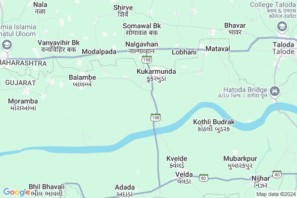
Patipada Map
EDIT Map
Add Your House
 ..
..
Current Corona Virus Infected Patients Count in Surat District
| City Name | District Name | Total Covid cases |
|---|---|---|
| Surat District | Surat | 521 |
| Surat | Surat | 5 |
| Tapi District | Tapi | 1 |
Locality Name :
Patipada
( પતિપદ )
Taluka Name : Nizar
District : Surat
State : Gujarat
Language : Gujarati and Sindhi, Hindi, Marvadi,english, Marathi, Telugu, And Oriya
Current Time 12:55 PM
Date: Tuesday , Apr 29,2025 (IST)
Time zone: IST (UTC+5:30)
Elevation / Altitude: 178 meters. Above Seal level
Telephone Code / Std Code: 02628
Assembly constituency : Nizar assembly constituency
Assembly MLA : Dr.Jayrambhai Chemabhai Gamit
Lok Sabha constituency : Bardoli parliamentary constituency
Parliament MP : PARBHUBHAI NAGARBHAI VASAVA
Serpanch Name :
Pin Code : 394380
Post Office Name : Kukurmunda
Main Village Name : Patipada
Commodities Prices : Taloda Market / Mandi
National Highways Reachable To Patipada
Nationa High Way :NH160H
Nationa High Way :NH160H
Rivers Near Patipada
Mangla
Bhad
Mangla
Bhad
About Patipada
Correct below Info and add more info about PatipadaPatipada is a small Village/hamlet in Nizar Taluka in Surat District of Gujarat State, India. It comes under Patipada Panchayath. It is located 162 KM towards East from District head quarters Surat. 283 KM from State capital Gandhinagar
Patipada Pin code is 394380 and postal head office is Kukurmunda .
Patipada is surrounded by Taloda Taluka towards East , Akkalkuwa Taluka towards west , Nandurbar Taluka towards South , Akarani Taluka towards North .
Nandurbar , Shahade , Songadh , Rajpipla are the near by Cities to Patipada.
This Place is in the border of the Surat District and Nandurbar District. Nandurbar District Taloda is East towards this place . It is near to the Maharashtra State Border.
Patipada 2011 Census Details
Patipada Local Language is Gujarati. Patipada Village Total population is and number of houses are . Female Population is -1.0%. Village literacy rate is -1.0% and the Female Literacy rate is -1.0%.
Population
| Census Parameter | Census Data |
| Total Population | |
| Total No of Houses | |
| Female Population % | -1.0 % ( ) |
| Total Literacy rate % | -1.0 % ( ) |
| Female Literacy rate | -1.0 % ( ) |
| Scheduled Tribes Population % | -1.0 % ( ) |
| Scheduled Caste Population % | -1.0 % ( ) |
| Working Population % | -1.0 % |
| Child(0 -6) Population by 2011 | |
| Girl Child(0 -6) Population % by 2011 | -1.0 % ( ) |
Patipada Census More Deatils.
Politics in Patipada
Bharatiya Janata Party , BJP , INC are the major political parties in this area.Polling Stations /Booths near Patipada
1)Fulavadi-10 (gorasa)2)Fulavadi-6(gadid)
3)Fulavadi-5 (kukarmunda-5)
4)Fulavadi-2 (kunkarmunda-2)
5)Fulavadi-1(kukarmunda-1)
HOW TO REACH Patipada
By Rail
There is no railway station near to Patipada in less than 10 km.Colleges near Patipada
Shree P.k. Desai Arts And Commers College
Address :
Schools in Patipada
Patipada Primary School
Address : patipada , nizar , tapi , Gujarat . PIN- 394380 , Post - Kukurmunda
Govt Health Centers near Patipada
1) Selamba , , near Primary school selamba , school selamba2) Sagbara , , near taluka Panchayat office , Panchayat office
3) Patlamau , main road patlamau , ,
Schools in Patipada,Nizar
Electronic Shops in Patipada,Nizar
Super Markets in Patipada,Nizar
Local Parks in Patipada,Nizar
Police Stations near Patipada,Nizar
Governement Offices near Patipada,Nizar
About Patipada &
History
How to reach Patipada
Tourist Places Near By Patipada
Schools in Patipada
Colleges in Patipada
Temperature & weather of Patipada
places in Patipada
Patipada photos
More Information
How to reach Patipada
Tourist Places Near By Patipada
Schools in Patipada
Colleges in Patipada
Temperature & weather of Patipada
places in Patipada
Patipada photos
More Information
Village Talk
Post News or Events about this Village
Near Cities
Nandurbar 24 KM near
Shahade 40 KM near
Songadh 79 KM near
Rajpipla 83 KM near
Nandurbar 24 KM near
Shahade 40 KM near
Songadh 79 KM near
Rajpipla 83 KM near
Near By Taluks
Nizar 0 KM near
Taloda 12 KM near
Akkalkuwa 18 KM near
Nandurbar 23 KM near
Nizar 0 KM near
Taloda 12 KM near
Akkalkuwa 18 KM near
Nandurbar 23 KM near
Near By Air Ports
Vadodara Airport 144 KM near
Gandhinagar Airport 197 KM near
Bhavnagar Airport 225 KM near
Indore Airport 245 KM near
Vadodara Airport 144 KM near
Gandhinagar Airport 197 KM near
Bhavnagar Airport 225 KM near
Indore Airport 245 KM near
Near By Tourist Places
Toranmal 59 KM near
Kevadia Narmada 65 KM near
Saputara 108 KM near
Dhule 108 KM near
Ankleshwar 130 KM near
Toranmal 59 KM near
Kevadia Narmada 65 KM near
Saputara 108 KM near
Dhule 108 KM near
Ankleshwar 130 KM near
Near By Districts
Nandurbar 24 KM near
Narmada 83 KM near
Alirajpur 99 KM near
Dang 107 KM near
Nandurbar 24 KM near
Narmada 83 KM near
Alirajpur 99 KM near
Dang 107 KM near
Near By RailWay Station
Nandurbar Rail Way Station 24 KM near
Dondaicha Rail Way Station 57 KM near
Nandurbar Rail Way Station 24 KM near
Dondaicha Rail Way Station 57 KM near