| Home | City Bus | Maps | Villages | Cities | Rail | Tourist Places | School | College | Pin Codes | Corona Cases Count |
| Distance Calculator Bus Services IFSC Codes Trace Mobile Number Weather Search Place Trace IP Available Cash ATM/Banks Locate Polling Booth Report an Error contact People |
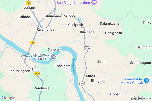
Gamlei
Gamlei Map
EDIT Map
Add Your House
 ..
..
Current Corona Virus Infected Patients Count in Sundargarh District
| City Name | District Name | Total Covid cases |
|---|---|---|
| Rourkela | Sundargarh | 3 |
| Sundargarh District | Sundargarh | 3 |
Locality Name :
Gamlei
( ଗମିଲେଇ )
Tehsil Name : Lahunipara
District : Sundargarh
State : Odisha
Language : Oriya and Sundargadi
Current Time 10:03 AM
Date: Thursday , Apr 24,2025 (IST)
Time zone: IST (UTC+5:30)
Elevation / Altitude: 328 meters. Above Seal level
Telephone Code / Std Code: 06625
Assembly constituency : Bonai assembly constituency
Assembly MLA : laxman munda
Lok Sabha constituency : Sundargarh parliamentary constituency
Parliament MP : Jual Oram
Serpanch Name :
Commodities Prices : Bonai Market / Mandi
Gamlei Live Weather
Temperature: 40.3 °C
clear sky
Humidity: 12%
Wind : 1.69 mt/sec towards SW
StationName : "Deogarh"
observed on 16 Mins Back
Temperature: 40.3 °C
clear sky
Humidity: 12%
Wind : 1.69 mt/sec towards SW
StationName : "Deogarh"
observed on 16 Mins Back
Gamlei Weather Forecast for Next 5 days
25-04-2025
27.3°C to 44.6°C
clear sky
27.3°C to 44.6°C
clear sky
26-04-2025
25.6°C to 45.8°C
clear sky
25.6°C to 45.8°C
clear sky
27-04-2025
24.9°C to 45.1°C
clear sky, scattered clouds, broken clouds, few clouds
24.9°C to 45.1°C
clear sky, scattered clouds, broken clouds, few clouds
28-04-2025
25.2°C to 42.3°C
scattered clouds, overcast clouds, broken clouds
25.2°C to 42.3°C
scattered clouds, overcast clouds, broken clouds
29-04-2025
23.1°C to 40.5°C
scattered clouds, few clouds, broken clouds, light rain, clear sky
23.1°C to 40.5°C
scattered clouds, few clouds, broken clouds, light rain, clear sky
National Highways Reachable To Gamlei
Nationa High Way :NH520
Nationa High Way :NH520
Rivers Near Gamlei
Baitarani
Barapandajor
Baitarani
Barapandajor
About Gamlei
Correct below Info and add more info about GamleiGamlei is a small Village/hamlet in Lahunipara Tehsil in Sundargarh District of Odisha State, India. It is located 118 KM towards East from District head quarters Sundargarh. 229 KM from State capital Bhubaneswar
Gamlei is surrounded by Bonaigarh Tehsil towards South , Gurundia Tehsil towards west , Koida Tehsil towards East , Barkote Tehsil towards South .
Debagarh , Raurkela , Joda , Barbil are the near by Cities to Gamlei.
Gamlei 2011 Census Details
Gamlei Local Language is Oriya. Gamlei Village Total population is 747 and number of houses are 199. Female Population is 49.5%. Village literacy rate is 62.0% and the Female Literacy rate is 28.4%.
Population
| Census Parameter | Census Data |
| Total Population | 747 |
| Total No of Houses | 199 |
| Female Population % | 49.5 % ( 370) |
| Total Literacy rate % | 62.0 % ( 463) |
| Female Literacy rate | 28.4 % ( 212) |
| Scheduled Tribes Population % | 34.3 % ( 256) |
| Scheduled Caste Population % | 11.2 % ( 84) |
| Working Population % | 56.1 % |
| Child(0 -6) Population by 2011 | 106 |
| Girl Child(0 -6) Population % by 2011 | 44.3 % ( 47) |
Gamlei Census More Deatils.
Politics in Gamlei
CPM , CPI(M) , BJP are the major political parties in this area.Polling Stations /Booths near Gamlei
1)Kelo Project Upper Primary School2)Kendrikela Ug Upper Primary School
3)San Raxi Ug Upper Primary School
4)Gadaruan Primary School
5)Chhidakudar Sevashram
HOW TO REACH Gamlei
By Rail
There is no railway station near to Gamlei in less than 10 km.Pincodes near Gamlei
770038 ( Bonaigarh ) , 770040 ( Lahunipara ) , 770041 ( Barsuan )Colleges near Gamlei
Lahunipara College
Address :
Schools in Gamlei
Gamleiu.g.u.pry. School
Address : gamlei , lahunipara , sundergarh , Sikkim . PIN- 770040 , Post - Lahunipara
Hospitals in Gamlei,Lahunipara
Sulabh Sauchalaya And Bath Complex
Bonai Link Road; Bonaigarh; Odisha 770038; India
3.1 KM distance Detail
more ..
Schools in Gamlei,Lahunipara
Sri Aurobindo Integral Education & Research center;Bonaigarh
Bonaigarh; Odisha 770038; India
3.0 KM distance Detail
NIAM Skill Development Training Center; Bonaigarh
Near block office; Bonaigarh; Odisha 770038; India
3.2 KM distance Detail
Government Girls High School
Bonai garh; Sundargarh; Bonai Link Road; Rourkela; Rourkela; Odisha 769007; India
3.3 KM distance Detail
Electronic Shops in Gamlei,Lahunipara
EZONE COMPUTER CARE
MAIN ROAD; BLOCK CHOWK;INFRONT OF YAMAHA SHOWROOM; BONAIGARH; Bonaigarh; Odisha 770038; India
3.4 KM distance Detail
Police Stations near Gamlei,Lahunipara
Gurundia Police Station
Gurundia Kuchinda Rd; Gurundia; Odisha 770043; India
22.7 KM distance Detail
About Gamlei &
History
How to reach Gamlei
Tourist Places Near By Gamlei
Schools in Gamlei
Colleges in Gamlei
Temperature & weather of Gamlei
places in Gamlei
Gamlei photos
More Information
How to reach Gamlei
Tourist Places Near By Gamlei
Schools in Gamlei
Colleges in Gamlei
Temperature & weather of Gamlei
places in Gamlei
Gamlei photos
More Information
Village Talk
Post News or Events about this Village
Near Cities
Debagarh 47 KM near
Raurkela 51 KM near
Joda 57 KM near
Barbil 60 KM near
Debagarh 47 KM near
Raurkela 51 KM near
Joda 57 KM near
Barbil 60 KM near
Near By Taluks
Lahunipara 0 KM near
Bonaigarh 14 KM near
Gurundia 22 KM near
Koida 25 KM near
Lahunipara 0 KM near
Bonaigarh 14 KM near
Gurundia 22 KM near
Koida 25 KM near
Near By Air Ports
Ranchi Airport 188 KM near
Bhubaneswar Airport 220 KM near
Gaya Airport 361 KM near
Raipur Airport 383 KM near
Ranchi Airport 188 KM near
Bhubaneswar Airport 220 KM near
Gaya Airport 361 KM near
Raipur Airport 383 KM near
Near By Tourist Places
Rourkela 51 KM near
Simdega 109 KM near
Sambalpur 124 KM near
Hirakud 130 KM near
Chotanagpur 145 KM near
Rourkela 51 KM near
Simdega 109 KM near
Sambalpur 124 KM near
Hirakud 130 KM near
Chotanagpur 145 KM near
Near By Districts
Deogarh 47 KM near
Kendujhar 74 KM near
Jharsuguda 109 KM near
Simdega 111 KM near
Deogarh 47 KM near
Kendujhar 74 KM near
Jharsuguda 109 KM near
Simdega 111 KM near
Near By RailWay Station
Bondamunda Rail Way Station 49 KM near
Rourkela Junction Rail Way Station 49 KM near
Bondamunda Rail Way Station 49 KM near
Rourkela Junction Rail Way Station 49 KM near