| Home | City Bus | Maps | Villages | Cities | Rail | Tourist Places | School | College | Pin Codes | Corona Cases Count |
| Distance Calculator Bus Services IFSC Codes Trace Mobile Number Weather Search Place Trace IP Available Cash ATM/Banks Locate Polling Booth Report an Error contact People |
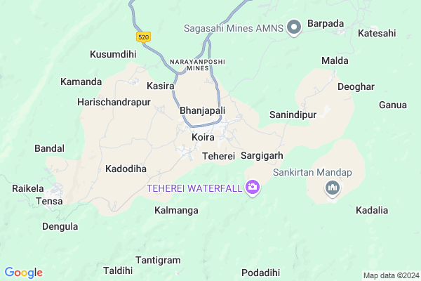
Koira
Koira Map
EDIT Map
Add Your House
 ..
..
Current Corona Virus Infected Patients Count in Sundargarh District
| City Name | District Name | Total Covid cases |
|---|---|---|
| Rourkela | Sundargarh | 3 |
| Sundargarh District | Sundargarh | 3 |
Locality Name :
Koira
( କୋଇର )
Tehsil Name : Koida
District : Sundargarh
State : Odisha
Language : Oriya and Sundargadi
Current Time 10:43 AM
Date: Friday , Apr 25,2025 (IST)
Time zone: IST (UTC+5:30)
Telephone Code / Std Code: 06625
Assembly constituency : Bonai assembly constituency
Assembly MLA : laxman munda
Lok Sabha constituency : Sundargarh parliamentary constituency
Parliament MP : Jual Oram
Serpanch Name :
Pin Code : 770048
Post Office Name : Koira
Commodities Prices : Bonai Market / Mandi
National Highways Reachable To Koira
Nationa High Way :NH520
Nationa High Way :NH520
Rivers Near Koira
Baitarani
Katangmunda
Baitarani
Katangmunda
About Koira
Correct below Info and add more info about KoiraKoira is a Village in Koida Tehsil in Sundargarh District of Odisha State, India. It is located 148 KM towards East from District head quarters Sundargarh. 10 KM from Koida. 224 KM from State capital Bhubaneswar
Koira Pin code is 770048 and postal head office is Koira .
Malda ( 9 KM ) , Kalta ( 9 KM ) , Dengula ( 9 KM ) are the nearby Villages to Koira. Koira is surrounded by Joda Tehsil towards East , Lahunipara Tehsil towards west , Bansapal Tehsil towards South , Jhumpura Tehsil towards East .
Joda , Barbil , Kendujhar , Raurkela are the near by Cities to Koira.
Demographics of Koira
Oriya is the Local Language here.Politics in Koira
CPM , CPI(M) , BJP are the major political parties in this area.Polling Stations /Booths near Koira
1)Barsuan Ispat Lower School2)Barhamusa Primary School
3)Belkudar Primary School
4)San Balijore Primary School
5)Tankajoda Primary School
HOW TO REACH Koira
By Rail
There is no railway station near to Koira in less than 10 km.Colleges near Koira
Kansbahal College Laing
Address :
Arakhita Askara +3 Mahavidyalaya Tendra Ghanashyampur
Address : At/po -tendra Via Kenaveta Dist Sundargarh
Ujalpur College, Ujalpur
Address :
Neelashaila Mahavidyalaya
Address :
Neelashaila Mahavidyalaya
Address :
Schools in Koira
Gopabandhu Ucha Vidyalay
Address : koira , koira , sundergarh , Sikkim . PIN- 770048 , Post - Koira
Koira Govt. Nodal U.p. School
Address : koira , koira , sundergarh , Sikkim . PIN- 770048 , Post - Koira
Koira Project U.pry. School
Address : koira , koira , sundergarh , Sikkim . PIN- 770048 , Post - Koira
Govt Health Centers near Koira
1) JAMUKESWAR , Jamukeswar CHC , Jamukeswar , Near Shiva TemplePetrol Bunks in Koira,Koida
HP Petrol Pump - Hindustan Fuel's
AT Kalta Road(nh 215) Po- Sundergarh;; Koira; Odisha 770048; India
0.5 KM distance Detail
more ..
Local Parks in Koira,Koida
National Geological Monument
Nomira; Banspani Rd; Bandhuabeda; Odisha 758034; India
22.5 KM distance Detail
About Koira &
History
How to reach Koira
Tourist Places Near By Koira
Schools in Koira
Colleges in Koira
Temperature & weather of Koira
places in Koira
Koira photos
More Information
How to reach Koira
Tourist Places Near By Koira
Schools in Koira
Colleges in Koira
Temperature & weather of Koira
places in Koira
Koira photos
More Information
Village Talk
Post News or Events about this Village
Near Cities
Joda 25 KM near
Barbil 32 KM near
Kendujhar 49 KM near
Raurkela 60 KM near
Joda 25 KM near
Barbil 32 KM near
Kendujhar 49 KM near
Raurkela 60 KM near
Near By Taluks
Koida 10 KM near
Joda 21 KM near
Lahunipara 32 KM near
Bansapal 38 KM near
Koida 10 KM near
Joda 21 KM near
Lahunipara 32 KM near
Bansapal 38 KM near
Near By Air Ports
Ranchi Airport 176 KM near
Bhubaneswar Airport 215 KM near
Gaya Airport 356 KM near
Netaji Subhas Chandra Bose Airport 379 KM near
Ranchi Airport 176 KM near
Bhubaneswar Airport 215 KM near
Gaya Airport 356 KM near
Netaji Subhas Chandra Bose Airport 379 KM near
Near By Tourist Places
Rourkela 60 KM near
Simdega 123 KM near
Barehipani & Joranda Barehipani & Joranda Falls 126 KM near
Seraikela 126 KM near
Chotanagpur 140 KM near
Rourkela 60 KM near
Simdega 123 KM near
Barehipani & Joranda Barehipani & Joranda Falls 126 KM near
Seraikela 126 KM near
Chotanagpur 140 KM near
Near By Districts
Kendujhar 48 KM near
Deogarh 76 KM near
West Singhbhum 102 KM near
Simdega 124 KM near
Kendujhar 48 KM near
Deogarh 76 KM near
West Singhbhum 102 KM near
Simdega 124 KM near
Near By RailWay Station
Dangoaposi Rail Way Station 51 KM near
Bondamunda Rail Way Station 56 KM near
Dangoaposi Rail Way Station 51 KM near
Bondamunda Rail Way Station 56 KM near