| Home | City Bus | Maps | Villages | Cities | Rail | Tourist Places | School | College | Pin Codes | Corona Cases Count |
| Distance Calculator Bus Services IFSC Codes Trace Mobile Number Weather Search Place Trace IP Available Cash ATM/Banks Locate Polling Booth Report an Error contact People |
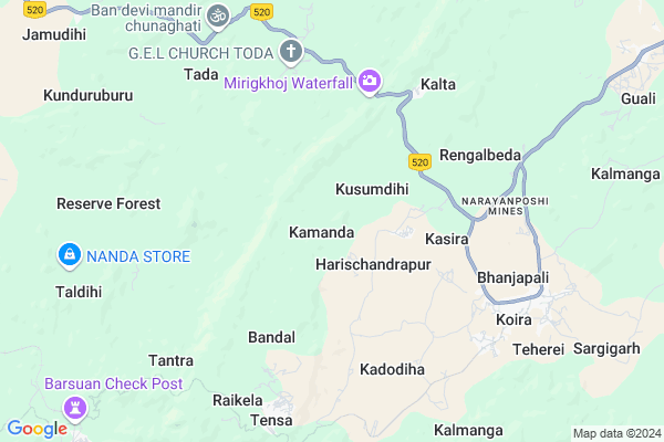
Kamanda
Kamanda Map
EDIT Map
Add Your House
 ..
..
Current Corona Virus Infected Patients Count in Sundargarh District
| City Name | District Name | Total Covid cases |
|---|---|---|
| Rourkela | Sundargarh | 3 |
| Sundargarh District | Sundargarh | 3 |
Locality Name :
Kamanda
( କମାଣ୍ଡା )
Tehsil Name : Koida
District : Sundargarh
State : Odisha
Language : Oriya and Sundargadi
Current Time 07:08 AM
Date: Saturday , Apr 26,2025 (IST)
Time zone: IST (UTC+5:30)
Telephone Code / Std Code: 06625
Assembly constituency : Bonai assembly constituency
Assembly MLA : laxman munda
Lok Sabha constituency : Sundargarh parliamentary constituency
Parliament MP : Jual Oram
Serpanch Name :
Pin Code : 770042
Post Office Name : Tensa
Commodities Prices : Bonai Market / Mandi
Kamanda Live Weather
Temperature: 23.7 °C
clear sky
Humidity: 19%
Wind : 1.25 mt/sec towards S
StationName : "BolÄ\u0081nÄ«khodÄ\u0081n"
observed on 1 Hours Back
Temperature: 23.7 °C
clear sky
Humidity: 19%
Wind : 1.25 mt/sec towards S
StationName : "BolÄ\u0081nÄ«khodÄ\u0081n"
observed on 1 Hours Back
Kamanda Weather Forecast for Next 5 days
27-04-2025
25.2°C to 43.8°C
clear sky, scattered clouds, broken clouds, overcast clouds
25.2°C to 43.8°C
clear sky, scattered clouds, broken clouds, overcast clouds
28-04-2025
26.1°C to 38.8°C
overcast clouds, broken clouds, scattered clouds
26.1°C to 38.8°C
overcast clouds, broken clouds, scattered clouds
29-04-2025
23.4°C to 39.1°C
broken clouds, clear sky, scattered clouds, light rain, few clouds
23.4°C to 39.1°C
broken clouds, clear sky, scattered clouds, light rain, few clouds
30-04-2025
21.1°C to 37.5°C
few clouds, clear sky, light rain, broken clouds
21.1°C to 37.5°C
few clouds, clear sky, light rain, broken clouds
Edit below overview about Kamanda
Edit below overview about Kamanda
OverView of Kamanda
1-Kamanda is village of koida block.2-Where ignite awardies of 2016 3-Dhanurjaya Dehury born in kamanda in 2003.4-Where situated SR Group steel plant. 5-Bhubaneswar to kamanda (7hours).6-surround the village beautiful forest and river situated. 7-nearest the village big river is kalanadi.Edit below overview about Kamanda
National Highways Reachable To Kamanda
Nationa High Way :NH520
Nationa High Way :NH520
Rivers Near Kamanda
Baitarani
Katangmunda
Baitarani
Katangmunda
About Kamanda
Kamanda is a small Village/hamlet in Koida Tehsil in Sundargarh District of Odisha State, India. It is located 141 KM towards East from District head quarters Sundargarh. 2 KM from Koida. 229 KM from State capital Bhubaneswar
Kamanda Pin code is 770042 and postal head office is Tensa .
Dengula ( 8 KM ) , Koida ( 9 KM ) , Jamudihi ( 12 KM ) , Soyamba ( 14 KM ) , Malda ( 15 KM ) are the nearby Villages to Kamanda. Kamanda is surrounded by Joda Tehsil towards East , Lahunipara Tehsil towards west , Bonaigarh Tehsil towards west , Bansapal Tehsil towards South .
Joda , Barbil , Raurkela , Kendujhar are the near by Cities to Kamanda.
Kamanda 2011 Census Details
Kamanda Local Language is Oriya. Kamanda Village Total population is 1081 and number of houses are 233. Female Population is 48.5%. Village literacy rate is 38.5% and the Female Literacy rate is 12.2%.
Population
| Census Parameter | Census Data |
| Total Population | 1081 |
| Total No of Houses | 233 |
| Female Population % | 48.5 % ( 524) |
| Total Literacy rate % | 38.5 % ( 416) |
| Female Literacy rate | 12.2 % ( 132) |
| Scheduled Tribes Population % | 63.0 % ( 681) |
| Scheduled Caste Population % | 8.1 % ( 88) |
| Working Population % | 34.3 % |
| Child(0 -6) Population by 2011 | 218 |
| Girl Child(0 -6) Population % by 2011 | 47.2 % ( 103) |
Kamanda Census More Deatils.
Politics in Kamanda
CPM , CPI(M) , BJP are the major political parties in this area.Polling Stations /Booths near Kamanda
1)Shankhaposh Ug Upper Primary School2)San Balijore Primary School
3)Tankajoda Primary School
4)Shasyakela Primary School
5)Madhupur Project Upper Primary School-ii
HOW TO REACH Kamanda
By Rail
Barsuan Rail Way Station is the very nearby railway stations to Kamanda.Colleges near Kamanda
Kansbahal College Laing
Address :
Arakhita Askara +3 Mahavidyalaya Tendra Ghanashyampur
Address : At/po -tendra Via Kenaveta Dist Sundargarh
Ujalpur College, Ujalpur
Address :
Neelashaila Mahavidyalaya
Address :
Neelashaila Mahavidyalaya
Address :
Schools in Kamanda
Kamanda U.g.u.p. School
Address : kamanda , koira , sundergarh , Sikkim . PIN- 770052 , Post - Kalta
Govt Health Centers near Kamanda
1) JAMUKESWAR , Jamukeswar CHC , Jamukeswar , Near Shiva TemplePetrol Bunks in Kamanda,Koida
KALYANIKA FILLING STATION
KATOTIA; KOIRA; SUNDERGARH; SUNDERGARH; Odisha 770048; India
7.6 KM distance Detail
HP Petrol Pump - Hindustan Fuel's
AT Kalta Road(nh 215) Po- Sundergarh;; Koira; Odisha 770048; India
7.7 KM distance Detail
more ..
Local Parks in Kamanda,Koida
About Kamanda &
History
How to reach Kamanda
Tourist Places Near By Kamanda
Schools in Kamanda
Colleges in Kamanda
Temperature & weather of Kamanda
places in Kamanda
Kamanda photos
More Information
How to reach Kamanda
Tourist Places Near By Kamanda
Schools in Kamanda
Colleges in Kamanda
Temperature & weather of Kamanda
places in Kamanda
Kamanda photos
More Information
Village Talk
Post News or Events about this Village
Near Cities
Joda 29 KM near
Barbil 33 KM near
Raurkela 53 KM near
Kendujhar 57 KM near
Joda 29 KM near
Barbil 33 KM near
Raurkela 53 KM near
Kendujhar 57 KM near
Near By Taluks
Koida 2 KM near
Joda 26 KM near
Lahunipara 27 KM near
Bonaigarh 40 KM near
Koida 2 KM near
Joda 26 KM near
Lahunipara 27 KM near
Bonaigarh 40 KM near
Near By Air Ports
Ranchi Airport 173 KM near
Bhubaneswar Airport 221 KM near
Gaya Airport 351 KM near
Netaji Subhas Chandra Bose Airport 384 KM near
Ranchi Airport 173 KM near
Bhubaneswar Airport 221 KM near
Gaya Airport 351 KM near
Netaji Subhas Chandra Bose Airport 384 KM near
Near By Tourist Places
Rourkela 53 KM near
Simdega 115 KM near
Seraikela 128 KM near
Barehipani & Joranda Barehipani & Joranda Falls 134 KM near
Chotanagpur 135 KM near
Rourkela 53 KM near
Simdega 115 KM near
Seraikela 128 KM near
Barehipani & Joranda Barehipani & Joranda Falls 134 KM near
Chotanagpur 135 KM near
Near By Districts
Kendujhar 56 KM near
Deogarh 72 KM near
West Singhbhum 104 KM near
Simdega 117 KM near
Kendujhar 56 KM near
Deogarh 72 KM near
West Singhbhum 104 KM near
Simdega 117 KM near
Near By RailWay Station
Bondamunda Rail Way Station 48 KM near
Rourkela Junction Rail Way Station 52 KM near
Bondamunda Rail Way Station 48 KM near
Rourkela Junction Rail Way Station 52 KM near