| Home | City Bus | Maps | Villages | Cities | Rail | Tourist Places | School | College | Pin Codes | Corona Cases Count |
| Distance Calculator Bus Services IFSC Codes Trace Mobile Number Weather Search Place Trace IP Available Cash ATM/Banks Locate Polling Booth Report an Error contact People |
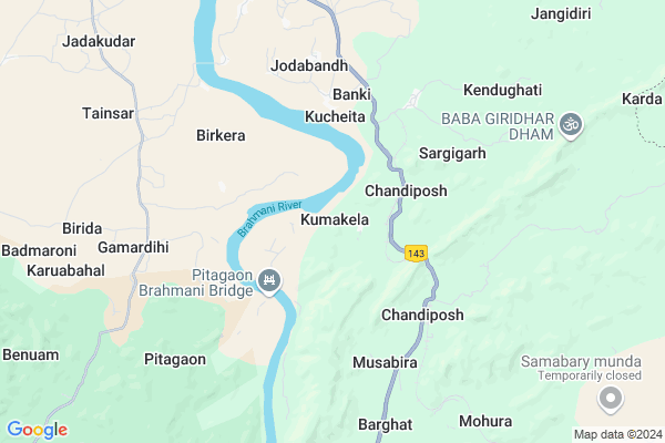
Kumakela
Kumakela Map
EDIT Map
Add Your House
 ..
..
Current Corona Virus Infected Patients Count in Sundargarh District
| City Name | District Name | Total Covid cases |
|---|---|---|
| Rourkela | Sundargarh | 3 |
| Sundargarh District | Sundargarh | 3 |
Locality Name :
Kumakela
( କୁମାକ୍ୱେଲ )
Tehsil Name : Gurundia
District : Sundargarh
State : Odisha
Language : Oriya and Sundargadi
Current Time 10:34 AM
Date: Friday , Apr 25,2025 (IST)
Time zone: IST (UTC+5:30)
Elevation / Altitude: 205 meters. Above Seal level
Telephone Code / Std Code: 06625
Assembly constituency : Bonai assembly constituency
Assembly MLA : laxman munda
Lok Sabha constituency : Sundargarh parliamentary constituency
Parliament MP : Jual Oram
Serpanch Name :
Pin Code : 770037
Post Office Name : Lathikata
Commodities Prices : Panposh Market / Mandi
Kumakela Live Weather
Temperature: 35.9 °C
clear sky
Humidity: 8%
Wind : 1.08 mt/sec towards S
StationName : "BÄ\u0081nposh"
observed on 1 Hours Back
Temperature: 35.9 °C
clear sky
Humidity: 8%
Wind : 1.08 mt/sec towards S
StationName : "BÄ\u0081nposh"
observed on 1 Hours Back
Kumakela Weather Forecast for Next 5 days
26-04-2025
24.9°C to 44.4°C
clear sky
24.9°C to 44.4°C
clear sky
27-04-2025
23.1°C to 45.1°C
clear sky, scattered clouds, few clouds
23.1°C to 45.1°C
clear sky, scattered clouds, few clouds
28-04-2025
25.7°C to 42.5°C
scattered clouds, broken clouds, overcast clouds
25.7°C to 42.5°C
scattered clouds, broken clouds, overcast clouds
29-04-2025
23.3°C to 41.0°C
overcast clouds, broken clouds, light rain, scattered clouds
23.3°C to 41.0°C
overcast clouds, broken clouds, light rain, scattered clouds
30-04-2025
21.4°C to 40.2°C
few clouds, clear sky, light rain, overcast clouds, scattered clouds
21.4°C to 40.2°C
few clouds, clear sky, light rain, overcast clouds, scattered clouds
National Highways Reachable To Kumakela
Nationa High Way :NH520
Nationa High Way :NH520
Rivers Near Kumakela
Katangmunda
Hathia
Katangmunda
Hathia
About Kumakela
Correct below Info and add more info about KumakelaKumakela is a small Village/hamlet in Gurundia Tehsil in Sundargarh District of Odisha State, India. It is located 103 KM towards East from District head quarters Sundargarh. 26 KM from Gurundia. 259 KM from State capital Bhubaneswar
Kumakela Pin code is 770037 and postal head office is Lathikata .
Lathikata ( 9 KM ) , Tainsar ( 9 KM ) , Jadakudar ( 11 KM ) , Ramjodi ( 12 KM ) , Suidihi ( 13 KM ) are the nearby Villages to Kumakela. Kumakela is surrounded by Raurkela Tehsil towards North , Gurundia Tehsil towards South , Bisra Tehsil towards North , Lahunipara Tehsil towards South .
Raurkela , Rajagangapur , Biramitrapur , Barbil are the near by Cities to Kumakela.
Kumakela 2011 Census Details
Kumakela Local Language is Oriya. Kumakela Village Total population is 1184 and number of houses are 255. Female Population is 49.6%. Village literacy rate is 61.1% and the Female Literacy rate is 26.3%.
Population
| Census Parameter | Census Data |
| Total Population | 1184 |
| Total No of Houses | 255 |
| Female Population % | 49.6 % ( 587) |
| Total Literacy rate % | 61.1 % ( 724) |
| Female Literacy rate | 26.3 % ( 311) |
| Scheduled Tribes Population % | 80.2 % ( 949) |
| Scheduled Caste Population % | 6.3 % ( 75) |
| Working Population % | 32.8 % |
| Child(0 -6) Population by 2011 | 184 |
| Girl Child(0 -6) Population % by 2011 | 48.9 % ( 90) |
Kumakela Census More Deatils.
Politics in Kumakela
CPM , CPI(M) , BJP are the major political parties in this area.Polling Stations /Booths near Kumakela
1)Chandiposh Ug Upper Primary School2)Baneikela Project Upper Primary School
3)Banki Primary School
4)Koilijhor Primary School
5)Jibika Primary School
HOW TO REACH Kumakela
By Rail
Chandiposi Rail Way Station , Champajharam Rail Way Station are the very nearby railway stations to Kumakela.Colleges near Kumakela
Kansbahal College Laing
Address :
Arakhita Askara +3 Mahavidyalaya Tendra Ghanashyampur
Address : At/po -tendra Via Kenaveta Dist Sundargarh
Ujalpur College, Ujalpur
Address :
Neelashaila Mahavidyalaya
Address :
Neelashaila Mahavidyalaya
Address :
Schools in Kumakela
Kumakela U.p. School
Address : kumakela , gurundia , sundergarh , Sikkim . PIN- 770037 , Post - Lathikata
Petrol Bunks in Kumakela,Gurundia
RUDRA FUEL CENTRE; LATHIKATA
AT - LATHIKATA; PO - LATHIKATA; PS - LATHIKATA; NH143; Kulamunda; Odisha 770037; India
8.8 KM distance Detail
HP PETROL PUMP - GANESH FUELS LATHIKATA
Suidhi Hatibandha PO Lathikata; Sambalpur; Odisha 770037; India
12.9 KM distance Detail
more ..
Colleges in Kumakela,Gurundia
Priyadarshini Mahila Mahavidylaya
C Block; Jalda; Rourkela; Odisha 769043; India
15.7 KM distance Detail
Chinmaya Technical Academy; Chinmay ITI
Fertilizer Township; IDL Road; Sundergarh; Sector 22; Rourkela; Odisha 769011; India
17.3 KM distance Detail
more ..
Super Markets in Kumakela,Gurundia
Subham Complex
Rourkela - Barkote Rd; A - Block; OCL Industrial Twp; Rourkela; Odisha 769007; India
17.0 KM distance Detail
Local Parks in Kumakela,Gurundia
Ispat Fitness Path;Puspa Park
Fertilizer Twp; Hatibandha; Odisha 769007; India
17.3 KM distance Detail
About Kumakela &
History
How to reach Kumakela
Tourist Places Near By Kumakela
Schools in Kumakela
Colleges in Kumakela
Temperature & weather of Kumakela
places in Kumakela
Kumakela photos
More Information
How to reach Kumakela
Tourist Places Near By Kumakela
Schools in Kumakela
Colleges in Kumakela
Temperature & weather of Kumakela
places in Kumakela
Kumakela photos
More Information
Village Talk
Post News or Events about this Village
Near Cities
Raurkela 23 KM near
Rajagangapur 39 KM near
Biramitrapur 44 KM near
Barbil 59 KM near
Raurkela 23 KM near
Rajagangapur 39 KM near
Biramitrapur 44 KM near
Barbil 59 KM near
Near By Taluks
Lathikata 11 KM near
Raurkela 22 KM near
Gurundia 24 KM near
Bisra 26 KM near
Lathikata 11 KM near
Raurkela 22 KM near
Gurundia 24 KM near
Bisra 26 KM near
Near By Air Ports
Ranchi Airport 164 KM near
Bhubaneswar Airport 249 KM near
Gaya Airport 334 KM near
Raipur Airport 380 KM near
Ranchi Airport 164 KM near
Bhubaneswar Airport 249 KM near
Gaya Airport 334 KM near
Raipur Airport 380 KM near
Near By Tourist Places
Rourkela 23 KM near
Simdega 81 KM near
Chotanagpur 118 KM near
Sambalpur 129 KM near
Gumla 129 KM near
Rourkela 23 KM near
Simdega 81 KM near
Chotanagpur 118 KM near
Sambalpur 129 KM near
Gumla 129 KM near
Near By Districts
Deogarh 67 KM near
Simdega 82 KM near
Kendujhar 94 KM near
Sundargarh 99 KM near
Deogarh 67 KM near
Simdega 82 KM near
Kendujhar 94 KM near
Sundargarh 99 KM near
Near By RailWay Station
Chandiposi Rail Way Station 2.4 KM near
Champajharam Rail Way Station 6.7 KM near
Rourkela Junction Rail Way Station 21 KM near
Bondamunda Rail Way Station 22 KM near
Chandiposi Rail Way Station 2.4 KM near
Champajharam Rail Way Station 6.7 KM near
Rourkela Junction Rail Way Station 21 KM near
Bondamunda Rail Way Station 22 KM near