| Home | City Bus | Maps | Villages | Cities | Rail | Tourist Places | School | College | Pin Codes | Corona Cases Count |
| Distance Calculator Bus Services IFSC Codes Trace Mobile Number Weather Search Place Trace IP Available Cash ATM/Banks Locate Polling Booth Report an Error contact People |
Kapatmunda
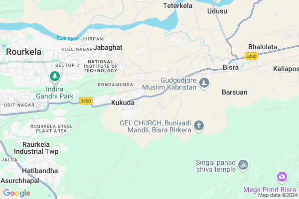
Kapatmunda Map
EDIT Map
Add Your House
 ..
..
Current Corona Virus Infected Patients Count in Sundargarh District
| City Name | District Name | Total Covid cases |
|---|---|---|
| Rourkela | Sundargarh | 3 |
| Sundargarh District | Sundargarh | 3 |
Locality Name :
Kapatmunda
( କପାଟିମୁଣ୍ଡା )
Tehsil Name : Bisra
District : Sundargarh
State : Odisha
Language : Oriya and Sundargadi
Current Time 01:58 PM
Date: Wednesday , Apr 30,2025 (IST)
Time zone: IST (UTC+5:30)
Elevation / Altitude: 224 meters. Above Seal level
Telephone Code / Std Code: 0661
Assembly constituency : Biramitrapur assembly constituency
Assembly MLA : george tirkey
Lok Sabha constituency : Sundargarh parliamentary constituency
Parliament MP : Jual Oram
Serpanch Name :
Pin Code : 770036
Post Office Name : Bisra
Commodities Prices : Panposh Market / Mandi
Kapatmunda Live Weather
Temperature: 37.0 °C
clear sky
Humidity: 28%
Wind : 2.36 mt/sec towards S
StationName : "BÄ\u0081nposh"
observed on 2 Hours Back
Temperature: 37.0 °C
clear sky
Humidity: 28%
Wind : 2.36 mt/sec towards S
StationName : "BÄ\u0081nposh"
observed on 2 Hours Back
Kapatmunda Weather Forecast for Next 5 days
01-05-2025
21.5°C to 39.9°C
clear sky, light rain, scattered clouds
21.5°C to 39.9°C
clear sky, light rain, scattered clouds
02-05-2025
20.9°C to 37.6°C
clear sky, light rain, broken clouds
20.9°C to 37.6°C
clear sky, light rain, broken clouds
03-05-2025
20.5°C to 39.9°C
clear sky, light rain, broken clouds
20.5°C to 39.9°C
clear sky, light rain, broken clouds
04-05-2025
23.6°C to 41.1°C
broken clouds, few clouds, clear sky, light rain, scattered clouds
23.6°C to 41.1°C
broken clouds, few clouds, clear sky, light rain, scattered clouds
05-05-2025
24.4°C to 42.4°C
few clouds, clear sky, scattered clouds, overcast clouds
24.4°C to 42.4°C
few clouds, clear sky, scattered clouds, overcast clouds
National Highways Reachable To Kapatmunda
Nationa High Way :NH320D
Nationa High Way :NH320G
Nationa High Way :NH320D
Nationa High Way :NH320G
Rivers Near Kapatmunda
Kalia
Pada
Kalia
Pada
About Kapatmunda
Correct below Info and add more info about KapatmundaKapatmunda is a Village in Bisra Tehsil in Sundargarh District of Odisha State, India. It is located 110 KM towards East from District head quarters Sundargarh. 5 KM from Bisra. 277 KM from State capital Bhubaneswar
Kapatmunda Pin code is 770036 and postal head office is Bisra .
Sector D ( 1 KM ) , Sector - C ( 1 KM ) , Sector C ( 1 KM ) , Sector - D ( 1 KM ) , Sector - B ( 2 KM ) are the nearby Villages to Kapatmunda. Kapatmunda is surrounded by Raurkela Tehsil towards west , Lathikata Tehsil towards west , Nuagaon Tehsil towards North , Kuarmunda Tehsil towards west .
Raurkela , Biramitrapur , Rajagangapur , Barbil are the near by Cities to Kapatmunda.
Kapatmunda 2011 Census Details
Kapatmunda Local Language is Oriya. Kapatmunda Village Total population is 1816 and number of houses are 416. Female Population is 50.1%. Village literacy rate is 67.1% and the Female Literacy rate is 29.9%.
Population
| Census Parameter | Census Data |
| Total Population | 1816 |
| Total No of Houses | 416 |
| Female Population % | 50.1 % ( 910) |
| Total Literacy rate % | 67.1 % ( 1218) |
| Female Literacy rate | 29.9 % ( 543) |
| Scheduled Tribes Population % | 82.3 % ( 1495) |
| Scheduled Caste Population % | 6.4 % ( 117) |
| Working Population % | 28.9 % |
| Child(0 -6) Population by 2011 | 209 |
| Girl Child(0 -6) Population % by 2011 | 52.2 % ( 109) |
Kapatmunda Census More Deatils.
Politics in Kapatmunda
JMM , SKD , are the major political parties in this area.Polling Stations /Booths near Kapatmunda
1)Mangratoli Project Primary School2)Nuagaon High School
3)Kudahudang Upper Primary School
4)Kardega Upper Primary School
5)Loaram Primary School
HOW TO REACH Kapatmunda
By Rail
Bondamunda Rail Way Station , Dumerta Rail Way Station are the very nearby railway stations to Kapatmunda.Colleges near Kapatmunda
Neelasaila Mahavidyalaya
Address : Jhirpani, Rourkela.
Schools in Kapatmunda
Kapatmunda (m) M.e. School
Address : kapatmunda , bisra , sundergarh , Sikkim . PIN- 770036 , Post - Bisra
Hospitals in Kapatmunda,Bisra
S E RAILWAY HOSPITAL
Sector - C; Bondamunda; Pograbahal; Odisha 770036; India
1.4 KM distance Detail
SHIVA MEDIACL HALL (GUPTA BABU KA DAWA DUKAN )
Sector - C; Rourkela; Odisha 770036; India
1.4 KM distance Detail
more ..
Petrol Bunks in Kapatmunda,Bisra
APNA NIRMAL FUELS
BISRA;BISRA ROAD;SUNDERGAR; SUNDERGARH; Odisha 770036; India
5.6 KM distance Detail
more ..
Colleges in Kapatmunda,Bisra
College of Arts Science and Technology
Gundichapli; Rourkela; Odisha 770036; India
0.8 KM distance Detail
more ..
Schools in Kapatmunda,Bisra
Madhu Sudhan Upper Primary School
Gundichapli; Rourkela; Odisha 770036; India
0.7 KM distance Detail
Electronic Shops in Kapatmunda,Bisra
RVM STUDIO
Sector-D; Main Road; Rourkela Rd; Sector - D; Pograbahal; Odisha 770032; India
0.9 KM distance Detail
Super Markets in Kapatmunda,Bisra
Sahu & Brother Vegetables Merchant
ubi bank; bondamunda near; Bondamunda; Rourkela; Odisha 769010; India
3.1 KM distance Detail
Tilkanagar Community Centre 'B' Block
Rourkela Rd; Bondamunda; Rourkela; Odisha 769011; India
3.4 KM distance Detail
Police Stations near Kapatmunda,Bisra
Railway Protection Force; Barraick
Sector - C; Barahabas; Odisha 770036; India
1.2 KM distance Detail
Governement Offices near Kapatmunda,Bisra
Bondamunda Gram Panchayat
RS Colony; Bondamunda; Rourkela; Odisha 770036; India
2.2 KM distance Detail
Civil Eng. Department; NIT RKL
National Institute of Technology; Sector 1; Rourkela; Odisha 769008; India
5.6 KM distance Detail
About Kapatmunda &
History
How to reach Kapatmunda
Tourist Places Near By Kapatmunda
Schools in Kapatmunda
Colleges in Kapatmunda
Temperature & weather of Kapatmunda
places in Kapatmunda
Kapatmunda photos
More Information
How to reach Kapatmunda
Tourist Places Near By Kapatmunda
Schools in Kapatmunda
Colleges in Kapatmunda
Temperature & weather of Kapatmunda
places in Kapatmunda
Kapatmunda photos
More Information
Village Talk
Post News or Events about this Village
Near Cities
Raurkela 7 KM near
Biramitrapur 28 KM near
Rajagangapur 41 KM near
Barbil 54 KM near
Raurkela 7 KM near
Biramitrapur 28 KM near
Rajagangapur 41 KM near
Barbil 54 KM near
Near By Taluks
Bisra 6 KM near
Raurkela 7 KM near
Lathikata 15 KM near
Nuagaon 18 KM near
Bisra 6 KM near
Raurkela 7 KM near
Lathikata 15 KM near
Nuagaon 18 KM near
Near By Air Ports
Ranchi Airport 142 KM near
Bhubaneswar Airport 266 KM near
Gaya Airport 313 KM near
Raipur Airport 392 KM near
Ranchi Airport 142 KM near
Bhubaneswar Airport 266 KM near
Gaya Airport 313 KM near
Raipur Airport 392 KM near
Near By Tourist Places
Rourkela 7 KM near
Simdega 69 KM near
Chotanagpur 96 KM near
Gumla 111 KM near
Jashpur 122 KM near
Rourkela 7 KM near
Simdega 69 KM near
Chotanagpur 96 KM near
Gumla 111 KM near
Jashpur 122 KM near
Near By Districts
Simdega 70 KM near
Deogarh 89 KM near
Kendujhar 102 KM near
Sundargarh 105 KM near
Simdega 70 KM near
Deogarh 89 KM near
Kendujhar 102 KM near
Sundargarh 105 KM near
Near By RailWay Station
Bondamunda Rail Way Station 1.9 KM near
Dumerta Rail Way Station 2.7 KM near
Bondamunda K Cabin Rail Way Station 6.2 KM near
Rourkela Junction Rail Way Station 8 KM near
Bondamunda Rail Way Station 1.9 KM near
Dumerta Rail Way Station 2.7 KM near
Bondamunda K Cabin Rail Way Station 6.2 KM near
Rourkela Junction Rail Way Station 8 KM near