| Home | City Bus | Maps | Villages | Cities | Rail | Tourist Places | School | College | Pin Codes | Corona Cases Count |
| Distance Calculator Bus Services IFSC Codes Trace Mobile Number Weather Search Place Trace IP Available Cash ATM/Banks Locate Polling Booth Report an Error contact People |
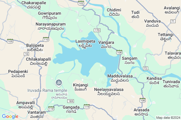
Kopara
Kopara Map
EDIT Map
Add Your House
 ..
..
Current Corona Virus Infected Patients Count in Srikakulam District
| City Name | District Name | Total Covid cases |
|---|---|---|
| Srikakulam District | Srikakulam | 3 |
Locality Name :
Kopara
( కోరారు )
Mandal Name : Vangara
District : Srikakulam
State : Andhra Pradesh
Region : Andhra
Language : Telugu
Current Time 01:24 PM
Date: Sunday , Apr 27,2025 (IST)
Time zone: IST (UTC+5:30)
Elevation / Altitude: 132 meters. Above Seal level
Telephone Code / Std Code: 08941
Assembly constituency : Rayachoti assembly constituency
Assembly MLA : GADIKOTA. SRIKANTH REDDY.
Lok Sabha constituency : Hindupur parliamentary constituency
Parliament MP : KURUVA GORANTLA MADHAV
Serpanch Name :
Pin Code : 535557
Post Office Name : Balijipeta
Alternate Village Name : Koppara Kottavalasa , Koppara
Commodities Prices : Kasinagar Market / Mandi
Kopara Live Weather
Temperature: 41.0 °C
few clouds
Humidity: 21%
Wind : 1.03 mt/sec towards N
StationName : "PÄ\u0081lkonda"
observed on Now
Temperature: 41.0 °C
few clouds
Humidity: 21%
Wind : 1.03 mt/sec towards N
StationName : "PÄ\u0081lkonda"
observed on Now
Kopara Weather Forecast for Next 5 days
28-04-2025
27.5°C to 41.8°C
few clouds, light rain, broken clouds, scattered clouds
27.5°C to 41.8°C
few clouds, light rain, broken clouds, scattered clouds
29-04-2025
27.4°C to 38.1°C
broken clouds, scattered clouds, light rain, clear sky
27.4°C to 38.1°C
broken clouds, scattered clouds, light rain, clear sky
30-04-2025
26.2°C to 38.1°C
clear sky, few clouds, light rain, scattered clouds
26.2°C to 38.1°C
clear sky, few clouds, light rain, scattered clouds
01-05-2025
25.7°C to 39.1°C
clear sky, light rain, broken clouds
25.7°C to 39.1°C
clear sky, light rain, broken clouds
02-05-2025
26.5°C to 39.5°C
clear sky, few clouds, moderate rain, light rain, scattered clouds
26.5°C to 39.5°C
clear sky, few clouds, moderate rain, light rain, scattered clouds
Rivers Near Kopara
Boduru Gedda
Potula Gedda
Boduru Gedda
Potula Gedda
About Kopara
Correct below Info and add more info about KoparaKopara is a Village in Vangara Mandal in Srikakulam District of Andhra Pradesh State, India. It belongs to Andhra region . It is located 54 KM towards North from District head quarters Srikakulam. 650 KM from State capital Hyderabad
Kopara Pin code is 535557 and postal head office is Balijipeta .
Kopara is surrounded by Balijipeta Mandal towards west , Veeraghattam Mandal towards North , Therlam Mandal towards South , Palakonda Mandal towards East .
Rajam , Bobbili , Parvathipuram , Amadalavalasa are the near by Cities to Kopara.
This Place is in the border of the Srikakulam District and Vizianagaram District. Vizianagaram District Balijipeta is west towards this place .
Koppara 2011 Census Details
Kopara Local Language is Telugu. Koppara Village Total population is 2968 and number of houses are 749. Female Population is 47.3%. Village literacy rate is 51.7% and the Female Literacy rate is 17.7%.
Population
| Census Parameter | Census Data |
| Total Population | 2968 |
| Total No of Houses | 749 |
| Female Population % | 47.3 % ( 1404) |
| Total Literacy rate % | 51.7 % ( 1533) |
| Female Literacy rate | 17.7 % ( 526) |
| Scheduled Tribes Population % | 0.0 % ( 1) |
| Scheduled Caste Population % | 12.9 % ( 384) |
| Working Population % | 44.2 % |
| Child(0 -6) Population by 2011 | 269 |
| Girl Child(0 -6) Population % by 2011 | 50.6 % ( 136) |
Koppara Census More Deatils.
Politics in Kopara
TD , TDP , YSRC , Yuvajana Sramika Rythu Congress Party , YSRCP , INC are the major political parties in this area.Polling Stations /Booths near Kopara
1)Kothalaguttapalle2)Surakvandlapalli
3)Nakkavandlapalli H/o Abbavaram
4)Gandlapalli H/o Setty Palli
5)Velligollu
HOW TO REACH Kopara
By Road
Amadalavalasa is the Nearest Town to Kopara. Amadalavalasa is 56 km from Kopara. Road connectivity is there from Amadalavalasa to Kopara.By Rail
There is no railway station near to Kopara in less than 10 km. How ever there are railway Stations from Near By town Amadalavalasa. are the railway Stations near to Amadalavalasa. You can reach from Amadalavalasa to Kopara by road after .By Bus
Palakonda APSRTC Bus Station , Rajam APSRTC Bus Station , Bobbili APSRTC Bus Station are the nearby by Bus Stations to Kopara .APSRTC runs Number of busses from major cities to here.Colleges near Kopara
Apswr Jr College For Girls, Vangara
Address : Vangara
Govt Jr College Vangara
Address : Govt Jr College Vangara
Schools in Kopara
Zphs Koppara
Address : koppara , vangara , srikakulam , Andhra Pradesh . PIN- 535557 , Post - Balijipeta
Govt Health Centers near Kopara
1) Devakivada , 1--1 , , Bc Street2) Kottisa , 1--14 , , Bc Street
3) Voni , 1--128 , , Bc Street
Hospitals in Kopara,Vangara
Penki Balakrishna correspondent VijayaKrishna Clinics
Arasada; Andhra Pradesh 532122; India
10.2 KM distance Detail
more ..
Petrol Bunks in Kopara,Vangara
Priyanka Fillig Station Hindustan Petroleum
Srikakulam; SH-37; ParvathiPuram Road; Veeraghattam; Veeraghattam; Andhra Pradesh 523460; India
11.8 KM distance Detail
more ..
Colleges in Kopara,Vangara
Govt.Junior College Vangra At Madduvalasa
Mugguru; Andhra Pradesh 532122; India
5.0 KM distance Detail
govt degree college veeraghattam
SH 37; Veeraghattam; Andhra Pradesh 532460; India
11.7 KM distance Detail
more ..
Schools in Kopara,Vangara
Mpup School
Devakiwada;Sreeharipuram;AndhraPradesh-532122; Sriharipuram; Visakhapatnam; Andhra Pradesh; India
3.2 KM distance Detail
About Kopara &
History
How to reach Kopara
Tourist Places Near By Kopara
Schools in Kopara
Colleges in Kopara
Temperature & weather of Kopara
places in Kopara
Kopara photos
More Information
How to reach Kopara
Tourist Places Near By Kopara
Schools in Kopara
Colleges in Kopara
Temperature & weather of Kopara
places in Kopara
Kopara photos
More Information
Village Talk
Post News or Events about this Village
Near Cities
Rajam 21 KM near
Bobbili 28 KM near
Parvathipuram 29 KM near
Amadalavalasa 44 KM near
Rajam 21 KM near
Bobbili 28 KM near
Parvathipuram 29 KM near
Amadalavalasa 44 KM near
Near By Taluks
Vangara 0 KM near
Balijipeta 8 KM near
Veeraghattam 10 KM near
Therlam 15 KM near
Vangara 0 KM near
Balijipeta 8 KM near
Veeraghattam 10 KM near
Therlam 15 KM near
Near By Air Ports
Vishakhapatnam Airport 116 KM near
Rajahmundry Airport 280 KM near
Bhubaneswar Airport 332 KM near
Raipur Airport 387 KM near
Vishakhapatnam Airport 116 KM near
Rajahmundry Airport 280 KM near
Bhubaneswar Airport 332 KM near
Raipur Airport 387 KM near
Near By Tourist Places
Vizayanagaram 65 KM near
Araku Valley 91 KM near
Ananthagiri 91 KM near
Simhachalam 113 KM near
Visakhapatnam 121 KM near
Vizayanagaram 65 KM near
Araku Valley 91 KM near
Ananthagiri 91 KM near
Simhachalam 113 KM near
Visakhapatnam 121 KM near
Near By Districts
Srikakulam 52 KM near
Vizianagaram 63 KM near
Rayagada 73 KM near
Gajapati 97 KM near
Srikakulam 52 KM near
Vizianagaram 63 KM near
Rayagada 73 KM near
Gajapati 97 KM near
Near By RailWay Station
Parvatipuram Rail Way Station 28 KM near
Bobbili Junction Rail Way Station 28 KM near
Parvatipuram Rail Way Station 28 KM near
Bobbili Junction Rail Way Station 28 KM near